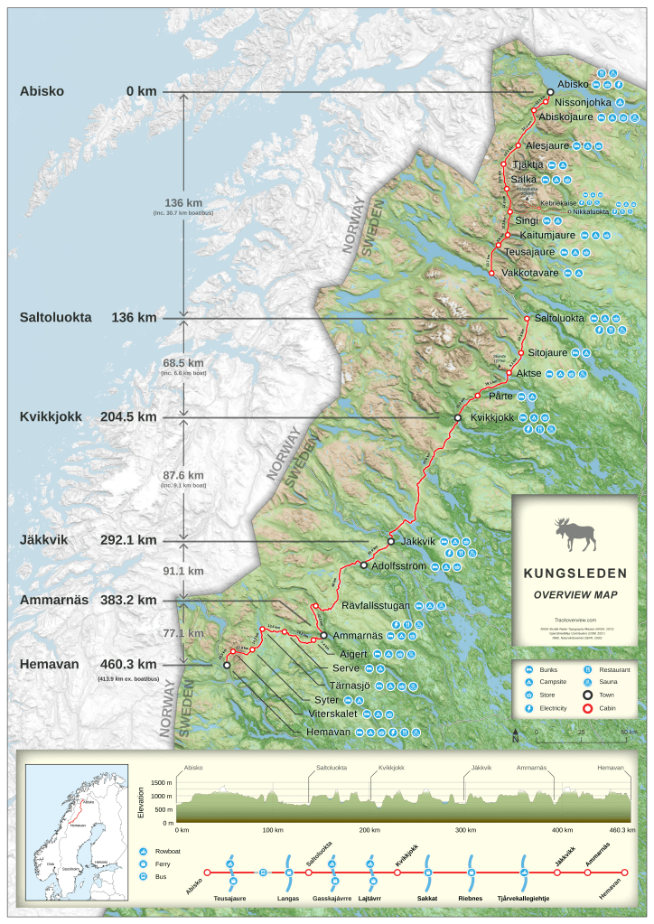
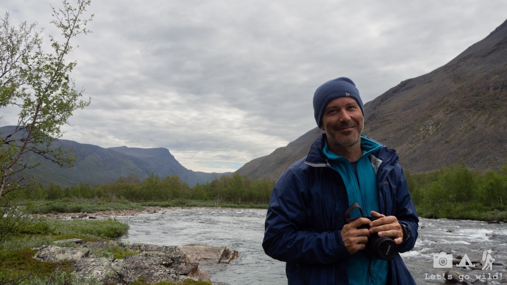
A bit tired from the heat in Corsica last year and from our own Mediterranean climate zone, we packed our bags to go to the North – Swedish region of Lapland and its most famous trail Kungsleden, the “King’s trail”. The trail itself goes from Abisko un in the very North of Sweden to Hemavan in a stretch of more than 400 km divided into 5 sections. Obviously, hiking the full trail was not an option for us due to shortage of kid’s free time, but we did hope to do the two most northern sections (Abisko to Kvikkjokk).
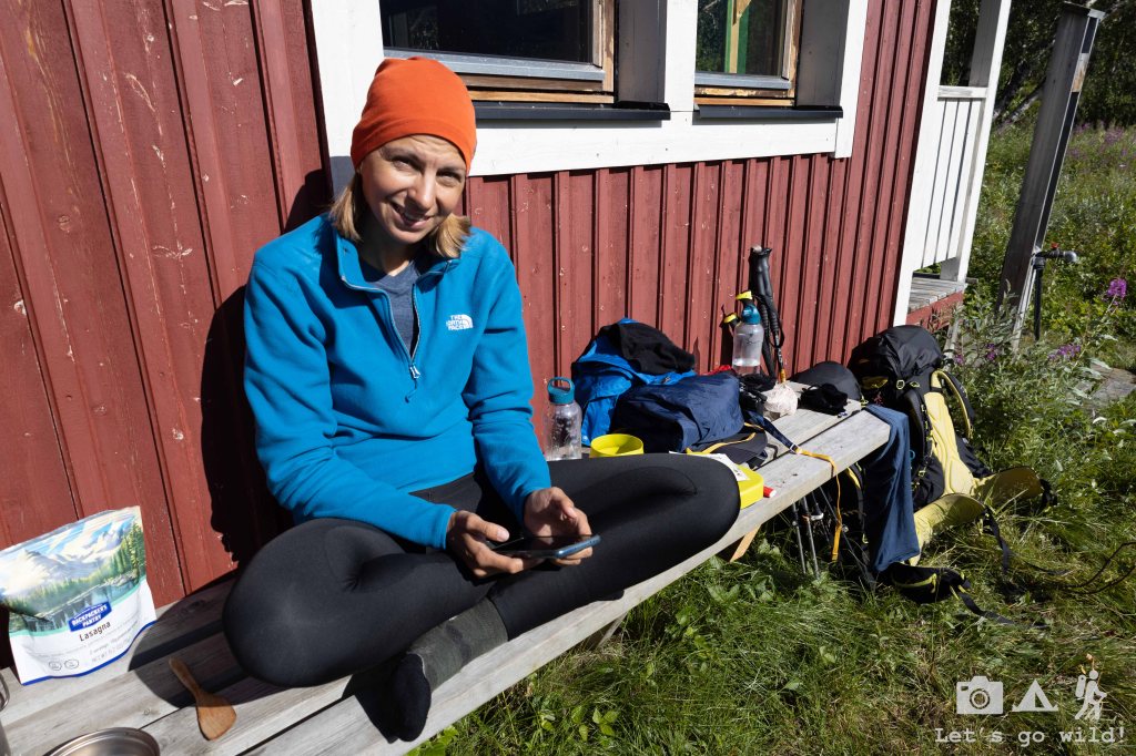
For us, the trip began with a lengthy preparation and packing part which was no less exciting: learning important info about the trail, reviewing our gear, packing and unpacking and then packing again until nothing is missing nor do we pack too much…
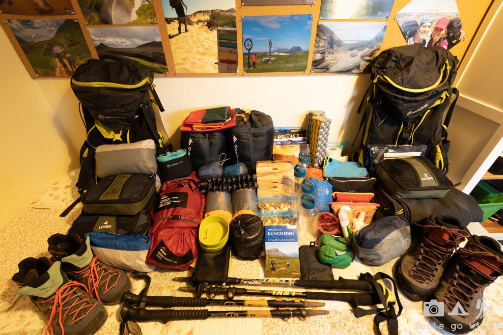
Learning from our previous mistakes we dedicated quite some time to prepare the trip as logistics in the North is a challenge in itself. But there will be another post about preparation and packing.
Reaching the starting point of Kungsleden was definitely not easy:
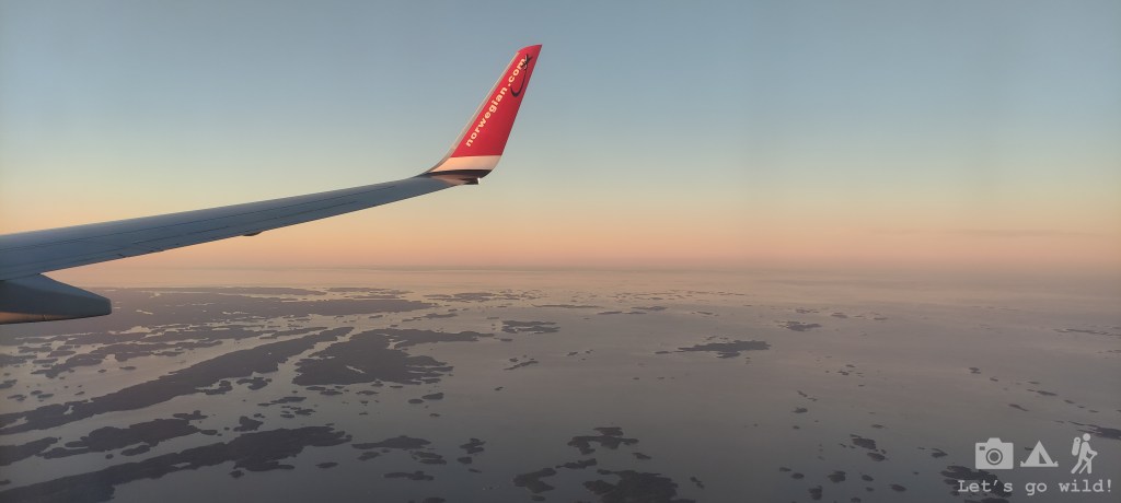
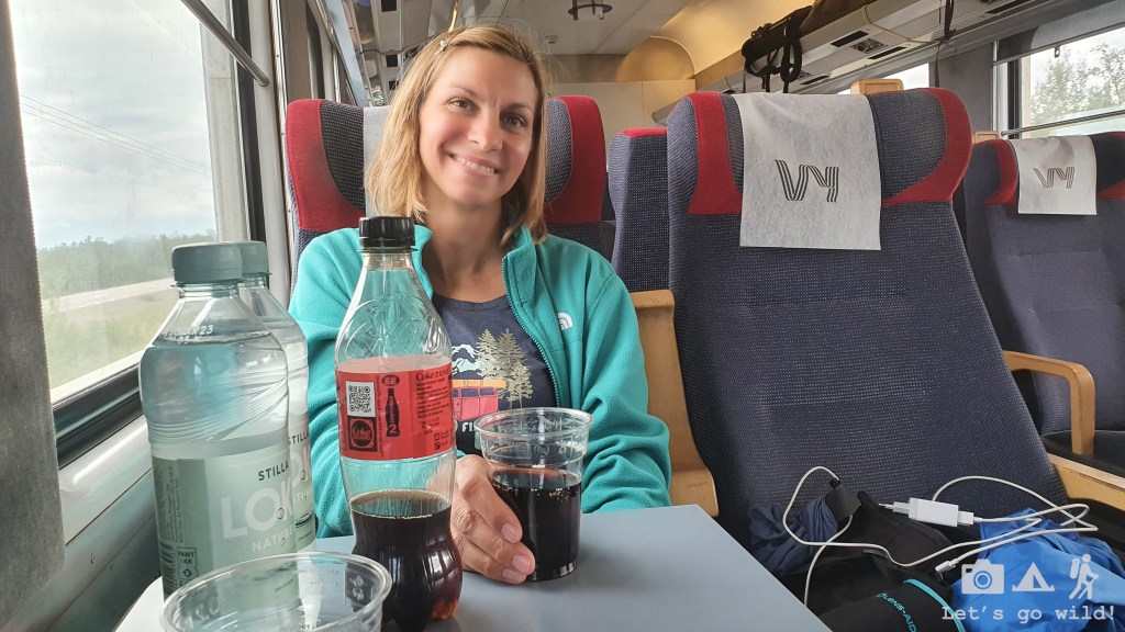
Step no 1. – arrive Stockholm late Monday evening. It was a beautiful day with clear skies allowing us to admire the archipelago surrounding Stockholm. What a curious place to visit…
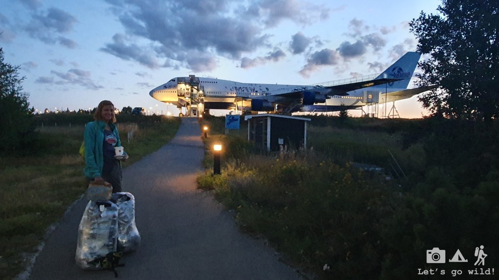
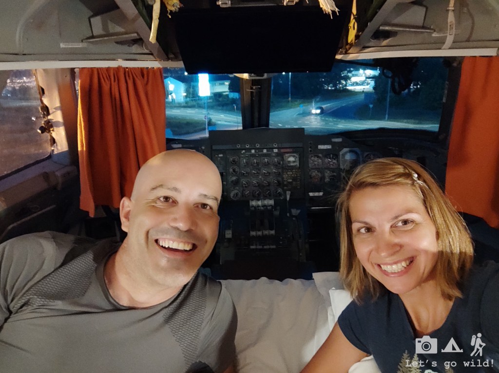
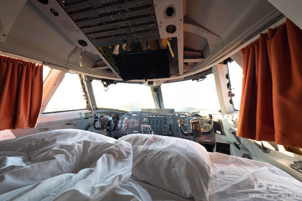
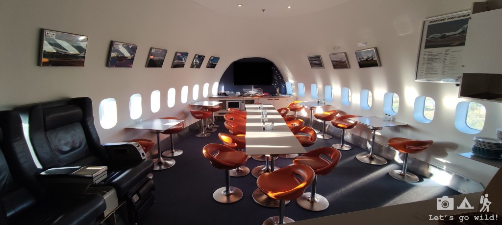
Step no 2. – overnight stay in an airport hotel. Well, to make it more fun we went for an alternative and had some good fun in an old Jumbo aircraft – first class!
Step no 3. – early morning flight to Kiruna. I have never seen a flight so full of backpackers in my life!
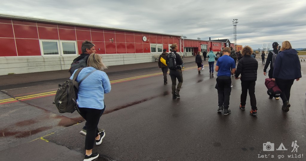
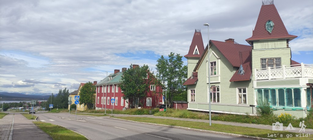
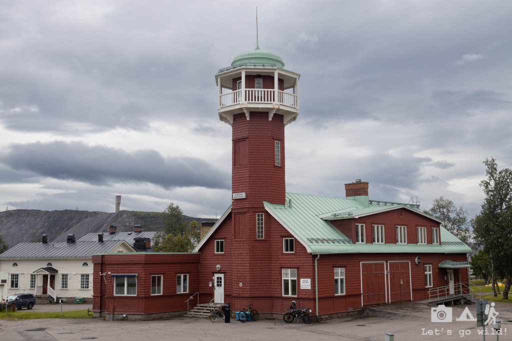
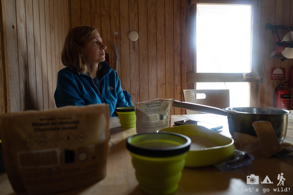
Step no 4. – Take a bus to the city of Kiruna, buy gas, have lunch and kill several hours waiting for the train. I have to admit that leaving the bus on the first stop to go to Intersport for the gas was kind of a mistake (even more so when I saw a hiking shop in the city center just few minutes away from the bus). It looked close by in the map but in reality we had to walk around 4 km just to get to the train as the shop and train station are in completely opposite sides of this small city. Of course, it’s not a big deal if you plan to stay overnight in Abisko and start the hike the next day, but that wasn’t our plan…
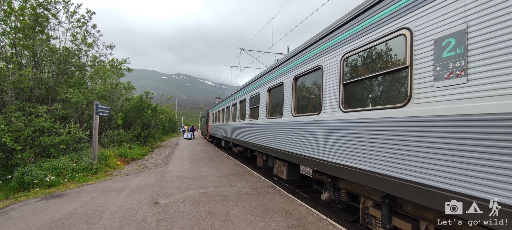
Step no 5. – 10 minutes on the bus to get to the train station and then 2 hours train ride until we finally reach Abisko at 4pm and directly jump into the trail.
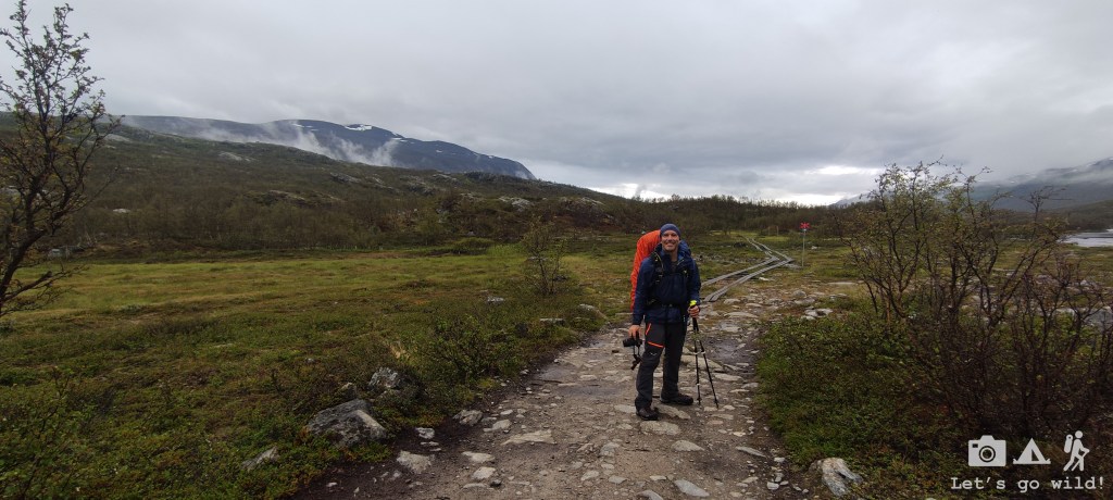
So, after many, many hours since we left home we were finally able to start our hike.
Day 1. The late start
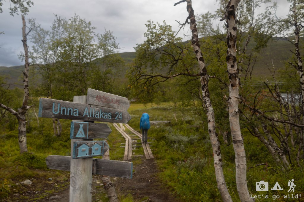
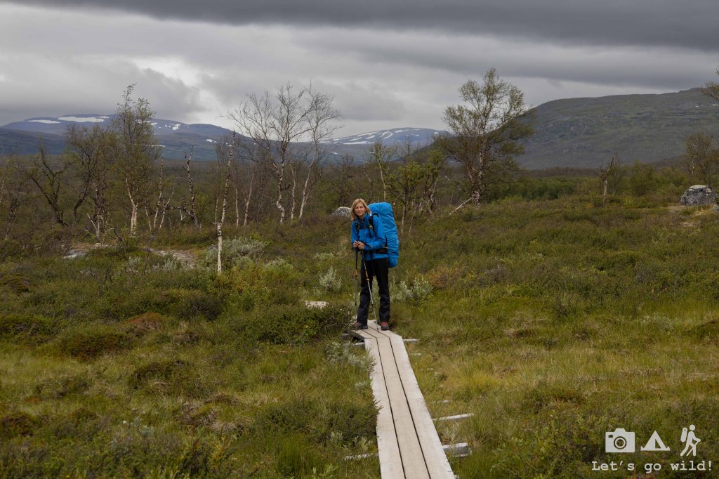
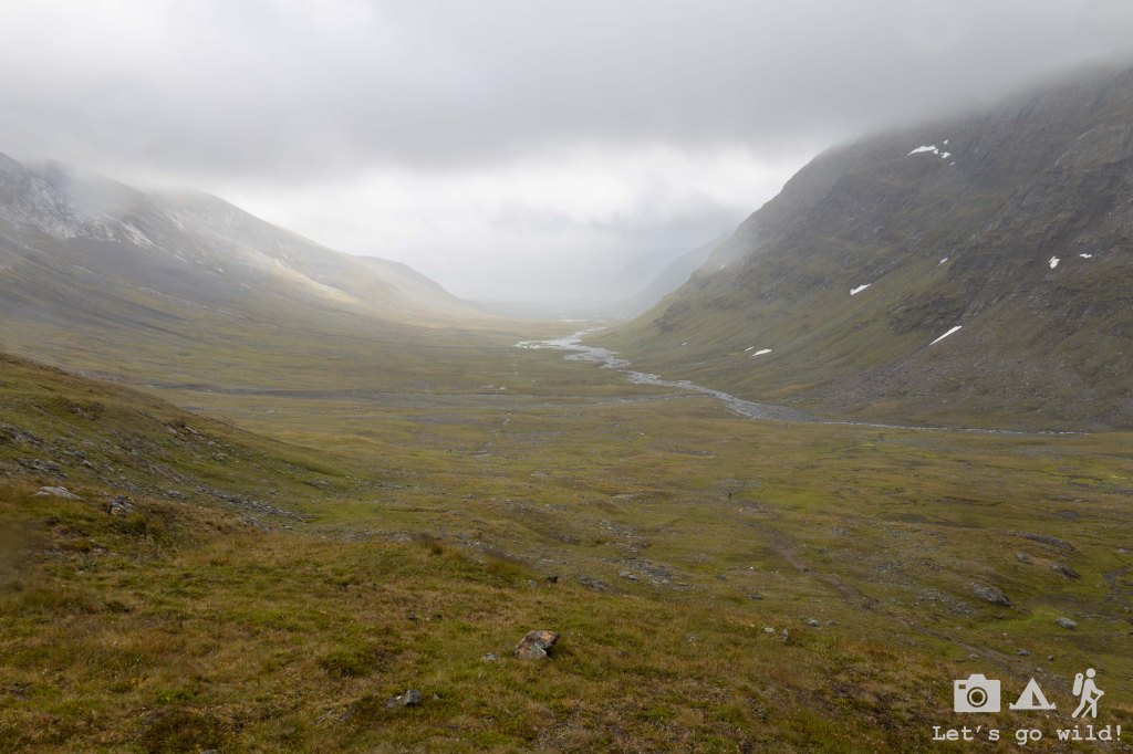
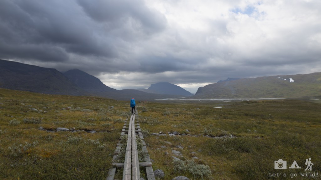
Abisko – Abiskojaure. Estimated 13.3 km, 115/10 m ↑↓.
The excitement took over the tiredness making those km ahead of us look less challenging. Our goal for the first day was to reach Abiskojaure and maybe, just maybe, if we still had energy, to walk few km more to be able to wild camp.
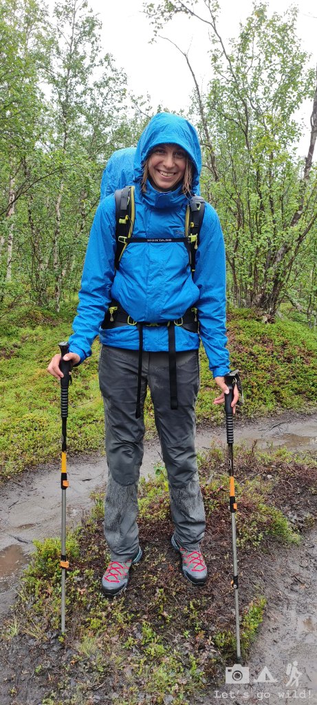
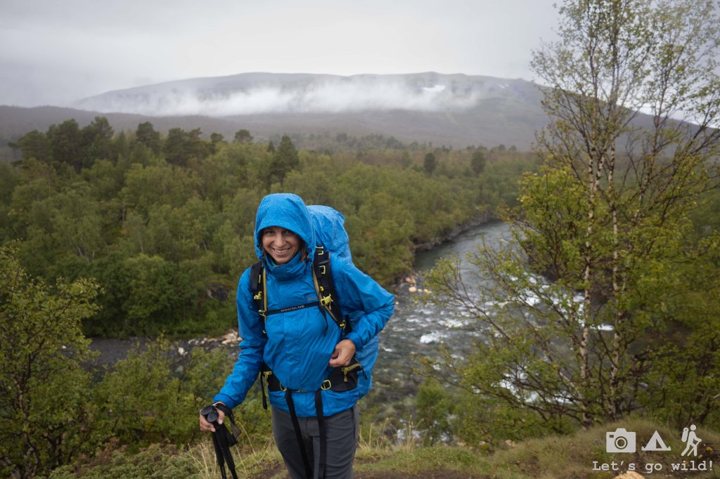
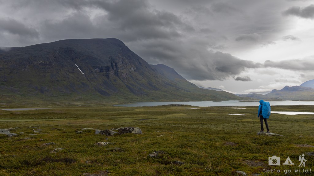
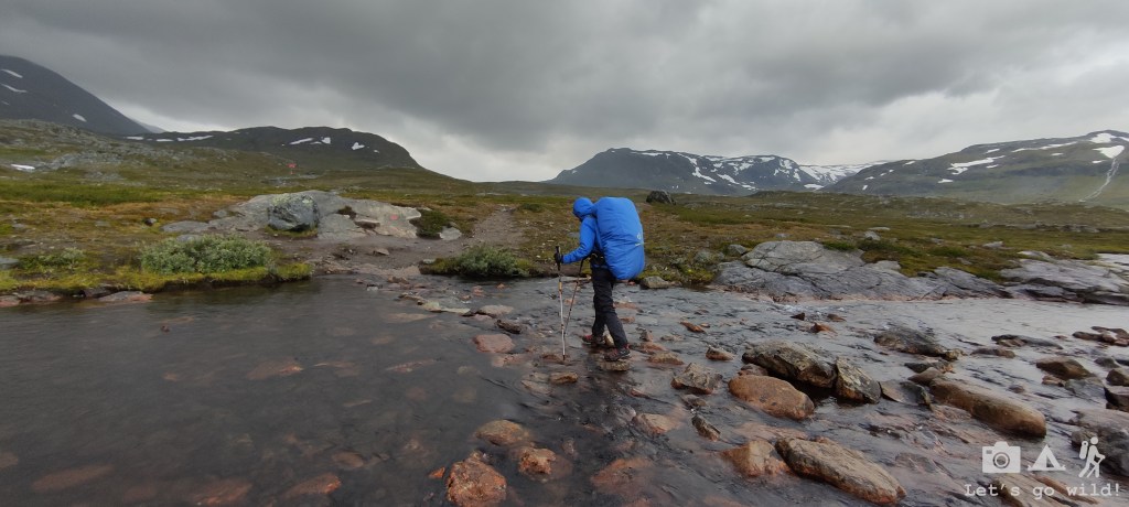
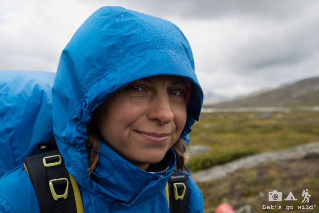
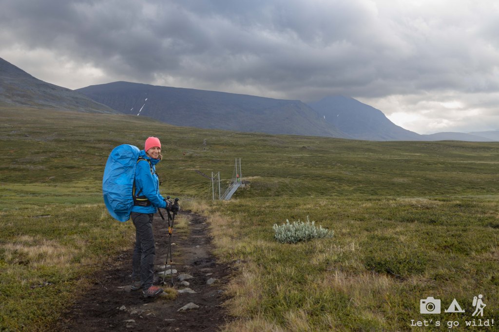
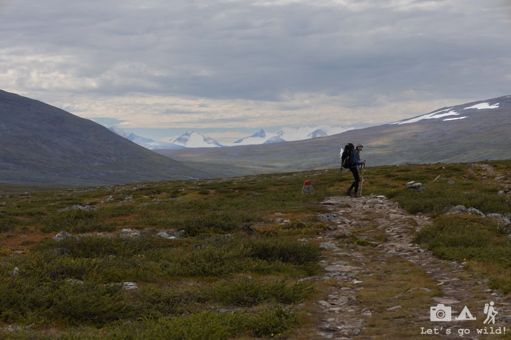
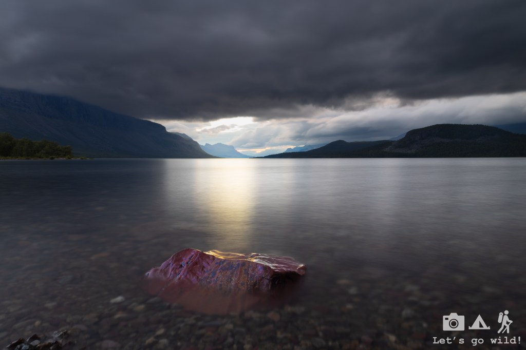
The North greeted us with rain. Just a few minutes before arriving Abisko first drops touched the window giving us just enough time to take out our rain jackets and rain covers for the backpacks.
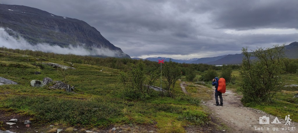
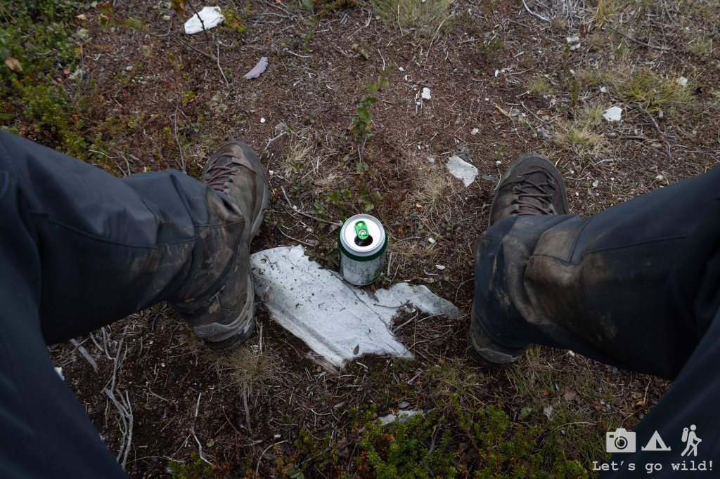
Due to the late hour and rain, we decided not to visit the Abisko STF station (which was on the opposite side of the railway) and went directly to the trail. In just 30 minutes we were completely soaked. Welcome to the North!
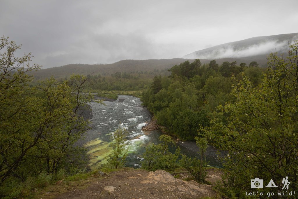
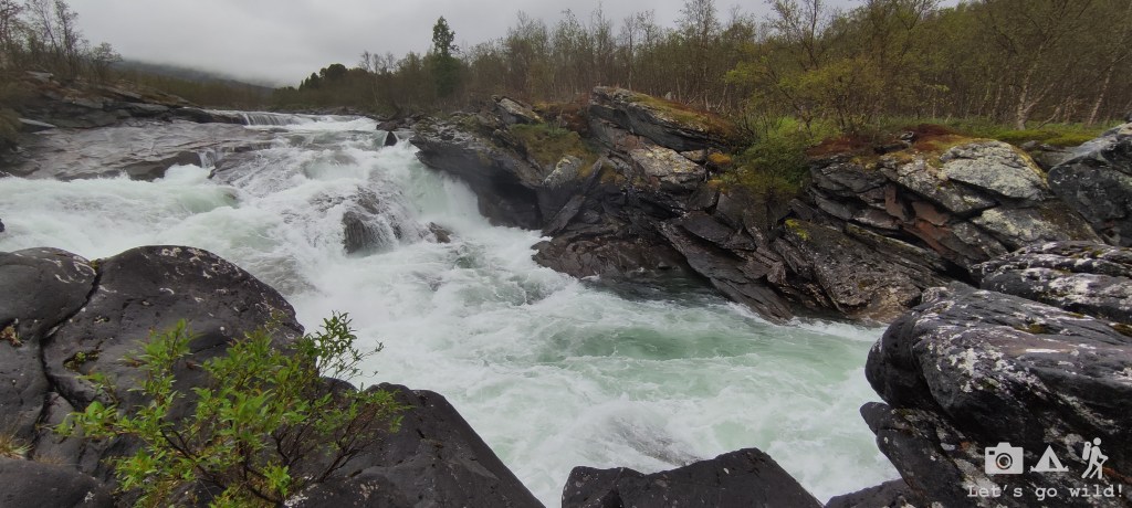
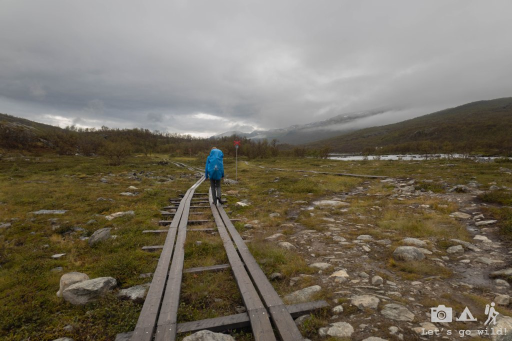
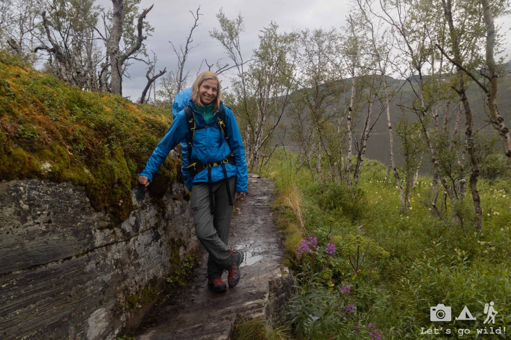
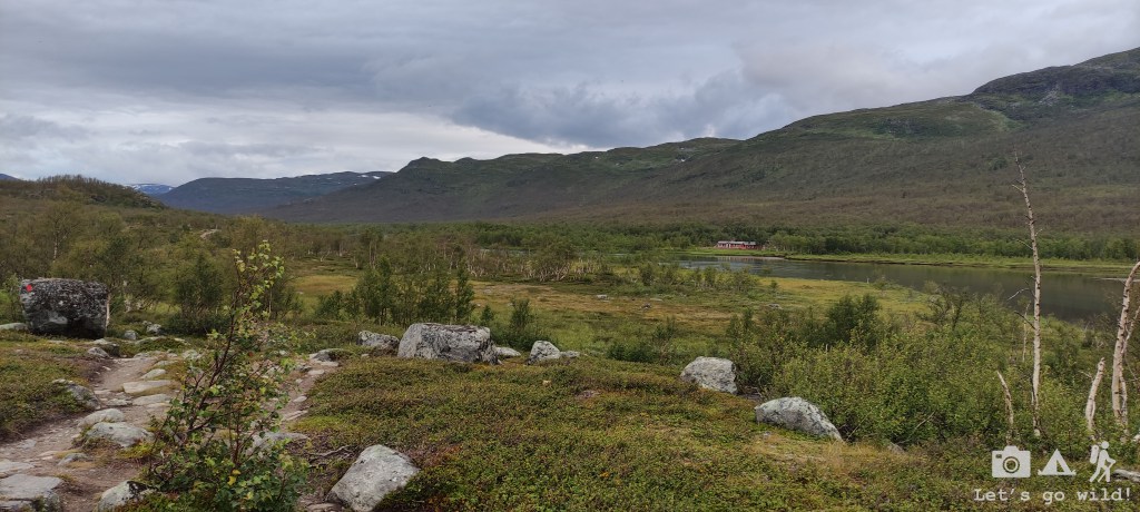
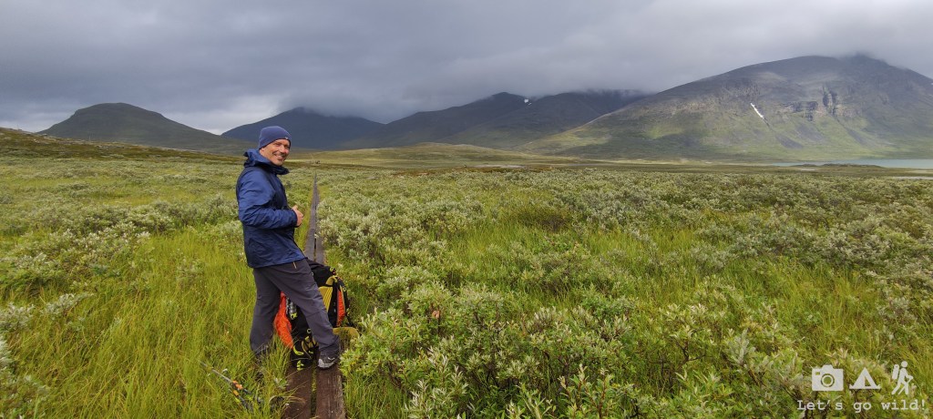
Despite the rain, the hike was quite pleasant and beautiful. The trail started in the forest following a path by a river with some nice spots to stop and admire the wilderness. Very soon you realize how far away from the civilization you are: no sounds of cars, airplanes, factories or even your mobile phone. Yes, there is no mobile coverage whatsoever just a couple km into the trail. And there won’t be any until almost Vakkotavare several days ahead.
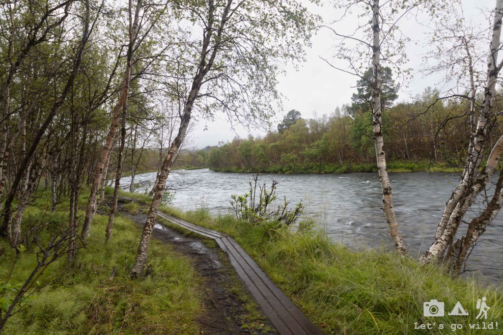
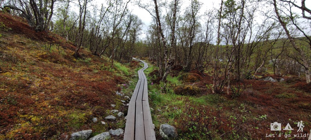
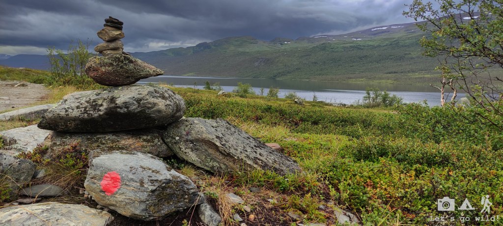
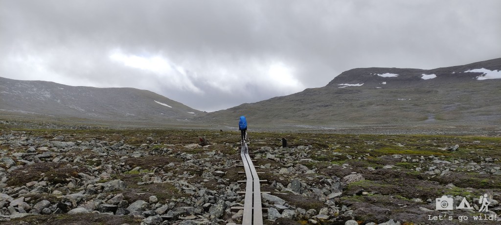
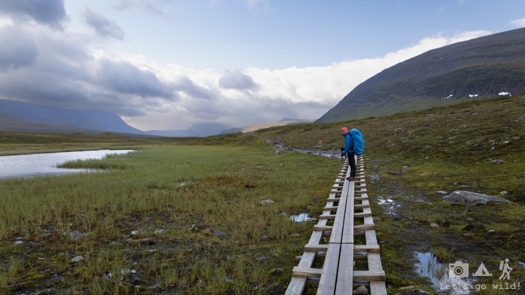
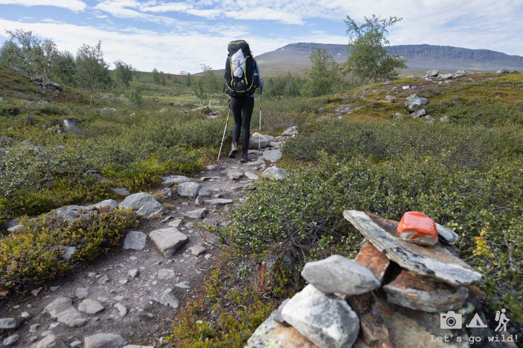
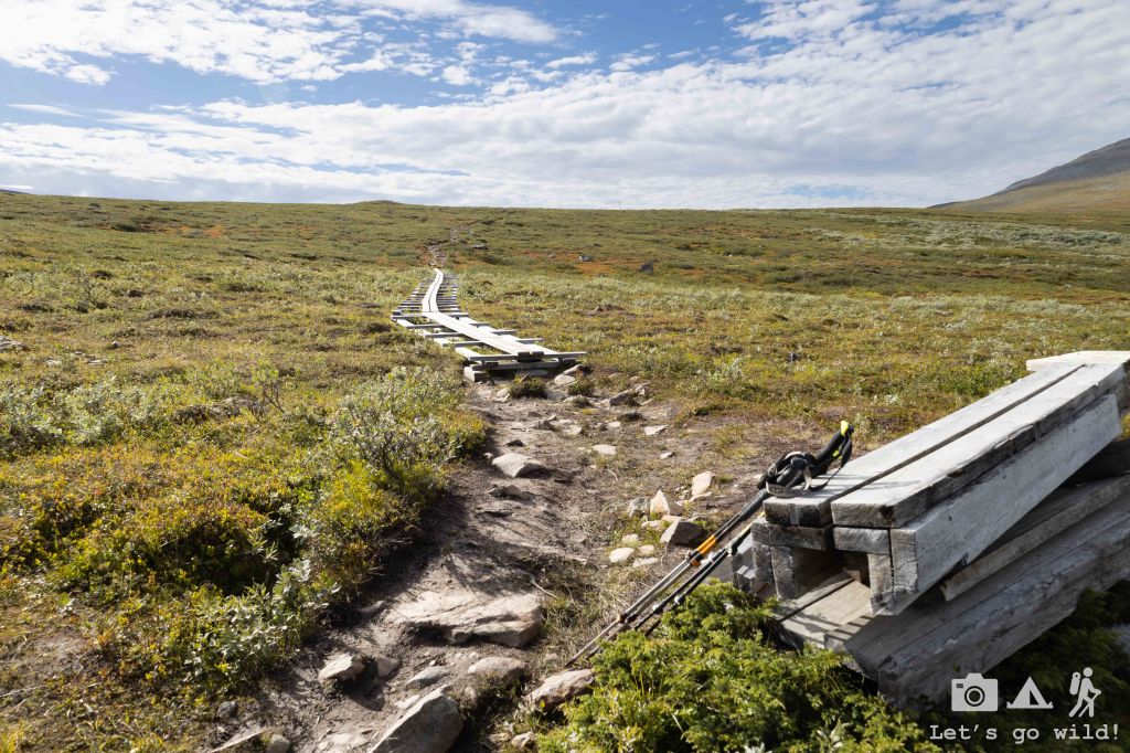
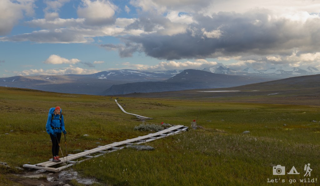
Very soon we learned that the path is extraordinarily well marked and easy to follow once you get used to spot the red markings on the stones or trees. Besides, in most of the parts the path itself is just impossible to miss due to the board walks made to save both nature and our feet. At the beginning those board walks seemed to me an exaggeration but a couple of days into the trail and I realized that it probably would not be doable without them and started appreciating them much more.
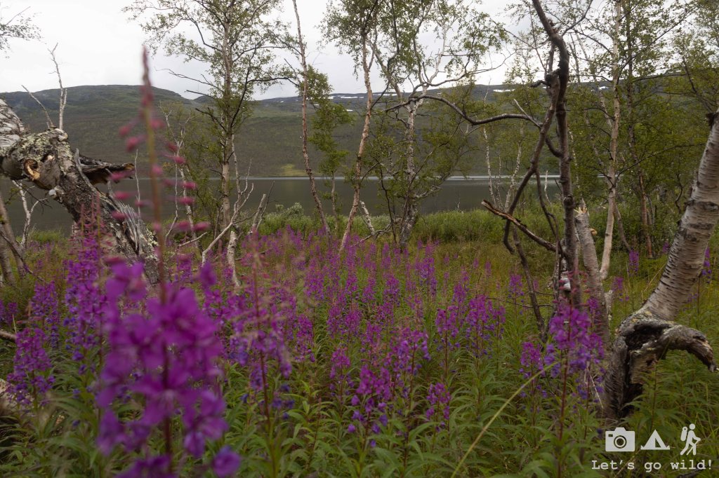
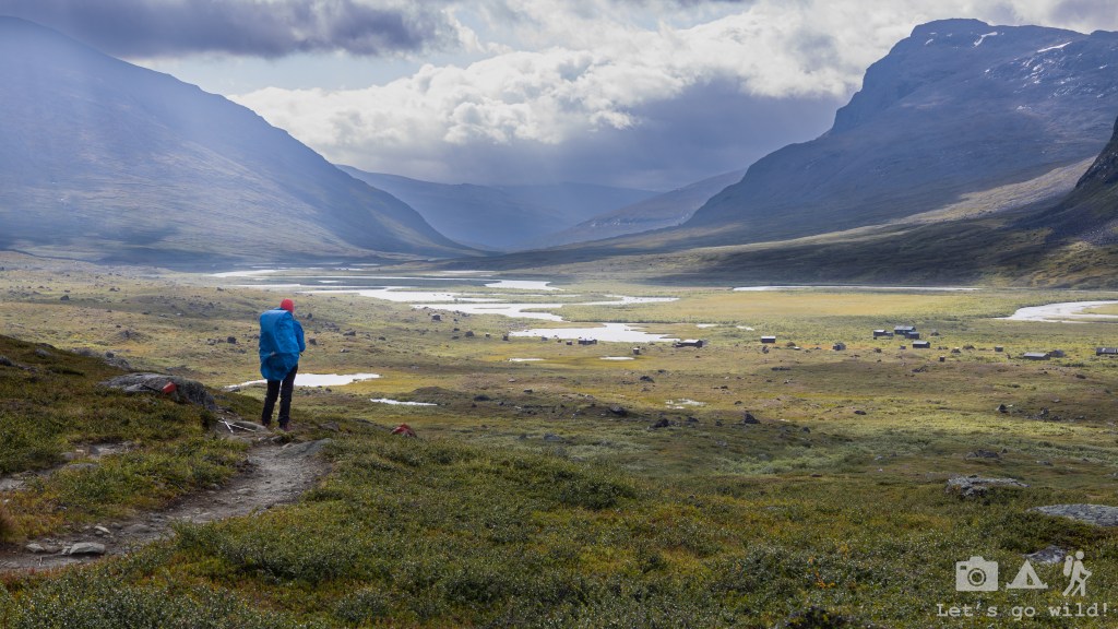
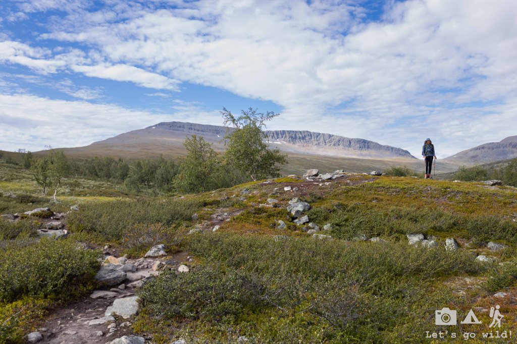
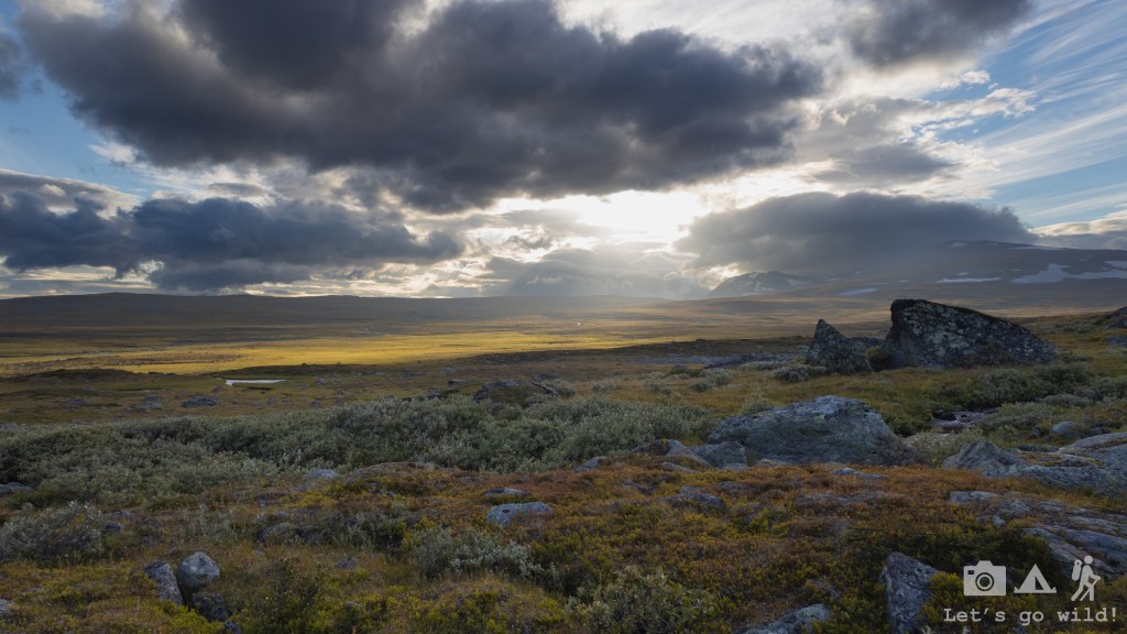
After several km we reached the treeline and started getting a bit more opened views to the river and the surrounding mountains which kept us well entertained.
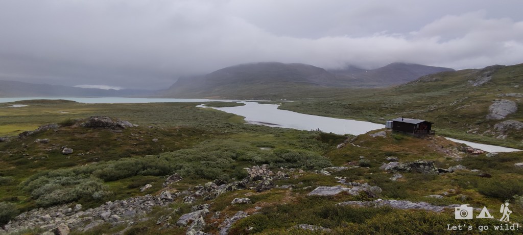
It was getting late but the good thing about the North in summer is that there is really no need to rush as there will always be light for you to walk and the schedules become somewhat blurry. It was probably around 8pm when we first saw Abiskojaure and some naked people running into the river from the sauna. Yet, we didn’t arrive on time to enjoy it ourselves as there was still quite a bit left to reach it.
Even though ideally we wanted to wild camp as much as possible on this hike, we decided to stop and camp in the area of STF Abiskojaure, taking advantage of the drying room, shop and other warm facilities. After all, it had been a long day with accumulated tiredness of all the travel and extra km in Kiruna. No regrets.
Day 2. The rainbow day
Abiskojaure – Alesjaure. Estimated 20.3 km, 345/55 m ↑↓.
The night was calm and with no alarms set for the morning we had quite a good rest. We packed our tent almost dry, had a slow breakfast in the hut and dressed dry and warm clothes. The sky thou promised us they wouldn’t stay dry for long.
It was a wet day. The rain was pouring every now and then, the wind was getting stronger, and the temperatures were significantly lower, forcing us to wear hats and gloves even during the active hike in the middle of August.
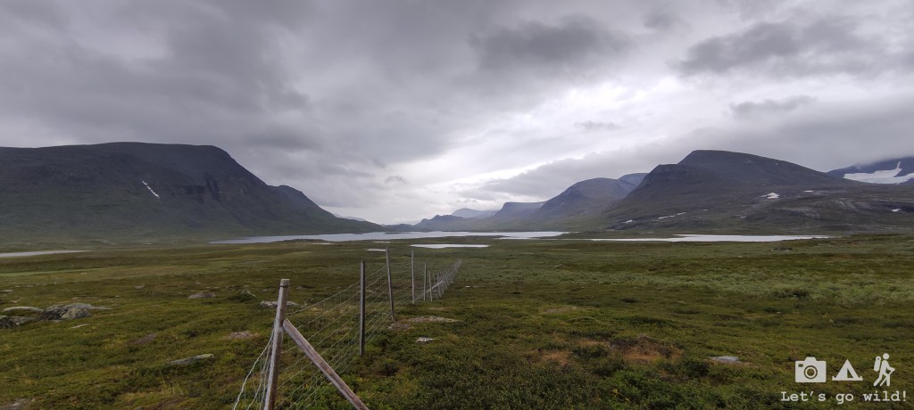
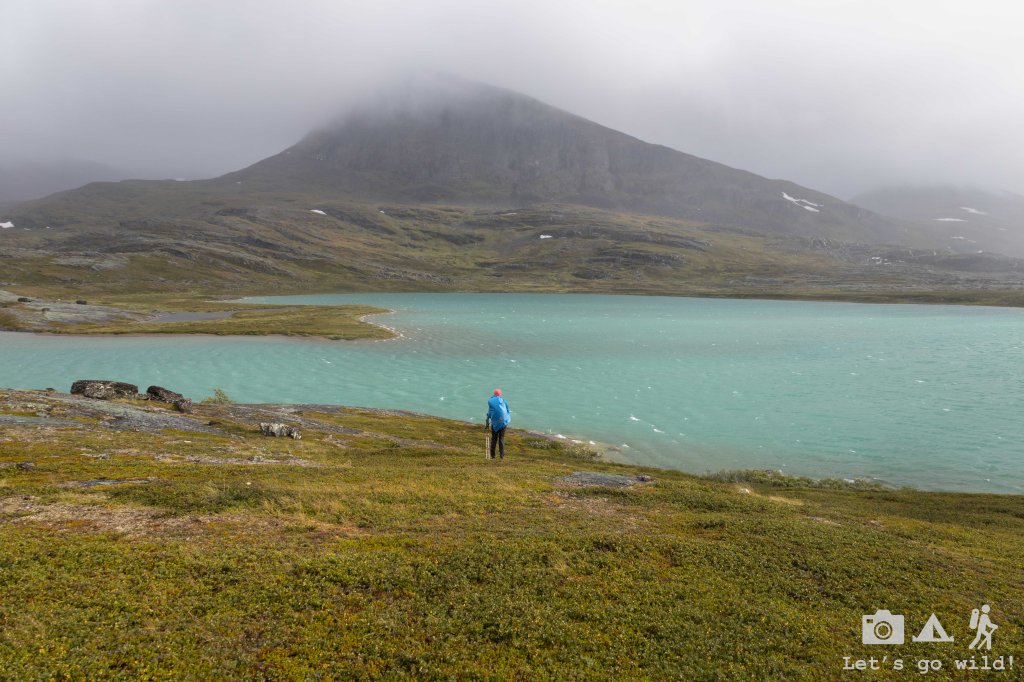
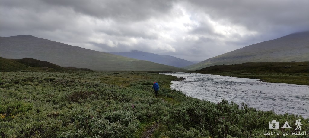
The trail was easy and straightforward with a barely noticeable incline taking us into the higher mountain valleys with gorgeous lakes that we would be following for the rest of the day.

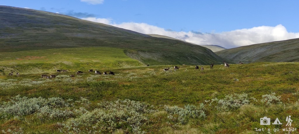
Two days into the hike we still haven’t seen much of the wildlife or reindeers. We came across the first reindeer fence by the lakes, yet no reindeers were found. And who could blame them for hiding on such a rainy day?
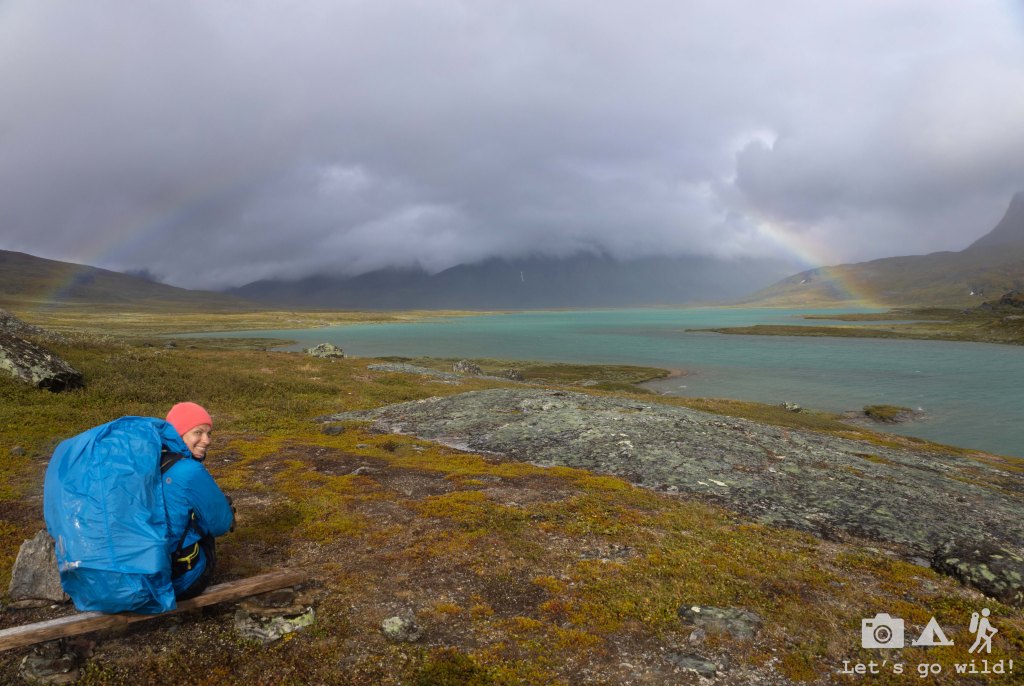
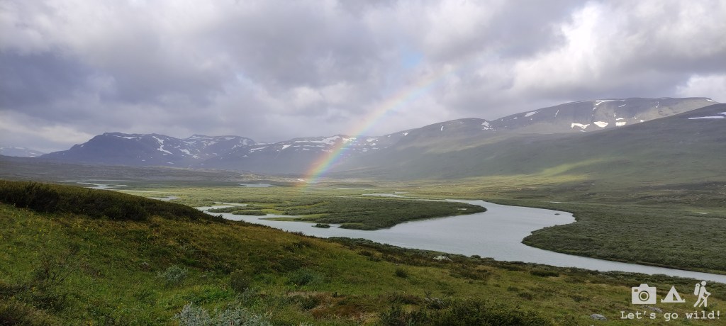
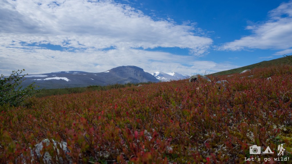
However rainy, the Nordic summer treated us with some pleasant surprises every now and then as well. Every time the sun would come out for a minute (literally), it would award us with a spectacular rainbow forcing us to stop and admire the moment. Sometimes so short that it would be gone before we reached our camera.
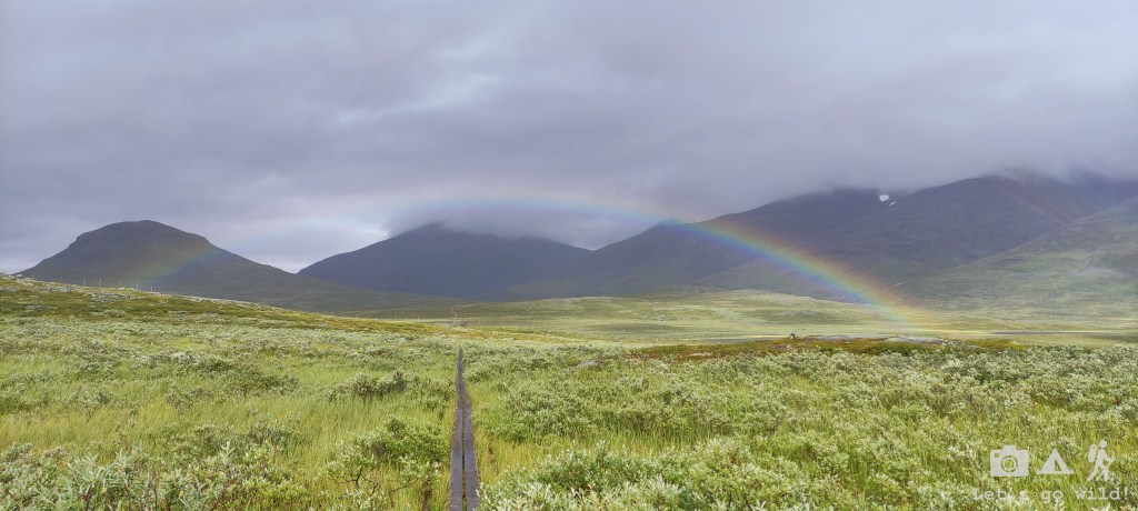
The Rádujávri Lake was absolutely gorgeous due to its bright emerald color that I just couldn’t stop admiring. I can only imagine how impressive it must look on a sunny day. But even though the skies were dark, and the clouds were very low, we were once again awarded with a perfect rainbow joining the two sides of the lake like a colorful bridge.


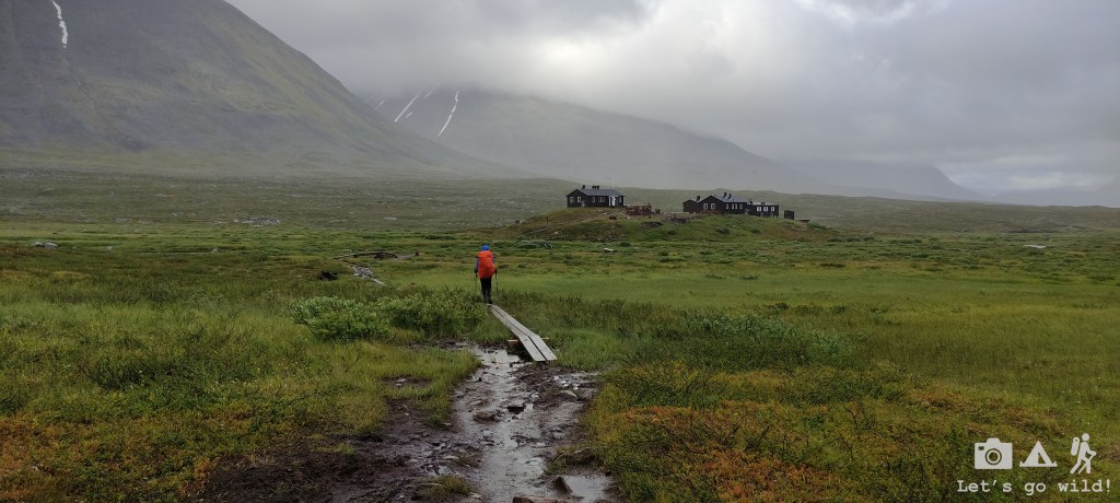
Soon after our lunch break the weather started getting worse again forcing us to hurry up and try to reach Alesjaure STF before the sauna hours. Even though there were some decent wild camping spots really close by Alesjaure, we decided to camp in the hut area again due to the weather that wasn’t promising anything good for the night.
After pitching the tent right next to a hut which gave us some protection from the growing wind, we finally went to try out the sauna. A bit awkward the first time to be surrounded by naked people popping in. You could clearly distinguish the natives (naked) and the tourists (dressed or covered all over with towels). We tried to have a swim in the river as well, but I think we were not hot enough yet, thus after a very quick dip we went back to the crowded sauna for another round before it closed.
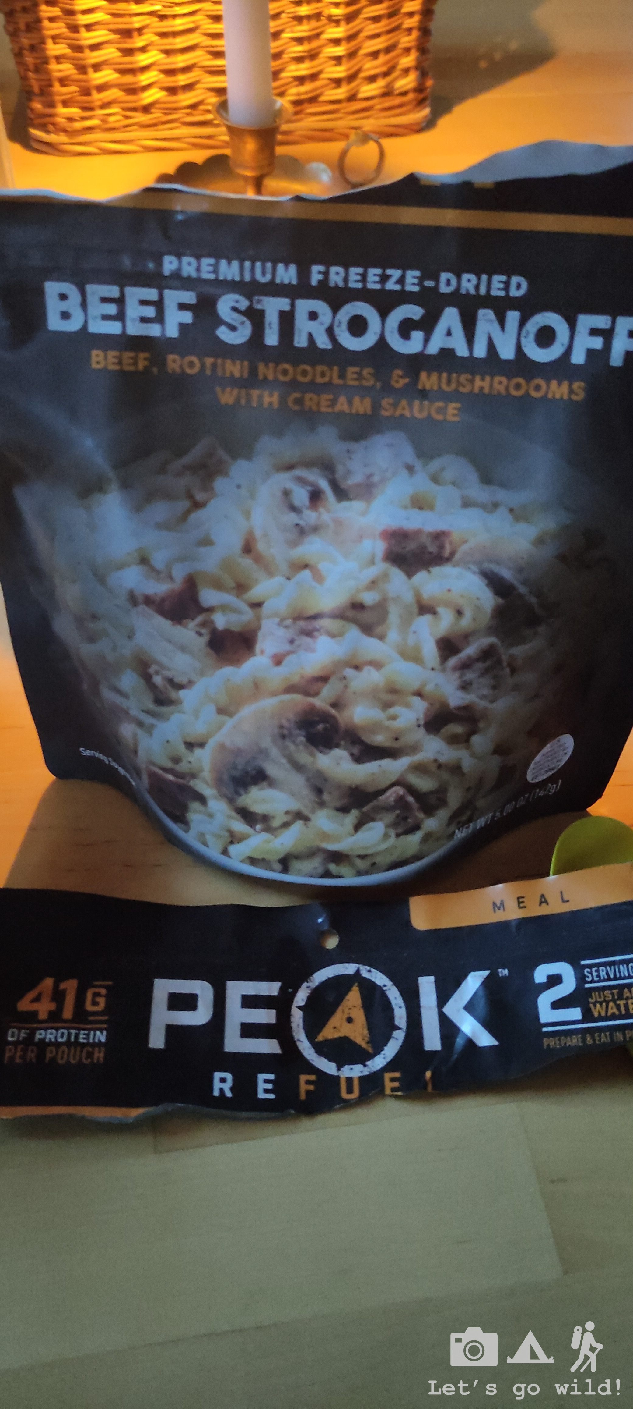
Getting spoiled by the hut services, we cooked our dinner inside as well. To be honest, it really felt good to be dry and warm before going to sleep after such a cold day. Besides we filled our bellies with the best adventure food we had in a long time: Beef stroganoff from Peak Refuel. It was a first time we tried this brand and we honestly were very much impressed.
All warm, full and happy we finally crawled back to our tent for the night.
Day 3. When the weather gods turn back on you.
Alesjaure – Tjaktja – Salka. Estimated 13.1 + 12.5 = 25.6 km, 380/345 m ↑↓.
We didn’t sleep much that night… if any at all. The wind was getting even worse, and I think it changed a bit the direction, so our tent was moving a lot. Really a lot. Between the noise and the worrying that the tent might break it was complicated to get any rest.
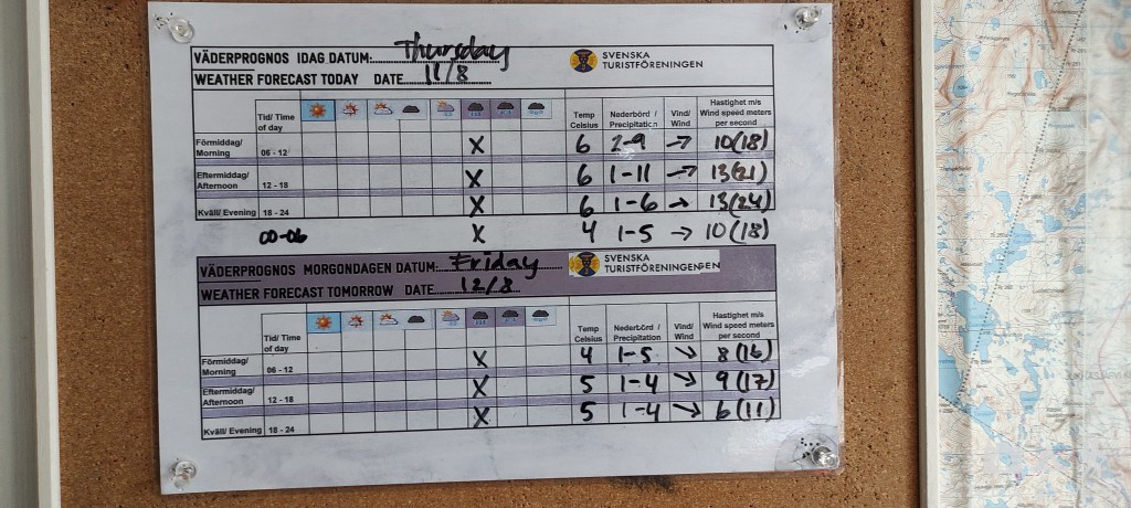
The tent survived (10 points for MSR) but we decided to get up earlier as we were not sleeping anyways. We went to have breakfast inside the hut and were really worried about the weather forecast for the day: the wind would get even stronger, the temperature would drop even lower, we would have to climb the highest point of the whole Kungsleden (obviously the pass would be extremely windy) and if all of this wasn’t enough – we would have to join the stages of two days, walking almost 26 km to reach Salka (although the real count with some deviations reached just a bit more than 28 km).
The start was psychologically hard. It took a lot of effort to leave the warm and dry service hut and go out into the wind and rain. Little devil on my left shoulder was clearly saying “You are staying here” when I was watching poor hikers struggling with the wind. But we got our shit together and went out into the cold.
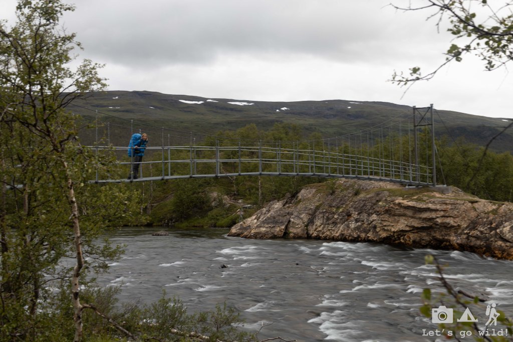
The trail wasn’t difficult in general. Kungsleden is not a difficult hike per se. We had to cross some rivers but never really had to remove the shoes – simply jumping from rock to rock was enough to keep our feet relatively dry. What made the hike difficult was the weather. Walking against the strong wind makes you waste much more energy than you would imagine. And if you get rain on top of that… lovely.
The wind was present all day and we knew it would reach its worst after midday. But the rain was more sporadic, and we even got some (very few) moments of relative sun. Just enough for a rainbow to show up for a few minutes.
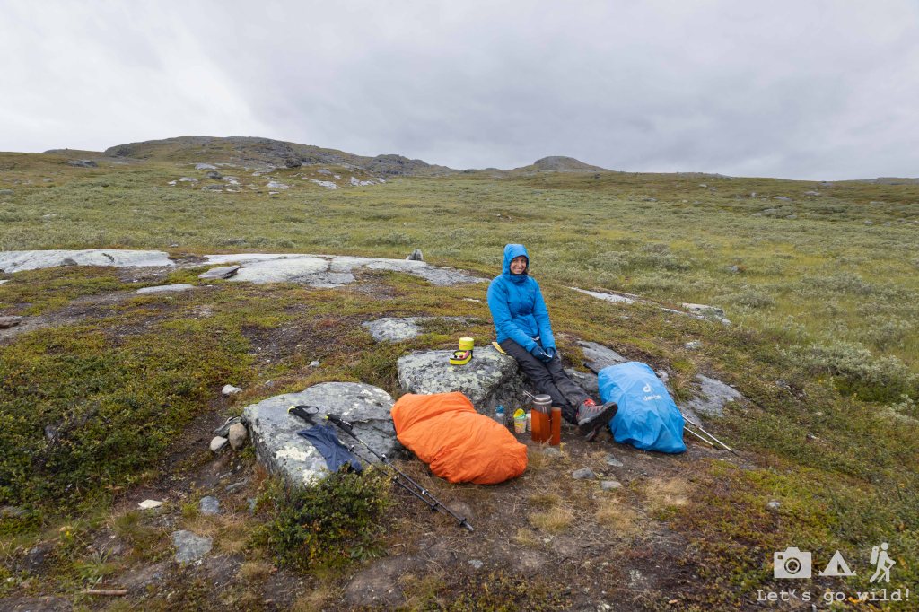
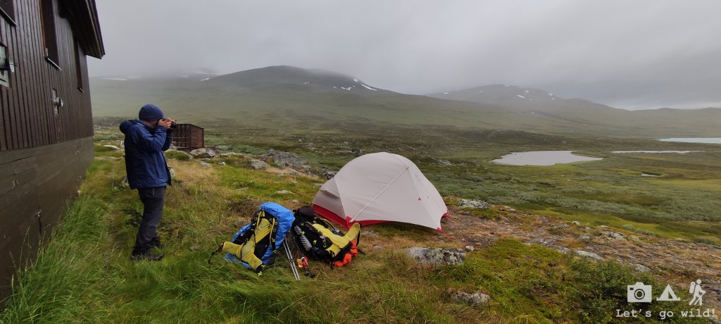
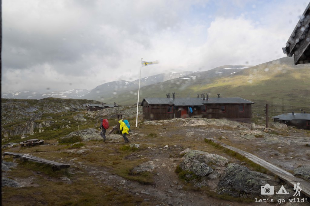
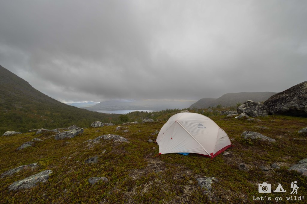
A bit tired from fighting with the wind, we reached the interim hut and stopped to have proper lunch, rest, warm up and dry up a bit. Tjaktja hut it the smallest from the ones we saw and is located just a few km before the pass, right next to a gorgeous waterfall. We squeezed into the tiny kitchen with other hikers to share our stories while having a meal and learned that at least two tents got broken that night forcing people to pack up and continue walking as early as 2am. Few more extra points of appreciation went to out for our MSR Hubba Hubba for the resilience.
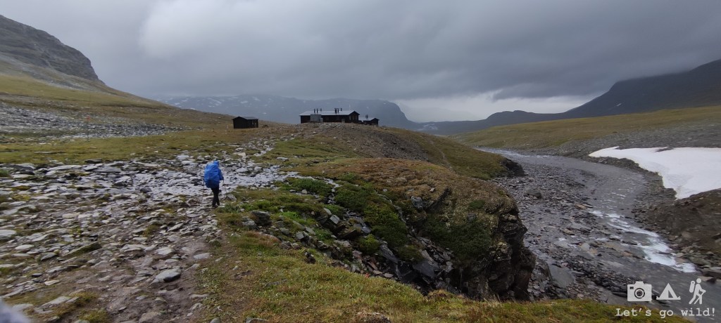
After refueling, we set off for another 13 km section to reach Salka. It had some climb to the pass that was never very steep and would have been an easy walk if it wasn’t for the wind.
The Tjaktja pass opened the views to a beautiful valley that we would follow for the next 30 km. However, the weather didn’t allow us to enjoy it much or take proper photos. We rushed to descent, hoping the wind would be softer down in the valley.
Gosh we were wrong… We had no idea that this specific valley is known for its ability to generate even stronger winds than up on the mountain. At first it was funny. The wind was blowing mainly to our backs, so we felt a relief for not having to fight it. But as we walked deeper into the valley, the wind gusts grew stronger, were changing direction every now and then and would blow me off the track once in a while. I was literally being blown away. And even though in the beginning it was a bit funny, it stopped being so when I realized that I can’t control myself anymore and was being carried away hectically in the field full of rocks. One bad fall and it could all end very bad… I even had to throw myself to the ground in some moments on purpose, just to avoid a bad unintended fall. Seriously, I have never experienced such a strong wind in my life.
It got scary. We still had around 8 km to walk, and I couldn’t move forward more than a couple of steps at a time. We couldn’t walk. But we obviously couldn’t stay overnight there either. So, we kept pushing through bit by bit, very concentrated on every step and hoping for the hut to show up behind the corner. That was a long waiting and psychologically and physically exhausting hike.
We arrived the hut quite late in the evening and I was desperate to sleep inside. No way I was going to sleep in a tent with that wind. But the refuge wasn’t big enough to accommodate all the hikers and we were forced to pitch our tent once again. I was nervous. Even ready to stay sitting at the table in the kitchen all night. Right after pitching our tent, we bought some pasta and other goodies in the refuge shop and went inside. We got a good spot at the table and stayed there talking with other hikers. All of them suffered a lot during the day and many were reconsidering their plan moving forward as they were not ready for such a terrible weather.
We stayed up enjoying our dinner until it got very late, and we finally were left alone. When our bodies started collapsing, we gathered the rests of our bravery and crawled back to our tent.

Day 4. The hope is back.
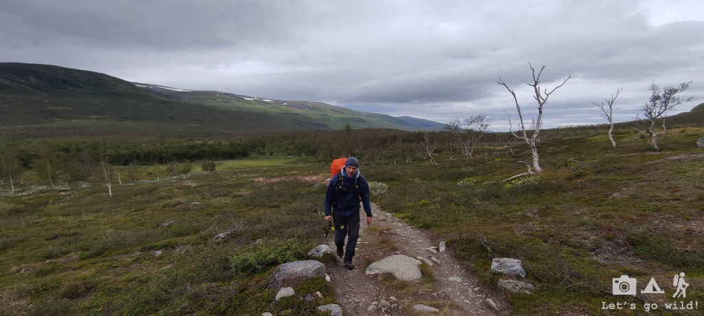
Salka – Singi – Kaitumjaure. Estimated 11.6 + 12.2 = 23.8km, 120/320 m ↑↓.
The night was cold, but the wind wasn’t as bad as I expected. We actually managed to sleep some. The weather forecast was better for today, with winds still strong but bearable, yet the temperature dropping even further. The forecast was showing rain all day again, but the actual weather was showing some signs of improvement with a glimpse of sun coming out here and there.
We had our breakfast and packed the backpacks inside the drying room with no rush to get out into the cold.
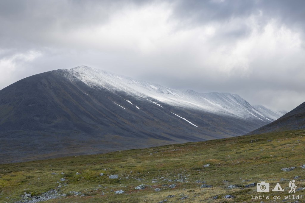
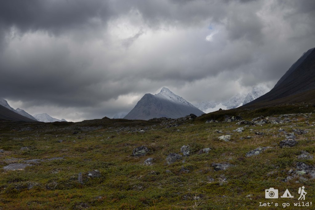
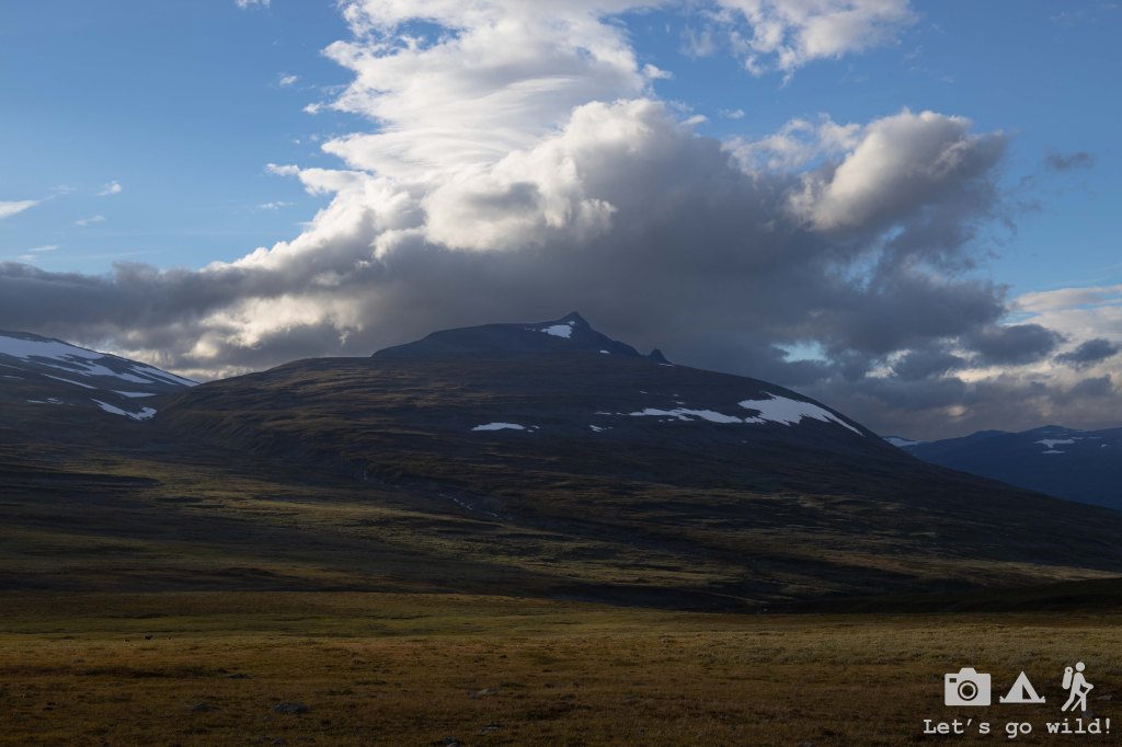
We started the hike with some dramatic clouds hanging above our heads and the surrounding mountains shining with a fresh white snow. It was clearly a cold night and the hikers who stayed in the Tjaktja hut or the refuge in the pass got to experience snow in mid-august for sure. Beautiful. Even some reindeers went out to admire it.

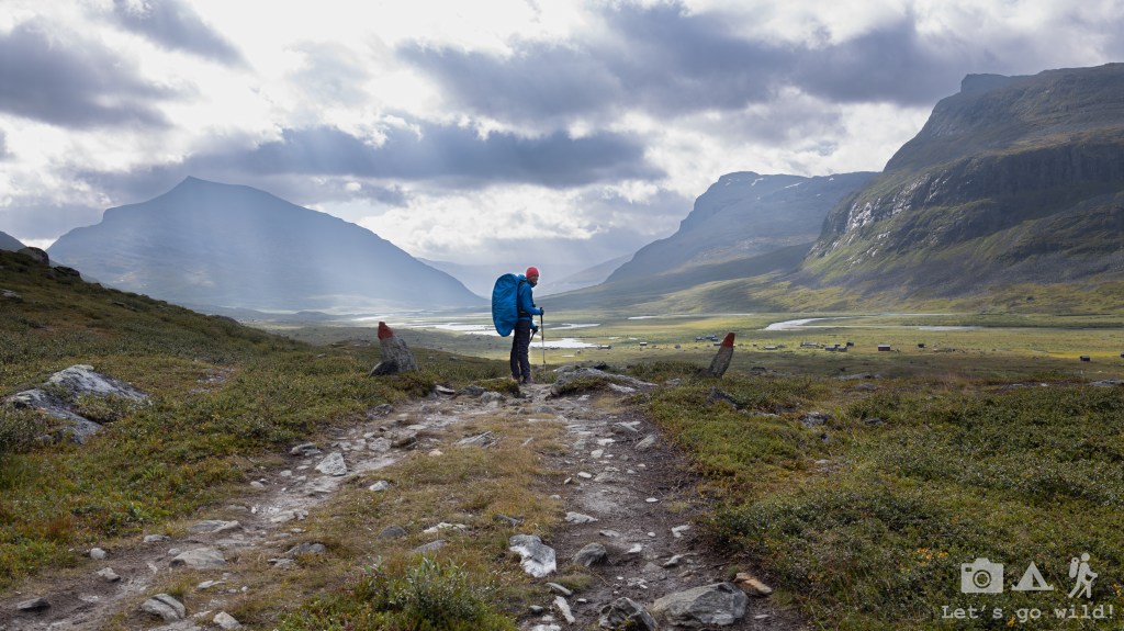
Soon enough, the valley started looking different. The glimpses of sun were dancing on the hills giving the landscape a more joyful feeling. It was a cold day but with the wind being less strong it was quite enjoyable.
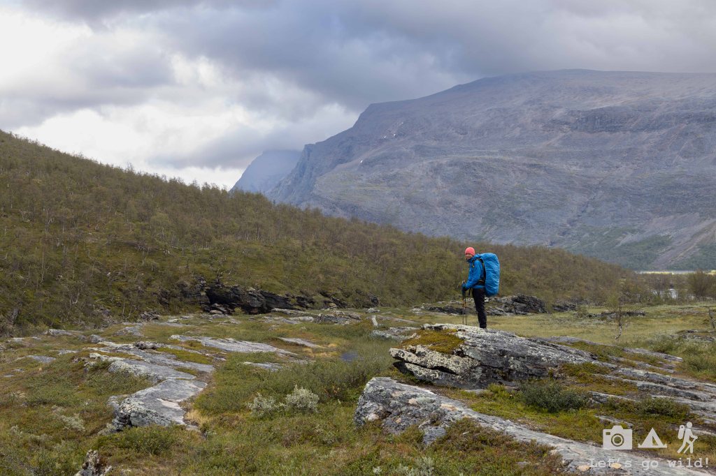
We were joining two stages again this day. First, we continued through the valley leaving Kebnekaise Mountain (the highest peak of Sweden, 2098 m) on our left, hidden in the clouds. Many hikers divert here to do the summit but that wasn’t our plan. Nor would I want to go there under these weather conditions.
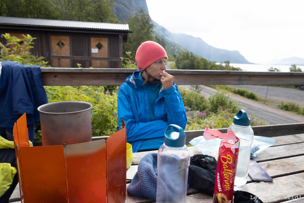
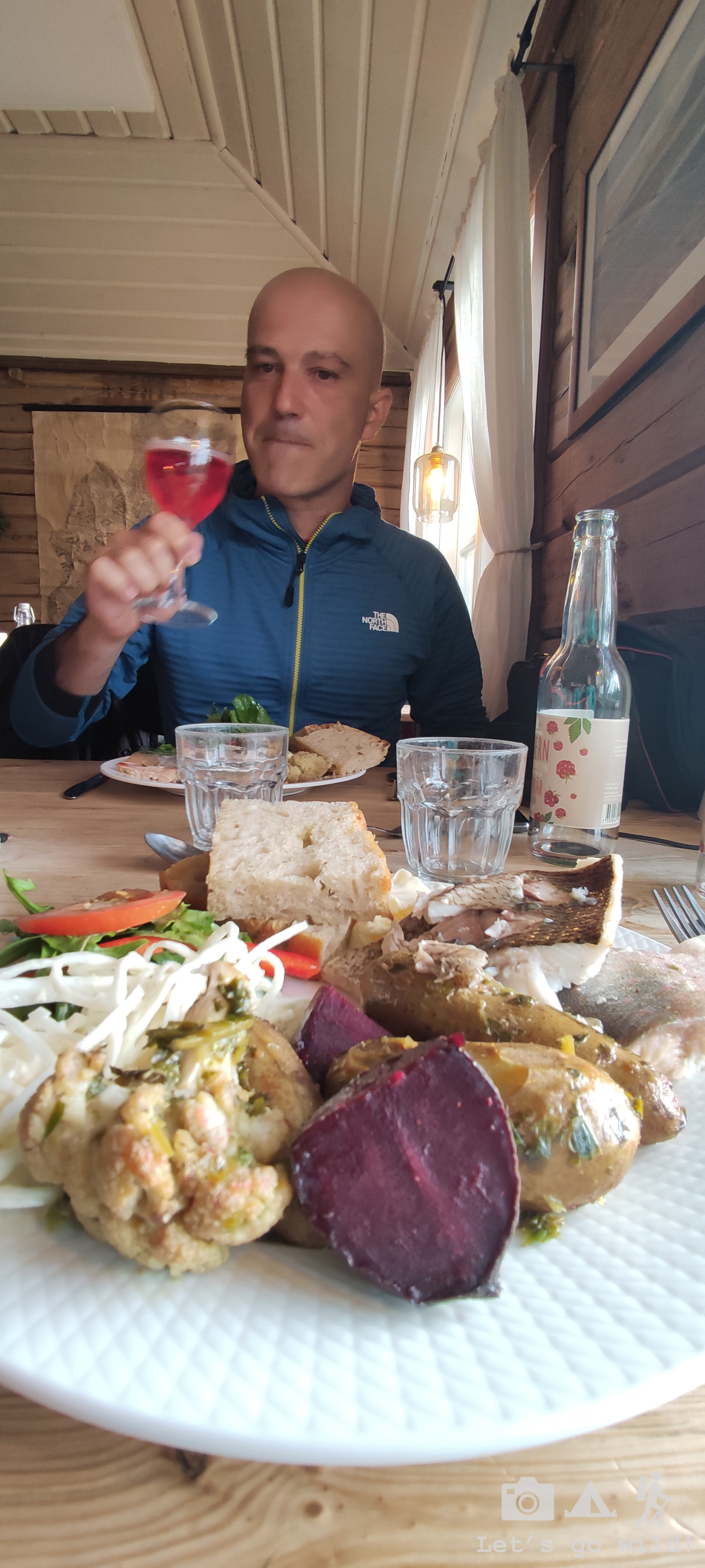
We continued straight until we passed an old Sami village and reached Singi. The weather was fairly good when we arrived, so we seized the moment and stopped to have lunch and rest our feet while admiring the views (by the way, this was the only hut that didn’t charge us as day visitors as we only used the tables outside).
The sun didn’t last long, and we got some raindrops before our water started boiling forcing us to look for at least partial shelter on the stairs of the hut, and rush back to the trail before our bones started freezing.

The rest of the path followed the valley with the river getting more consolidated and the mountains starting to close up the valley. We finally crossed it – all 30 km of it. “The beautiful valley of the winds” – that’s how I will always remember it.
The last kilometers of the day took us through a more mountainous area, with some easy climb and forest walk before opening up the views to the gorgeous lake right next to Kaitumjaure.
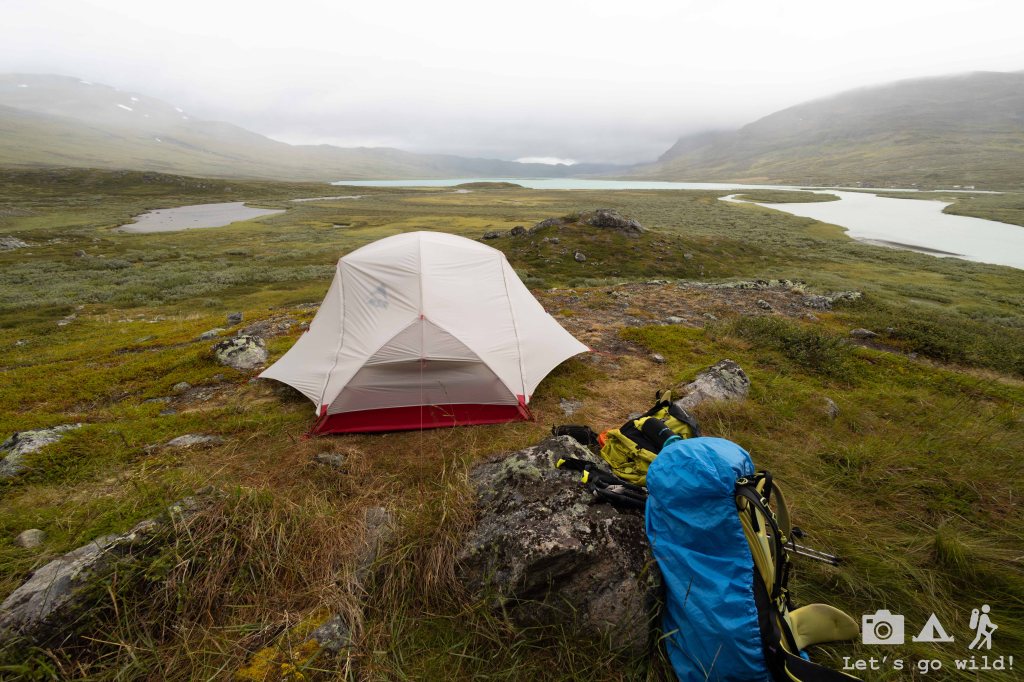
We walked approx. 24 km to today but didn’t feel very tired on arrival. Kaitumjaure is the first mountain hut after the diversion towards Kebnekaise summit and Nikkaluokta where many hikers finish their adventure. Thus, Kaitumjaure looked pretty much empty compared to all the previous huts. We were the first ones to pitch a tent and there were barely 3 or 4 tents more staying that night.
The warden was very nice and welcoming. He heated the sauna upon our request so we could warm up our bones and relax our muscles, gave each group a separate room to use for their cooking and drying, and even scaled the timings for the sauna to give some privacy. I do have to say that the sauna had a very weird construction with the gaps in floor through which the cold air was coming in all the time. With such a construction it is really not easy to heat it up! Thus, we spent the first hour simply washing ourselves and trying not to get cold. Yet, bit by bit the sauna got warmer, and we ended up having some good time and good company. One of the nice things about Kungsleden and the huts on its way is meeting so many awesome people and sharing stories in this cozy atmosphere. So, with all our love for wild camping, we didn’t regret a single night for staying next to the refuge.
Day 5. A resting day.
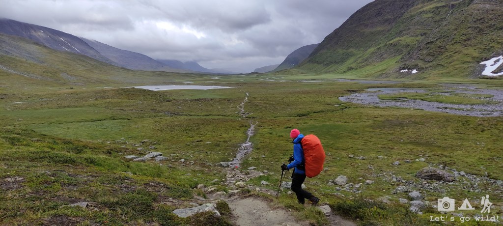
Kaitumjaure – Teusajaute. Estimated 8.6 km, 200/320 m ↑↓ + boat crossing.
After the relaxing sauna and a calm night, we had no rush to leave Kaitumjaure in the morning. If only we had more time, I wouldn’t have minded staying a couple of days in this place of outstanding beauty. But we had to move on.
The objective of the day was to Reach Teusajaure which was just 9 km away, cross the lake and wild camp in the first available spot.
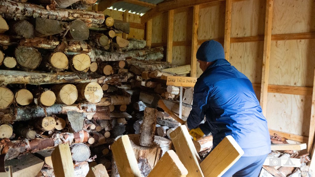
We started the day with some warmup chopping wood (community work) before we hit the trail.
My first steps were somewhat painful on the knees but got better once my body warmed up. The morning was fresh and cloudy, but the weather started getting better soon after we reached the river, forcing us to stop and remove some layers of clothing once in a while and pack our warm hats and gloves deeper in the backpacks. It felt sooo good.
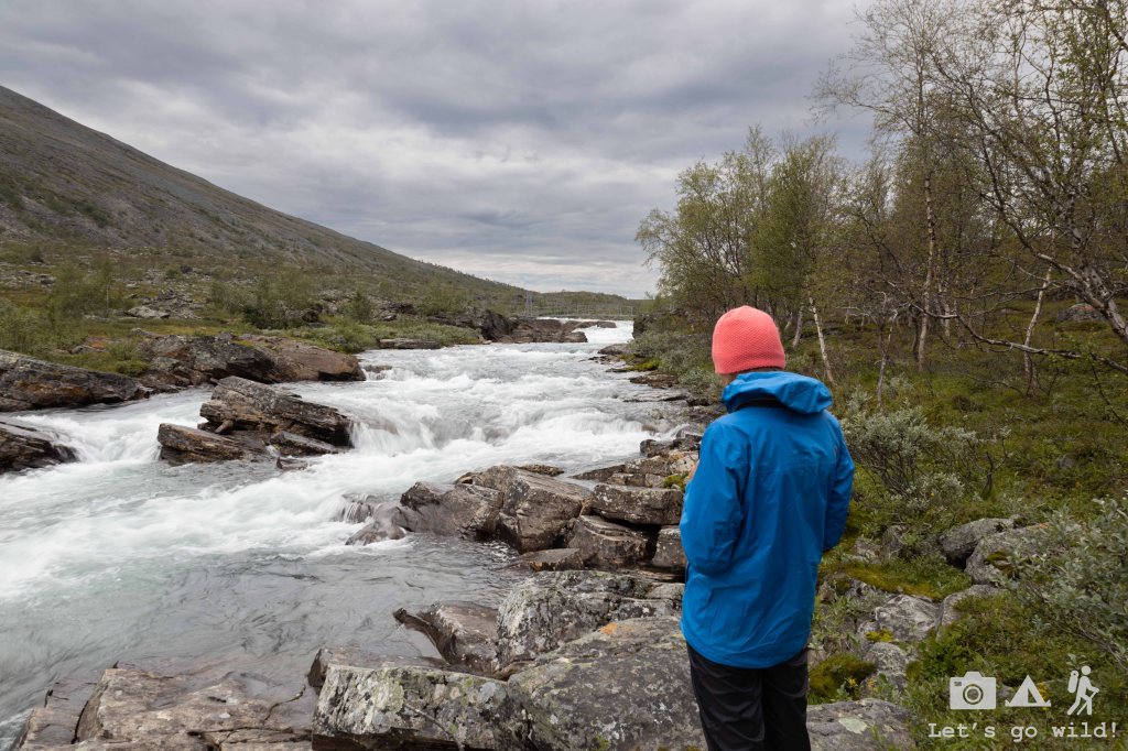
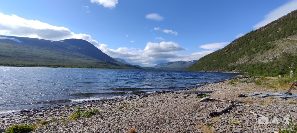
The path to Teusajaure was actually very easy, with some climb in the beginning and descent at the end, but mayor part of it taking us through a beautiful saddle with the views to snowy peaks of Sarek National Park.
We didn’t even notice how soon we started descending towards Teusajaure, getting back below the tree line and finding some splendid camping spots on the way and dinner ready to jump into your frying pan.
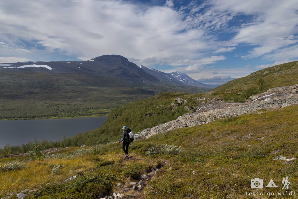
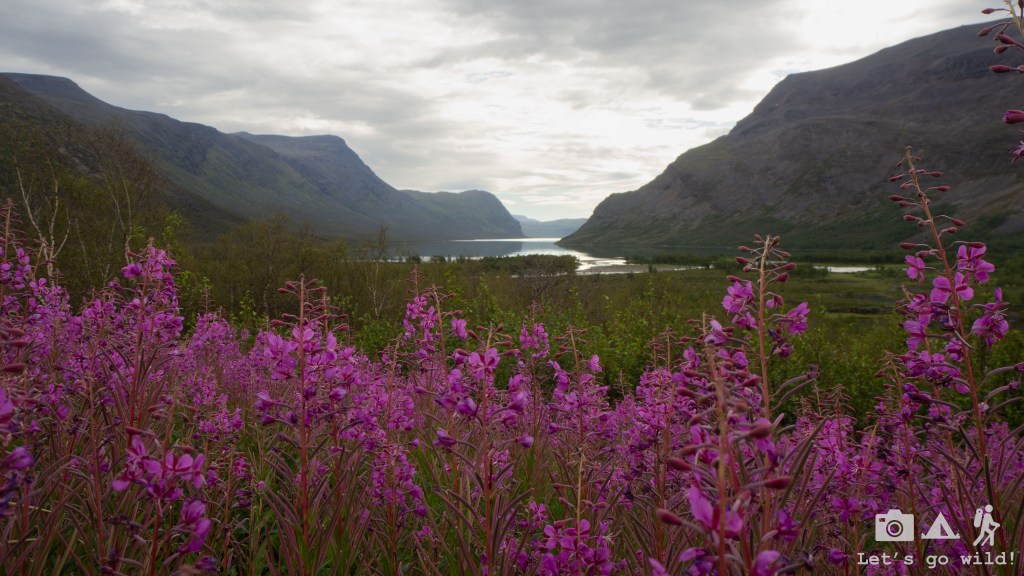
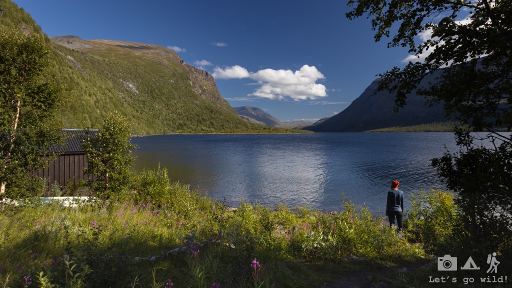
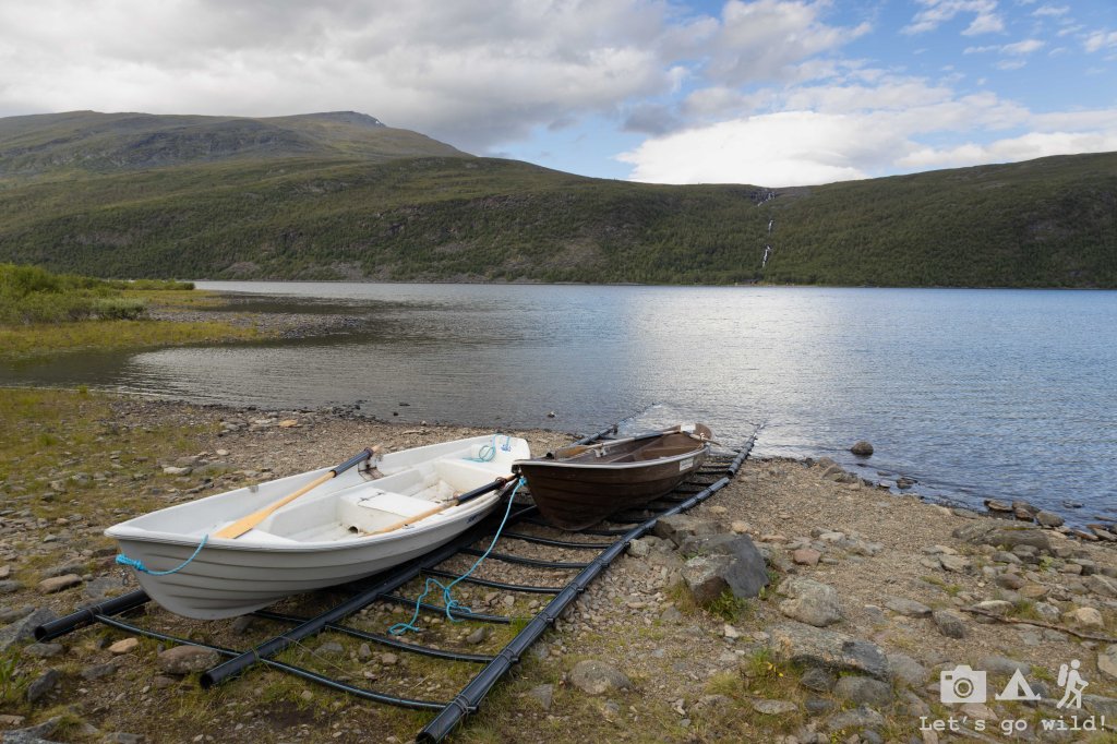
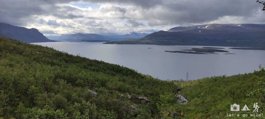
Teusajaure sits right on the shores of a lake with outstanding vistas that just make you want to stop the time and stay there a bit longer. And combined with the good weather it felt pretty much like heaven.
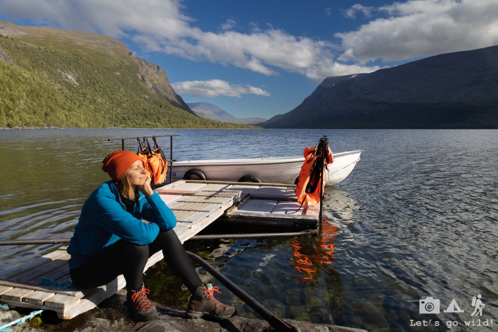
To continue the hike, we needed to cross the lake which could be done in two ways:
- Using the motorboat service provided by STF twice a day.
- Using the rowing boats.
The distance is not dramatic (900 meters) so rowing could be a fun option. However, the rowing distance depends heavily on the number of rowboats that you find on your shore. We only found 1, which meant that we would need to row to the other side, row back one boat and cross it again leaving at least 1 boat at each side of the lake. Given that we had to resupply our food and the shop was closed until 4pm, we decided that waiting for the motorboat service in such a wonderful weather with the views was not a bad idea either. So, we made ourselves cozy and relaxed several hours in this little heaven on earth.
The boat crossing was scheduled to 5 pm and we made sure to be on the first boat. The crossing only took a couple of minutes, yet those minutes were full of excitement as the boat was rocketing through the waves that now looked much bigger than from the shore.
Once on the other side, we started climbing and looking for any decent spot to stay overnight. But to be fair, no spectacular spot appeared. They all seemed to have left on the opposite side of the lake. So, we walked, and then we walked some more.
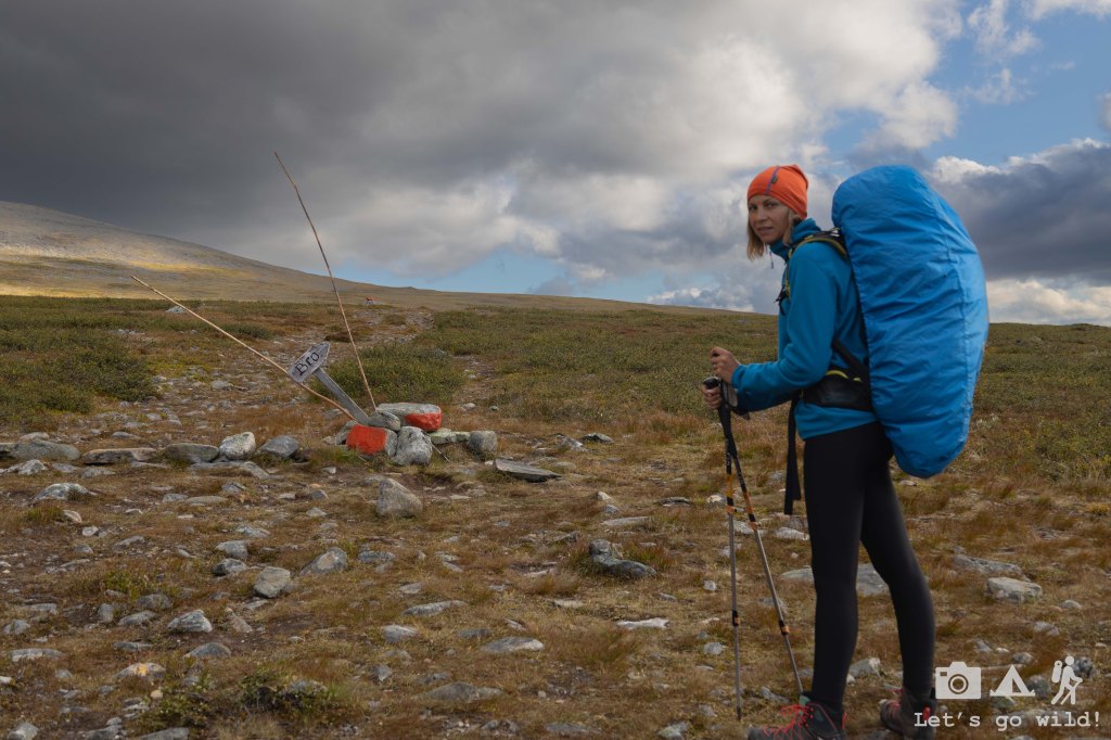
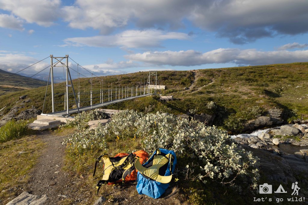
There was a really good camping spot next to a big bridge (Bro) some 5 km after the lake, but we didn’t feel that tired yet and wanted to approach Vakkotavare a bit more in a hope to get some mobile coverage. After all, it’s been 5 days since we let our loved ones know anything about us.
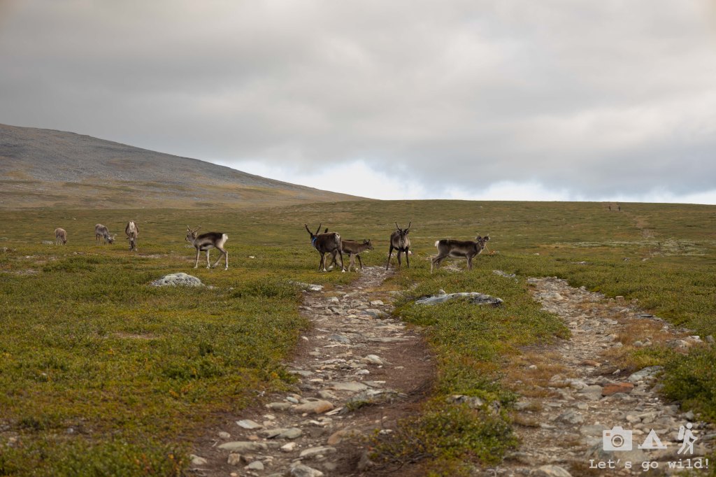
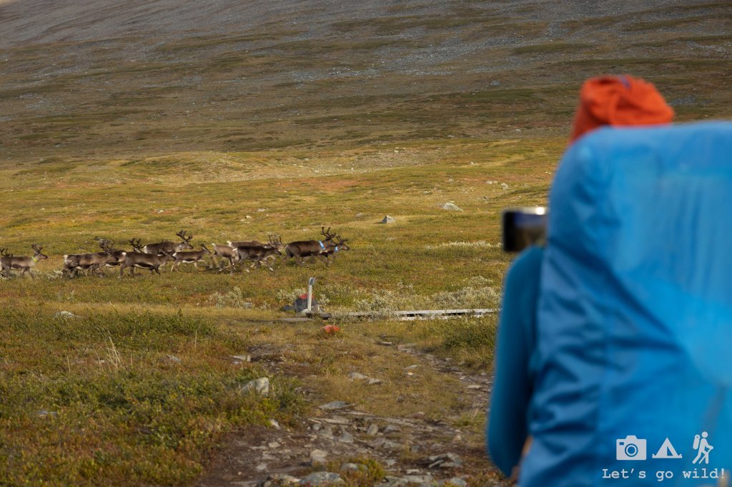
As we continued our climb which was now less steep, a huge herd of reindeers was showing us the way. Spectacular! They were keeping a safe distance from us yet staying close enough to admire them and accompanied us during at least an hour before diverting deeper into the fields.
The trail was going through a very bogy saddle, that didn’t have much of a drinking water nor decent dry spots to pitch a tent. So, we kept walking. The sun went behind the mountains, and we were still walking. Vakkotavare was approaching fast, yet the mobile coverage didn’t rush to appear.

Finally, just few kilometers before Vakkotavare the landscape started changing again with bigger rocks substituting the bogs and some tents emerging here and there. Just a couple of kilometers before the end of the section we got the views to the lake, mobile coverage and a nice spot to pitch our tent. I have to admit that we have a very twisted perception of a resting day… Approx 21 km with some 680m of ascent and 400m of descent, joining two stages for the third day in a row can hardly fit the conventional concept of a rest. Oh well, we can rest tomorrow.
Day 6. The hikers’ resort.
Somewhere close to Vakkotavare – Saltoluokta. Estimated 2 km, approx. 400 m ↓ + 30 km bus + boat.
Next morning, we started fairly early by picking up our wet tent and having just a quick snack for breakfast. We wanted to go down to Vakkotavare early enough to make sure we have a spot on the bus. We didn’t have any tickets prebooked and were worried that instead of two buses per day there was only the morning one left.
We were as close as a couple of km with the biggest descent you find on this section (the whole Teusajaure to Vakkotavare stage has 510 m of descent with majority of it being concentrated in the last 2 km). My knees didn’t like it at all. I was feeling some pain since the windy valley, but it was never too bad. Yet, this morning the pain made me suffer even though I was wearing a knee support, and we were moving fairly slow. I was happy to know that today we will be having a real resting day as we had pre-booked for this day a 3-course dinner in Saltoluokta and a sauna right next to a lake.
We reached Vakkotavare still an hour before the bus and were one of the first ones to arrive, thus even got a table to sit at for a calm breakfast while waiting. The hut sits right next to the road and a big lake on the other side of it. There is really not much space to pitch a tent (unless you want to sleep in a parking lot), so it was a good decision to stay for the night still up in the mountain.
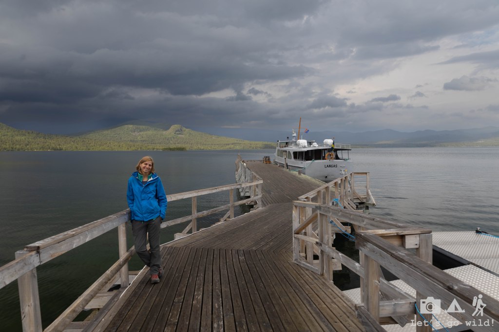
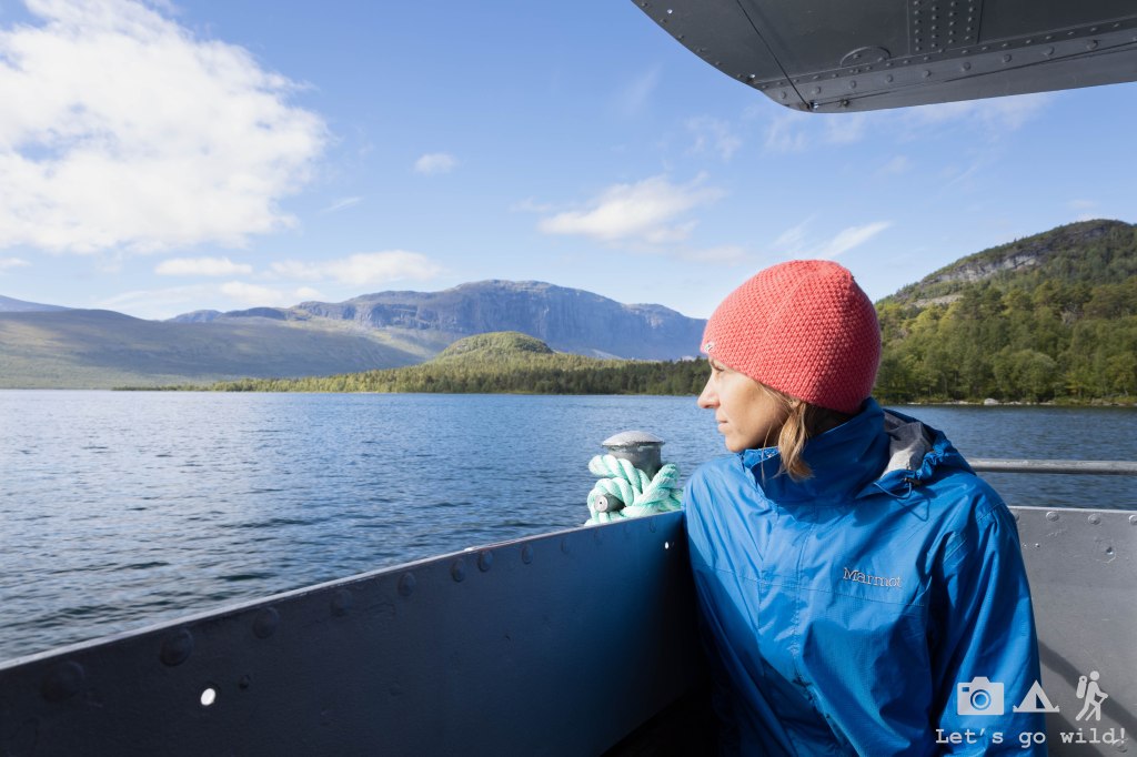
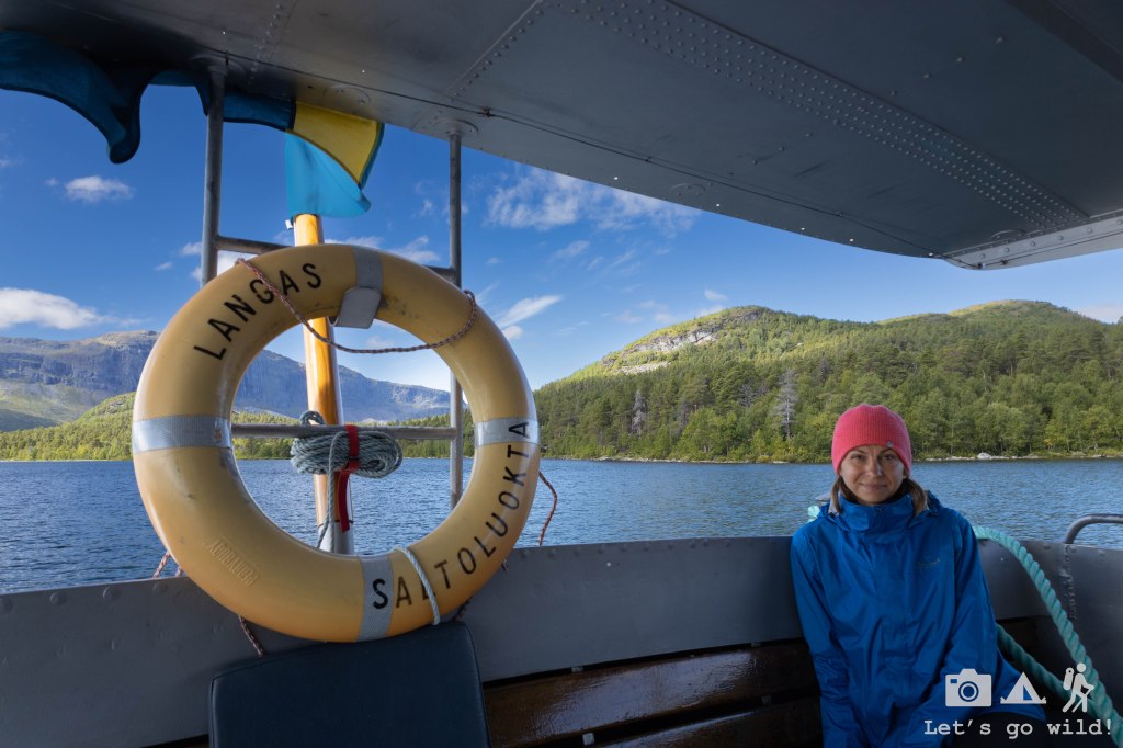
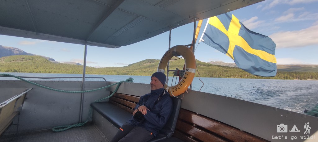
The boat crossing to get to Saltoluokta is 30 km away from Vakkotavare, but the road is far from being a highway, and with a shopping stop en route it takes around 1 hour to get there. The ferry schedule is perfectly aligned with the bus, so once we arrived, we directly stepped into the boat and crossed to the other side of Langas Lake. It was a short but nice crossing, with beautiful views and sunshine.
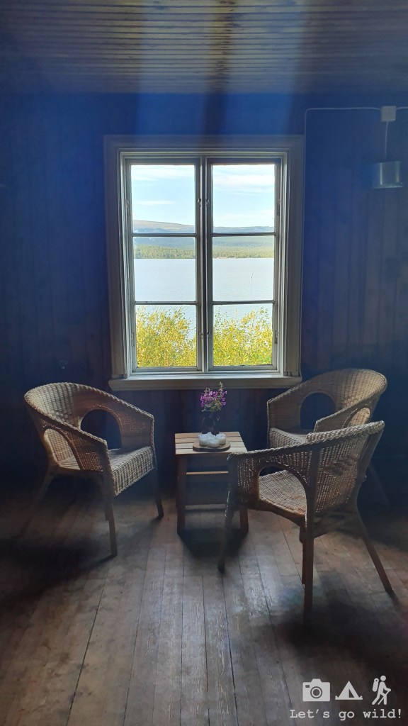
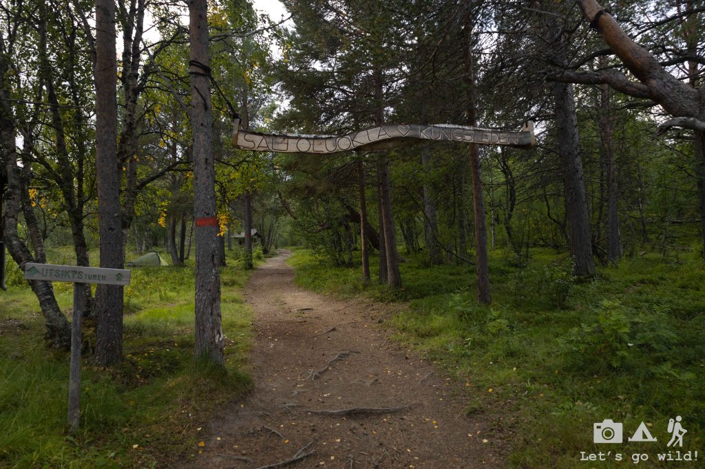
After that, there is just a short walk slightly up the hill to reach the mountain station of Saltoluokta. And what a noticeable difference it had compared to the small mountain huts we crossed on our way so far. Very quickly we realized it was a hikers’ resort with a big area, nice facilities and all kinds of services. Yes, finally we will have a true resting day!!
We had some drinks, pitched our tent and had a relaxing afternoon before going to our prebooked sauna and dinner to spoil ourselves. But my knee was giving very worrying signs. I could barely walk even around the area of the hut. Every step was marked with a sharp stinging pain. We were still hoping it would get better after a day of a rest but started thinking of a plan B in case it wouldn’t. Kungsleden doesn’t have many escape routes as it is in such a remote area that there are simply no roads or civilization around it. Thus, you need to estimate well if you can reach the next safe spot if you don’t want to call helicopter rescue on the way. Not to mention that you need satellite coverage for it as you can’t rely on the mobile at all.
The sauna was amazing. A huge sauna right next to the lake only for the two of us. A bit expensive, but worth every cent. This was the most relaxing moment in all of the hike: the beer, the heat and then the freshness of the lake when you run out for skinny dipping. It can’t get better that that.

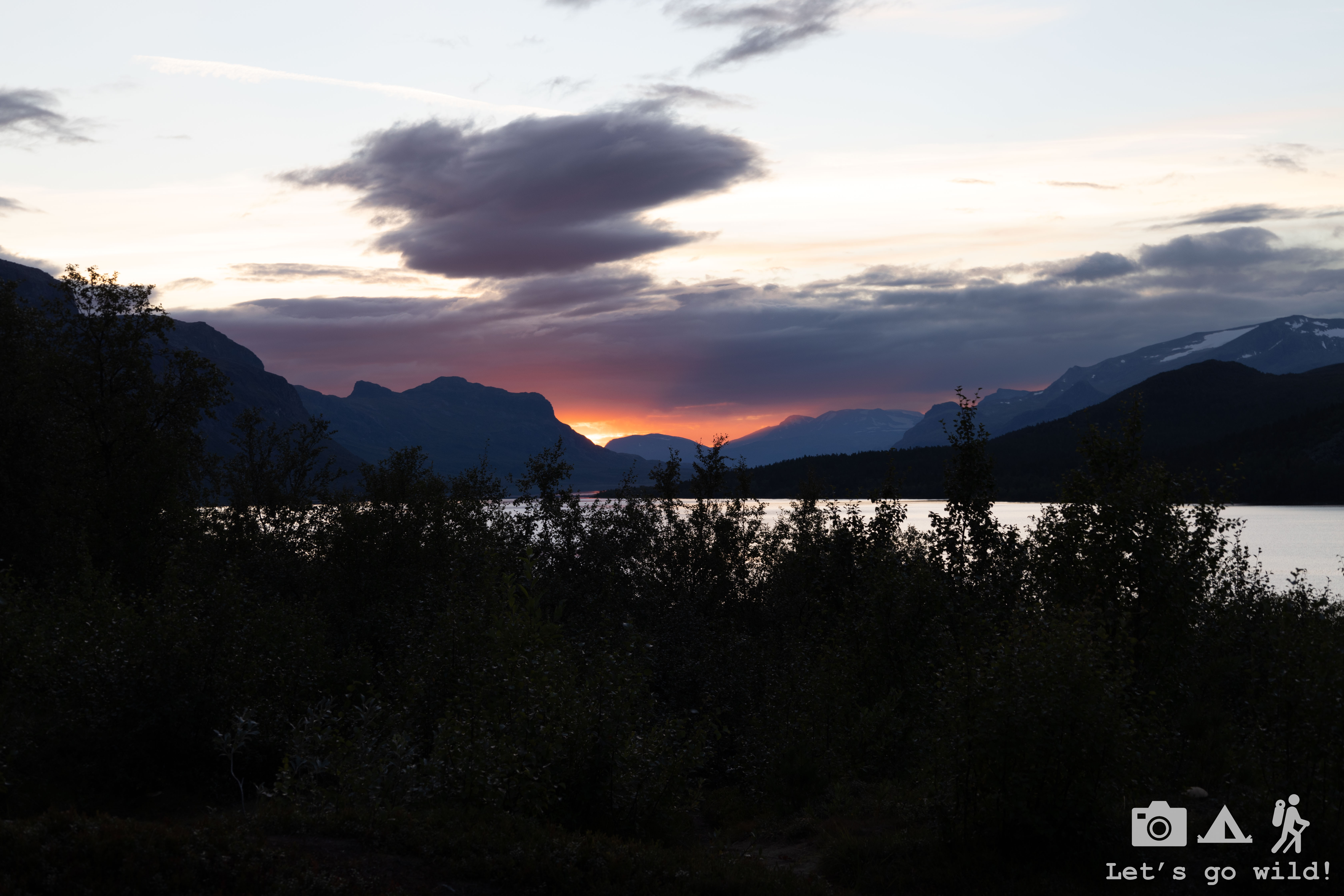
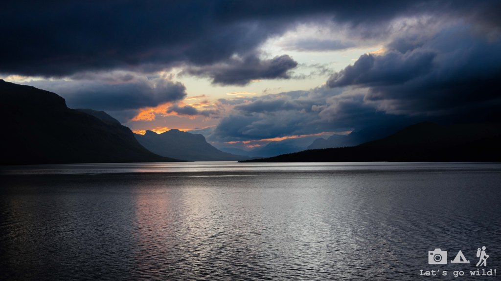
The dinner followed right after sauna. A feast for our bellies with a wonderful sunset in the background that we got between the main course and a desert. The sunsets are long here but by the time we finished our dinner it was a tiny bit too late to take spectacular photos.
We went to sleep fairly early being exhausted after a resting day, and a bit worried about my knee. Fingers crossed it would be better in the morning.
Day 7. New experiences
The morning didn’t bring any good news. My knee was equally bad (if not worse), and I struggled to even walk to the hut for breakfast. With a heavy feeling in my heart, I had to admit that once again we will have to end our adventure earlier than expected because of me. I needed more time for my knee to get better and time was something we did not have. Getting another day of rest would mean squeezing in the rest of the hiking days with no reliable escape option in between – something that sounded too risky to do given my poor condition.
Thus, we closed the chapter and replanned our next steps including one more day in this hikers’ paradise. Of course, as I couldn’t walk properly and we didn’t want to just stay doing nothing, we decided it would be a good idea to go… kayaking!! We did some kayaking with our kids before, but never really kayaked together, thus we thought we could go for a new experience. The day seemed cloudy but calm, with no significant winds in the forecast, thus we rented a kayak for a full day right after breakfast and off we went with no specific destination in our minds.
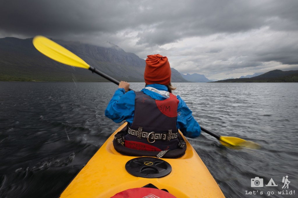
The lake was calm with crystal clear water allowing us to see the rocks lying deep in the bottom. We paddled a couple of kilometers with no rush, observing the coast and the mountains from a different angle.
And then the wind came. Never trust the forecast in the north… The waves grew suddenly and being quite unexperienced kayakers, we started feeling unsafe. Getting to the shore with the side wind, amongst the waves and big rocks, wasn’t an easy task but we managed somehow. It wasn’t really a suitable place to disembark, so we just stayed put, waiting for the wind to disappear as suddenly as it showed up.
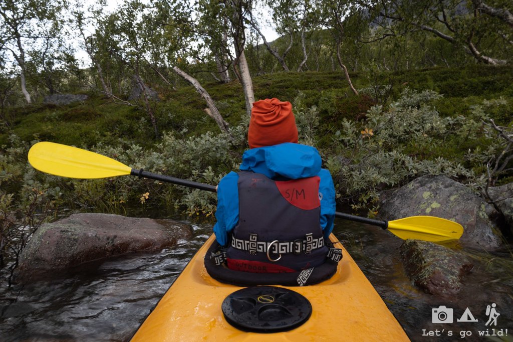
The wind was not going anywhere but it did have moments when it got somewhat better giving us an option to turn around and proceed. However, given the instability of the weather and huge black clouds hanging above our heads, we decided that it would be wiser to head back and paddle closer to the hut not to run into any stupid situation where we wouldn’t be able to return. We didn’t have food or any gear with us to make us through the night in case of an emergency. We paddled halfway back when the wind got calmer again, allowing us to stop in a tiny rocky beach to stretch our legs and enjoy the silence.

However, the weather was far from being pleasant and the cold got into our bones after a while, forcing us to get back to the kayak and move a bit more. We paddled for another hour or so exploring the lake and some small islands close to Saltoluokta before we decided we had enough.
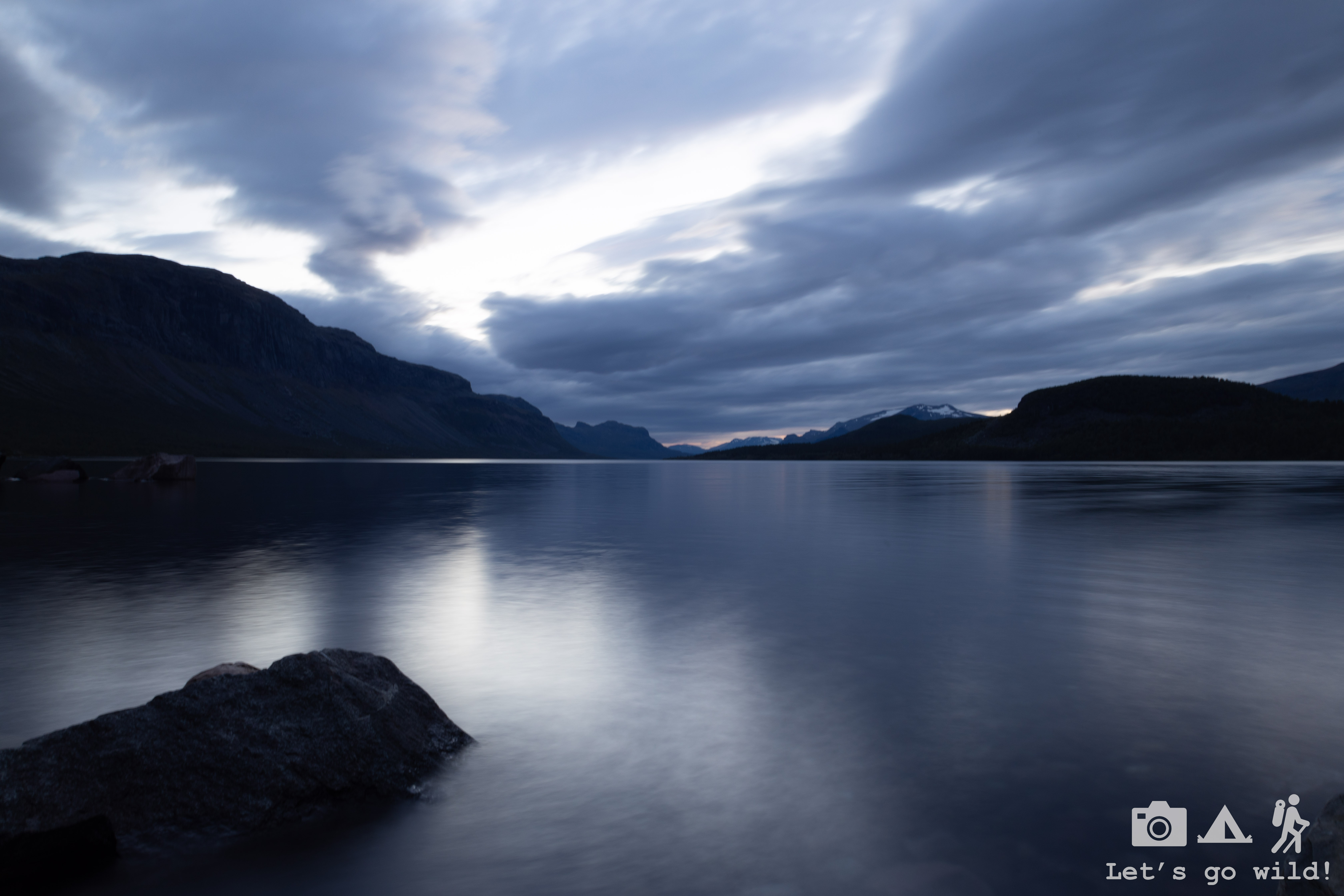
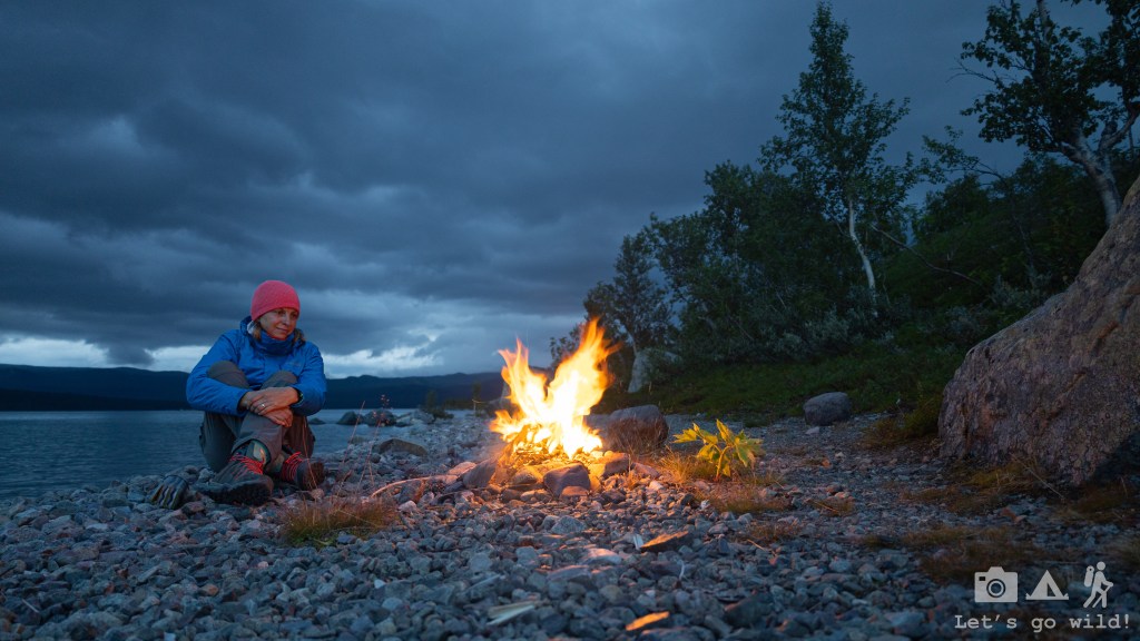
The rest of the day went calm, planning next steps in front of the big fireplace in the main building and enjoying the idyllic atmosphere of this “hiker’s resort” as we call it. We spoiled ourselves with another 3-course dinner, finally getting to eat the reindeer stew. The dinner was served earlier that day, so we had plenty of time to get back to the lake for the sunset, although it was much more cloudy and less impressive than the day before. Nevertheless, it was a nice and calm evening (would have been perfect for kayaking!!!) and while Pedro was taking photos, I managed to get us some fire. It was a peaceful moment to reflect on our week of adventures on the trail and the lessons learned for the future. Tomorrow will be a new day…
Day 8. Every end is a new beginning.
We had a loooong day of travel ahead of us, but the morning was calm and easy. We packed with no rush and went for a short walk around the area. My knee was feeling a bit better this morning, yet clearly not good enough to continue with the hike.
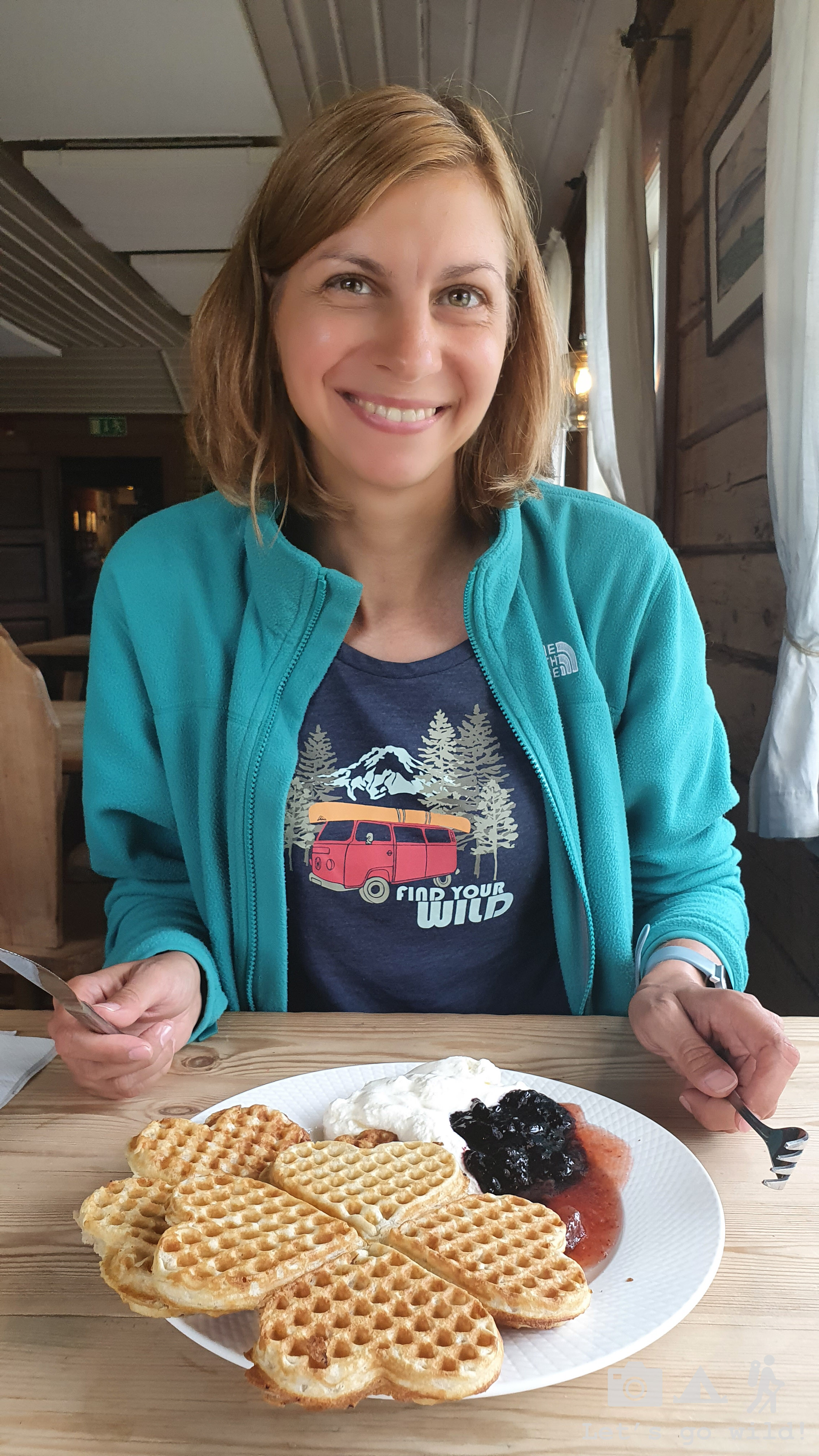
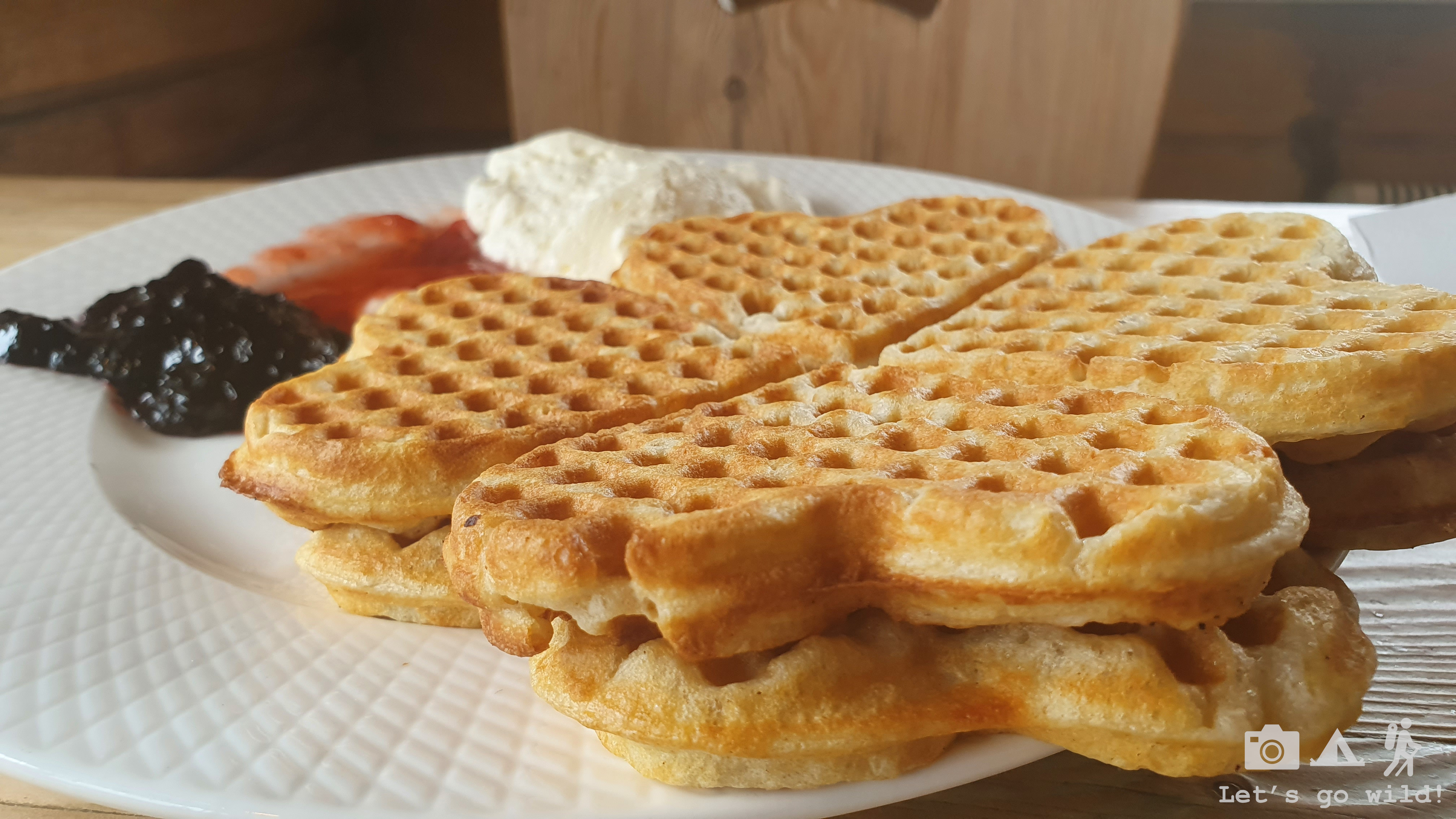
I drowned my sorrow in syrup (served with amazing waffles), said farewell to this amazing place and off we went.
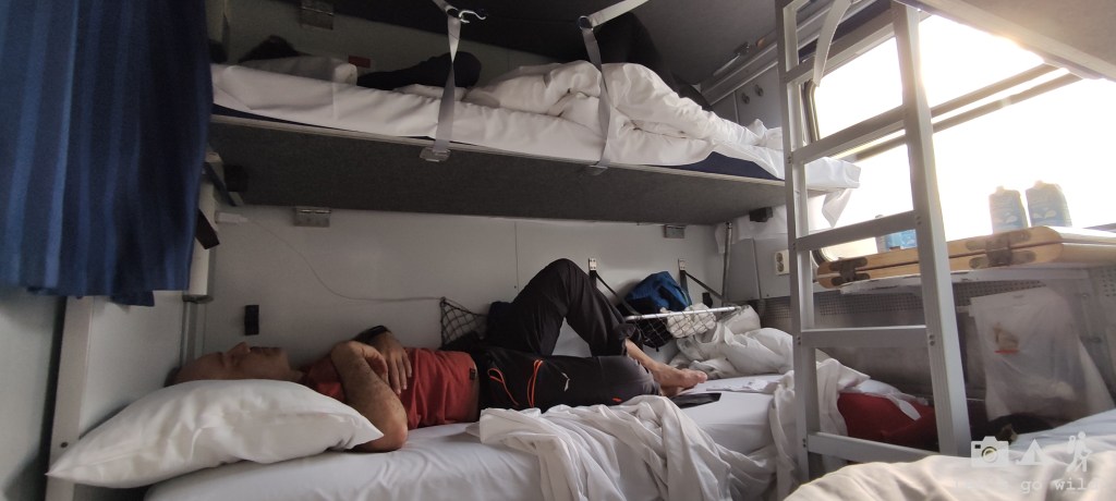
The boat. The bus to Gallivare. A crappy pizza and then the night train back to Stockholm. The hikers’ train with the hikers’ smell! And so, after almost 24 hours on the move we were back in Arlanda airport picking up a rental car to start a new adventure.