
France-Switzerland-Italy
12-23/06/2017
Probably first time in my life moments of a wonderful trip were overshadowed by the huge changes of life coming right afterwards. Took a while till a fairly free day popped out in a busy schedule with a few hours to be dedicated to reviving memories and putting them in a few lines. After a few lines I realized it will take longer than expected, but experiences and nice memories are worth this investment!
Day 1
Who said it’s going to be easy?
The book did.
Oh well, it lied.
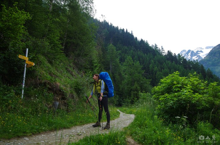
Planning holidays for this year was not an easy task. Very limited time for planning, very fixed dates and never ending super important things on the way ended up in us being at Chamonix- Mont Blanc (France) with a bare book of the Chamonix to Zermatt route (that was supposed to be studied a to z before coming, but had only few glimpses instead), no proper map (windows phone maps applications don’t count as they all are not suitable for any type of hiking whatsoever) and a desire to finally go out into the wild. Thank god we had to pass through the village and stumbled into a hiking equipment shop right in front of our eyes which reminded of a very tiny, but very important detail… WE NEED GAS!!! I can assure you that I have completely and fully forgotten about it and we could have ended up chewing dry and cold food at the evening.
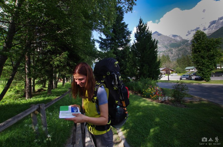
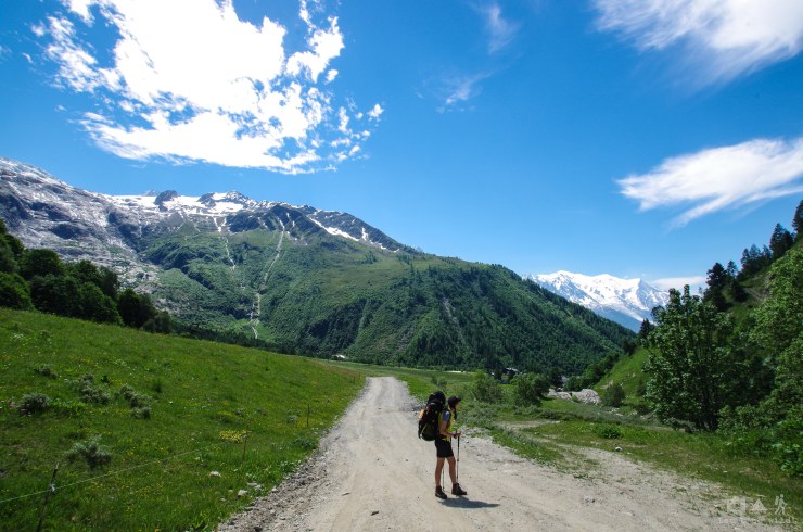
After fitting gas and water into our jumbo backpacks and wondering around to find the way out of the village, around 5 pm we finally manage to start going. The book said that first day of the route is just an easy stroll in the forest, with only a bit more than 200 meters of climb. Yeah, right… Well, to be honest, the book was right about the meters of the climb, but 9 km ended up being 13 and nothing even close to what we could call easy. Of course, it wasn’t the fault of the route itself. Rather of the 12 hours of travelling to reach the starting point and those black monsters sitting on our shoulders. All the way to Argentiere, our first destination, we were discussing how the hell we ended up with those jumbo backpacks, both above 20 kg of weight, after all the lessons we learned last year in Lofoten. What worried me even more – how the hell am I supposed to do tomorrow’s route with almost 1 km of climb if I struggle with this “easy stroll”???? This year, after having barely few hikes and no other option to exercise, I was far from being fit. It is not worth explaining how trashed we were when reached Argentiere that evening. Friendly French people helped to find the camping and as we are camping in a civilized place tonight – why not running to a bar close by for a beer? We deserved it.
Day route summary:
Chamonix to Argentiere – 4 hours, 12.87 km, ascent 218 m


Day 2
It was tough.
The beer for 15 Euros was good.
I hope we survive tomorrow.
Day 2 started with quite an idyllic morning: nice camping with mainly only tiny tents, hikers and climbers, flowers, bees, mountains all around and a beautiful glacier shining from the sun. It’s hard to say when we woke up as no alarm was set after such a long previous day, but we managed to leave camping around 11 am. Stage 2 of the Haute route invites you to first challenges of the trail (meaning around 1 km climb) to warm up your feet. After studying the route info beforehand in the evening, we decided to make a small shortcut and take a bus from Argentiere to Le Tour, therefor getting couple of extra hours to sleep and saving some energy for the climb. That was a wise decision. In high season, there is also an option to take a chairlift from Le Tour to Les Grandes, but clearly June is nothing even close to high season yet and we’ll soon learn that many of the options to facilitate the hike were actually not available yet.
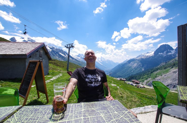
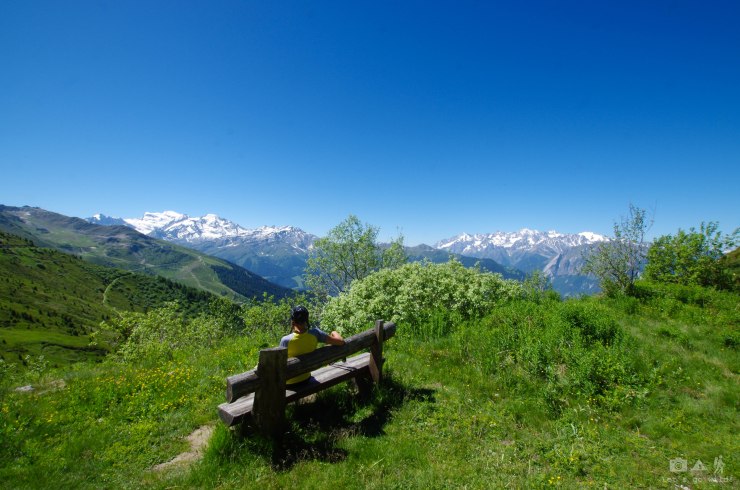
The climb to col de Balme (2204m) wasn’t very steep, nor very difficult, but jumbo backpacks and lack of air for my very-lowland-lungs made it tough to say the least. Amazing Mont Blanc massive behind us was used heavily as a reason for frequent stops to enjoy the views (saving lungs and heart from collapsing was just a secondary matter). In the middle of the climb we found a bar and decided to stop there for a beer, just in case the hut in the pass is closed. After refueling energy with the most expensive beer of the whole trip we got back to the trail.
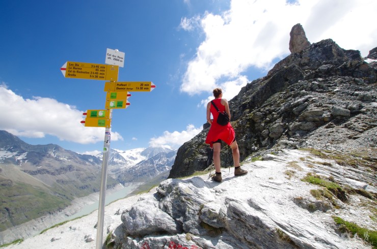
As we were climbing up, the skies were getting darker. We reached the pass and the hut (which wasn’t working of course) that welcomed us with howling cold wind and wonderful views on the France/Switzerland border. The book gives interesting note about this pass and it’s hut: the pass is measured at 2191m by French and 2204m by the Swiss. As the hut is entered from the Swiss side, it is reckoned to be in the Swiss territory, although its telephone number is French. What a blend!
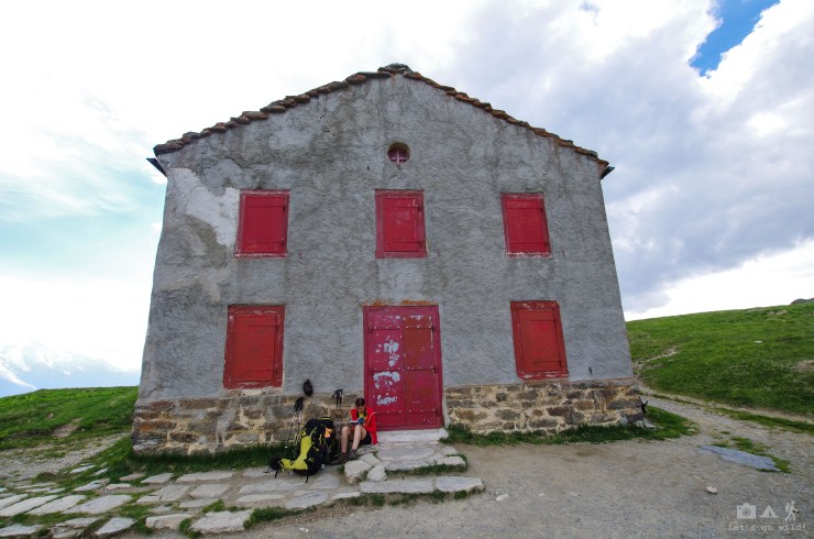
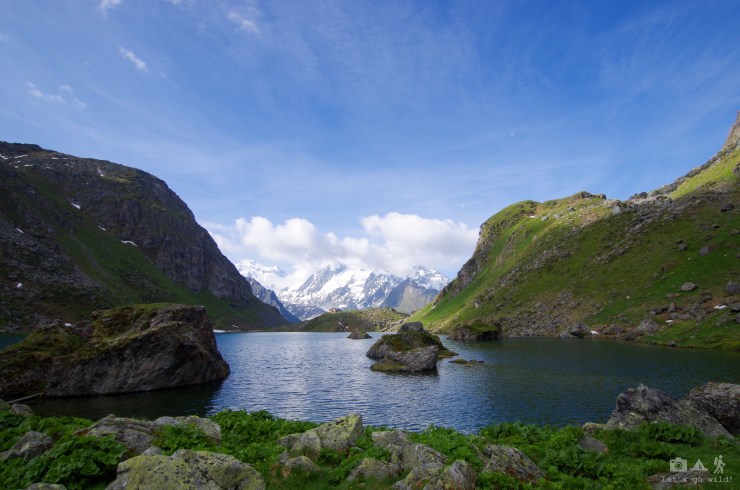
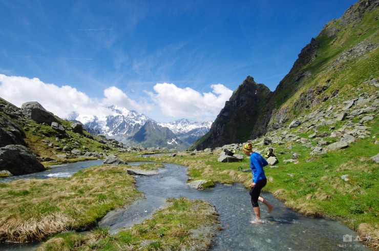
After crossing the pass, we got some raindrops and started a long and steep descent on a forest trail to our first village in Switzerland. Going down with jumbo backpacks is no easier than climbing up as our knees suffered a lot. With some unexpected excitement, we crossed a slightly flooded river managing to keep our feet dry and reached Le Peuty (1328m) and its minimalistic style camping, which was the closest to the wild camping style we could get in all this trip.
Choosing the destination for our holidays we were avoiding Switzerland as a very tourist and too civilized country. Well, in June, you can even start feeling lonely here and half of the civilization is actually closed. Yet the country seemed to be too civilized for wild camping as almost every flat spot is occupied and you would have to wonder further away from the trail to find a place for your tent as officially wild camping is not allowed in most of the areas. Although we had all equipment needed to be independent of civilization for all 11 days, we didn’t have enough energy to extend our hikes with extra km trying to find a wild place for a tent.
Day route summary:
Le Tour to Le Peuty – 7 hours, 10.76 km, ascent 754m, descent 871m


")


")
")


Day 3
If the gas stove doesn’t reach the valve – put a tiny stone and issue solved. Thank god for an engineer in your team.
Maps are useful and signs can be wrong.
Do not underestimate the swiss forest.
A beer can fix everything.
Pay close attention where your train is going.
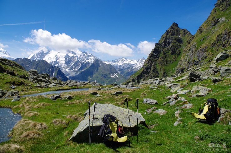
Morning in Le Peuty greeted a wet way. The night was rainy but we slept like babies. Camping was completely empty – our only neighbors (some youngsters from USA doing a Mont Blanc tour) have left before we managed to open our eyes. After struggling with our gas that all of the sudden stopped working but was fixed by a genius engineering, we pack our wet wet wet tent and off we go. Originally Haute route on stage 3 goes to Trient (or to be more exact stage 2 ends at Trient and not Le Peuty), then makes almost a U turn and goes to Arpette. After analyzing the minimalistic map we decide to take a shortcut and save couple of km, as the day is very long with more than 1 km of climb. But making shortcuts in mountains can’t be easy!!! After few discussions which way to go and some completely wild and bushy trails that haven’t seen people for quite some time (thank god as then we wouldn’t have found so many nice berries!), we manage to get into the original route. So happy and excited!!! Now the rest is just a piece of cake. Original trail up to Chalet du Glacier (1583m) is just a nice stroll on a wide and flat bisse path. From there we reach chalet in about half an hour stroll, stop to enjoy the views to Glacier du Trient and have lunch. Meanwhile the chalet opens and we can even have a beer.
After having a nice break and forgetting anxiousness we had in the morning part making shortcuts, we start the most difficult part of the day – the 1km+ ascent. Or at least we thought so. Less than half an hour from the chalet we see a sign showing our direction. And right after we see another, which is for a weird reason laying on the ground but directions seem to be more or less ok. We take the trail that was showing Arpette but very soon (I mean very soon – like in 20 meters) the trail disappears and we end up in a wild forest. Having noticed by now that the trails are not perfectly marked we start trying to find any marks or signs as the only thing we have to guide our way is the book, which is not very explicit on some parts and turns. In our attempt, we also find a couple of other hikers lost in the way. We were so determined to do the Haute Route and reach that damn Arpette that we try very VERY hard and using logics and statistics end up couple hundred meters above the trail in a dead end… Not to mention that we did those meters in a completely wild alpine forest, trying to make our way through big rocks, fallen trees, 1 meter high nettles, etc. And of course, after admitting our mistake and that we won´t be able to reach our destination today, we had to go all this way back down, which was no easier task.
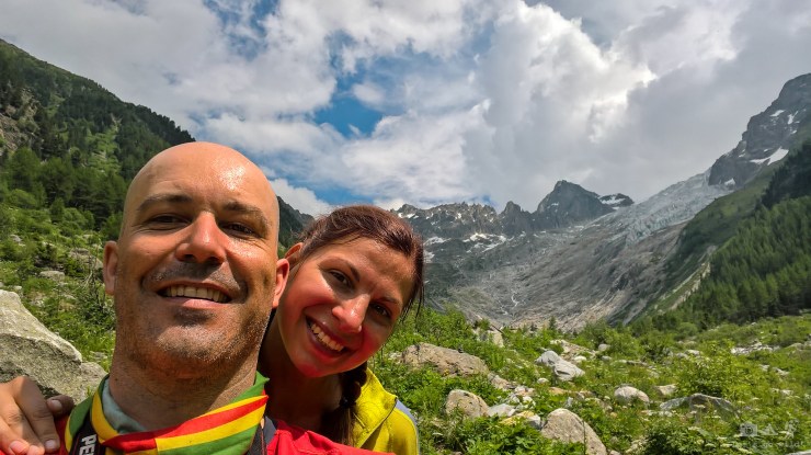
We lost aprox 3-4 hours in the wood, but they sure were not boring: full of hot discussions, emotions, pain and some fear, but ended up in jokes and laughter. Once out of the wood, we followed a glacier path for a while looking for any other sign of the trail we missed and admiring the glacier du Trient from afar. Realizing this is as close as we will get to it, we make a selfie and turn back to chalet with no other plan as to just have a beer and think of where to spend the upcoming night.
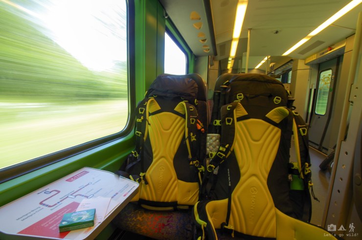
Cold drink refreshed our minds and seeing other two hikers returning with no luck to reach Arpette recovered a bit our dignity. We decide to walk back all the bisse path and try to catch a bus if we are lucky or stay another night in semi-wild camping of Le Peuty. The luck was on our side this time and after waiting some in the rain we finally get into the last bus going to Martigny. There we are supposed to switch to the train and, with another train switch on the way, reach Champex by late evening. Not sure if it was because of another beer we had while waiting for the train or because of a crazy day mood we changed our plan once again. Sitting warm and comfortable in the first train we notice that it actually goes to Le Chable, which is the end of stage 4 of the route. Quickly looking through the trail description of this stage we decide to skip it and “accidentally” miss our stop to change the train.
Le Chable greeted us with a thunderstorm and rain which forced us to run to the closest hotel we saw. Watching the storm through the window after having a hot shower and no need to put a wet tent was almost a blessing. This was a very long and completely unpredictable day and after having frustration of a lost day of the route we ended up being one day ahead of schedule. Tomorrow we can take it easy.
Day route summary:
Le Peuty to … Trient – 8 hours, 18.18 km, ascent 558m, descent 340m


Day 4
Now what?
Task no 1: find the trail. Ok, never mind…
Task no 2: find transportation. Anywhere.
Task no 3: climb 750 m of exposed trail.
Task no 4: find the f* way out of here! But that we can do some other day.
After having breakfast in the hotel we have a chat with an administrator trying to find out if there is any way to make a shortcut with public transportation on stage 5 of the Haute Route as 1636m climb wasn’t a very appealing option after such a crazy start of the trip, especially knowing that the hut in our destination was not yet working and weather forecast was showing high chances of another thunderstorm. Apparently cableways we needed were still in low season mode and were working only on weekends, meaning only open in two days. This was the time we had to accept yet another change of the route and instead of going to Cabane du Mont Fort (2457m) we turned our way to Cabane de Louvie (2250m), which seemed to be still a possible connection to jump back into Haute Route next day.
We took two busses (with an hour stop in a completely empty Lourtier) to get to Fionnay around lunch time, where a fairly short trail to Cabane de Louvie starts. It seemed to be a reasonable option for a calmer day. Yet, right after exiting the bus I heard Pedro commenting “this doesn’t look good”, but was too excited to start another hike and turned to the direction of the trail immediately. The trail starts zig-zagging through the cow fields (which always makes me feel a bit uncomfortable as no way I could run away from that animal with horns with my jumbo backpack on my shoulders. Or even without it…). The trail, apart from being quite steep, appeared to be quite exposed too which slowed down our pace dramatically as one of us has… vertigo. Probably our unfortunate changes of previous day plans kept us stubbornly going up step by step, until we finally reached the beautiful Louvie lake and it’s hut. Without discussions if we should put a tent tonight we take a chance to sleep in a bed again.

Even though the climb was challenging because of vertigo, we must admit it rewarded us with amazing views and the destination exceeded our expectations by far. Apart from having wonderful views to glaciers, it gave us a very close look at some wild life around here: uncountable flock of ibexes peacefully feeding themselves on the other side of the lake and later migrating to new spot, passing by right next to the trail. The photographer of the team grabbed camera and went down to the trail to have some closer photos, leaving me up there with half-finished dinner. After admiring the views from above for at least half an hour I started feeling lonely and went down too. If I feel not very comfortable passing through cow fields, it is not worth mentioning how long it took me to make steps on the trail that was literally blocked by one of these gorgeous animals with enormous horns and many of his flock fellows walking just few meters away… But the views were worth it and at least for a while distracted our minds from thinking how many meters of ascent or descent we have to do tomorrow.
Day route summary:
Fionnay to Cabane de Louvie – 3 hours, 4.5 km, ascent 744m


Day 5
Do not underestimate the mountains.
Swiss mountains are not suitable for people with vertigo. Don’t be ashamed to crawl, you can kill witnesses later.
No matter how much you are trashed, after two beers you can hike again.
“Time to go” – I heard before even opening my eyes 7am. At that moment I realized that going down won’t be easy. Going back the same way as we came up was not an option for anyone who has vertigo. Last night we analyzed maps (even bought one!!!), talked with an administrator of the hut who was very nice and friendly. She showed us the easiest way to go down without suffering too much of vertigo, but warned in advance that on the pass there will be 50 meters that will be quite exposed. Trying to forget the horrible breakfast we had (honestly, never ever try scrambled eggs as your dried travel meal) and those exposed 50 meters that are waiting for us up there we start our hike quite early. Or at least early to our standards as the hut was absolutely empty by the time we came to have our early morning coffee.
Louvie lake gives us great morning views and a bunch of mosquitos to hurry us up the hill. Yet, not having a proper breakfast makes us stop for energy bars before we even reach the exposed pass. I could also clearly feel on my legs that today my backpack is heavier than other days. On my request, we distributed weight equally this morning so when we came to the pass I had a pleasure to go through it twice: first with my own backpack slowly leading through the scary part, leaving Pedro’s backpack behind so it would be easier to maintain balance in vertigo moments, and after a safe place was reached I went back to take what was left behind. With a relief of passing through the scary part we hurry downhill to the nice river which will lead us all the way back to Fionnay.
After refreshing feet in the ice-cold water of the stream we have lunch and admire views to the mountains in front of us, the alpine flower fields and butterflies. Half of the way down was nice and easy until we reached the second half which again forced us to slow down on the steep zig-zags (both because of the slight exposure and my suffering knees). I could almost kill the two guys who took us over running downhill with their dogs. Crazy locals. And they don’t have monster backpacks too (I need a reason to restore my dignity at least a bit).
Reaching Fionnay felt more or less like getting back alive from the Everest. We went directly to the closest bar we saw to have a beer and calmly think of what to do next. Smiles got back on our faces fast and after a second beer we were ready to hike again. Not that we had much choice really… the closest camping was a bit more than an hour away and no busses go there on low season. But the trail is marked with yellow diamonds – we named it a path for “children, disabled and pregnant women”. That’s the mark we want to follow from now on. No more white/red/white mountain trails that need “head for the heights” as swiss call it.
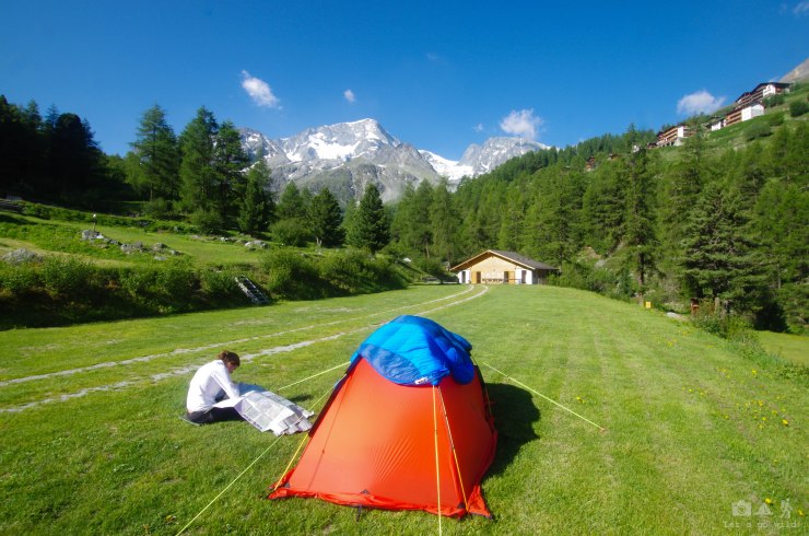
The camping in Bonachiesse appeared to be very nice: you could clearly feel that it was integrated into the natural wild nature and not exploited by greedy humans trying to make money out of every inch. We put a tent with no plan when we will be leaving this place. After such a crazy start of our holidays (oh wait, it’s almost middle already) we feel like we need a calm break.
Day route summary:
Cabane de Louvie to Bonachiesse – 8 hours, 10.77 km, ascent 471m, descent 1105m


Day 6
We deserved a resting day (not sure if 13 km route counts in).
Planning is important!
Eating dried travel food for 11 days surrounded by restaurants might not be the best idea…
Being sick of eating dried travel food for 5 days we go to have breakfast at the restaurant “Promenade” next to the camping. This was like heaven! Fresh bread, local cheese, amazing croissant… we realized we should have taken a photo of this amazing breakfast only after the plates were empty.
We spend morning relaxing, doing laundry and trying to plan our next steps. What we learned in five days is that we have to accept our limitations and plan our hikes accordingly:
- no more hiking with monster backpacks – this really makes hikes less pleasant, especially when you are not fit and with all the food and accommodation options you start feeling stupid for meaningless suffers.
- no more risk of vertigo – of course, one could say “why the hell you go to mountains if you have vertigo?” but… not all trails are exposed and you can reach some very amazing places without getting your head dizzy and legs shaking. We sure did a mistake on choosing initial route and not spending enough time on checking the detailed info beforehand. We decided that for the rest of the trip we will be doing radial hikes so that we could turn around and get back if we encounter a place that is over exposed.
- as we are already here and need to combine those two points listed above, we need to think of how to organize all this. So, we came up with an idea that we need to rent a car.
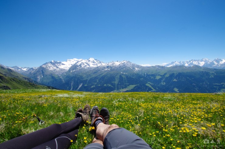
Relaxed that we have a plan by lunch time, we leave our backpacks and set off to the lake nearby. Or to the dam to be more precise. What a great difference to hike without a jumbo backpack!!! Feels like we are flying and you can actually enjoy every step of the trail! And what a great disappointment at the half empty dam… The views are far from what we saw in pictures. Suddenly we remember locals giving us advice couple of days ago that we could camp around here. Yeah, right… even if we could somehow reach the other side of the dam which looks a bit flatter, we would clearly have issues with drinking water. With an amazing speed, running in some sections of the white/red/white and yellow diamond trails we go down to our camping. Feels like it was a light and easy hike though we did 13 km!! This only confirms that our plan “no more hiking with jumbo backpacks” is 100% right.
After having yet another dinner of dried travel food I lose control over myself and we end up again in Promenade having cheese fondue with wine. Yummy! So full that we can barely move, we get back to our tiny tent. Tomorrow we have a very early start as we need to be back in Fionnay before 8 am to take the first bus back to Le Chable.
Day route summary:
Bonachiesse to Mauvoisin and back- 3,5 hours, 13.5 km, ascent 378m

")


Day 7
Miss-plan a stop in a train and you’ll get a 5 km punishment.
Better avoid 4* campings.
Sunday should be the resting day, right? Not this time, though! With a super early start (leaving camping before 7am) we hurry to catch the first bus in Fionnay to start our transition day. With an early morning start in Bonachiesse we must end the day in Sion with so much to do on the way!
After a fast but easy hour stroll down to Fionnay we take a bus to Le Chable. There we wait some and hop on the next bus to Verbier. A nice thing about Verbier region is that once you stay in any official overnight place and pay a small tourist fee, you get a ticket for free busses, gondolas or chairlifts that day. Too tempting not to take advantage of!! Of course, if they are working… After reaching Verbier we leave our backpacks in the gondola station and try the lifts to approach higher trails avoiding most of the climb. What an amazing invention!!!! Once there, we take an easy yellow diamond path (we love diamonds) to the only working restaurant around there.
Lazy and easy walk watching absolutely crazy mountain bikers, wonderful latte with a fresh baguette for breakfast we had to skip before, watching rich people enjoying their helicopter trip to the same place, then an easy way back and take another path towards the destination that was supposed to be the end point of stage 5 of the original Haute route. From here the path is so nice and easy that climbing almost 1,5 km on the very civilized and steep hill with jumbo backpacks (that we were supposed to do on day 4) looks absolutely meaningless. We almost reach the hut and lay down in a flower field to enjoy views to the Grand Combin massive.
After spending few hours up there in the busy and crowded mountain we go back to an almost ghostly empty Verbier and unfortunately few minutes late for the bus. Next one is in more than an hour so we take a chance to sit down for yet another beer. Swiss beer is good. When the time comes, we take the bus back to Le Chable, from there – a train to Martigny. And there we super quickly change the train to Sion. Trains here are like swiss watch… they are so aligned that you must act very quickly in order not to miss yours.
The day before we analyzed maps and saw that camping in Sion is right next to the train station. But what a mistake it was not to check exactly the names of the stops… we got off the train one stop too late and were punished with extra 5 km walk (jumbo backpacks included). This was probably the longest day both in terms of hours and km done. The camping in Sion was a complete disappointment (very crowded and oriented towards different type of campers) but we were too tired to go anywhere else. We can survive one night in a 4* camping. At least it has cold drinks…
Day route summary:
Bonachiesse to Fionnay, Verbier, Sion – 6 hours, 21.4 km, ascent 121m


Day 8
Dams in June are not impressive.
Hiking without jumbo backpacks makes a BIG difference.
Refreshing moments of knee high snow wearing shorts!
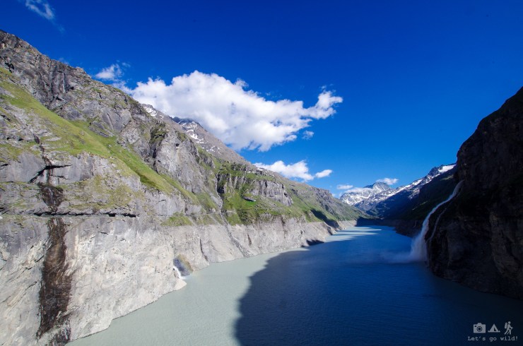
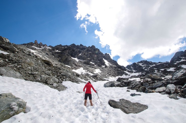
After a night in a “back yard” of the camping we finally get our rented car and start the new type of travel, yet trying to keep to the initial route as much as possible. We jump into the stage 7 of the initial route at the Lac des Dix, which appears to be yet another half empty dam. Dams in June are definitely not impressive. They accumulate the water during spring and summer to reach their beauty only in autumn. However, mountains surrounding the area are always beautiful. After a quick scan of possible routes we start the hike towards cabane de Prafleuri through a very rocky area with some leftovers of snow still hanging here and there. The trail is fairly easy and, of course, hiking without jumbo backpacks makes a BIG difference. The hut is still closed so we have our quick snack lunch with nice views and continue higher to col des Roux (2814m) which appeared to be the highest point of all our trip. To reach it we had to get cold, wet, muddy and bloody. Ok, it wasn’t that scary! But part of the trail was still covered with knee high snow and we were wearing only shorts (it summer for god’s sake!) which we had to cross and some steps gave a very refreshing feeling to put it slightly.
After that we had a short but steep climb towards the col where you can clearly see how the mountain is just sliding down… rocks here are so soft that you can easily break the smaller ones with your bare hands and together with the last melting snow give you a very wet and slippery slope. Our boots were soon covered in silver color mud, the same mud that colored our buts after a slip, one of which ended up in a few bloody scratches. But mountains and scratches are kind of inseparable. The pass greeted us with a usual wind and amazing views. After spending few moments there and discussing where to go next, we decided to get back the same way we arrived, as having no maps, no backpacks, no more water and a vertigo didn’t allow us to improvise much without getting into the trouble.
After this nice afternoon hike we hop into the car and go directly to Arolla, which was supposed to be the end of stage 7. Just after arriving to the camping we realized, that this will be a perfect place to stay and hike. Camping was small and cozy with direct views to mountains and glaciers. The best by far in all the trip. Though our rented Skoda Yeti looked poor next to BMW and Audi sport cabriolets out of three cars in total. Having had a car and possibility to shop for dinner we have a real feast: Spanish soup, French cheese with Swiss wine and German sausage – feels like heaven!!!! Are we getting spoiled and lazy here?
Day route summary:
Lac des Dix to col des Roux and back – 6 hours, 11.2 km, ascent 869m


Day 9
Don‘t leave any food outside, even in the plastic bag. You might end up without breakfast.
THE BIRDS – that moment when you are having a calm snack break and you suddenly remember a famous movie.
The morning after a super nice dinner with amazing views to the glacier gave us a little surprise – we don’t have breakfast!!! Being too lazy in the evening to put food into our car we left it outside in the bag, and in the morning… the food was gone. I honestly was thinking those were birds until the receptionist told us: “yeah… we have this fox that keeps coming at nights. Once it even stole a shoe. Use a fox box to protect your stuff” and gave us a plastic bucket. OK…. So now we know.
Eating one of the adventure foods for breakfast didn’t look appealing so we set of for search of bread and breakfast in the village. Arolla is so close and looks big and active enough, who could have thought it would be so difficult to get breakfast there in low season!!! After having breakfast in one of the hotels we finally start our hike towards glaciers which we were admiring last evening. Glaciers kept teasing us all the trip. You see them so beautiful from afar but once you try to reach them – things get complicated. And again – we gave up in the attempt when we decided not to cross a small snow covered path on the very steep and loose edge. One or two weeks later there would be no problems to pass it, but now it seemed too tricky to pass having nothing to hold on. We sat down for lunch break staring at the glacier as close as we managed to get on this trip when few birds came out of nowhere and started flying right above our heads, probably inspecting our meal. You surely feel only a guest here on these moments of encountering wilderness.
The hike to another glacier seemed to be a bit too long for today so we decide to have a quick run to the blue lake nearby. Now that I’m thinking… probably going to another glacier would have been a shorter hike. Don’t trust swiss on counting time!!!! At least in hikes. They have weird measures. We’ve ended up setting a new record of our trip with 1122m of accumulated climb and almost 19 km of distance. But the blue lake was definitely a beautiful place worth seeing. A tiny lake in the mountains with a very distinguishing blue color because of the specific algae thriving there.
Back in the camping we plan the next day, pack our stuff properly and go to sleep fairly early. At night going to the bathroom I unexpectedly meet the greedy fox. Ha ha! You won’t get anything from us tonight!!
Day route summary:
Arolla, glaciers and Lac Bleu- 9 hours, 18.68 km, ascent 1122m


Day 10
Zermatt is all that mountains shouldn’t be – a money making machine! You have to be very fit or very rich to get there.
If only we knew how messed up our plans can be!! Feeling the time ticking we decide to try reach Zermatt – the last point in our initial plan with great peaks around. We spend almost two hours in the car and end up in the dead end! There is no car road to reach Zermatt. To be fair there is, but it is closed and only cars with special permission car go there. We try to park a car at Tasch with a hope to get a train to Zermatt, but after seeing the amounts of people and the prices we decide it is not worth paying that (going there for one night would have costed much more than renting a car for a week!!!). Calculating the time we have left, we realize we can’t just hike there. So we change our plan once again to a complete unknown and… decide that we want to eat pizza for dinner. Italy is nearby anyway!
Few hours later we were having a nice walk in Verbania and eating AMAZING Italian ice-cream for a reasonable price (something we missed in Switzerland). After finding a camping that fits our standards (the lower in stars – the better) at the beautiful lake Maggiore, we’ve set our tent in a place all full of tiny rabbits and went back to have another lazy walk and dinner (so lazy that we forgot to turn on the tracker!). Pizza was amazing. 10 points! So was the sunset. Accept the changes and improvise… a different day but good in its own way.


")
Day 11
Expect the unexpected.
This was supposed to be the last full day of our trip. Tomorrow we go back home. Not wanting to get into any trouble with our return flights we decide to go back to France today, stay somewhere closer to Geneva and have an afternoon hike in Mont Blanc massive. So we have a refreshing morning swim in the lake, hop into our swiss car and direct it towards France, but… it breaks on the highway still in Italy! Not only the car broke but so did our nice afternoon plans. Oh well… we are not very lucky with planning on this trip anyway.
After almost 2 hours in the highway at +35 not being able to leave the car, waiting for the truck to pick us up, we learn some Italian words that might be useful: “voglio pisciare con urgenza”. The only thing that is left for us in this situation is laughter, so we try to make the most out of it. After changing our broken-down Skoda Yeti to Fiat Panda in Aosta airport we go to France through the shortest possible way (Mont Black tunnel – be ready to pay! A Lot! I don’t even want to remember that number) and sometime in the late afternoon end up in Chamonix – right where we started. One more reasonable price ice-cream and we are ready to go to Argentiere where we spent the first night of this crazy trip. Who could have thought… First time we went there it took us like 3 hours with 20+ kg backpacks on our shoulders. Now we reached it in 10 minutes by car… To be honest, I liked the first time more. People tend to quickly forget things they get easily but what comes with effort and suffer stays with you forever.


Day 12
Is this the end or new beginning?
I always get sad when nice holidays come to an end. But not this time. Since last evening I was already clearly living with the thought of the next upcoming adventure (changing my living place to a more southern country) which cannot even be compared to the one we just had. And it will also have changes in plans as well as require a lot of improvisation. The mind is too busy and we have too little time left for any hike so we just make a last stroll around Argentier, pack our equipment that has been our home for the last 12 days and go back to the Airport.
As in every trip we experienced a lot and learned something new. Learned to accept our limitations, to accept changes, to live one day at a time and make the most out of it even if something goes wrong. We also understood that hiking with jumbo backpacks is not always the best option, though if you want to hike without it – maybe low season is not the best option too. And even though the trip was not even close to the wilderness we love (we didn’t have a single night of wild camping!!!) it was wild enough in its challenges.
Next year – no more jumbo backpacks! (hmm… sounds like if I already heard it before…)

One Reply to “”