
OMG, where do i start?
People say it‘s best to start at the beginning. But our beginning was at the end!
…
Let´s start it over…
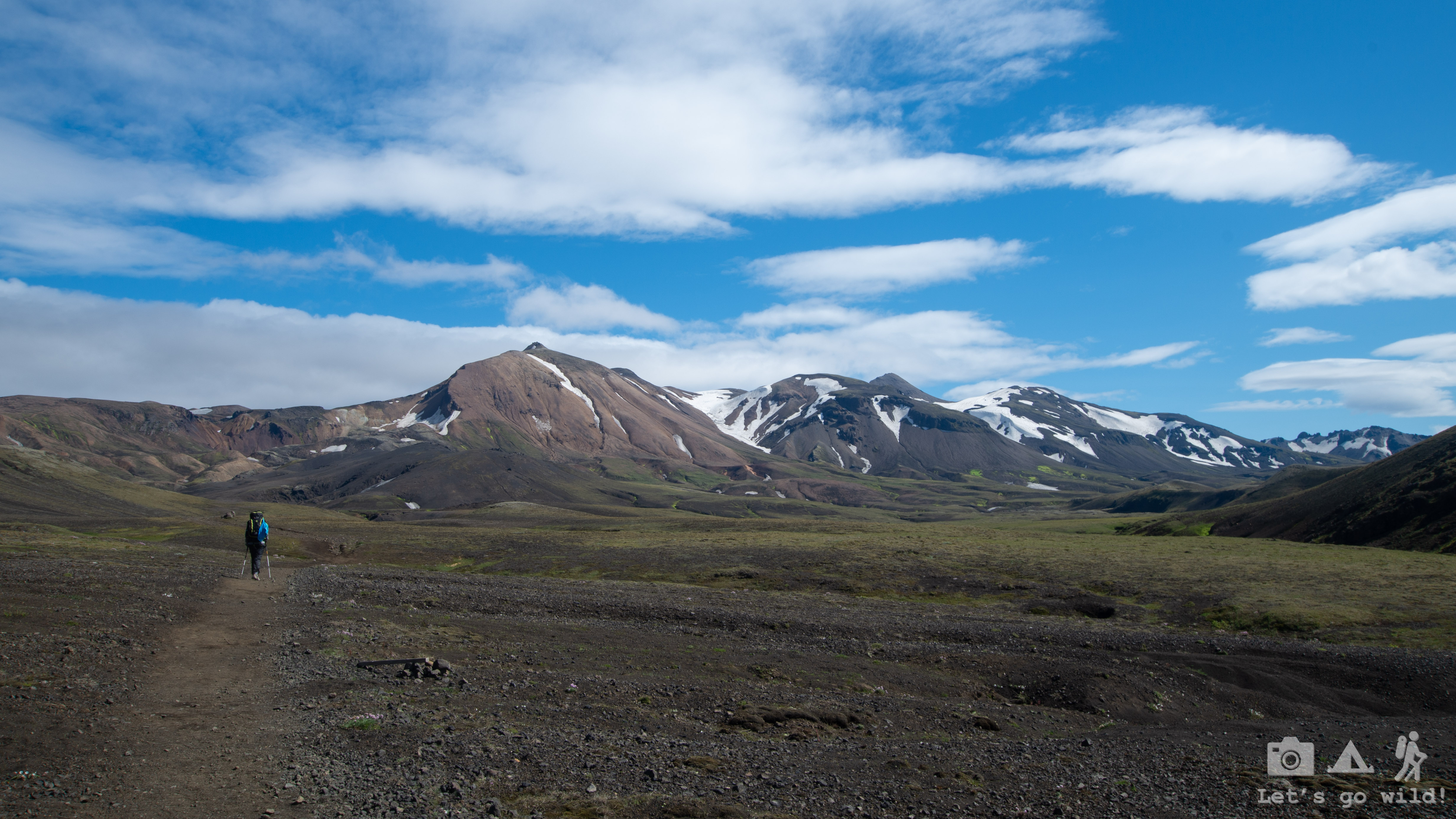
The idea of going to Iceland for our summer adventure was hanging in the air at least a couple of years until it finally became a reality. It was a well-prepared trip with loads of information in our heads and computer files. We had 10 days (including travel) for this trip and being hungry for adventures we chose a multiday hiking route in Laugavegur and Fimmvörðuháls trails in Southern Iceland. It is considered to be the most popular trail in all Iceland but also one of the most beautiful in the World.
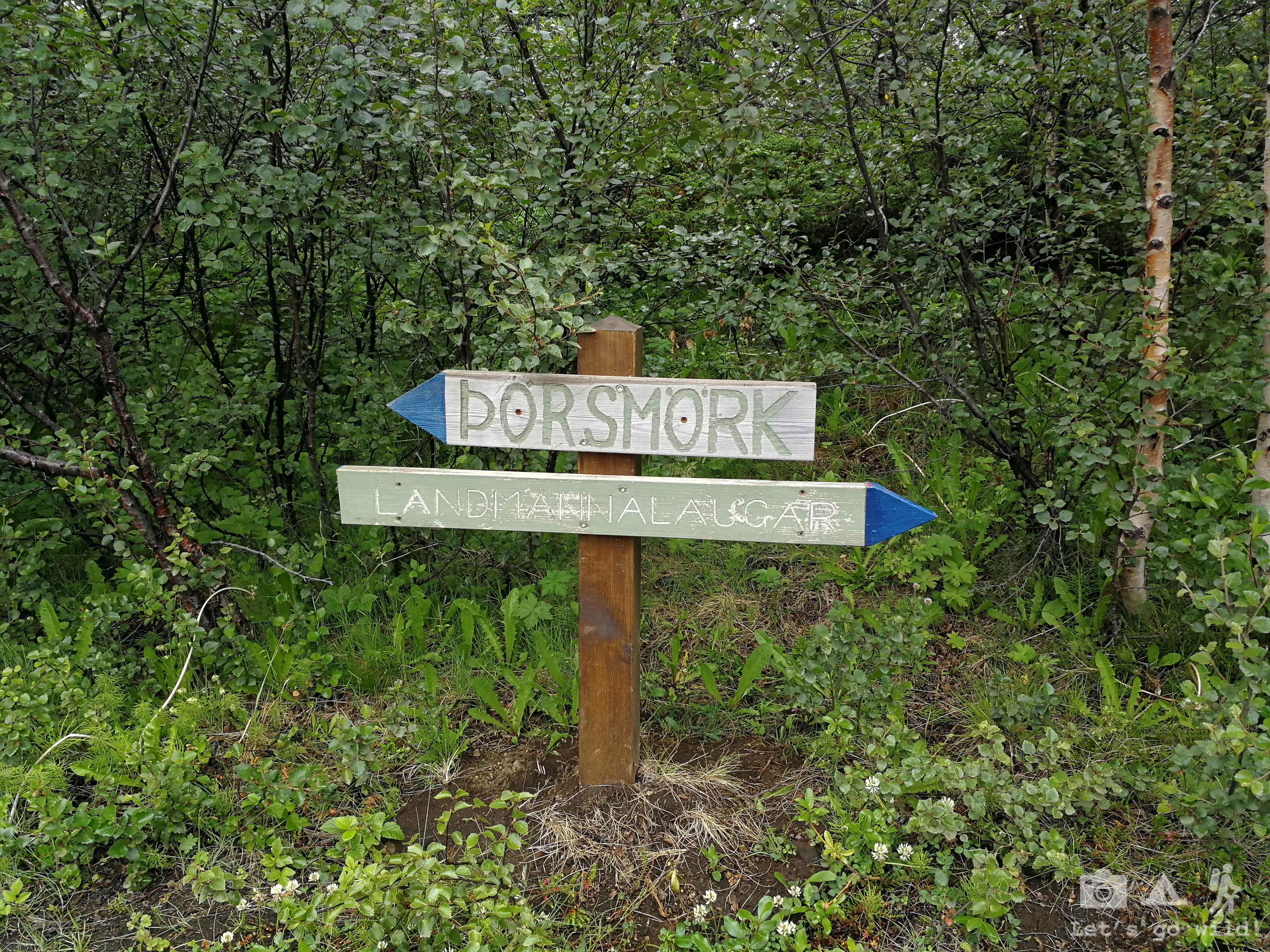
Our idea was to go from Skogar to Landmannalaugar. Normally this route is done in 5-6 days and it starts in Landmannalaugar, not finishes there. There are several reasons why north to south direction is considered the classical one for this route. The main reason for a start in the north is the easier hike with less ascent. But of course, we were crazy enough to start it at the end and finish it at the beginning. And we don’t regret it at all!! Even more, if we’d ever have to repeat this route, we would do it the same south to north direction again! But we will come to the reasons later.
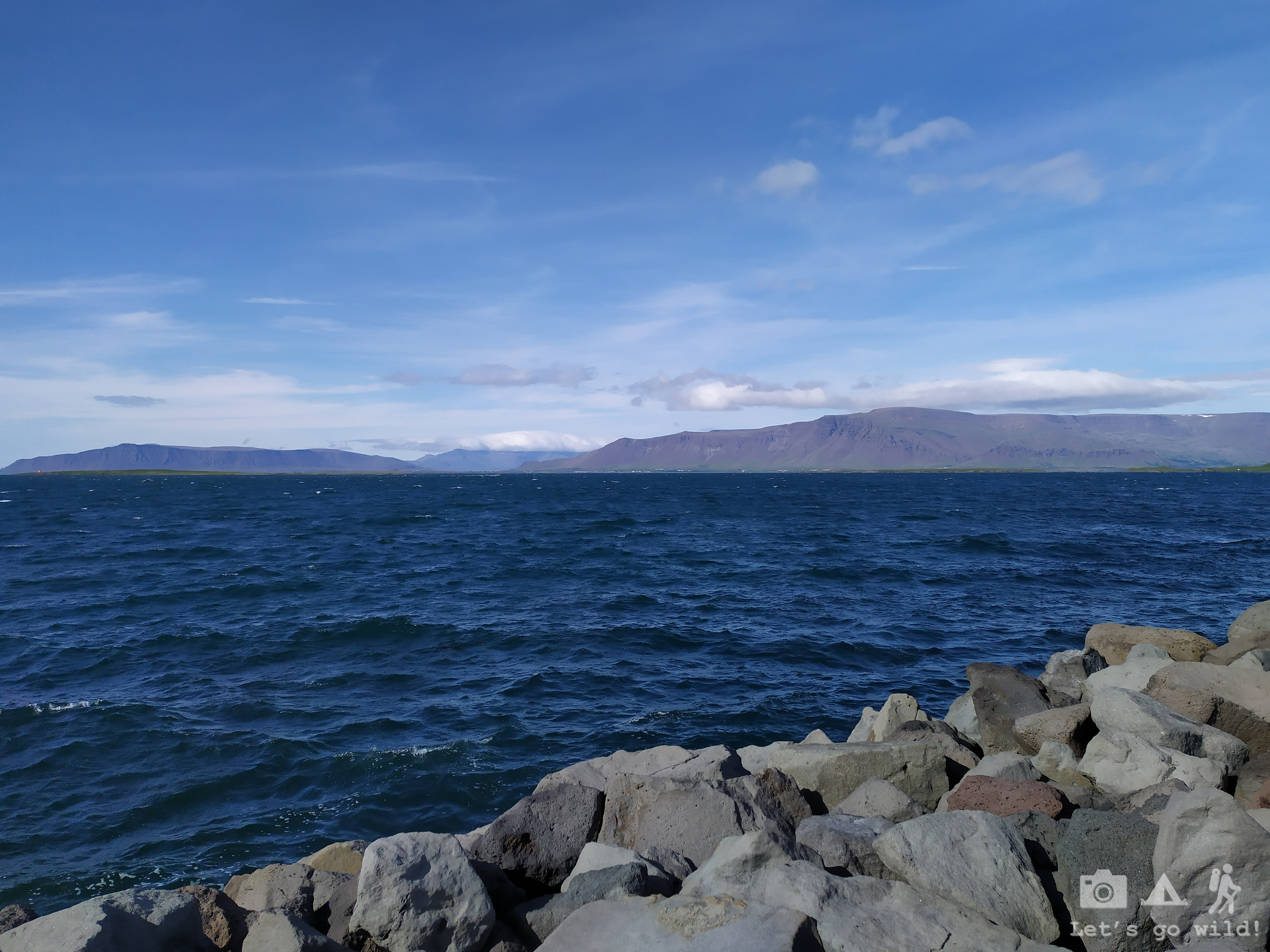
For now, let’s start at the real beginning – Reykjavik.
June 30, Sunday
The Arrival
Once again because of our crazy family set up we had to start our trip arriving from different places. I took a flight from Lithuania and Pedro came a few hours later from Spain.
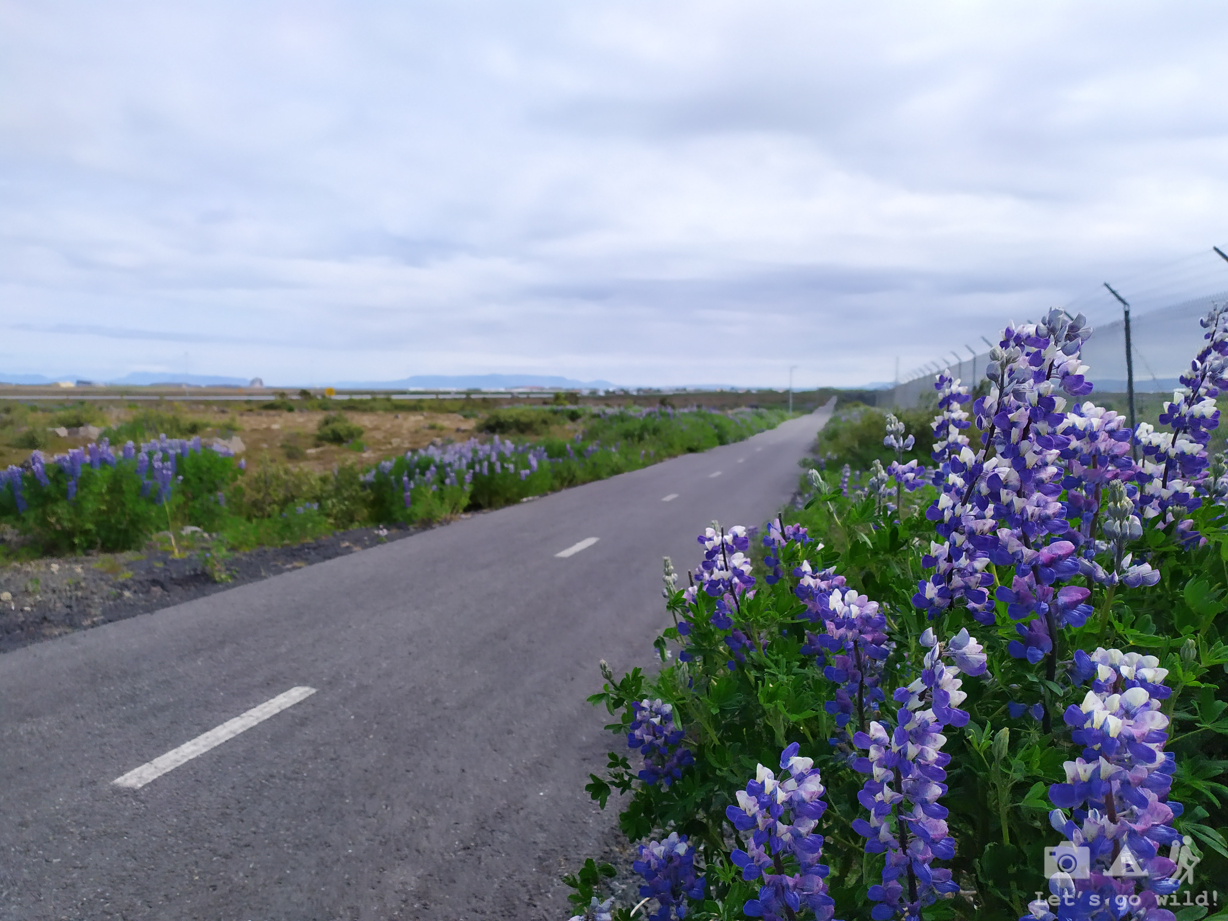
While waiting for Pedro to arrive I had a mission to walk to the closest village and fill up our food supplies with the missing ingredients for the next 9 days. With just a few km walk (mainly on bike roads) the mission was completed successfully, although on the way back to the airport some birds tried to convince me it’s their land and scared me almost to running.
Pedro also had a mission for the day: arriving to Reykjavik with both backpacks. As his flights were being delayed, we got a bit nervous. Delayed flights always end up with lost luggage… We already suffered that on our trips to Lofoten and Vietnam. 2 out of 3 times… Statistics is not in our favor on this matter!
Few nervous moments of waiting and a smile of relief when the backpacks showed up on the luggage belt. Hurray! Our adventures can start without a forced delay!
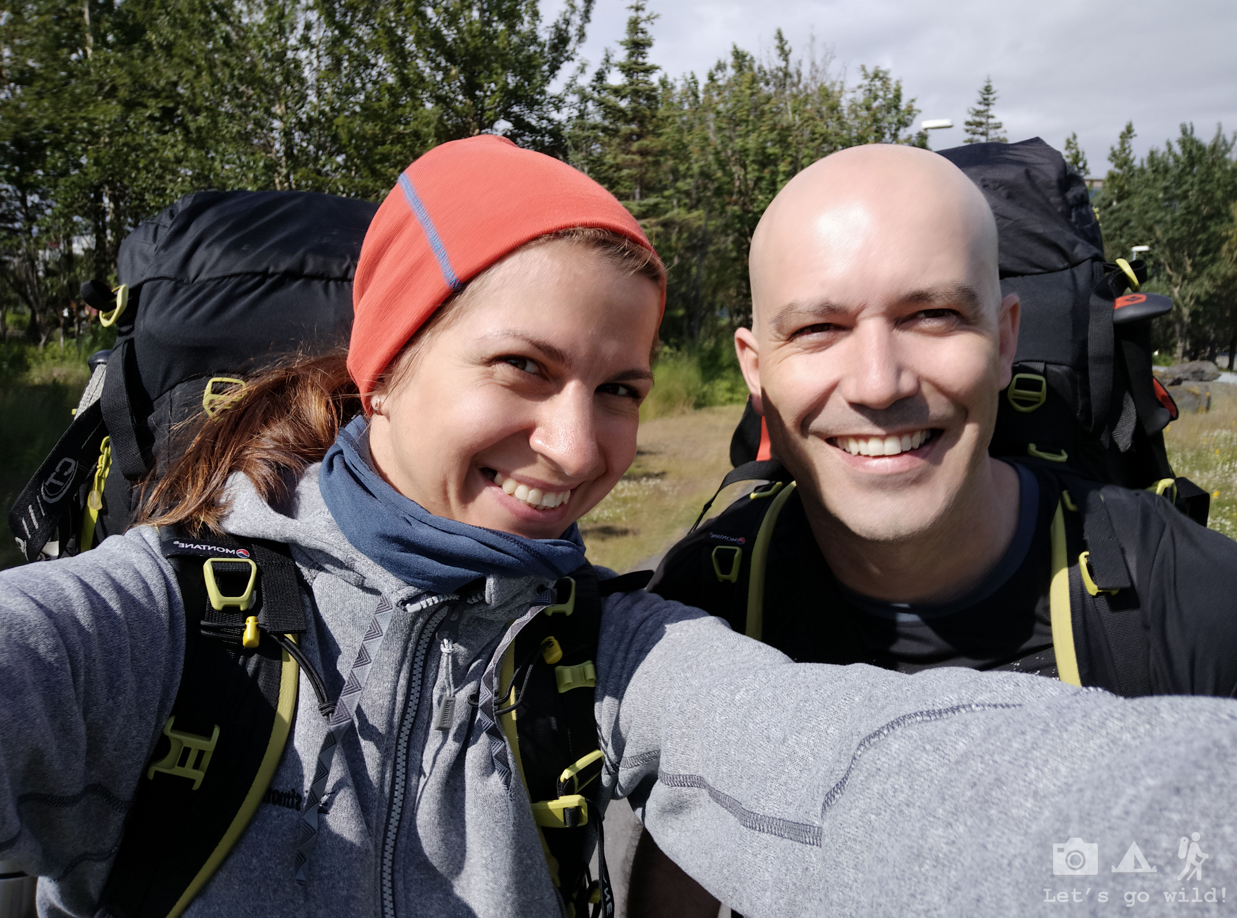
We hop on the first bus that was going to Reykjavik, without a transfer to the camping site. It’s just three km away from the bus station anyway. We can walk!
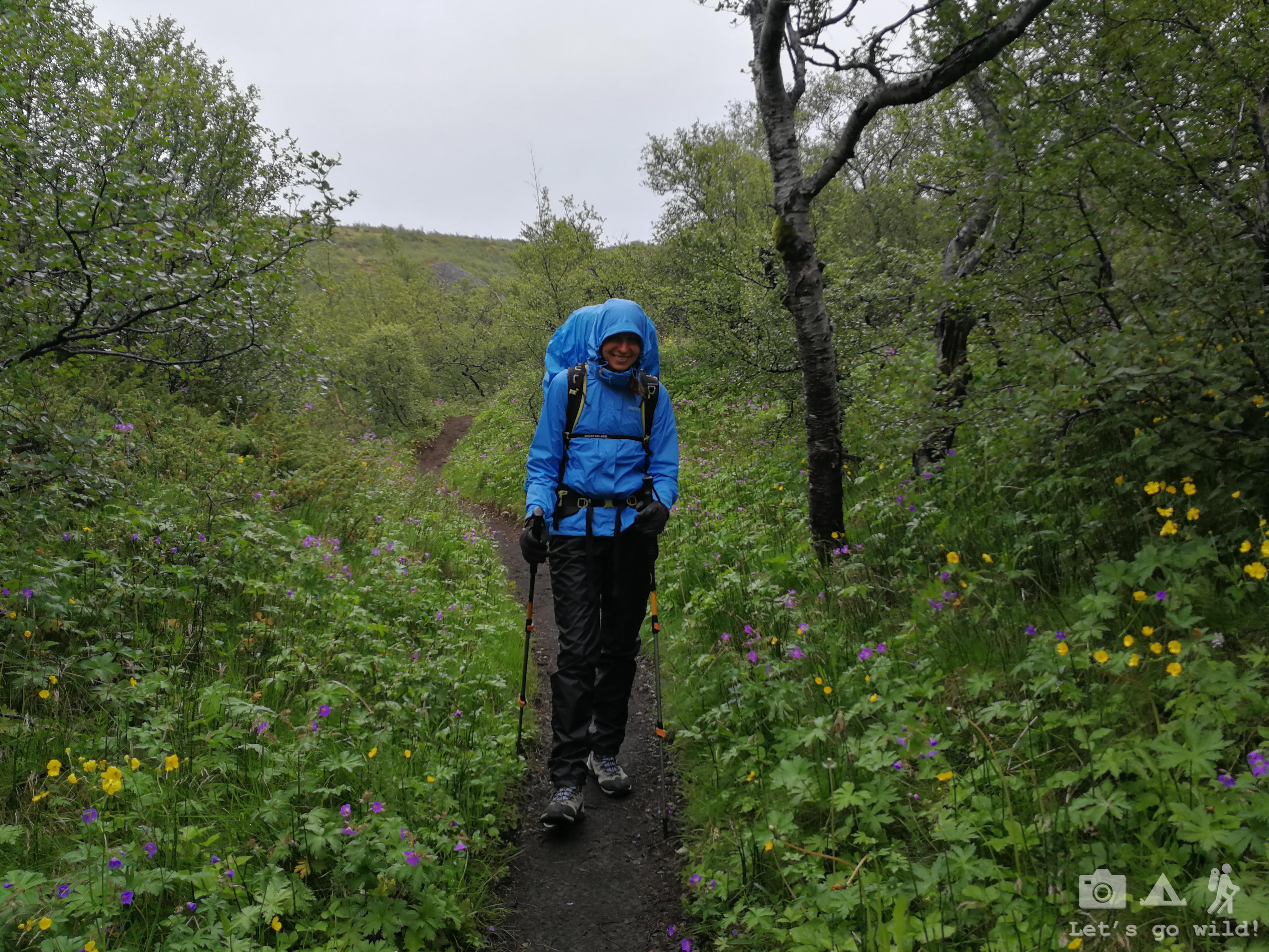
I don’t know how, but the bus finished the route not where we were expecting! Thus making our 3 km grow into aprox 5. Oh well… still not much! And we need to get used to the weight of our jumbo backpacks anyway!
Walking through Reykjavik I was only thinking that our backpacks weight like hell and we are about to do another crazy/stupid self-torturing multiday hike! Yet my belly was full of butterflies of excitement.
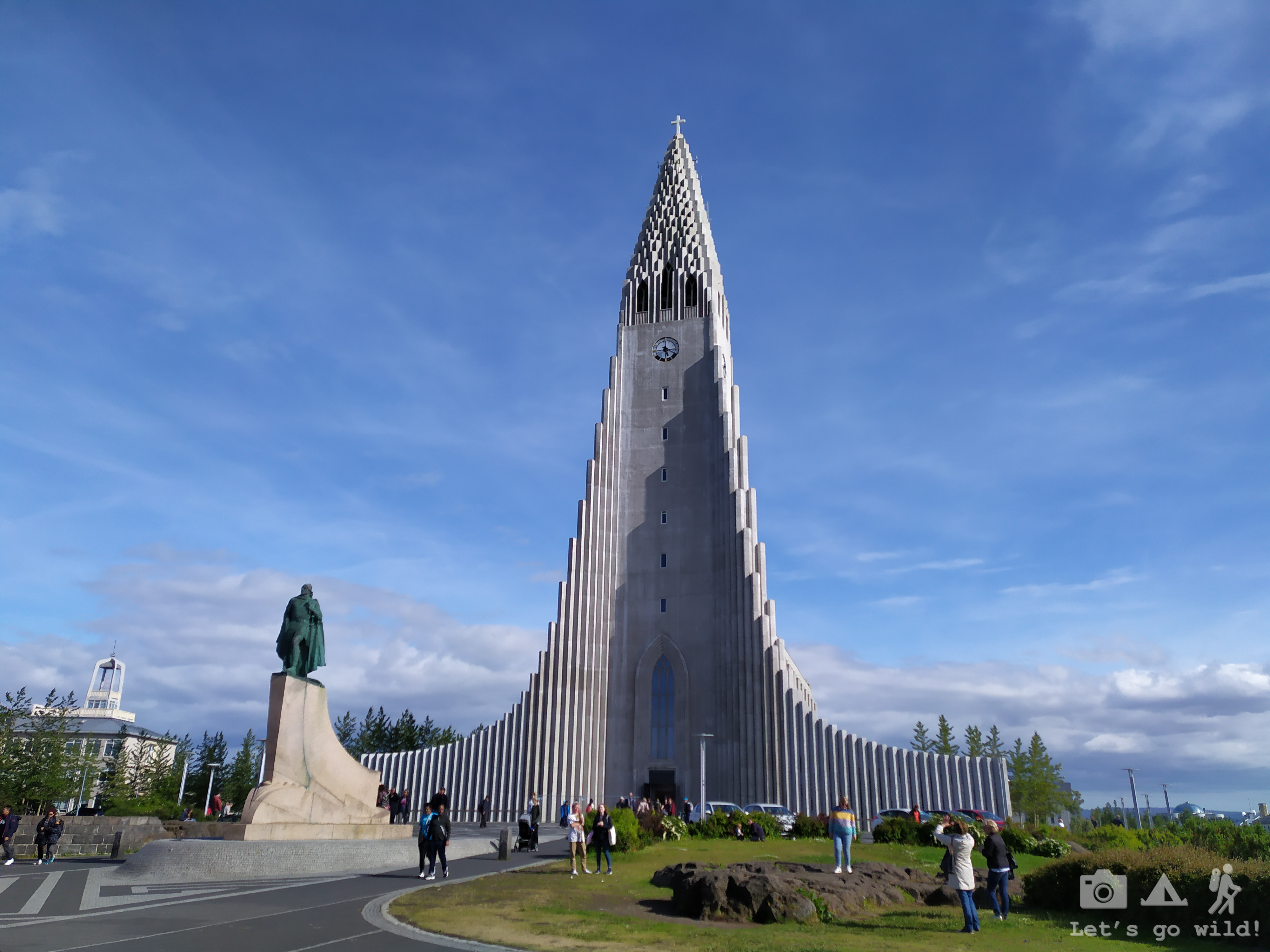
After settling in Reykjavik City Campsite with an amazing sunshine we went for a quick stroll through a botanical garden to have a beer in a beautiful bar. In Iceland, the weather might change so fast that you must enjoy every minute of sunshine you get.
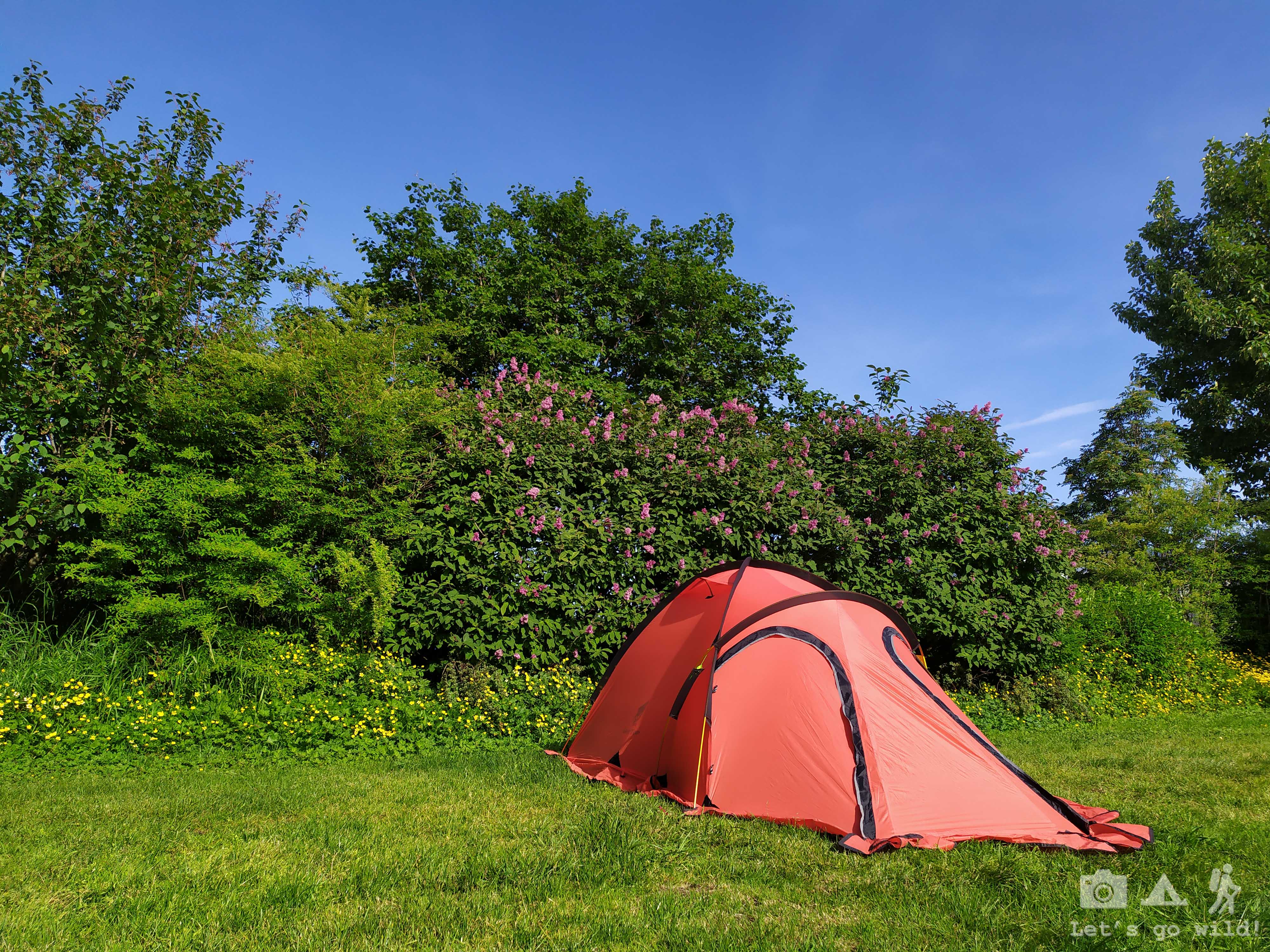
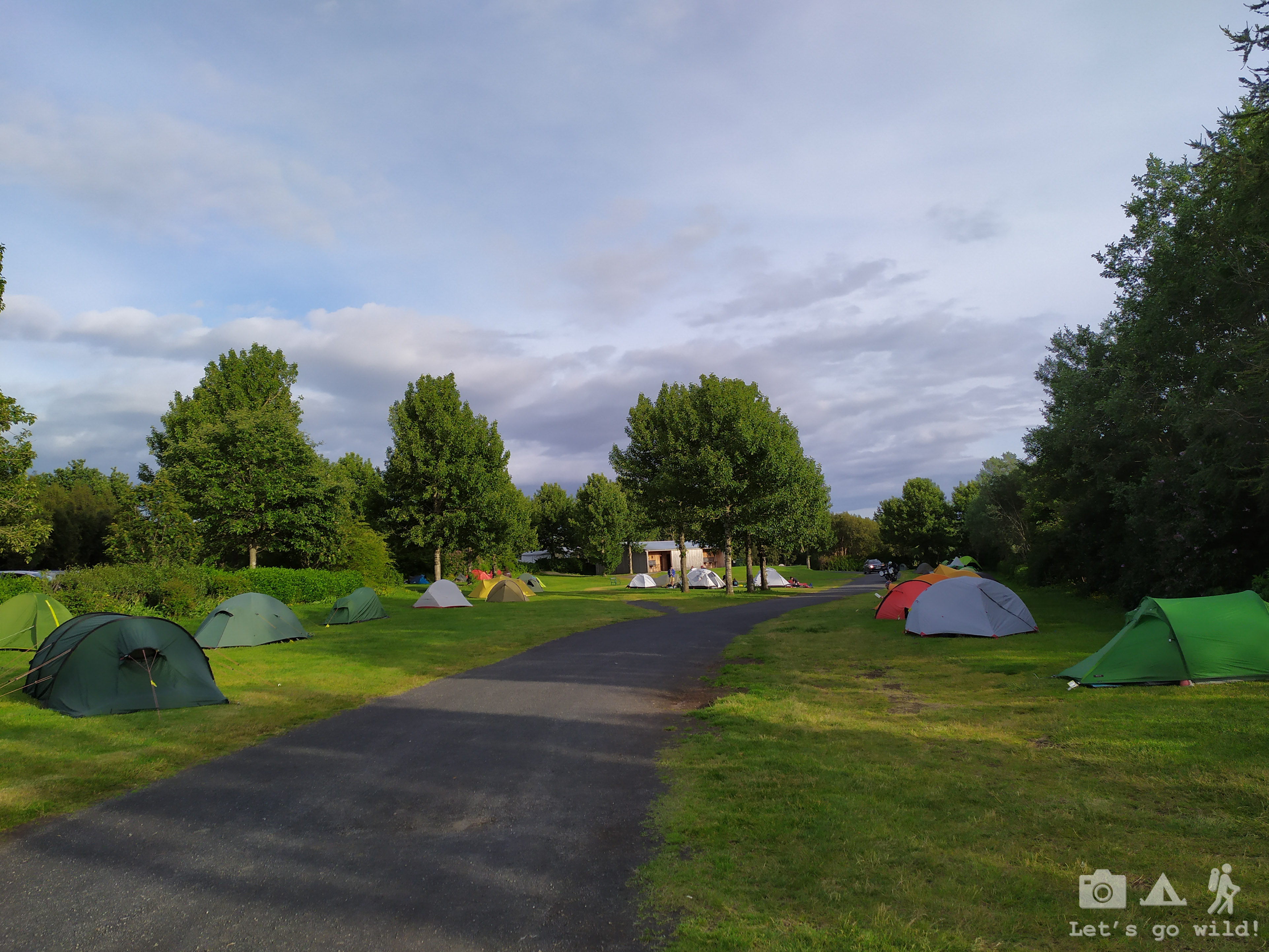
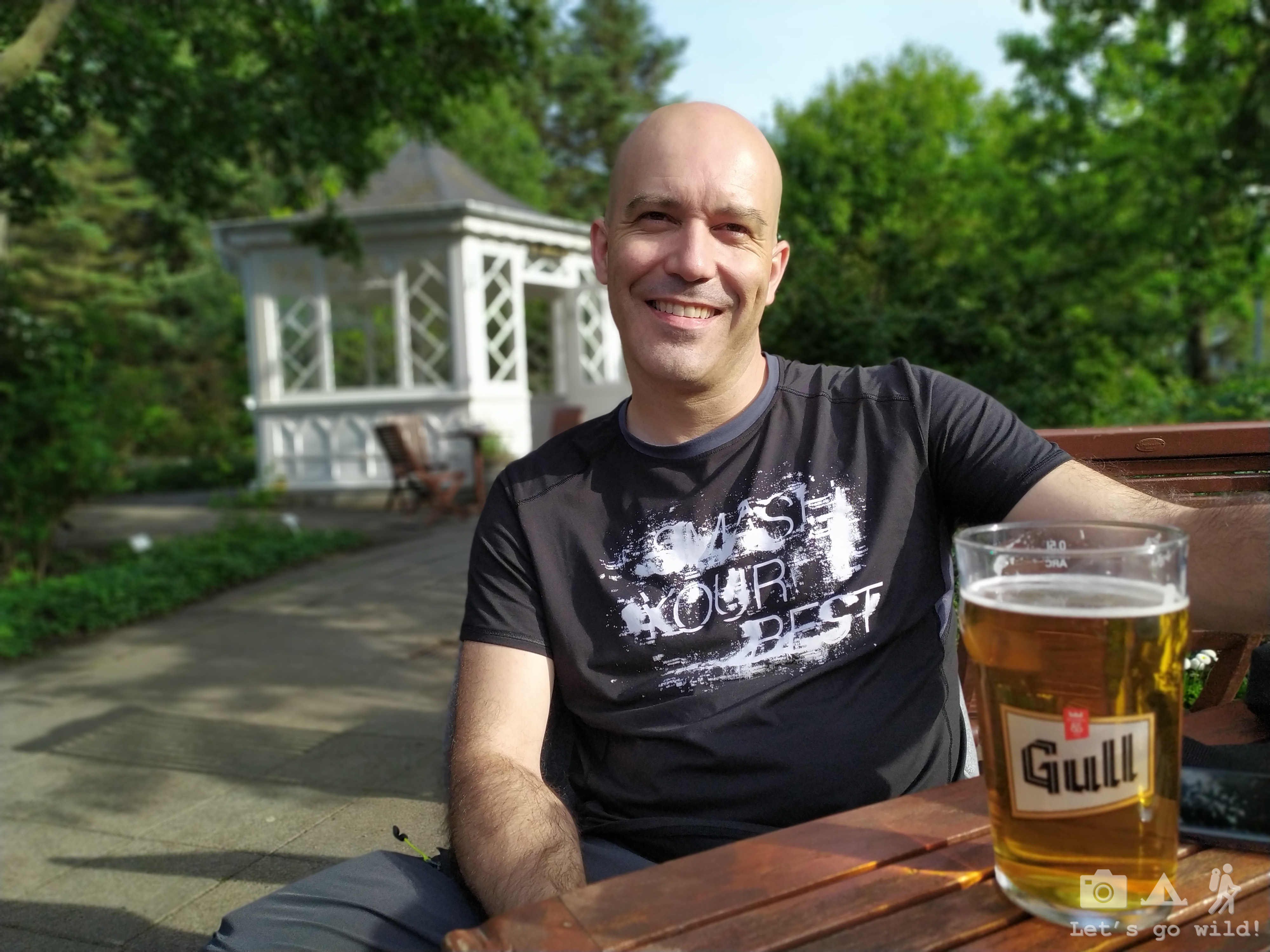
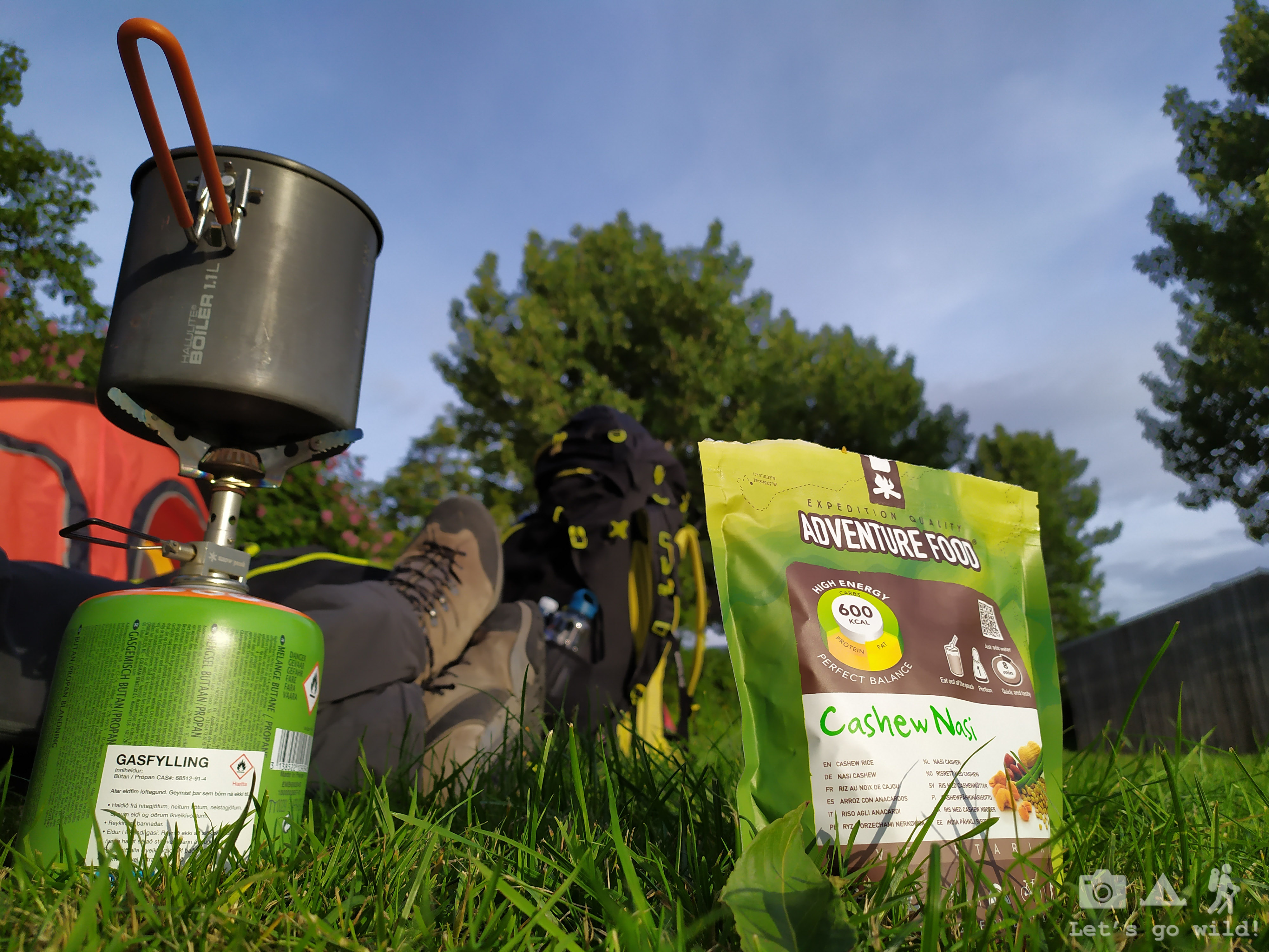
It was definitely our lucky day – the backpacks arrived, we got food and gas supplies filled up even on Sunday afternoon, sun was smiling at us and the bar had a happy hour (buy 1 get 1 free) for the beer! What a perfect start!
Now we only need to rest well and be ready to leave the camping at 7am tomorrow morning.
July 1, Monday
Before and After
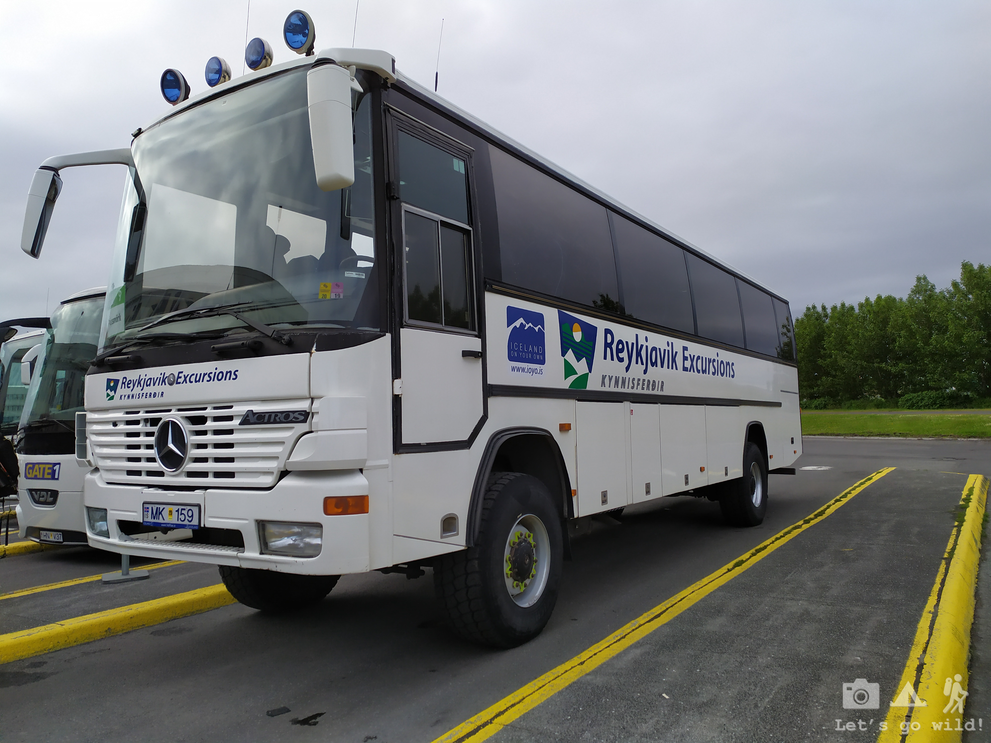
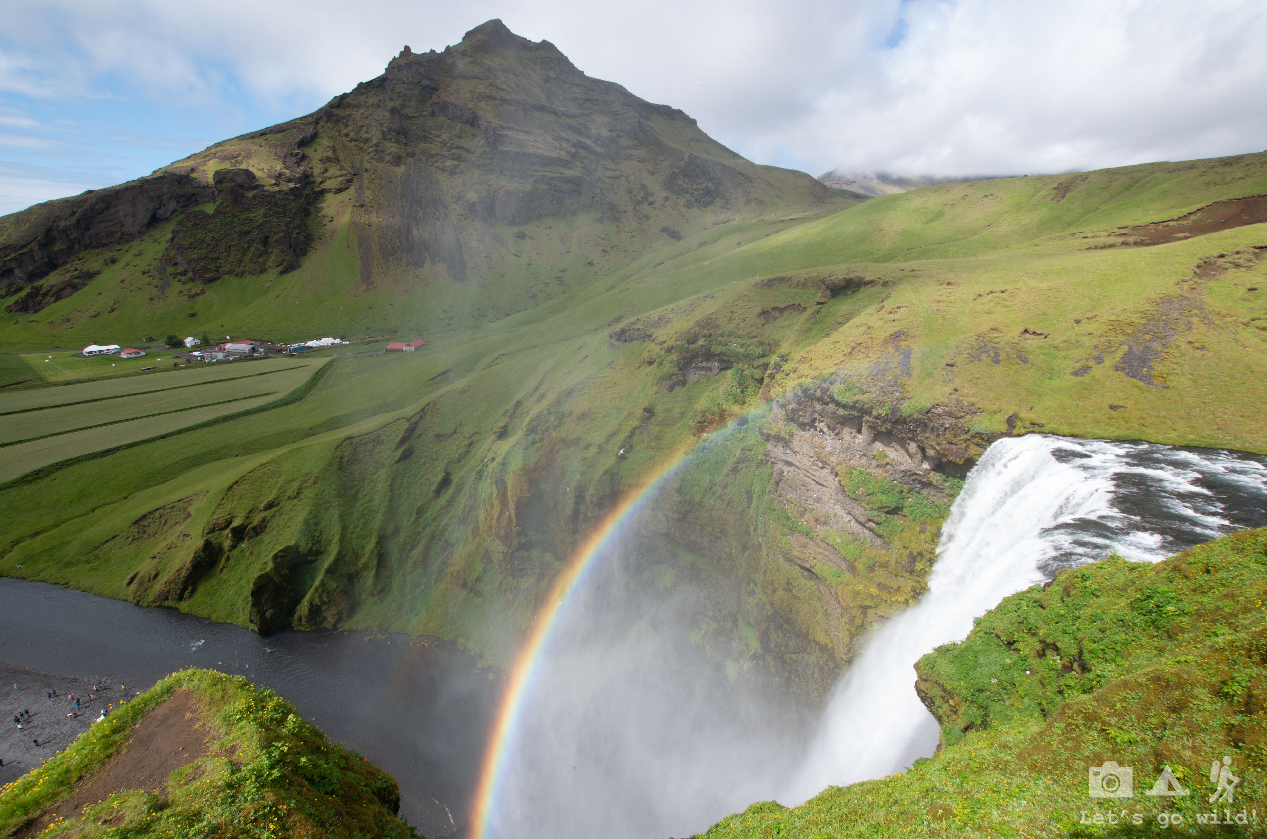
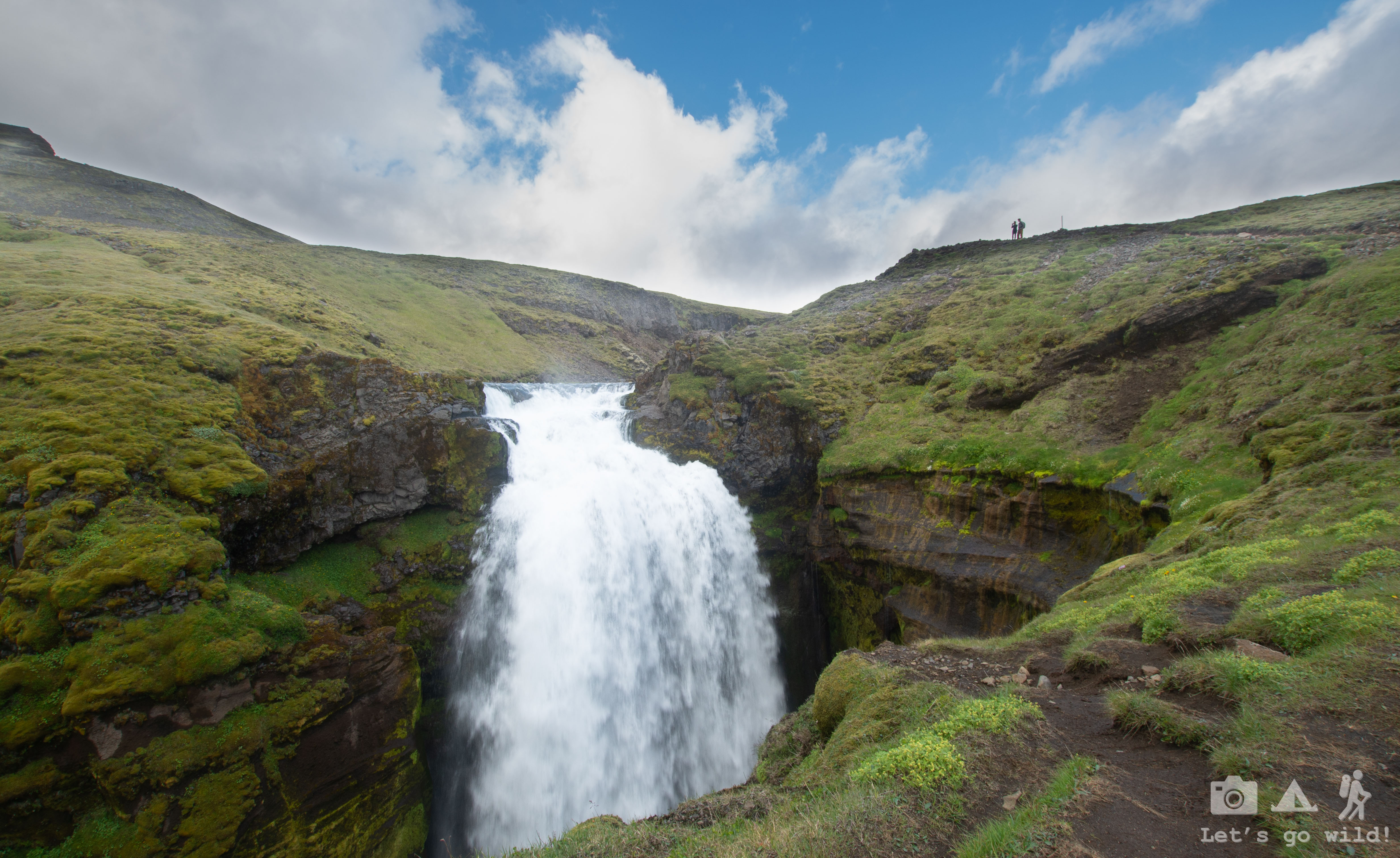
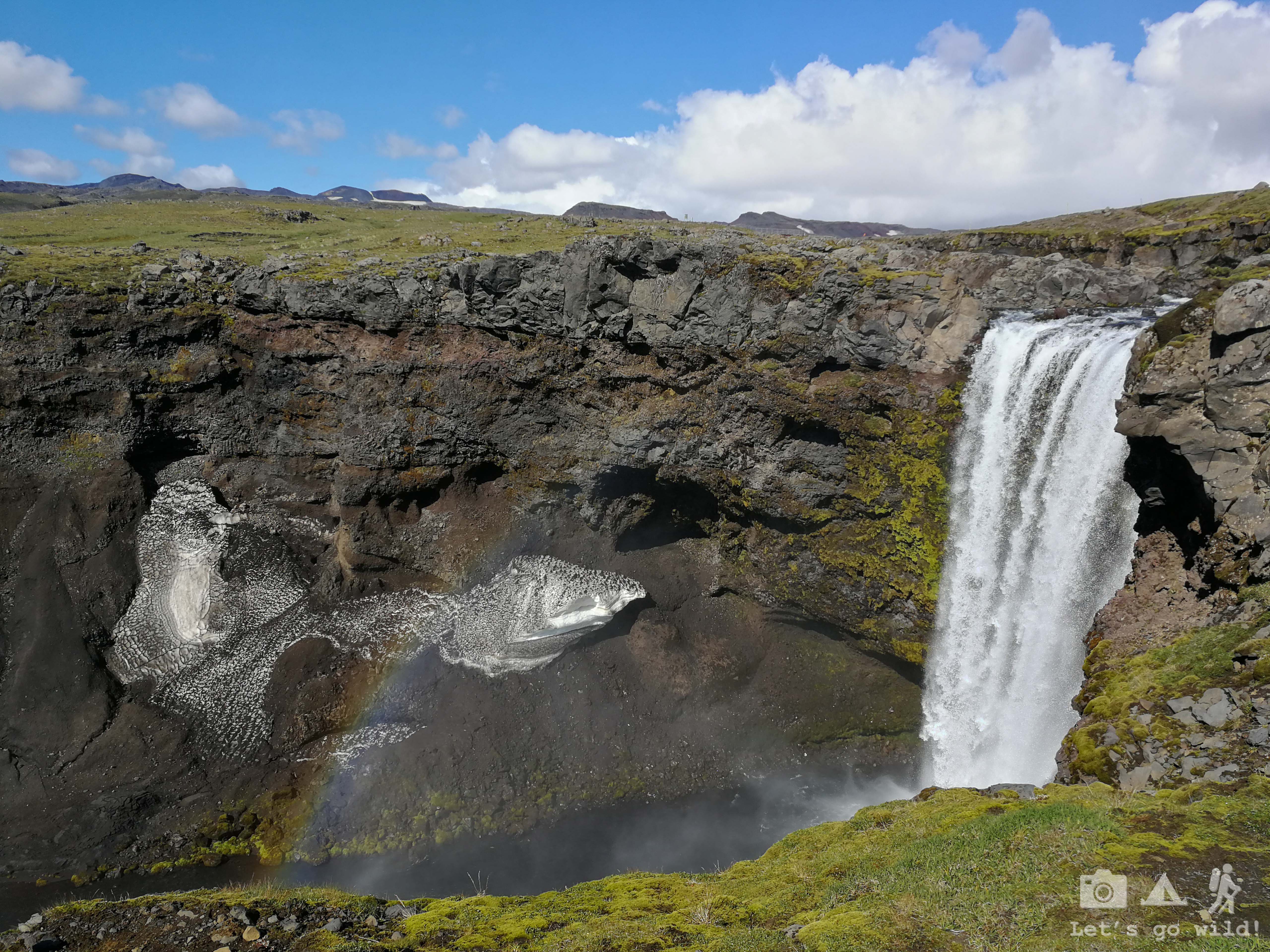
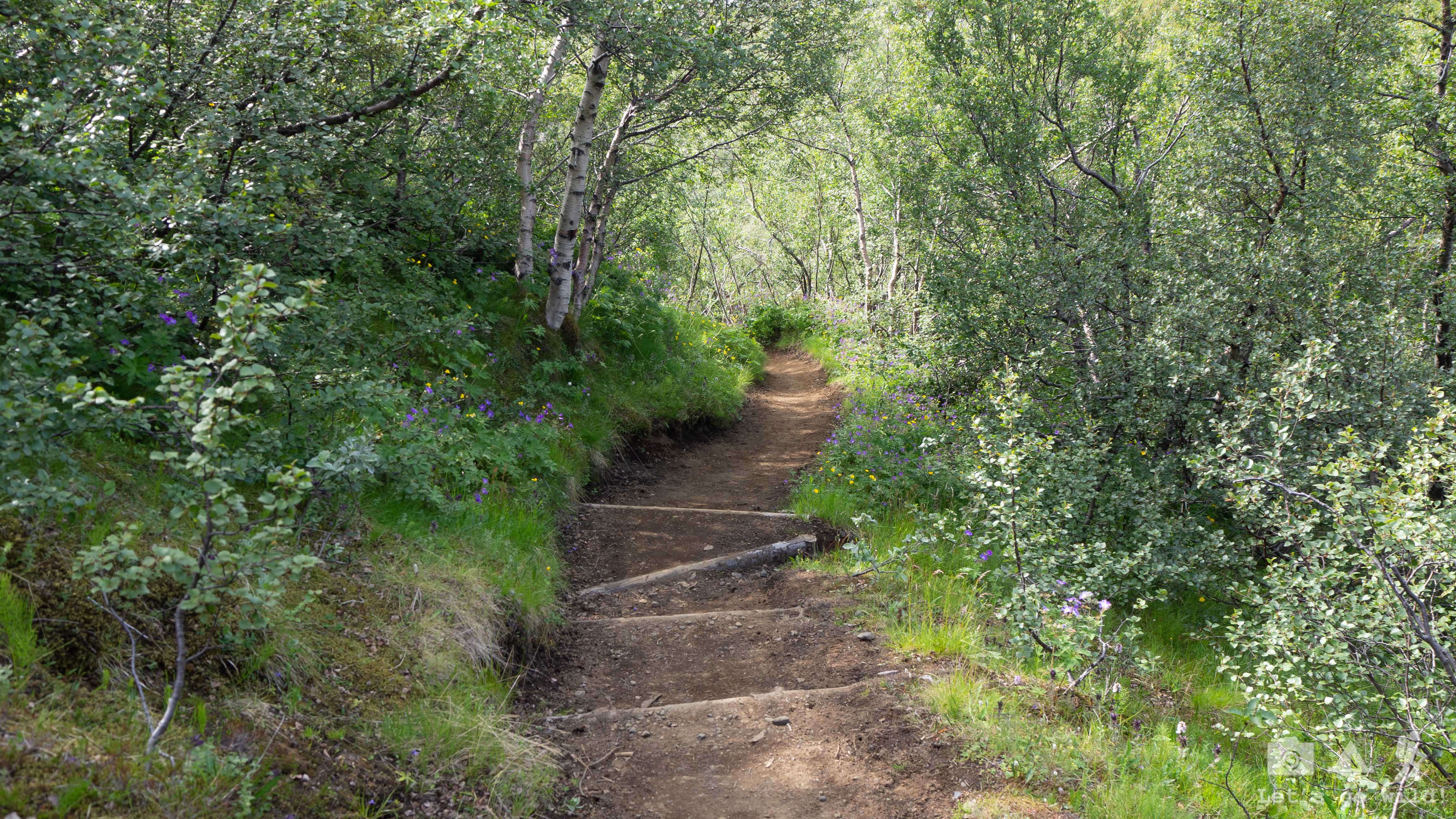
Our long day started with waking up 5:30 in the morning to catch the bus on time. Some chaotic packing and eating breakfast in the bus stop, then 4 hours on the road with a bunch of other crazy people (an American family with kids, a couple of French girls and a solo traveler) and finally, at 11:30 we are there, in Skogar, standing and staring at the first waterfall of the day. To be honest, more than staring at the waterfall I was staring at the climb that was waiting for us. Excited and scared…

Few photos in the bottom and off we go. Step by step. By step. By step… countless steps climbing the stairs up the 60 meters tall waterfall, crossing with hundreds of tourist who just came there for the day, all fresh and smiling, while we were sweating with our jumbo backpacks full of rocks (well, at least it felt that way!!!). “You deserve an Olympic medal for doing this!!!” I hear a girl commenting and try to smile her back. Not sure if it turned out to be a smile or a grin of suffer. It was a killer start!! Yet a very beautiful killer start.
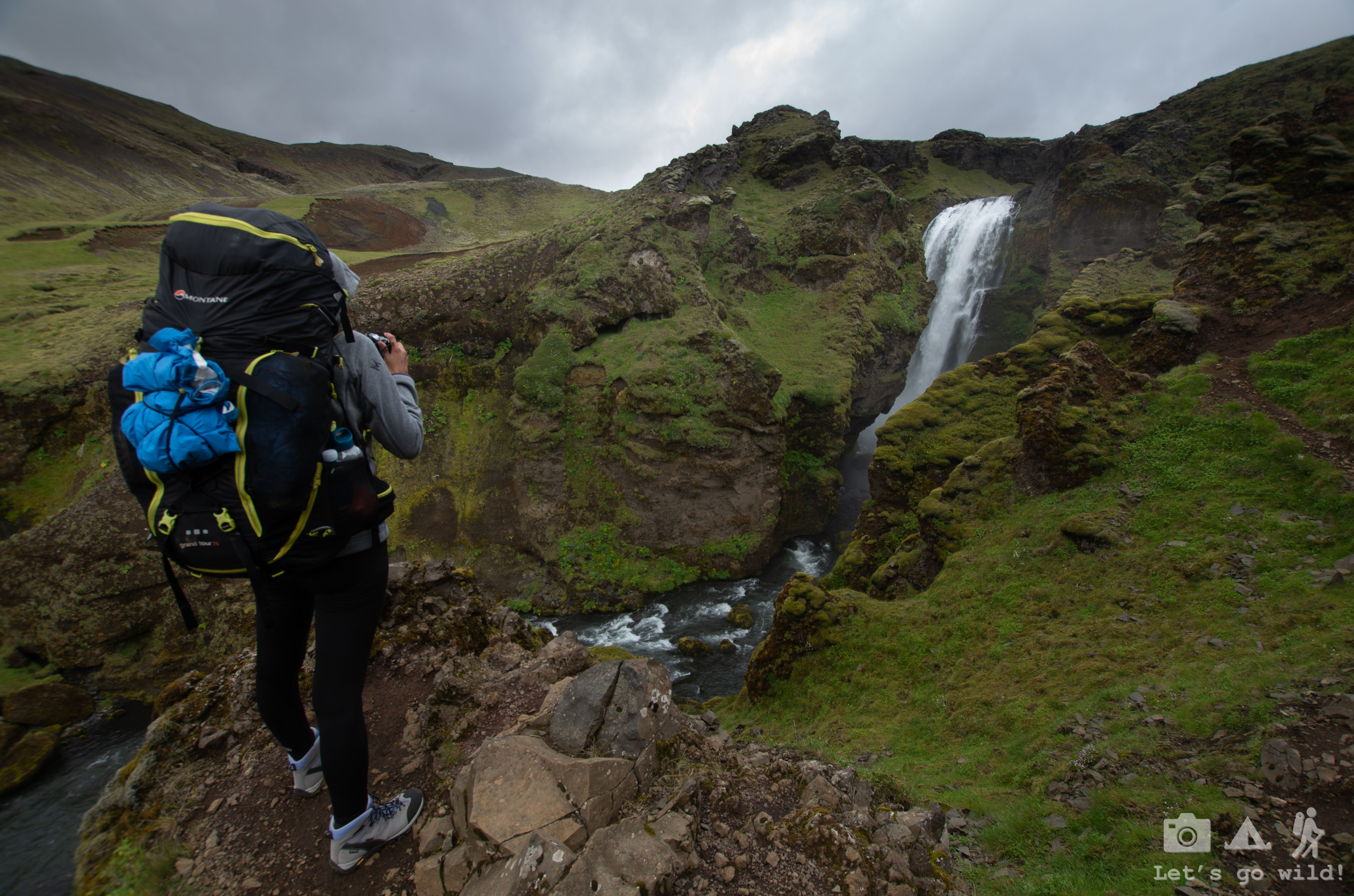
After climbing the first 60 meters the trail got much less inclined and with absolutely amazing views that made us forget the first half an hour of suffer very fast. All those stunning waterfalls and canyons filled our souls with joy and our bodies with energy. We kept walking slow and taking photos every few minutes of this countless number of waterfalls, not paying much attention to the pain in our backs and shoulders. Just after an hour of walking we were away from the crowds, enjoying this pure beauty of dancing water and 50 shades of green in the fields and mountains.


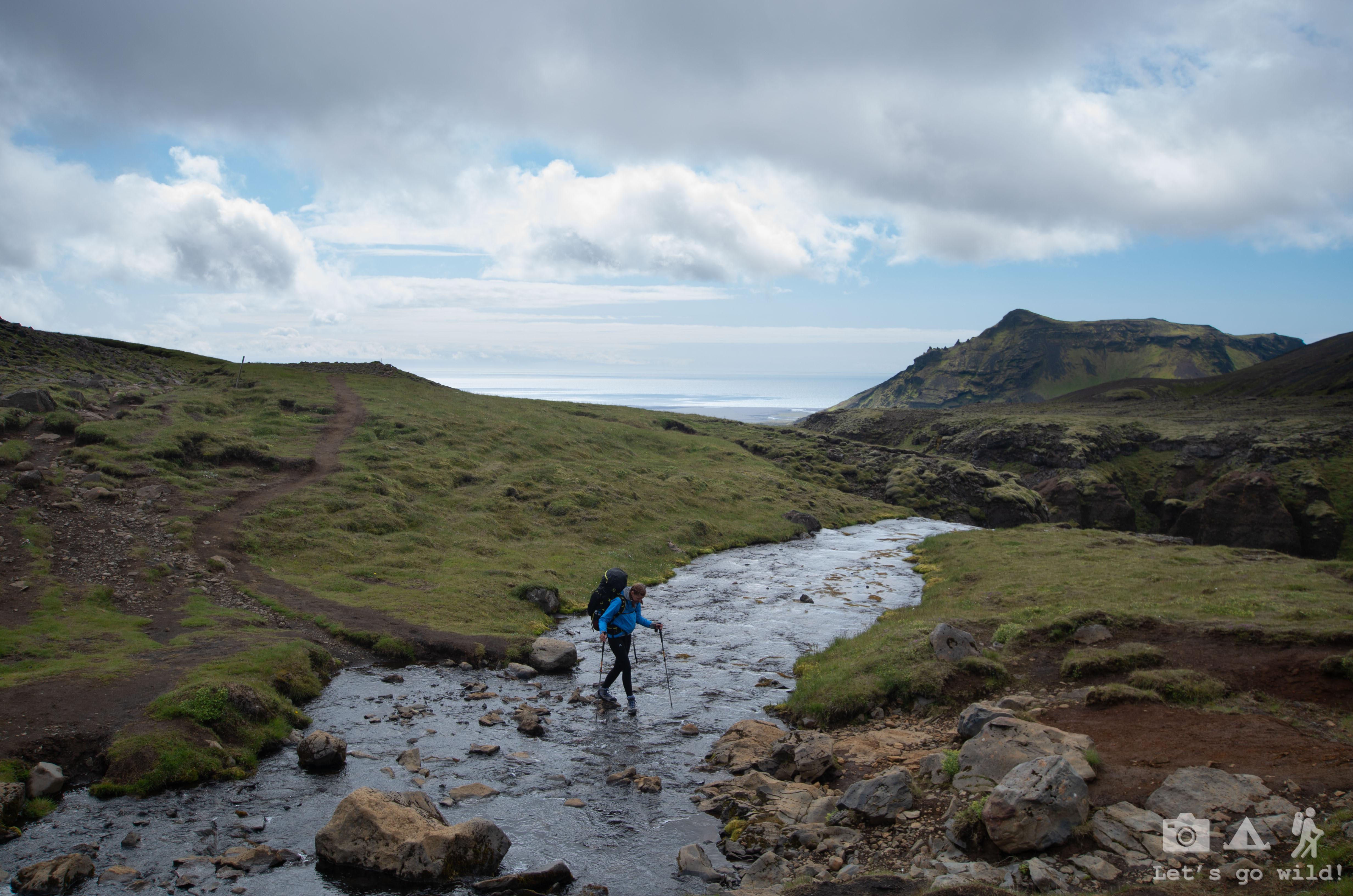


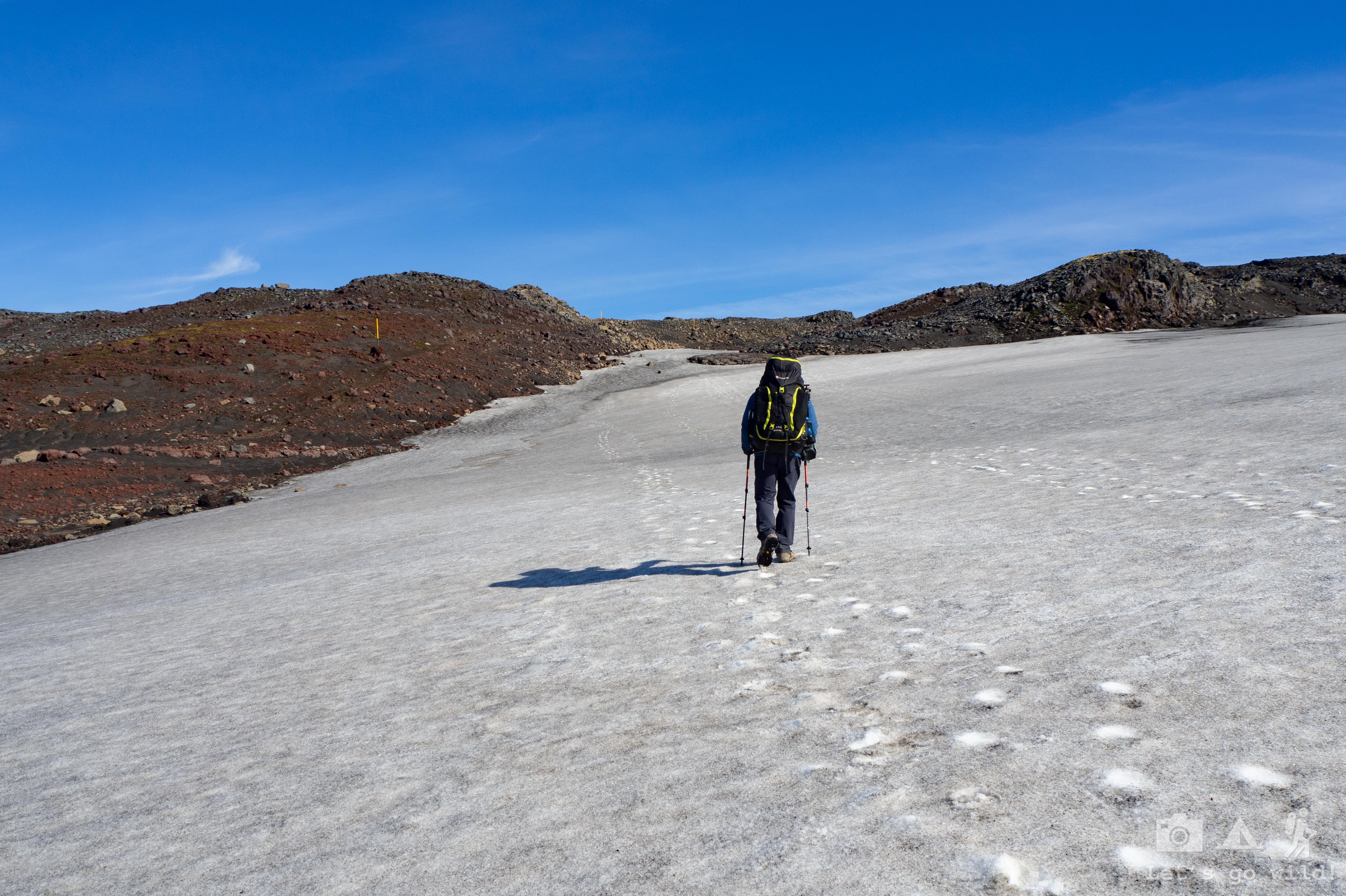
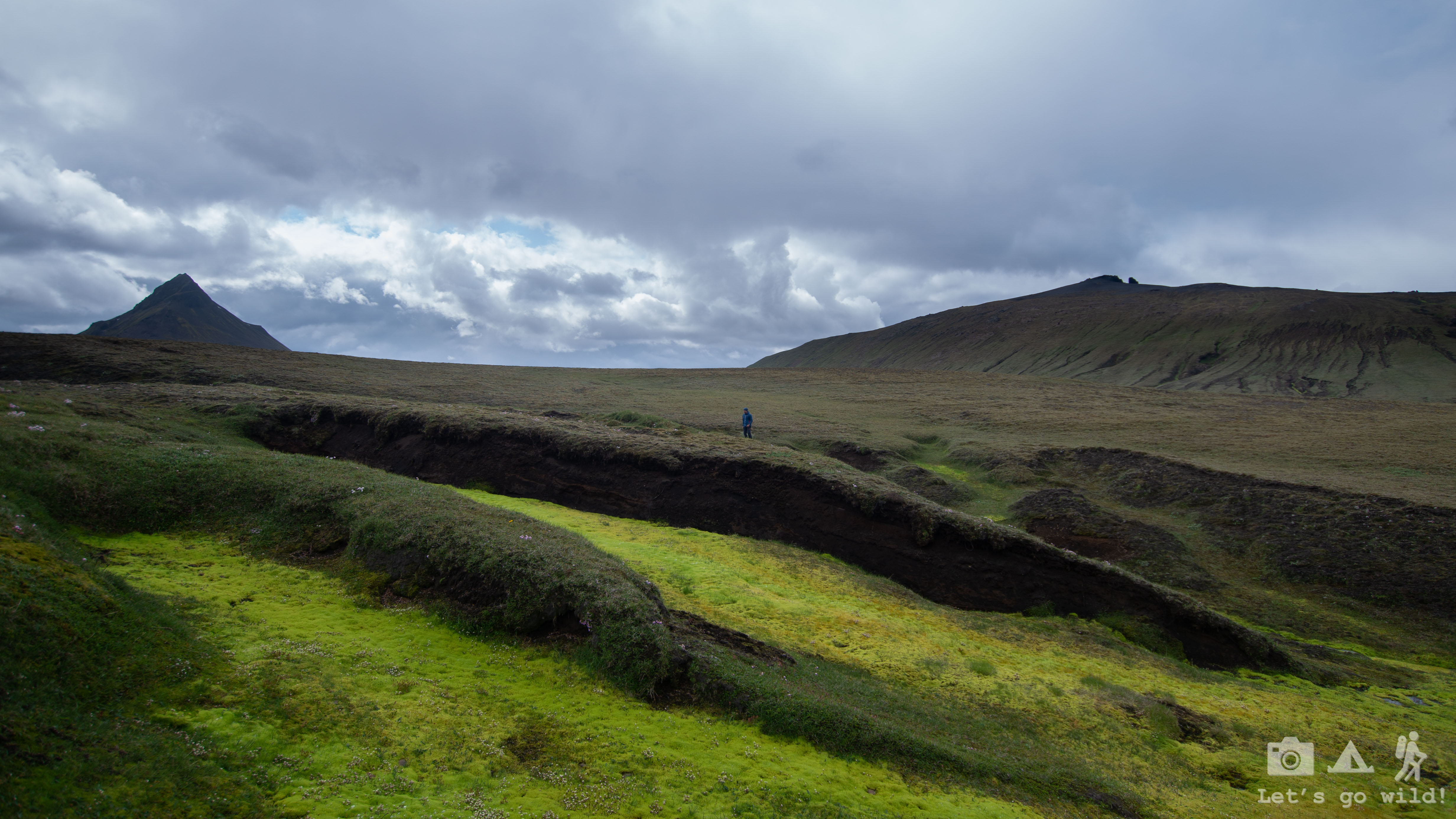
We walked up the river enjoying every moment for approximately 10 km until we finally reached the bridge and had to divert ourselves towards the first mountain hut where we would put our tent and stay for the night. This was a clear breaking point of the day which divided it into “before and after”. Before the bridge it was all green and fresh with panorama changing every now and then. After the bridge it was a dark, rocky and boring dirt road. Before the bridge we were walking quite relaxed and full of energy, not even noticing the count of kilometers in our tracker. After the bridge kilometers turned into miles and our backpacks got double heavier.

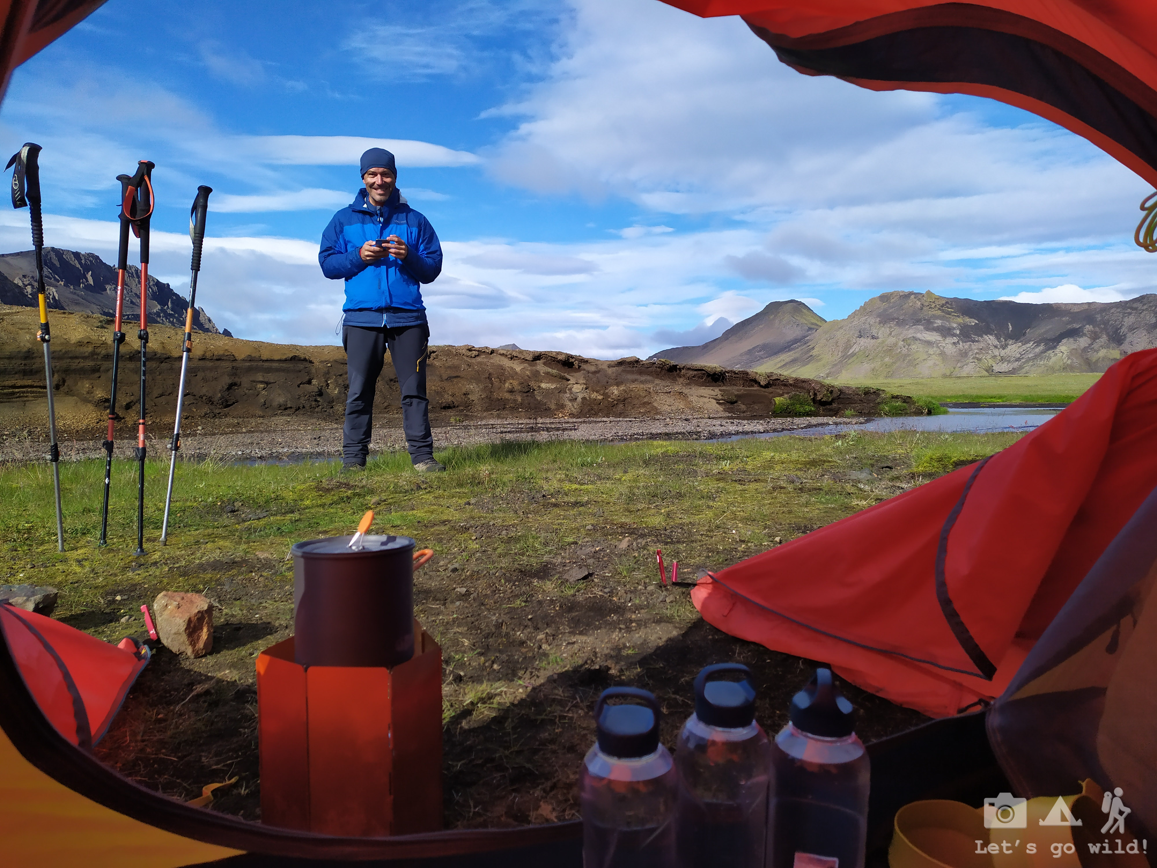
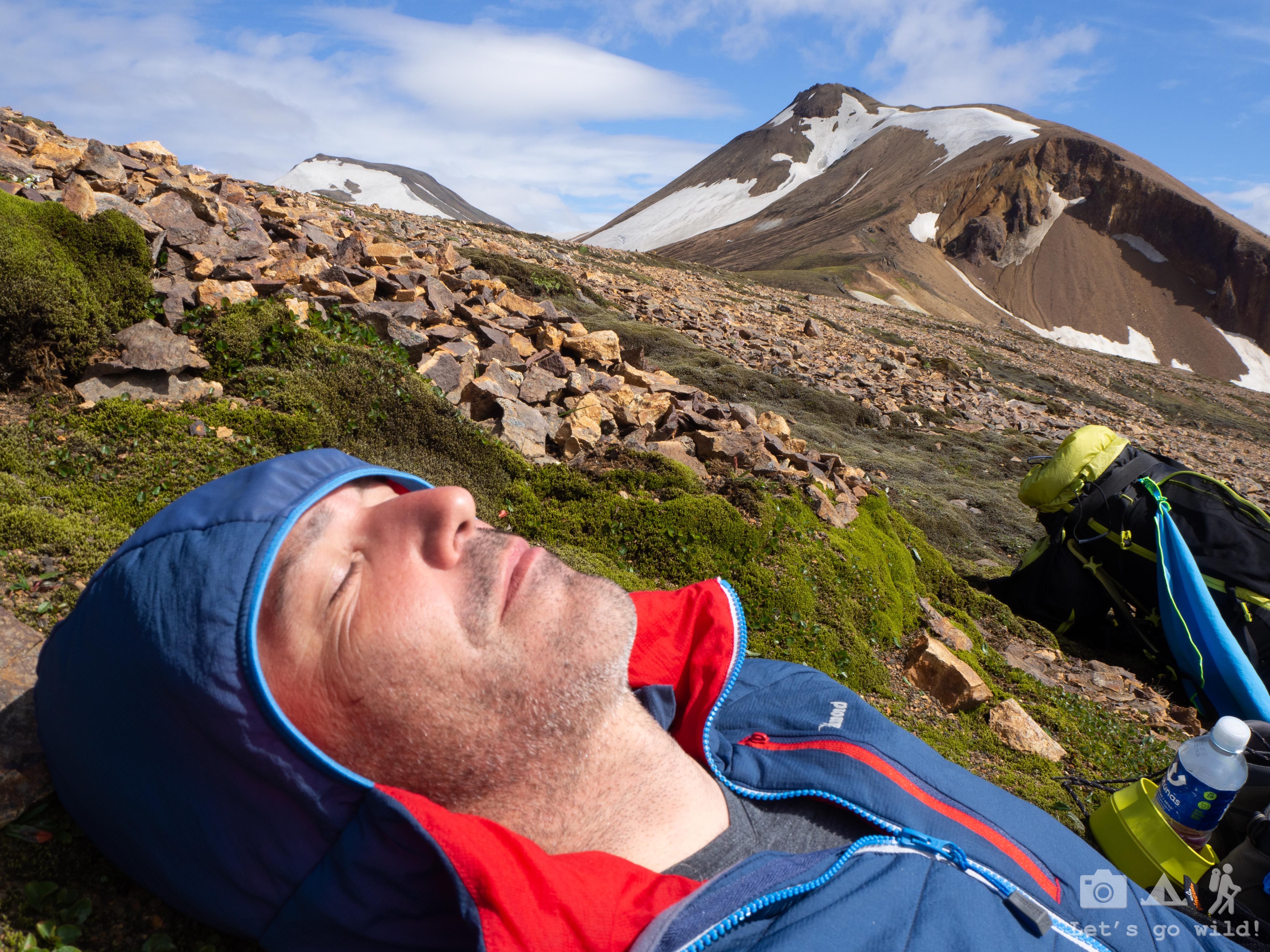
We saw in the map that there were two huts in the area. We planned to stay in the one that was more far away as from the description the first one seemed to be just an emergency hut. We knew there wouldn’t be water supplies in the hut, so we gathered water in the river just after crossing it, which made our backpacks even heavier. Last kilometers before the first hut were exhausting. We walked silently, each in its own pace, suffering all kinds of pain. We agreed to stop at the first hut just for a short break, to eat something, rest our shoulders and continue to the second hut.
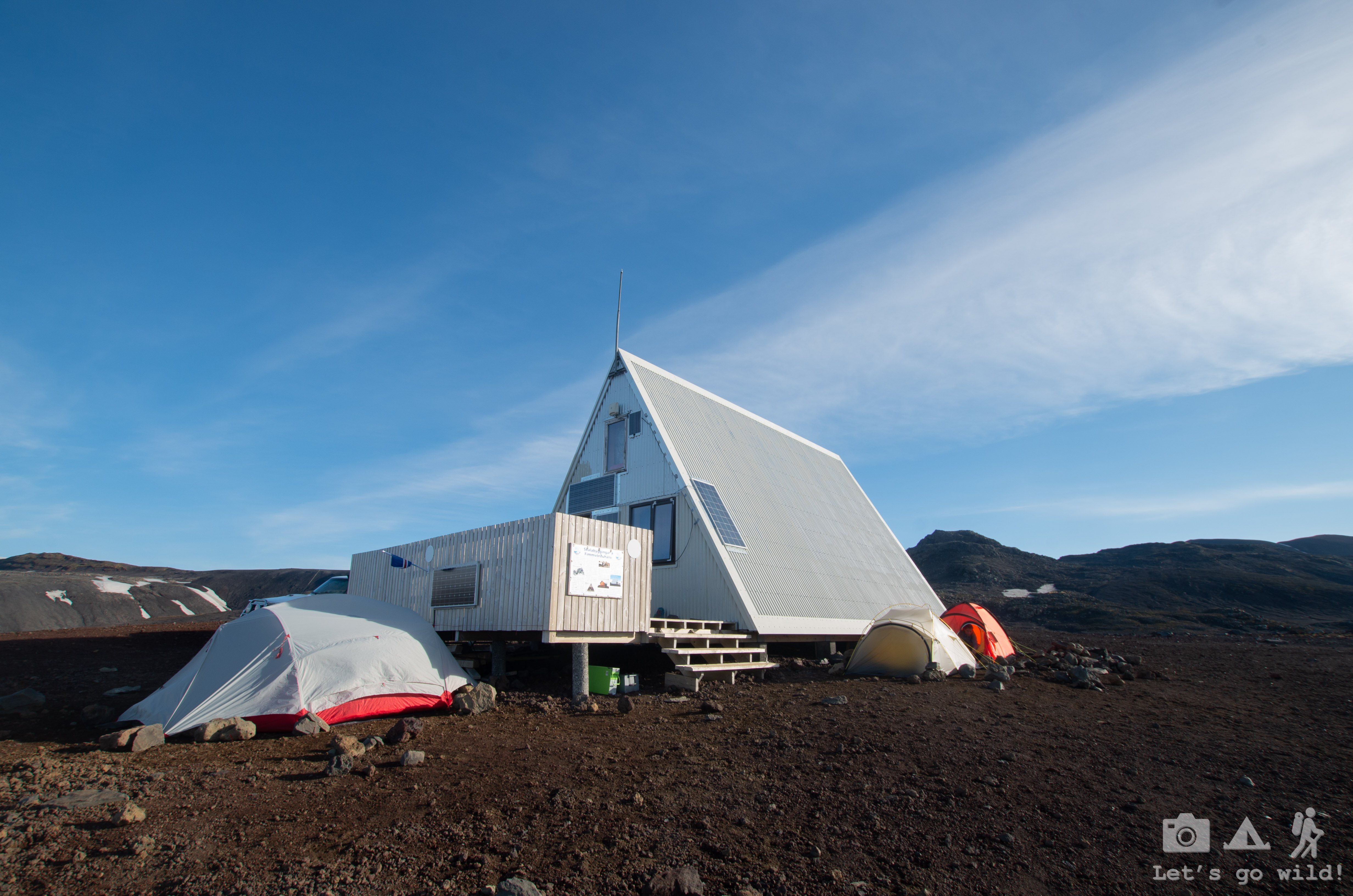
When we finally arrived, we saw there was someone inside but we were too shy to get in. We didn’t plan to stay there. All freezing (it got very very cold as we climbed to 1000 meters altitude) we sat down outside the hut, hiding from the wind, and had our extra snack, stealing it from the food supplies of upcoming days. Just before leaving, the hut warden saw us outside and came out to talk. I couldn’t be more grateful to this wonderful lady for talking us out of continuing to the next hut that day. She explained that even though it is close in distance, it is quite difficult to reach because of a few downhills before the final climb. Moreover, the second hut barely has flat space around it to put a tent. We thought of an option to join the route of two days into one as the second day is mainly downhill, but we were feeling two exhausted for doing that. The warden invited us to warm up inside before we do anything else. This tiny little emergency hut was the best refuge in all the hike where you could clearly feel the spirit of mountain people.
The solo traveler we met in the bus was already inside the hut, enjoying the warmth and the company of other hikers. He arrived a couple of hours before us. There was no sign of French girls or American family yet. We were wondering if they would reach the hut as the hike was pretty tough, especially for children. Few other people in the hut were going the opposite (or the classical) direction and were about to finish their route.
While having our warm dinner inside the hut, we heard other people arriving. What a great surprise it was to see the family reaching the hut! They did it!!! I was probably happier for them reaching the hut than for myself! Pure respect and admiration to these crazy Americans! And some extra points for sleeping in a tent too!
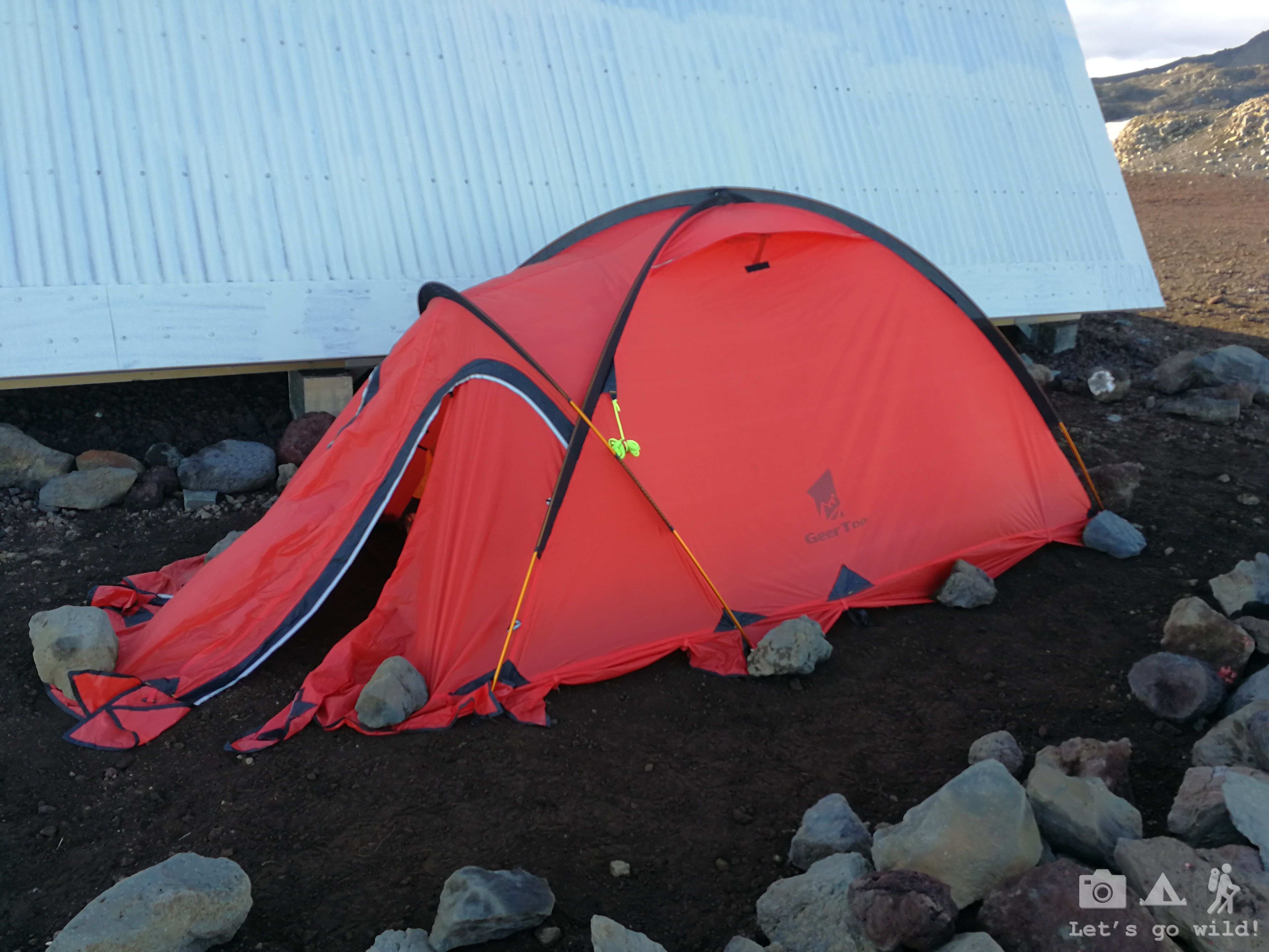
We’ve put the tent in the same spot where we were hiding from the wind while having our snack outside. The ground was so rocky that we couldn’t get the poles in and had to use the rocks to hold the tent from flying. It was very windy. And very cold. Yet the night wasn’t bad with our dawn sleeping bags and once the wind calmed down, it was pretty warm.
Statistics of the day:
Skogar – Baldvinsskáli Hut
14 km, ↑ 1031 m, countless waterfalls, 8:30 hours hiking.
July 2, Tuesday
Catwalk – check
Not sure how much I slept tonight. My sleeping mat failed me again and deflated slowly during the night. Did I mention before that the ground was so rocky and hard that we couldn’t get the poles in? Yes, now imagine sleeping on that without a proper mat! 10 minutes on one side and I start feeling the pain in my bones. I suffer for a while until the pain gets unbearable and turn on the other side. Few moments of relief and the pain starts crawling back slowly. I was rolling over all night like a sausage on a hot pan. Well, at least I wasn’t cold. Could have been worse…
The morning was fairly warm (given the circumstances) right until we had to hit the road. Welcome to the North!! The wind came back with all its power and I was appreciating every layer of my clothing that I had. Especially the thick winter gloves.
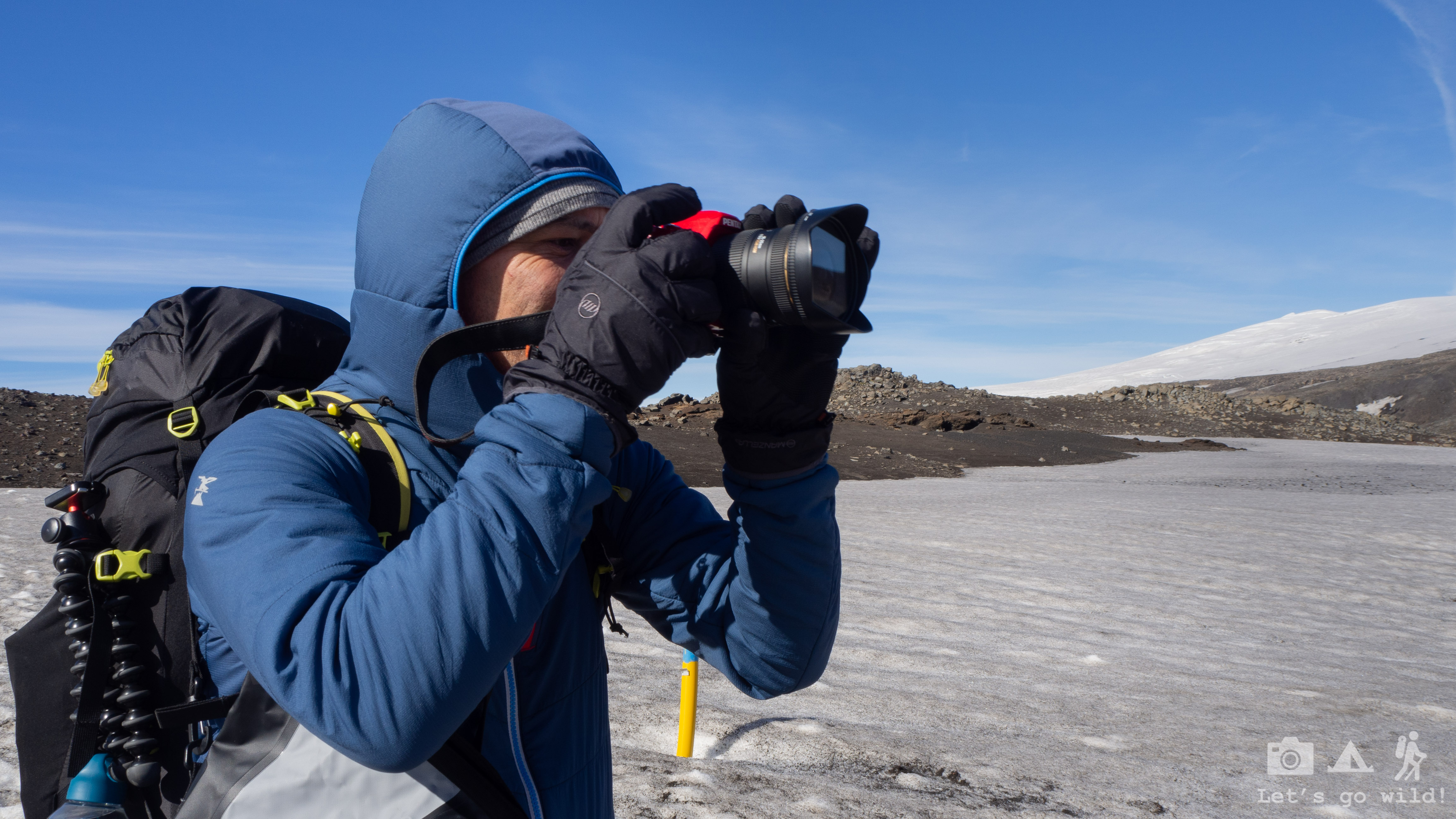
The start of the hike was apparently as hard as the warden described, with quite a few ups and downs and snow crossings. We were once again happy and thankful to the warden for convincing us to stay. Crossing this pass while being tired wouldn´t allow us to enjoy all of its beauty: the charming contrasts of the snow and black mountains, nor the perfect blue sky and sun which weren´t there yesterday. We enjoyed every moment of it, even if we had to take the photos with our thick gloves on!
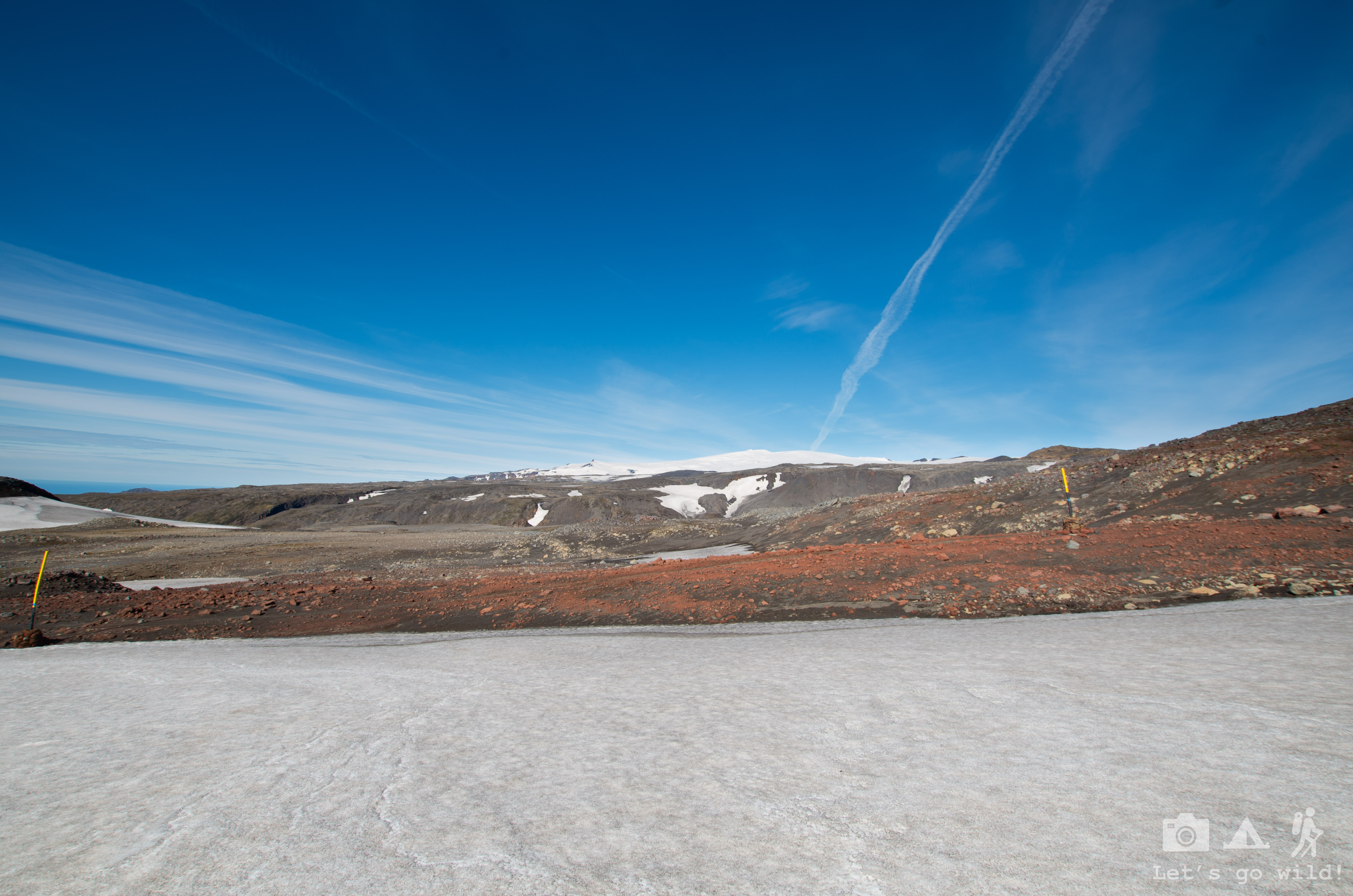

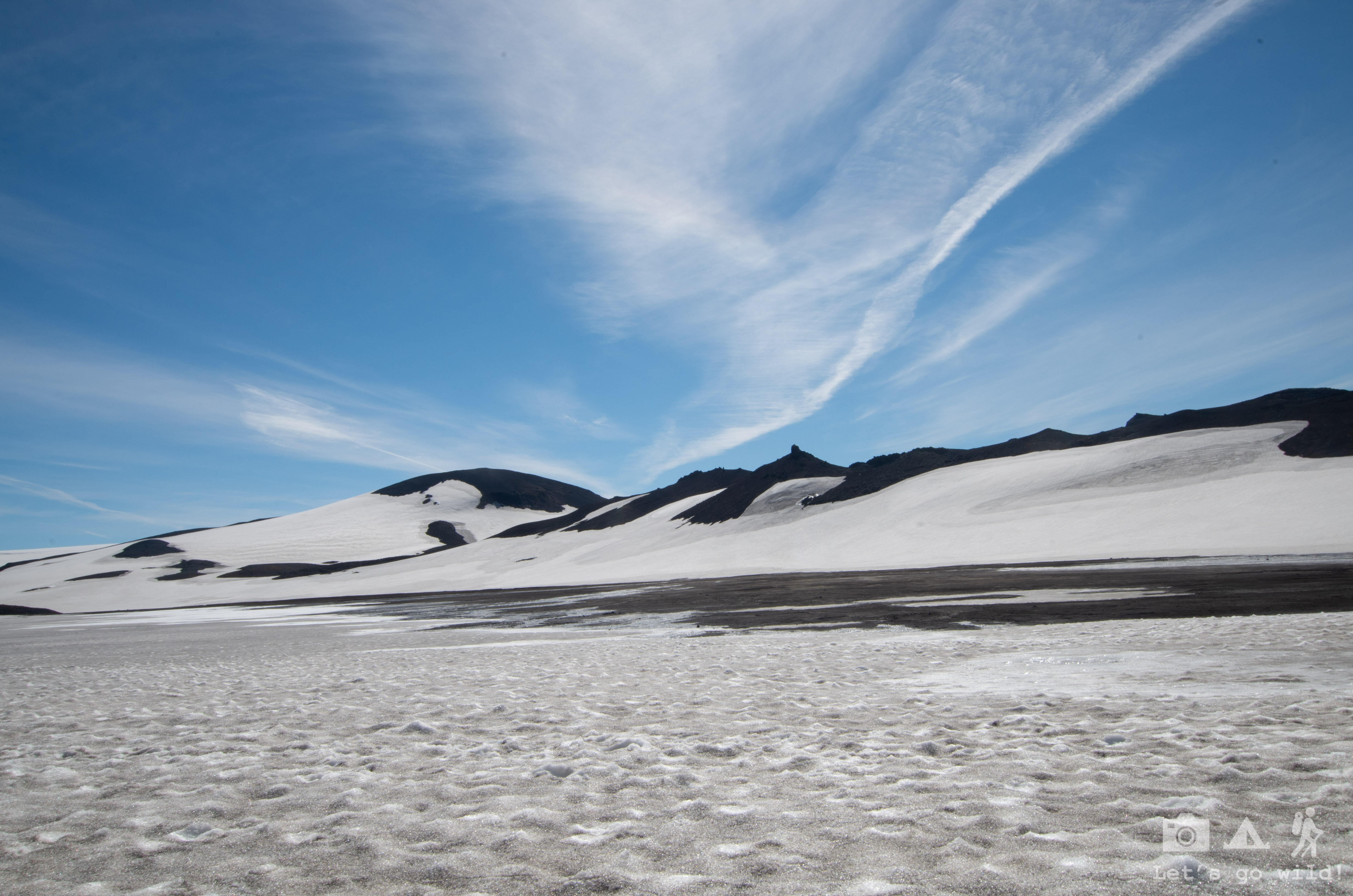
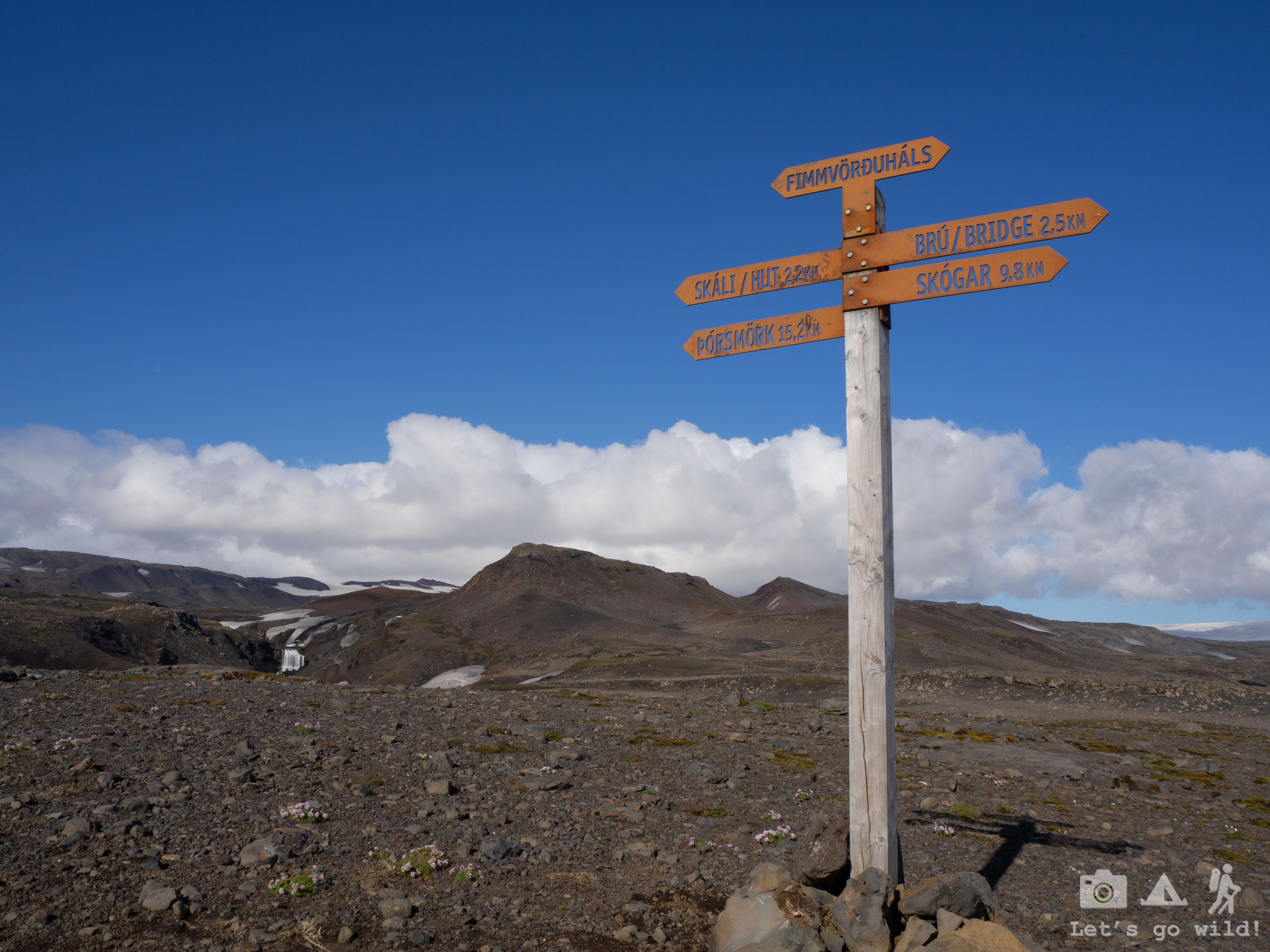
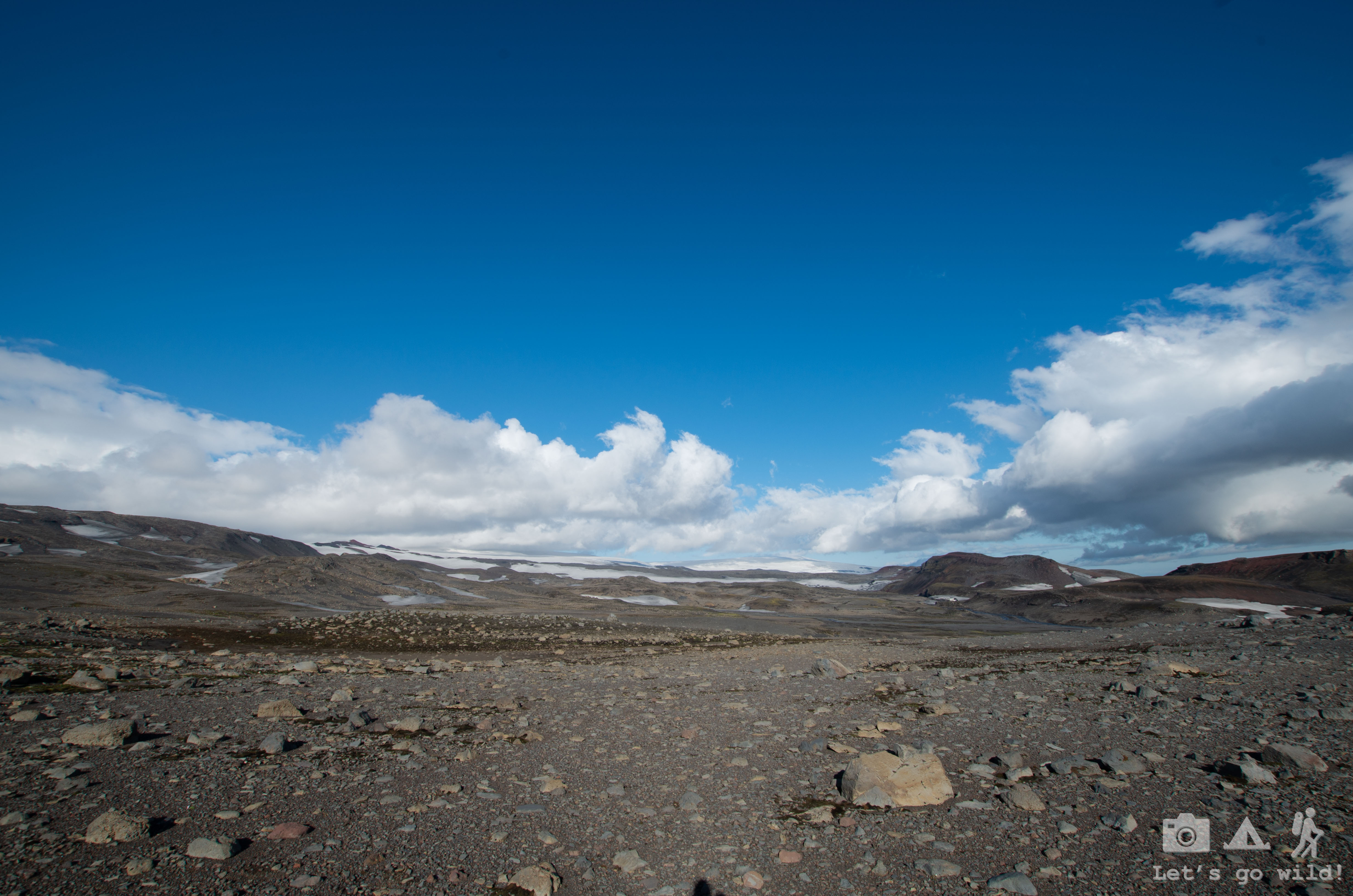
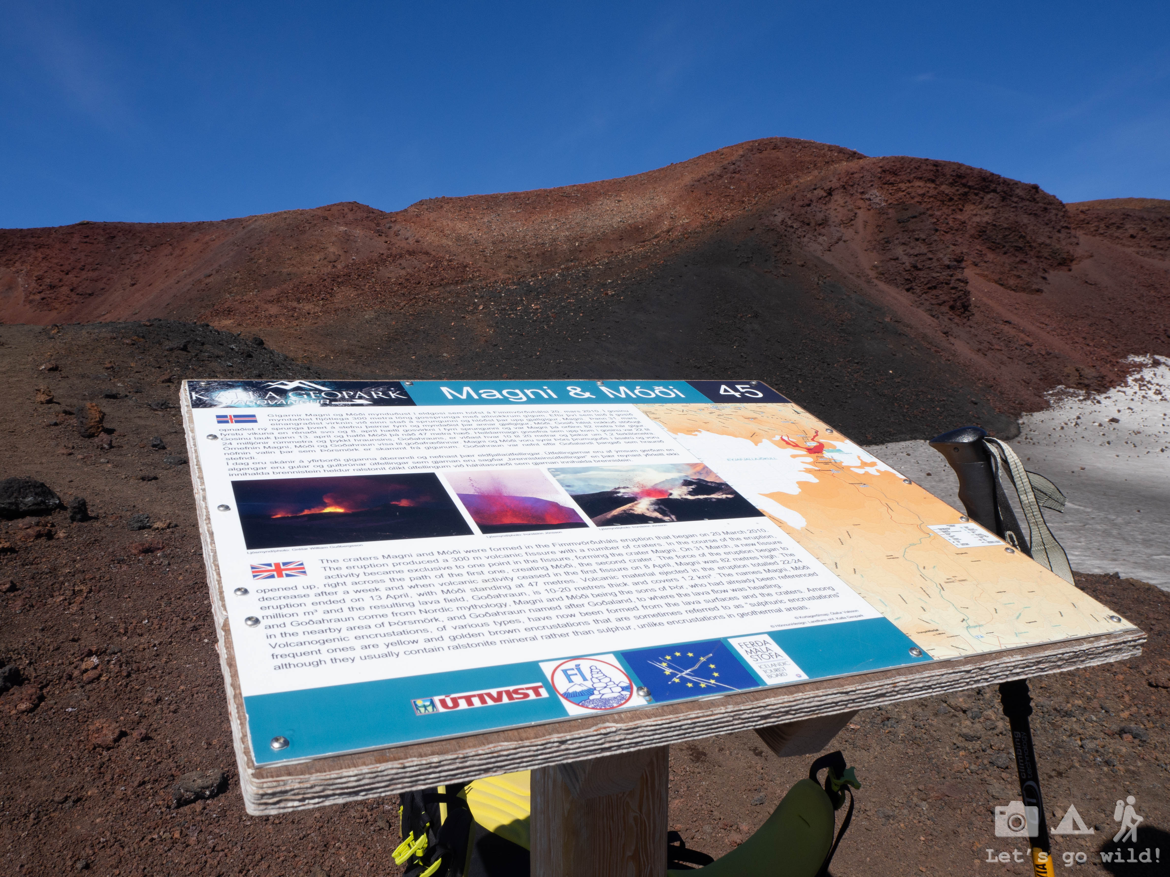
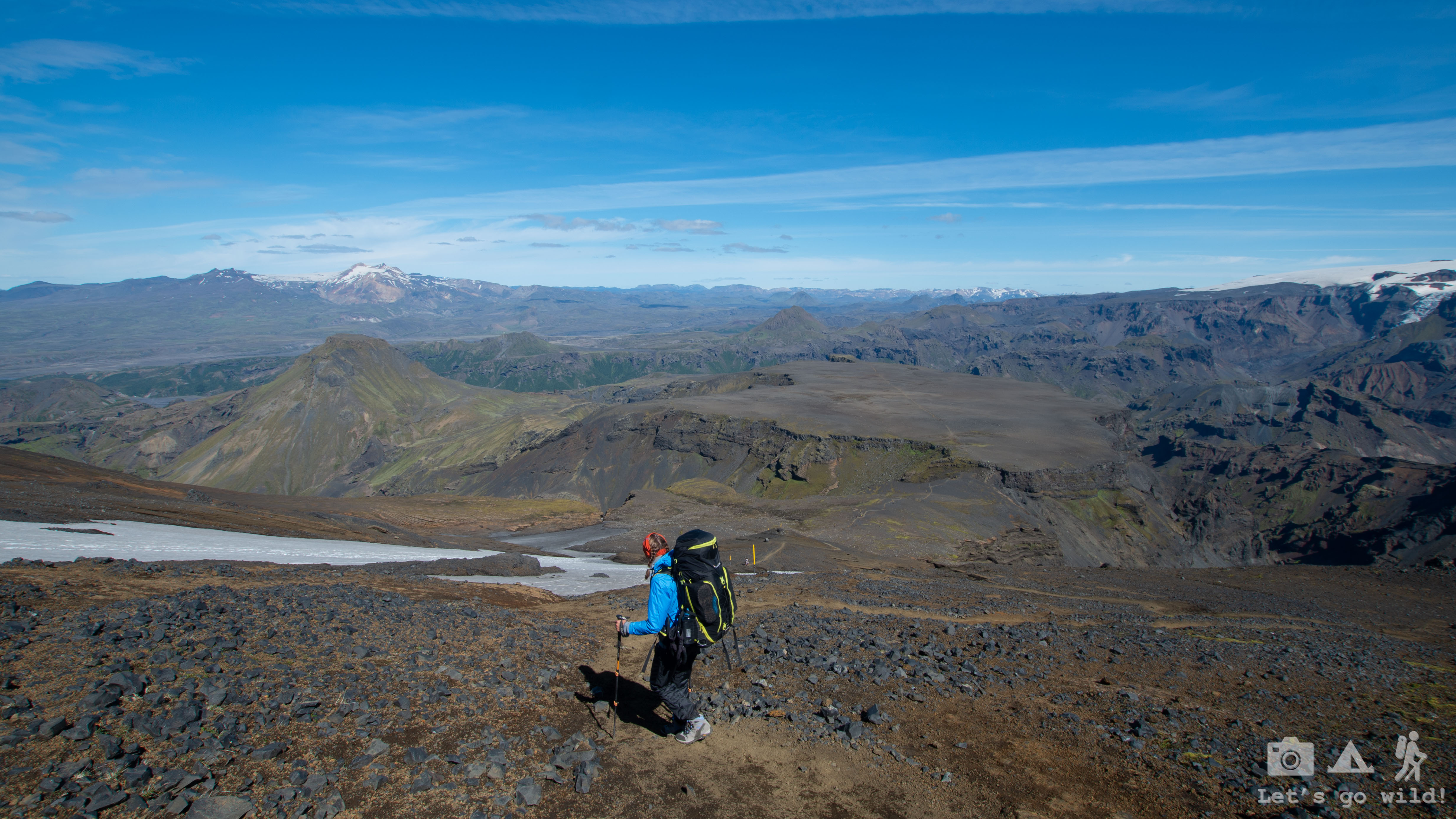
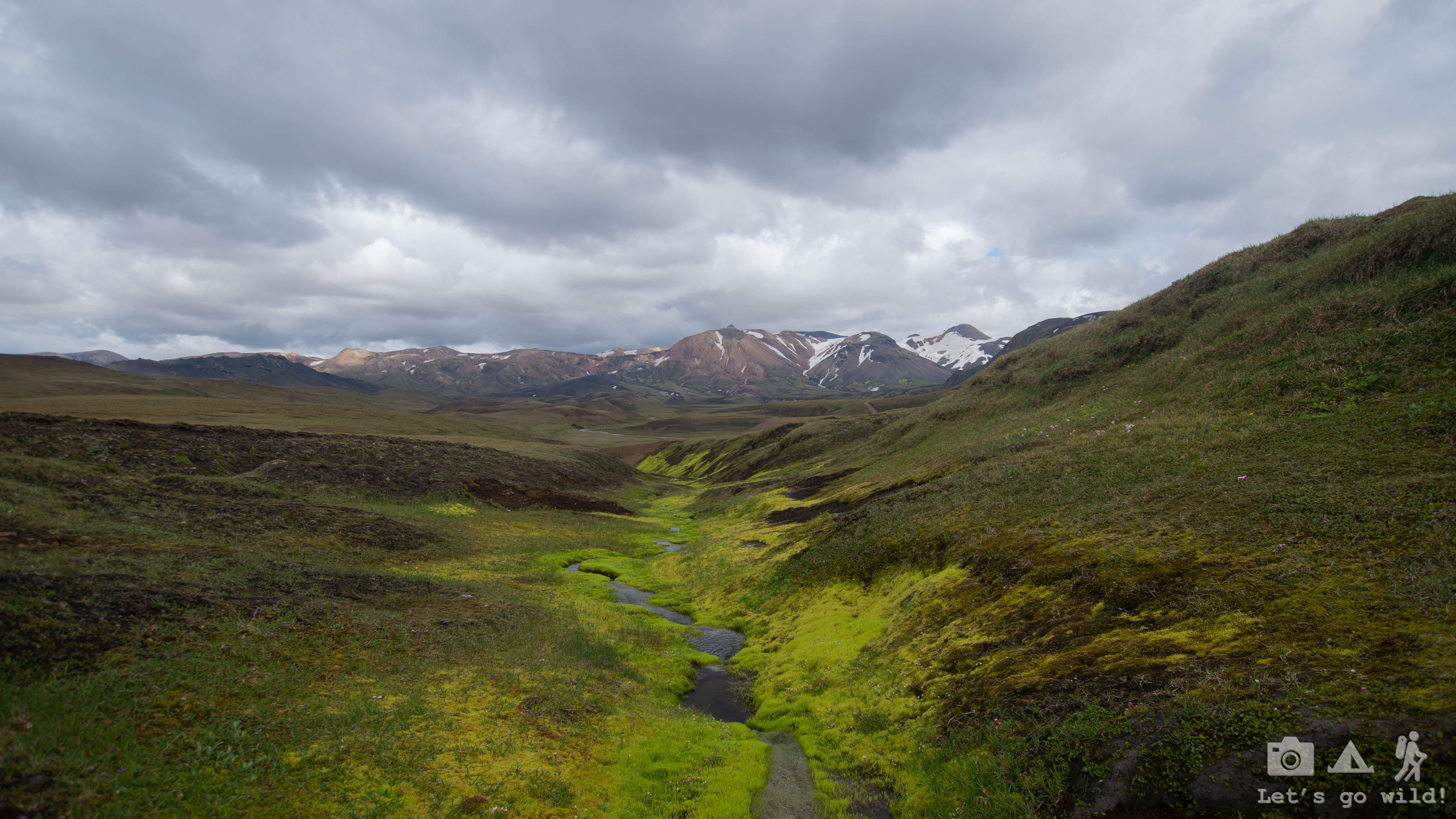
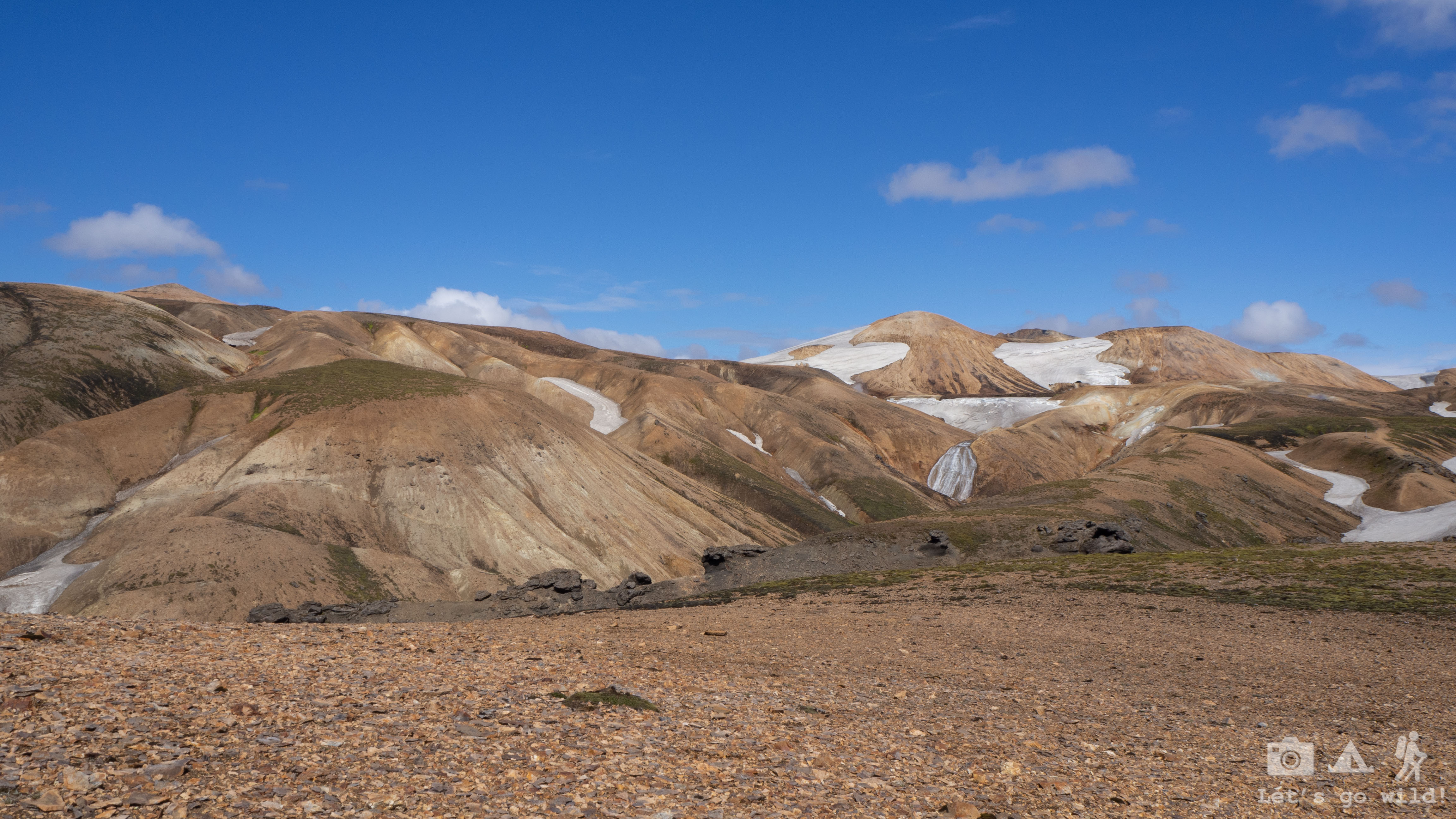
Very soon we reached the youngest mountains in the World – Magni and Modi, that were formed during a volcano eruption in 2010. The stunning red colour of Magni clearly stood out in the general panorama. These moments are the ones you crave for. After exploring the lava field, we dropped our heavy backpacks on the trail and ran up the volcano to have a sweet snack on the top. Maybe we haven’t been on the highest mountain of the world, but we’ve been on the youngest one! (Or at least that’s what they say…)
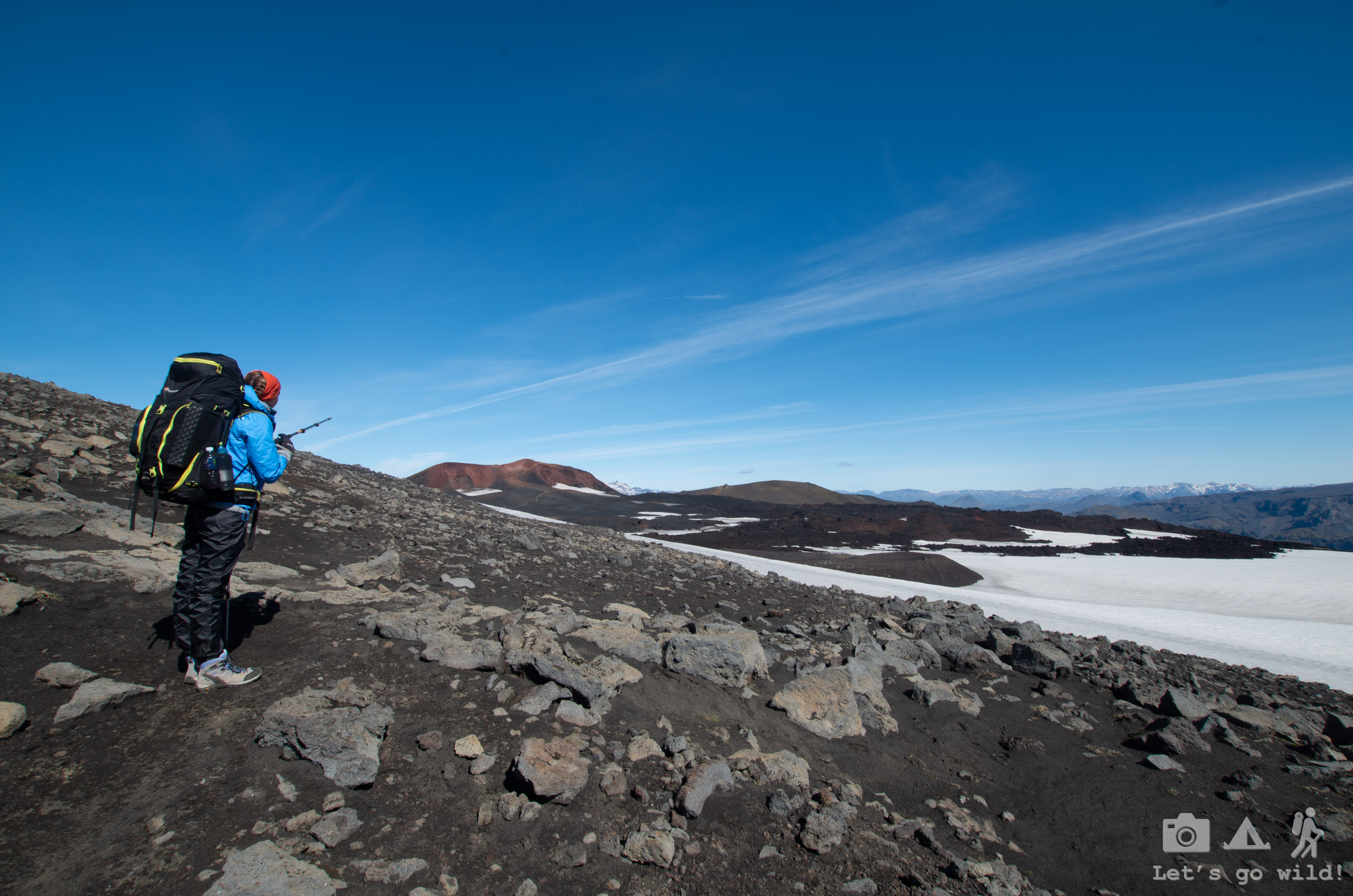


Few more turns after the volcanos and we start our descent of the day. An all day long and unexpectedly challenging descent.
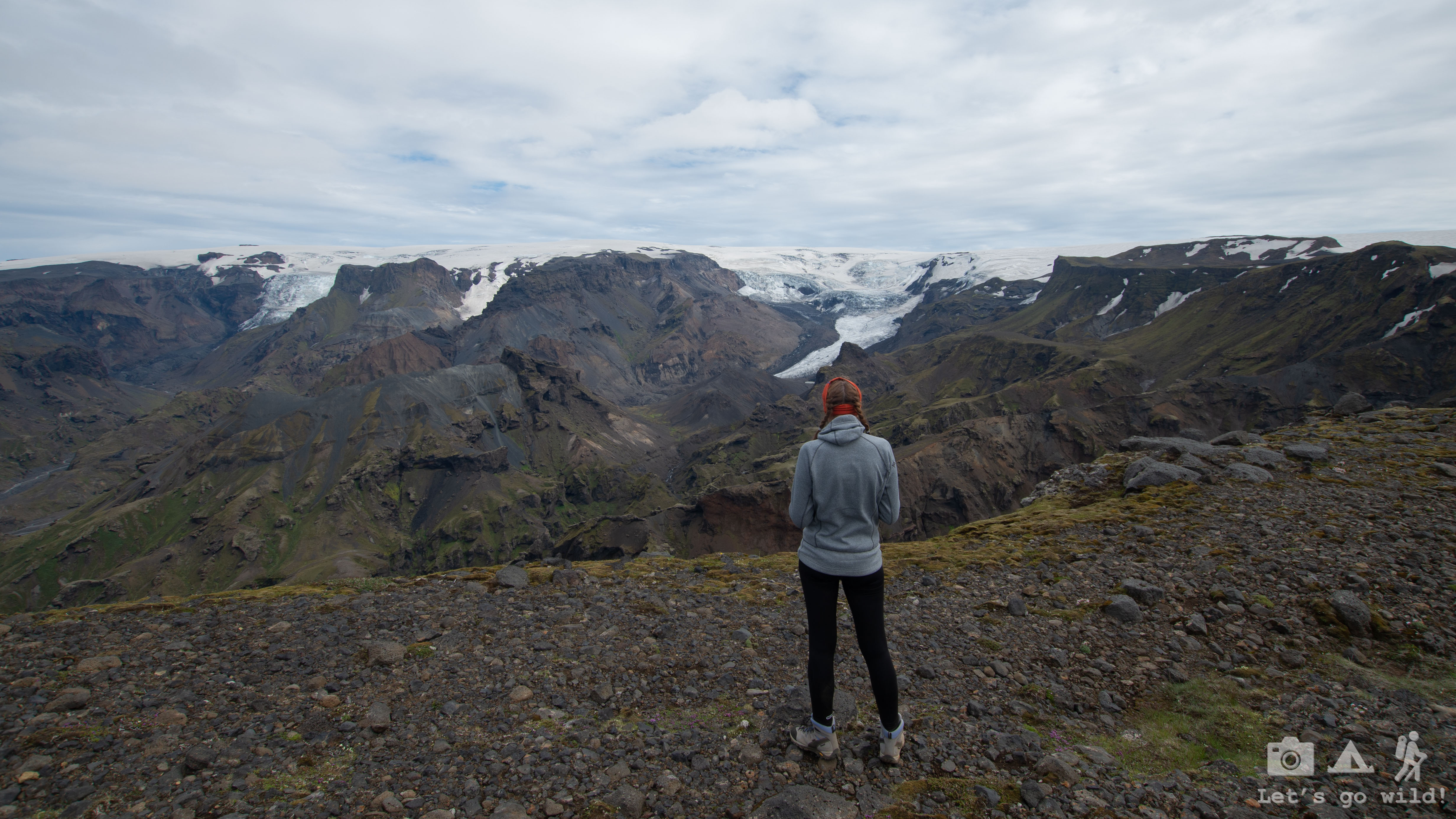
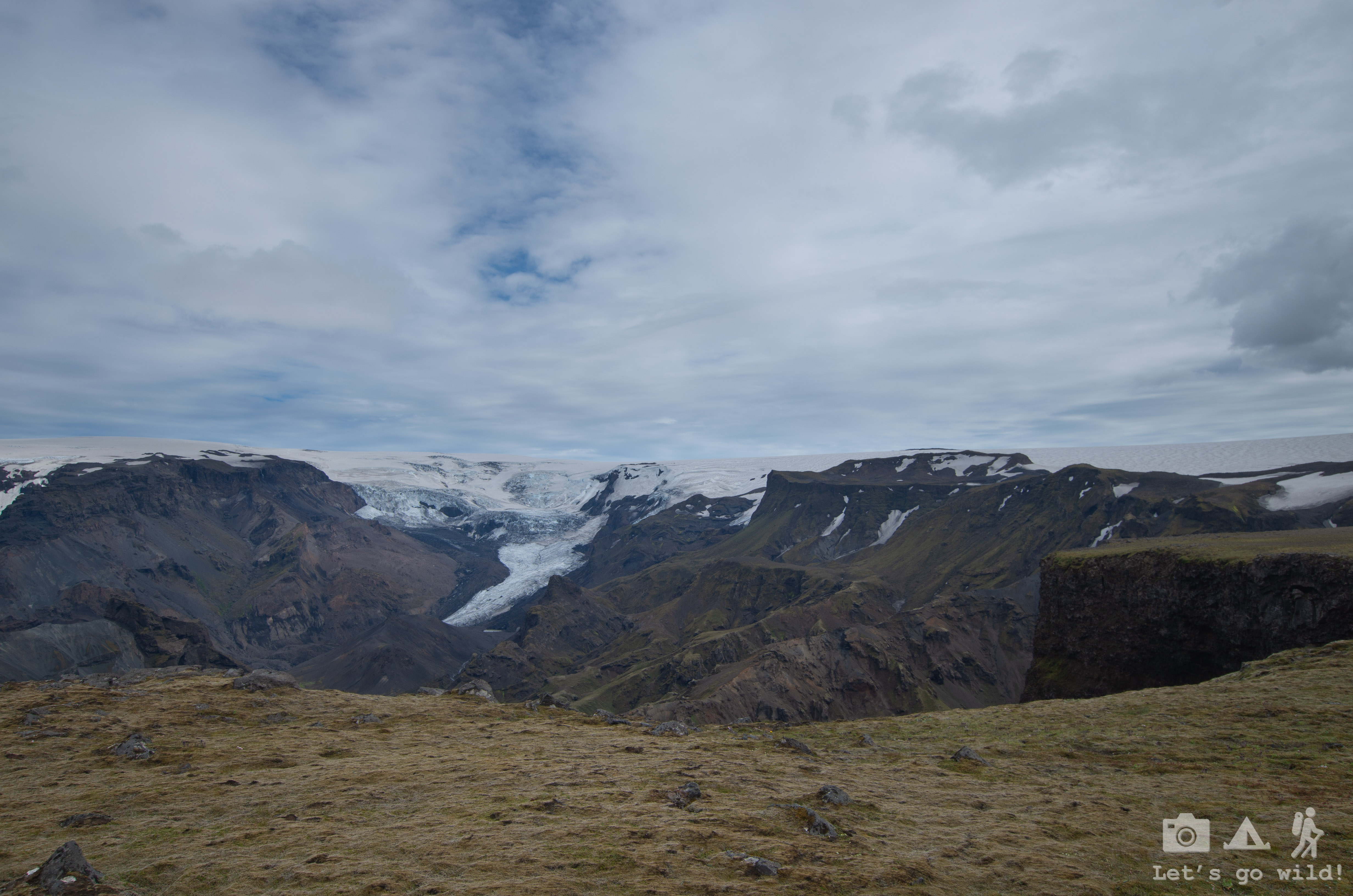
First, we started with quite steep slope with very loose rocks. I fell at least twice in this section on my but. Thankfully only my dignity suffered, no bigger injuries. The slope ended in quite a big flat area which gave beautiful views to the glacier – a perfect spot for an early lunch.
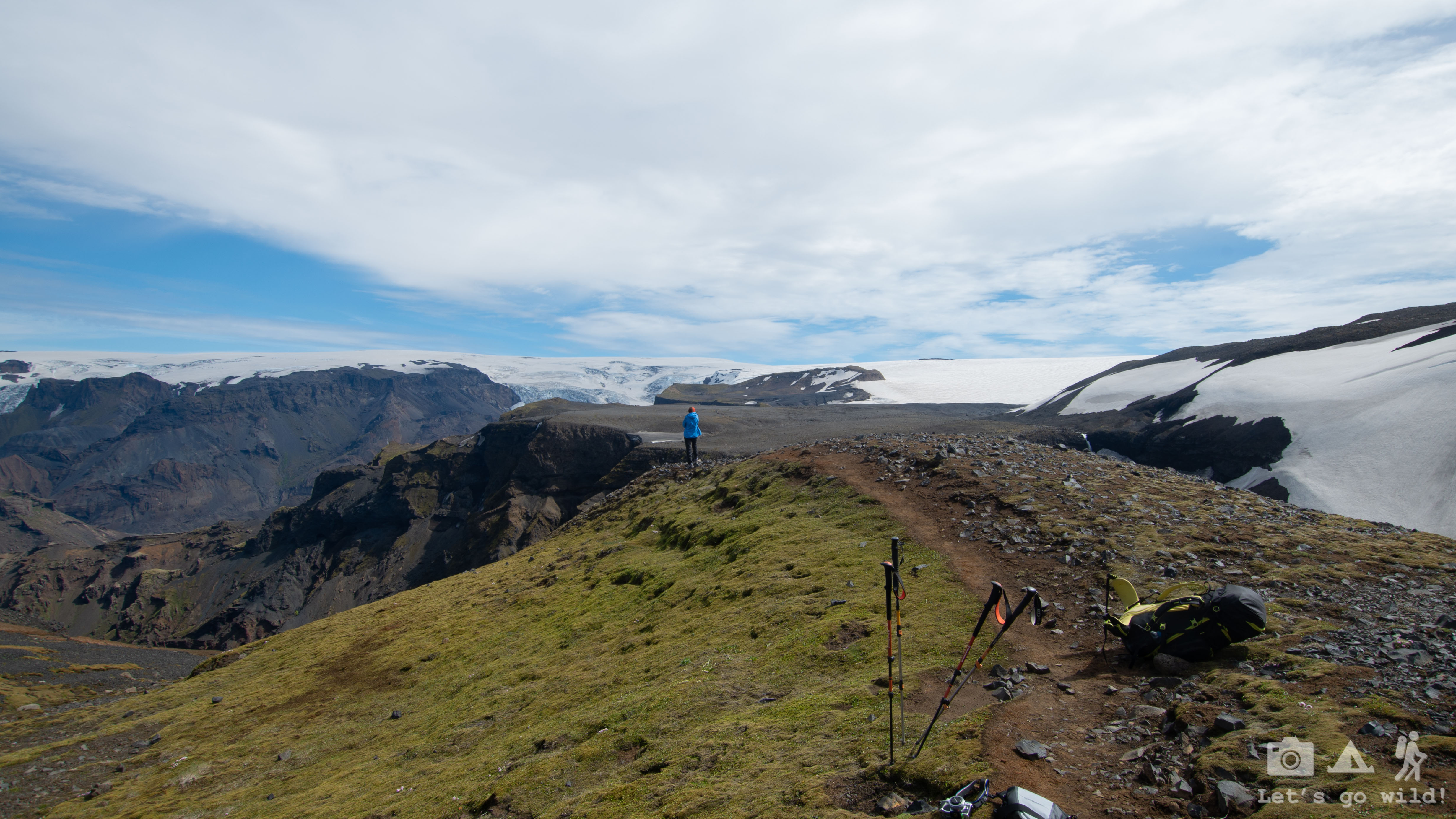
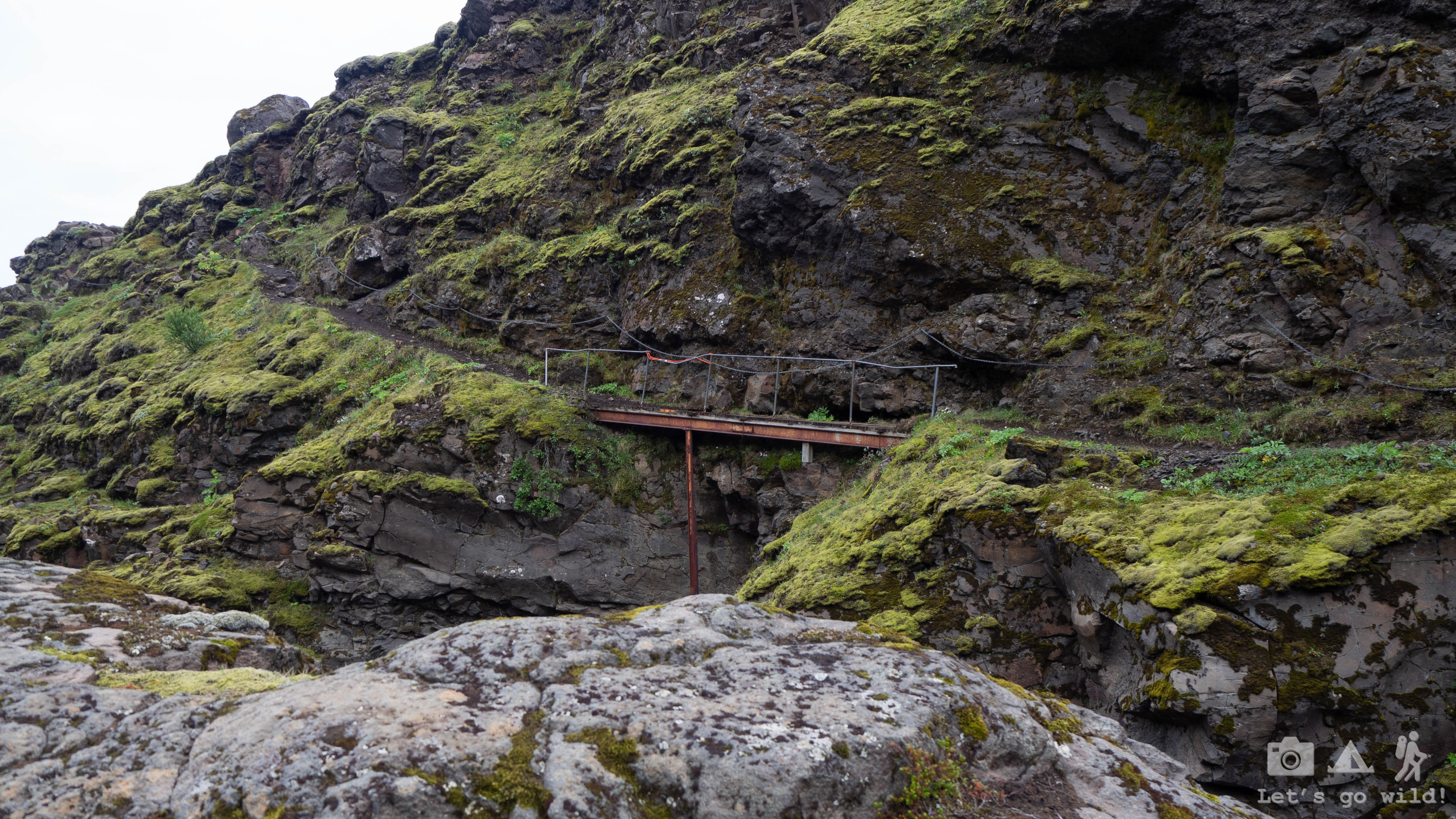
Right after that we had a section of chains on a narrow ridge. In this case the problem wasn’t so much of the exposure but rather of the loose chains! They were barely holding! We were very unpleasantly surprised that with such a good marking of the trail we have seen so far, Iceland seemed to have a very neglected attitude towards the basic safety. Shame on you Iceland! We were lucky to have a perfect weather that day so the trail was dry and not slippy. On a rainy day it could be quite dangerous to cross this part.
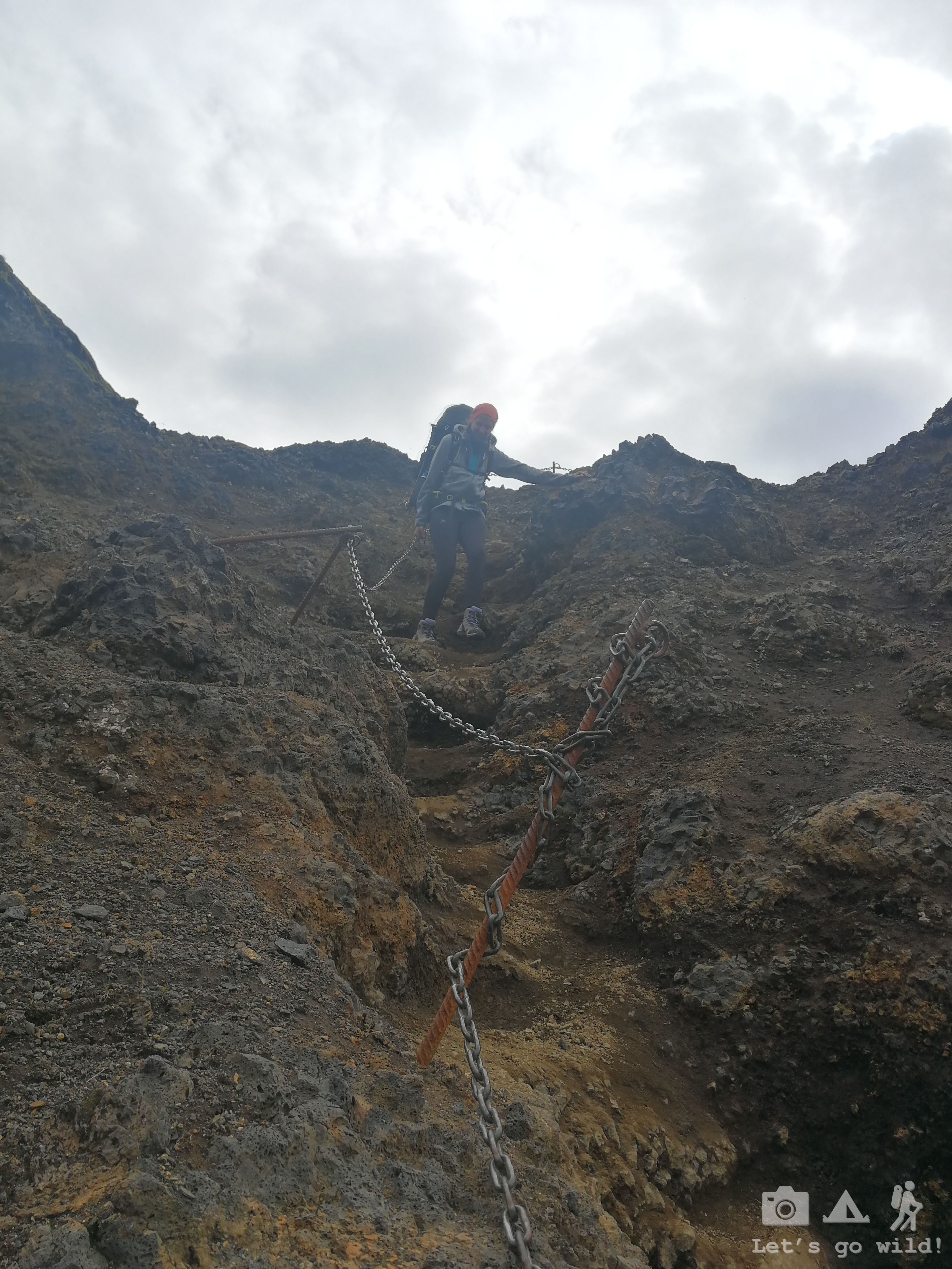
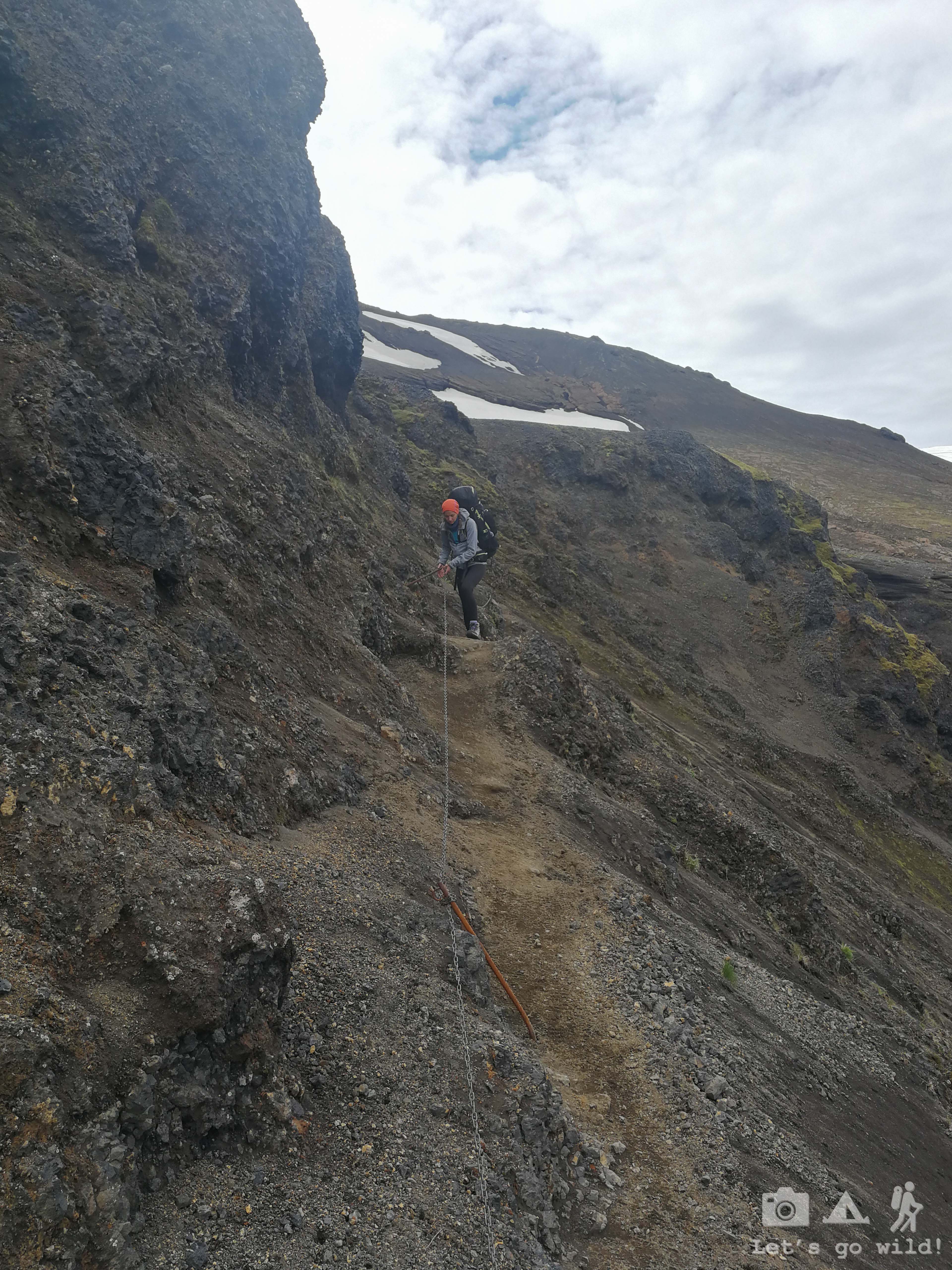
We got our shot of adrenaline, yet still had a huge amount of meters to descent which kept us a bit nervous. Will there be more chains like this? What else is waiting for us out there? The forms of the mountains we were crossing also kept us wondering if we would have problems with vertigo to get down…
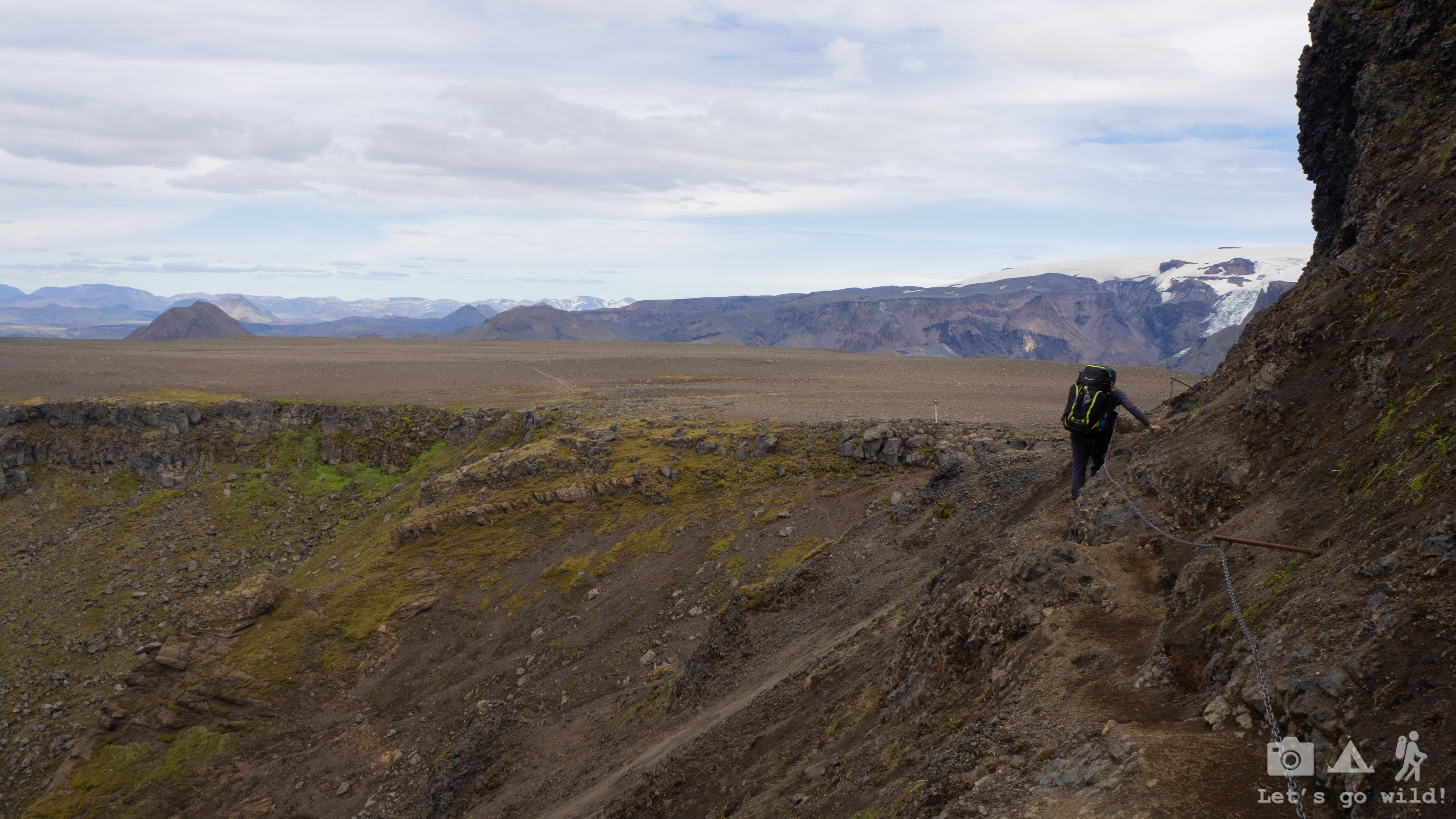
As we were getting lower, the green colour was coming back to the scenery. Expected distance of the hike for today was quickly running to an end and we still had quite a few meters of descent left. Few more turns and I freeze from the view I see. No way Pedro will cross this easily with his vertigo!!! A narrow and rocky ridge with steep slopes on both sides and no safety support whatsoever…

Breath in, breath out. Repeat 20 times. Check the path. Remove backpacks. Do the catwalk. Return for the backpacks. It´s done. We are finally safe on the other side! Let´s hope there are no more of these today!

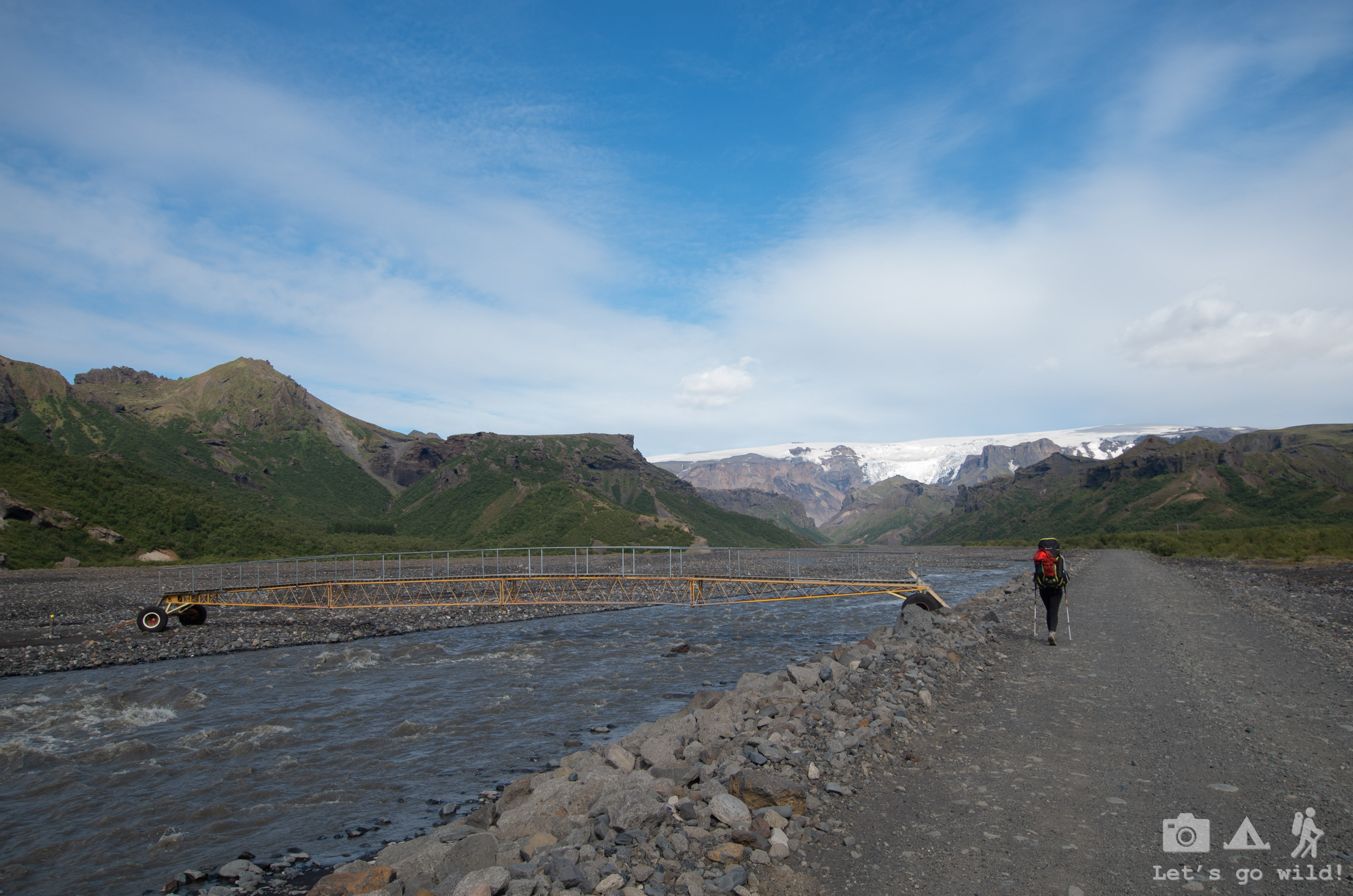
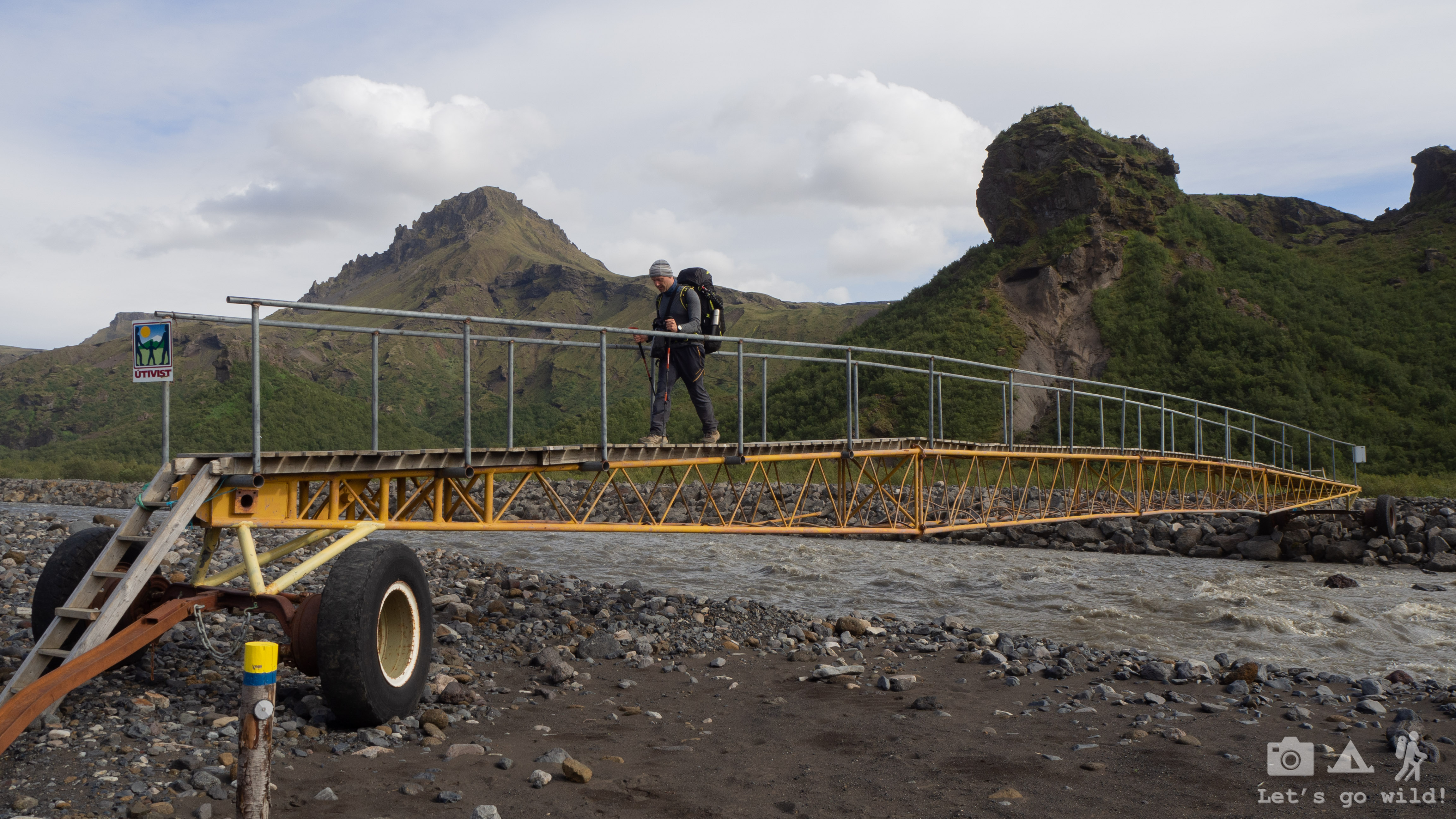
The rest of the trail was a piece of cake. Soon enough we reached a forest area – something not very common in the harsh nature of Iceland. Then we got down to the wide and rocky valley of the river. The maps were showing that there should be a bridge to cross it, but it wasn’t easy to find. No wonder… It had wheels!!! They probably move it according to the needs and shape of the river.
The last km again stretched into a mile, the backpacks got double heavier, and my ankle started hurting like hell. But all this suffer just maked the finish of the day more pleasant.
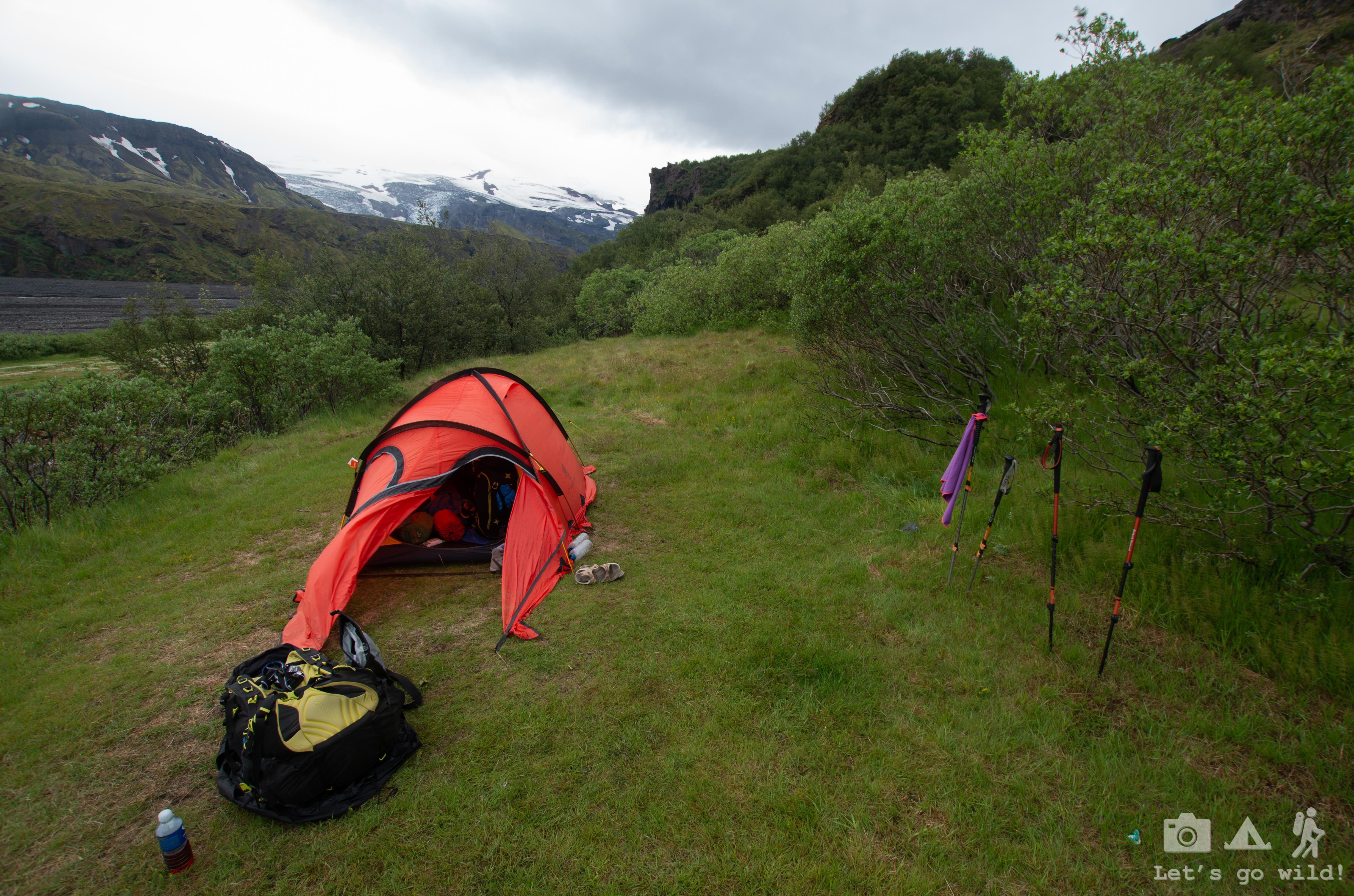
The campsite at Langidalur hut in Þórsmörk was fairly crowded. No wonder, as it is considered to be the end of a 4 days Laugavegur trail. We quickly pitched the tent and went for a beer – our reward after a tough day. Discussing our hike, we couldn’t stop thinking about the American family that was doing the same route as us during these two days. On the way back to our tent we saw them mounting theirs. How happy was I to see they all came down without any injuries! The father was equally unpleasantly surprised by the safety issues on the route, yet still managed to joke about it: “When I saw the first one I thought if I fall, I die here. The second one wasn’t that bad really. I thought if I fall, I’ll only need a few days in the hospital.” Thankfully no one fell. Once again admiration to a brave and strong 9 year old girl. I don’t think our daughters would cope with this route. Not yet.

Completely tired after another long day we went to sleep quite early. Tomorrow we will have an easier day for a change.
Statistics of the day:
Baldvinsskáli hut to Langidalur
14,4 km, ↑360 m, ↓1054 m, 8:30 hours on the trail
3:0 Laura wins on a fall count
1:0 Pedro wins on a catwalk
July 3, Wednesday
The black Wednesday
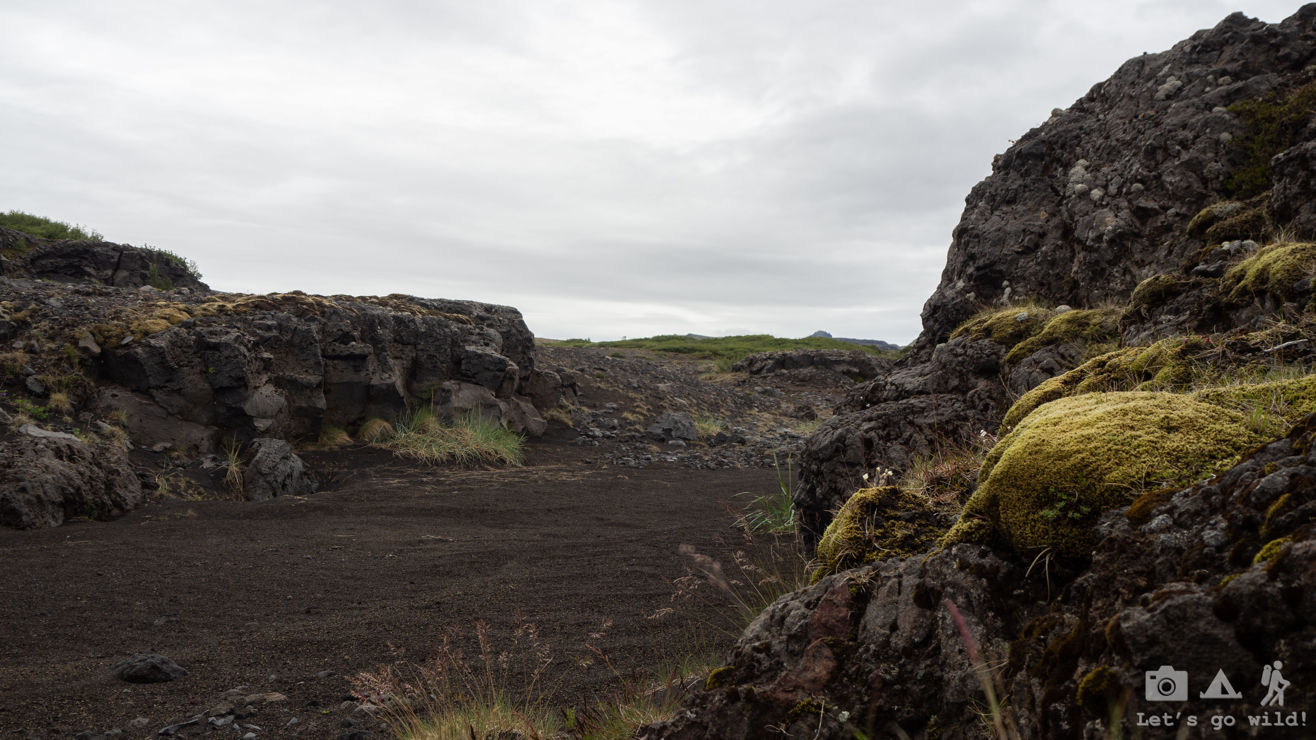
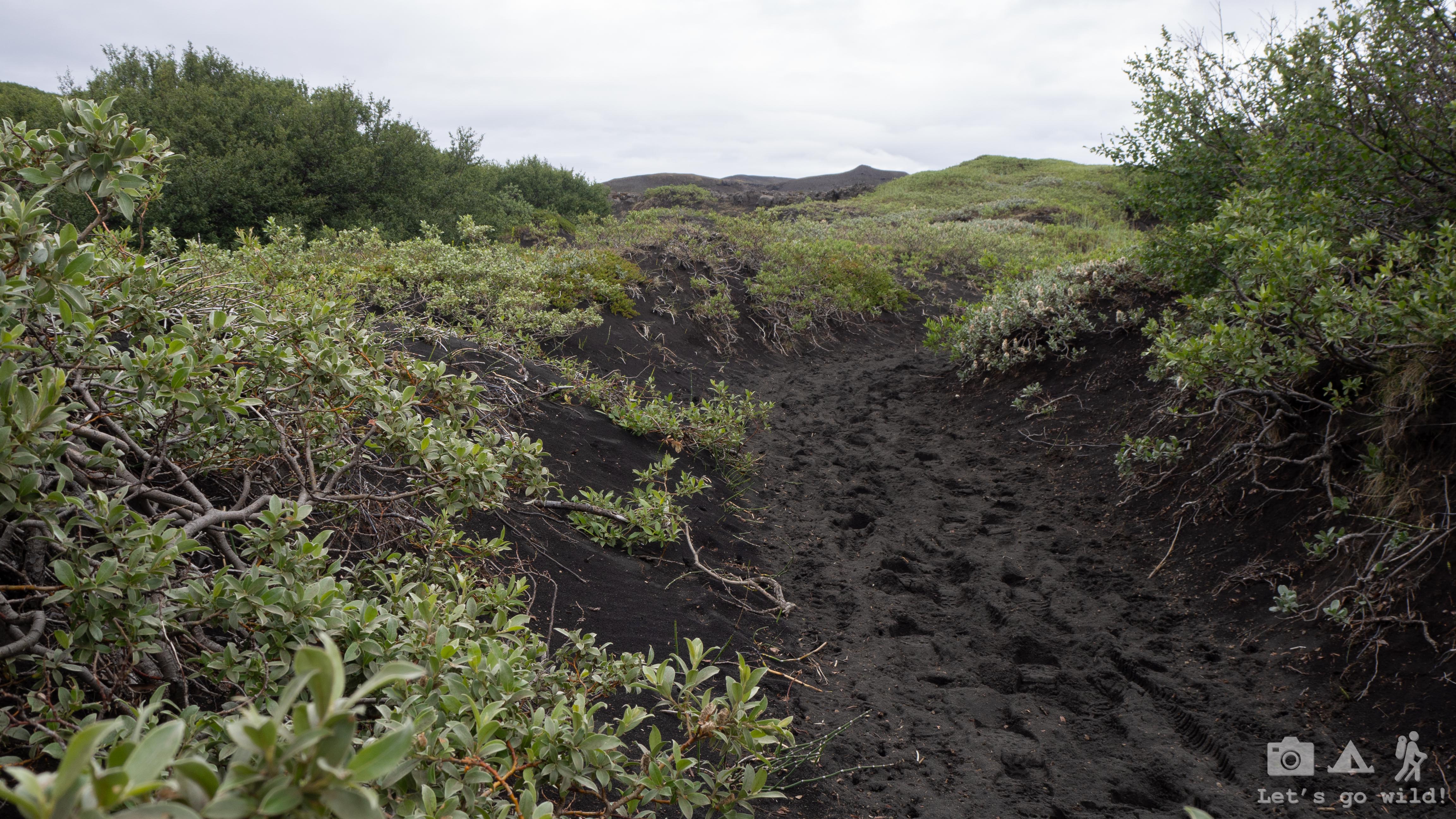
OK, before you think that something bad happened this day, I want to say it got this name for other reasons. Today black was the dominant color. Literally. Black sand, black mud, black mountains with some vibrant green here and there. The sky was also close to being black. It was the only day in all of our trip with rain during our hike. But it wasn’t a big loss as the most spectacular landscapes were on other parts of the route.
We started our morning crossing again some forest which disappeared fast once we climbed a little bit higher. It was quite a monotonous day with some WOW moments on the go that kept our spirit high:
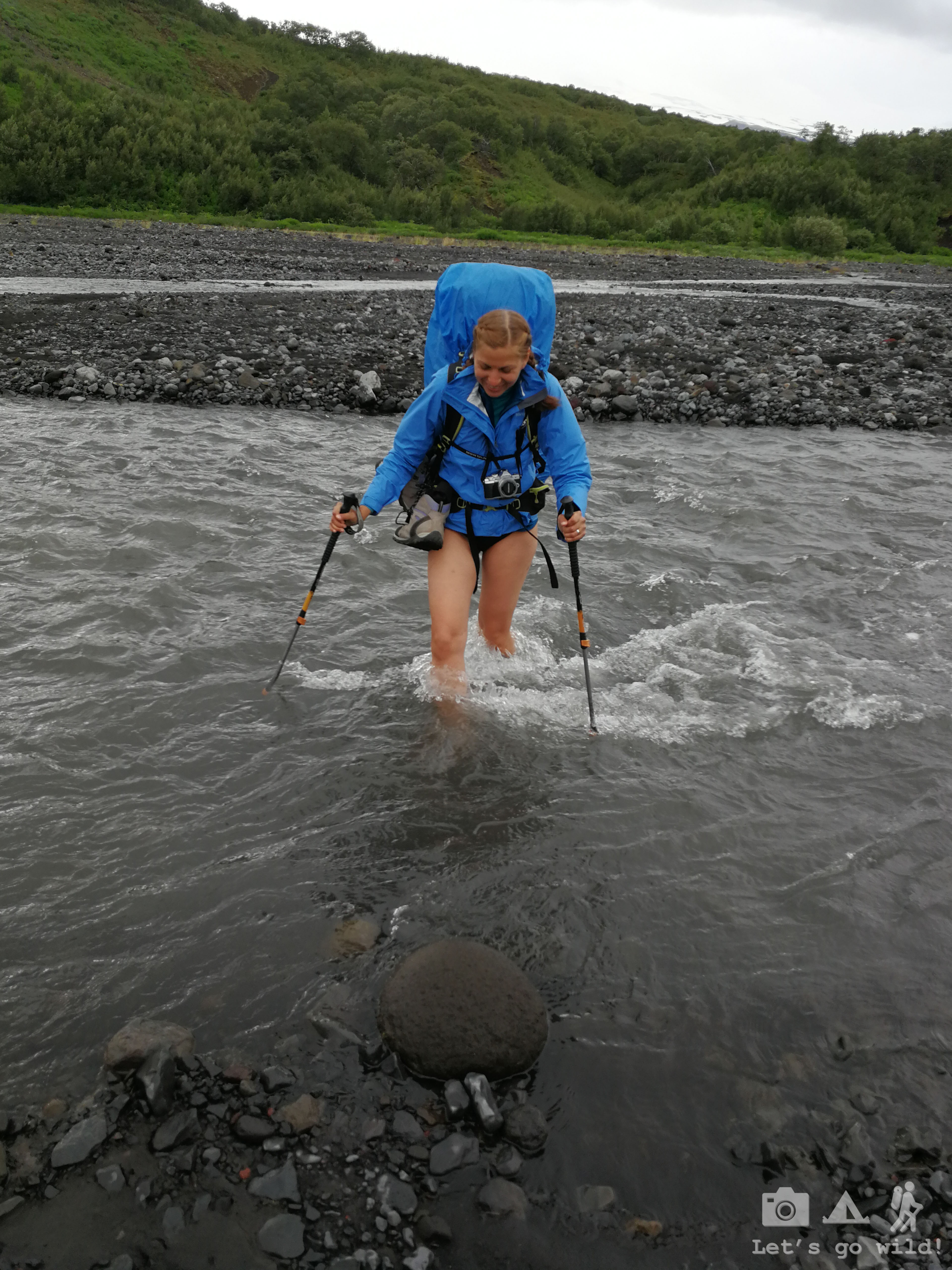
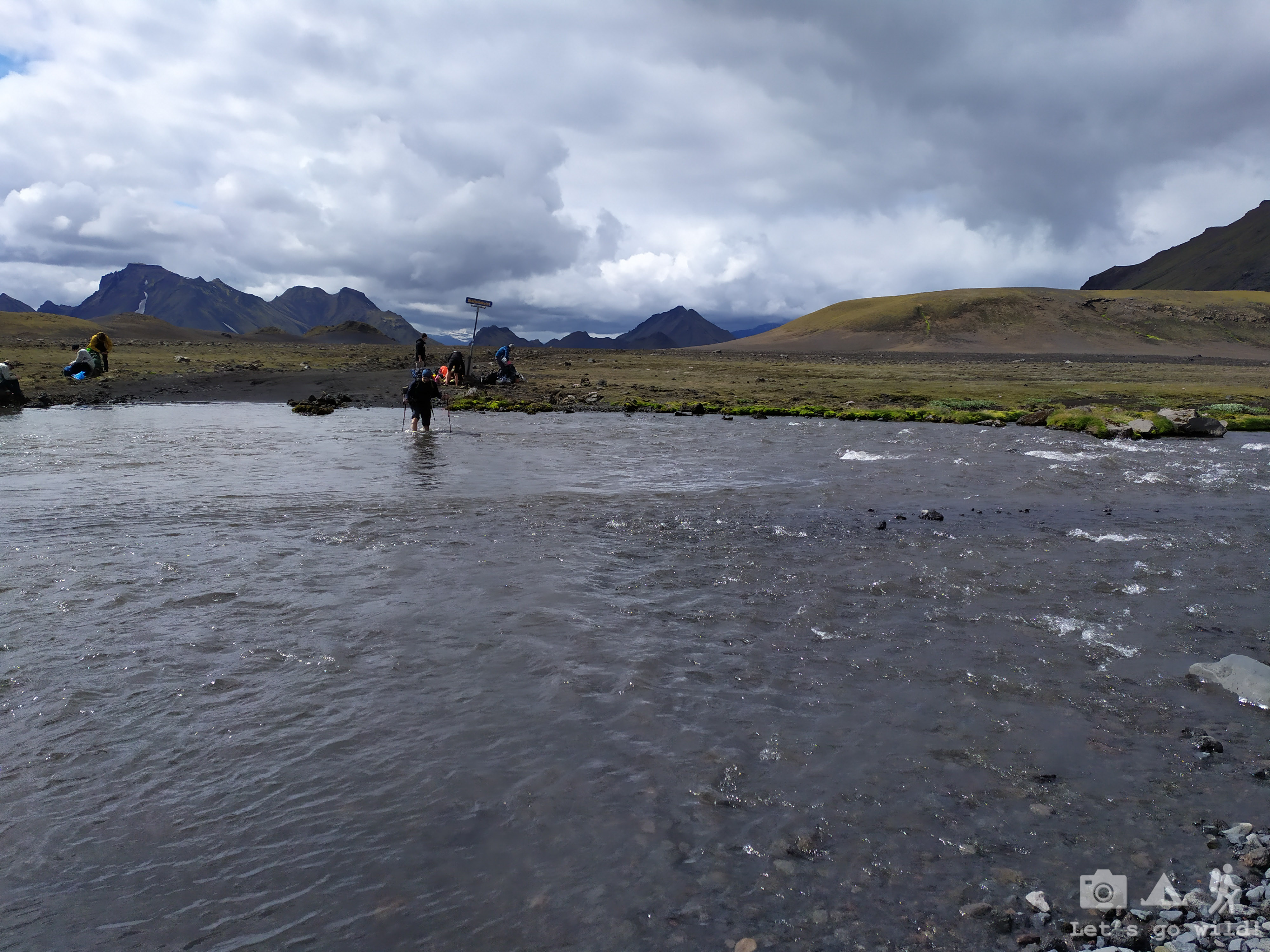
- the first knee-deep crossing of a freezing river

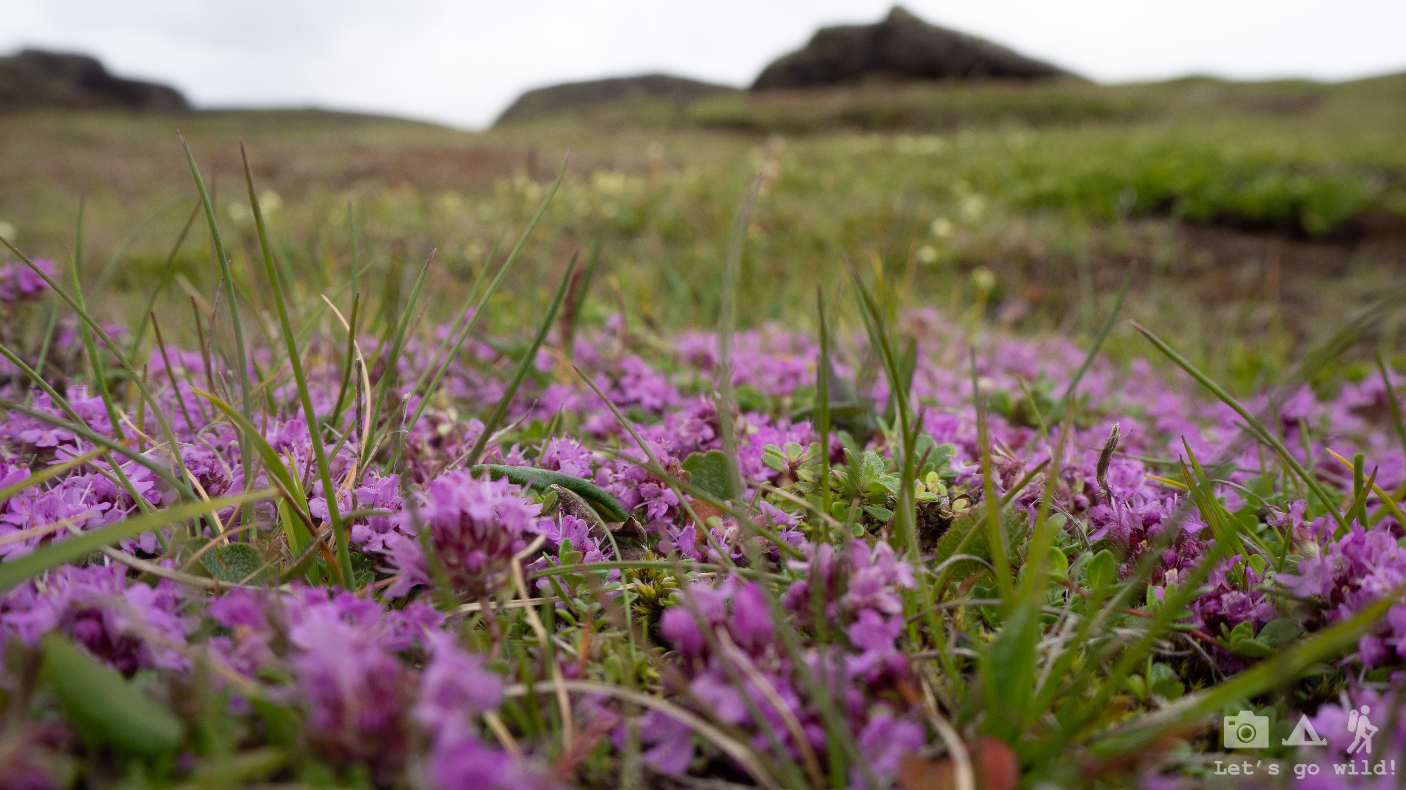
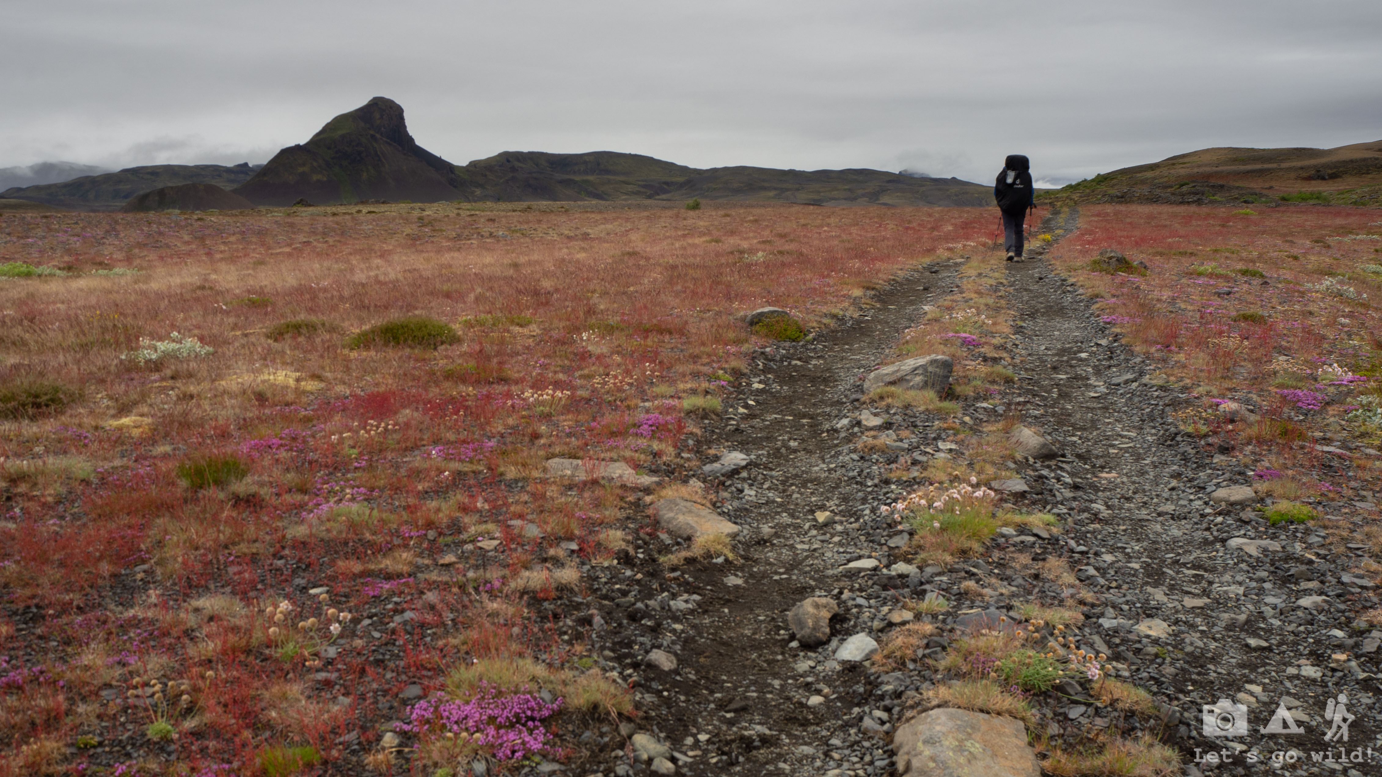
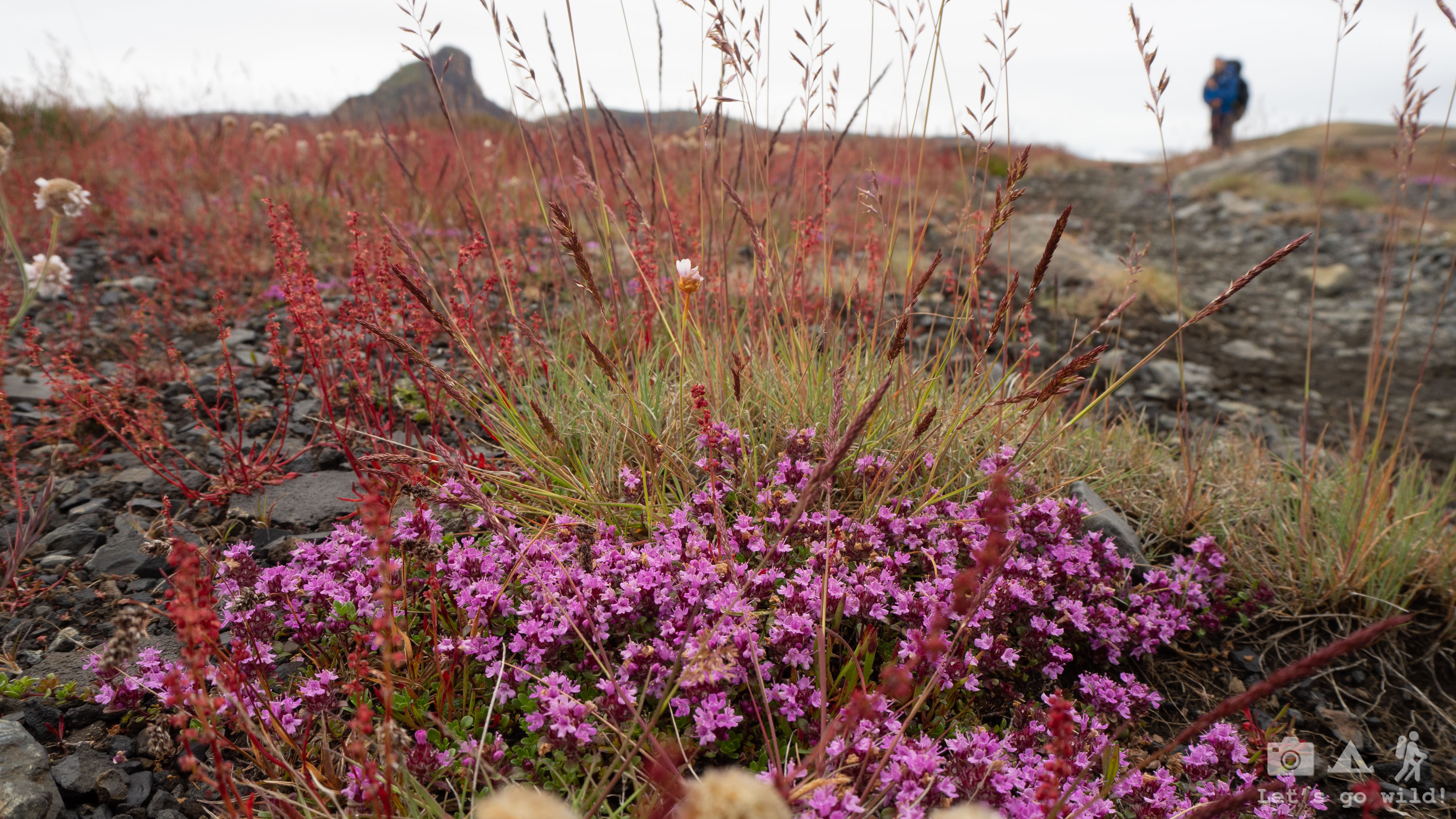
- the purple flower fields
- some steep climbs and breathtaking views you get at the top (which unfortunately couldn’t be captured due to the bad weather)

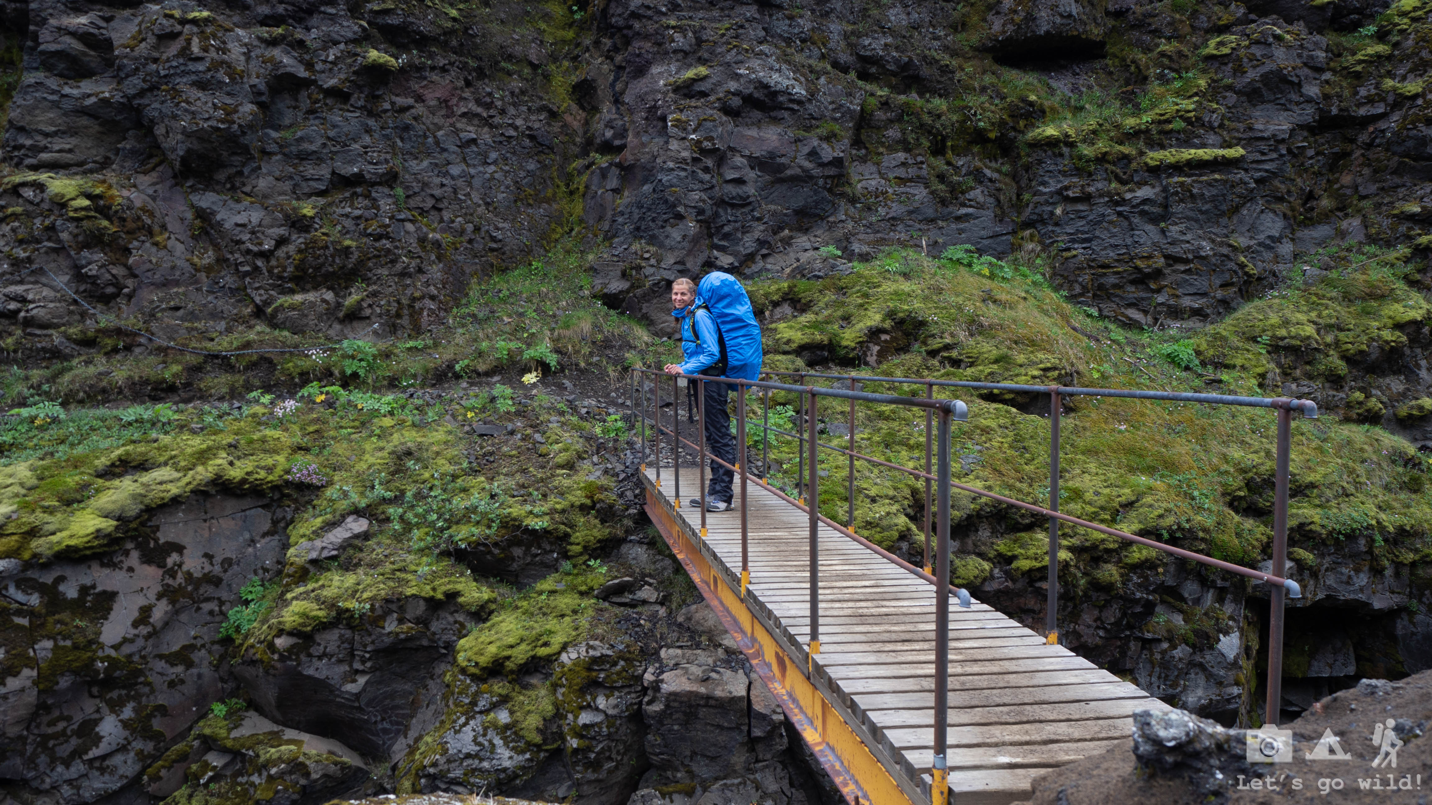
- a vertigo bridge crossing (yet not that bad to get to the catwalk again)
We got wet, we got tired, thus we even started inventing nonexistent races: the team “Let’s go wild” against the French, German and Check teams…
Not many hikers were going the same direction as we did and from all of them only the French girls actually reached the end in Landmannalaugar with us. We kind of got used to getting them around every now and then and were always wondering how their day went. We do not know the destiny of some other “teams” that we lost on the way.
The final “killer-mile” got its name today as well. We started seeing the hut from quite far away and it was approaching so painfully slow… the last kilometers seeing your destination were always the hardest.

The camping in Emstrur was our least favorite in all the trip. It was in a beautiful place but so crowded with people and tiny flies that it was difficult to find a spot for a night. But after yet another tiring walk, we didn’t really care anymore. We’ve pitched the tent, had our dinner and went to sleep early. Or at least we thought so. It is so easy to lose the track of time when there is literally no night. Time is a relative concept in Iceland during the summer.
Statistics of the day:
Langidalur to Emstrur
16,4 km, ↑708 m, ↓465 m, 1 river crossing, 1 vertigo bridge and 7 hours of walking.
July 4, Thursday
Icelandic desert
I don’t know what was worse this morning – bone pain after another hard sleep night or muscle pain after three intensive days of hiking. I got out of the tent and went to the bathroom still in my hiking pajamas. The walk with all the pains wasn’t graceful by far. The person I saw in the mirror scared me even more. How on earth did we manage to get so sunburned if there wasn’t really so much direct sun?? And we come from sunny Spain!!
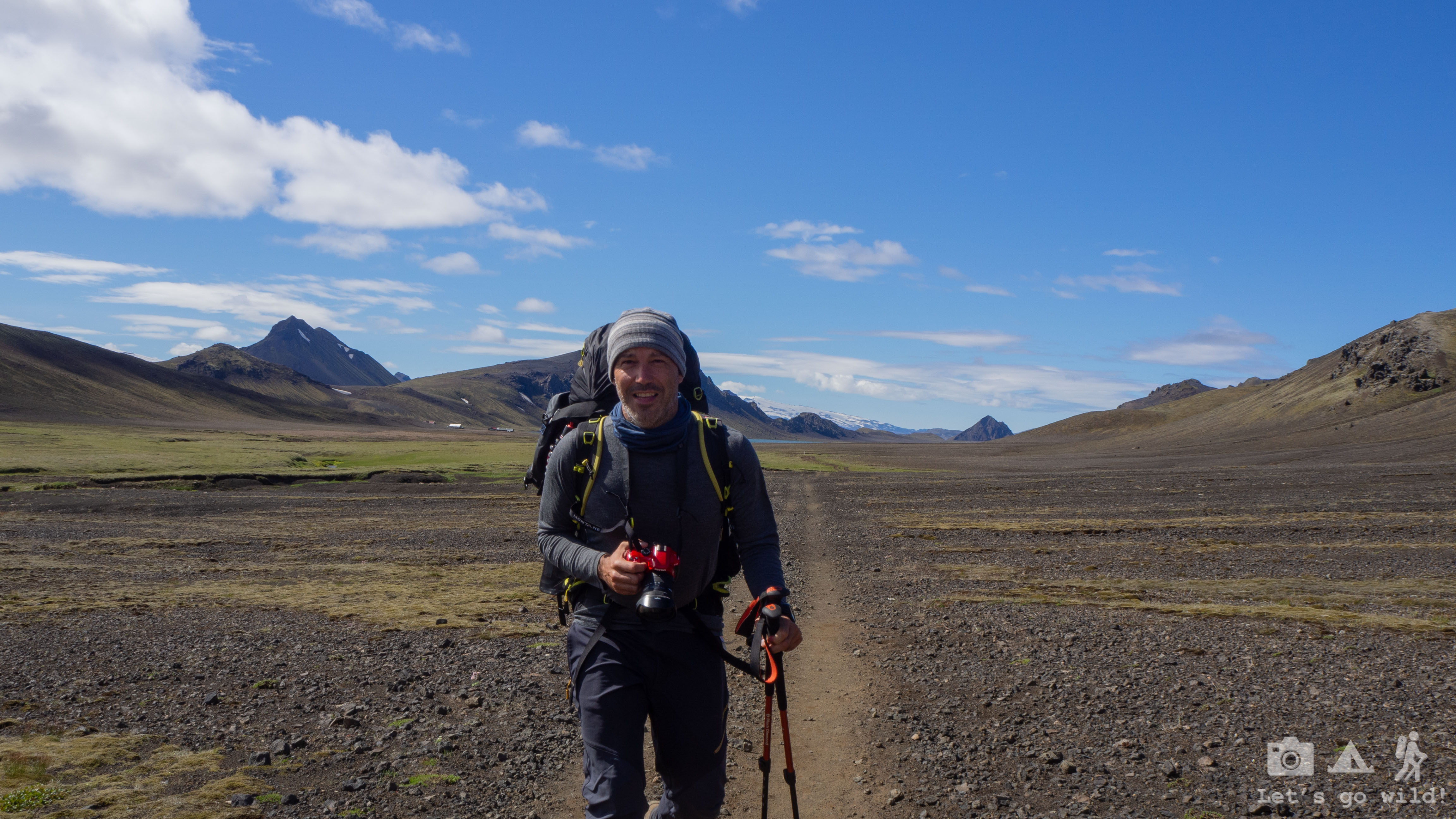
Another routine packing, another pour-on breakfast and we kick off for a new day of adventures. Slowly.
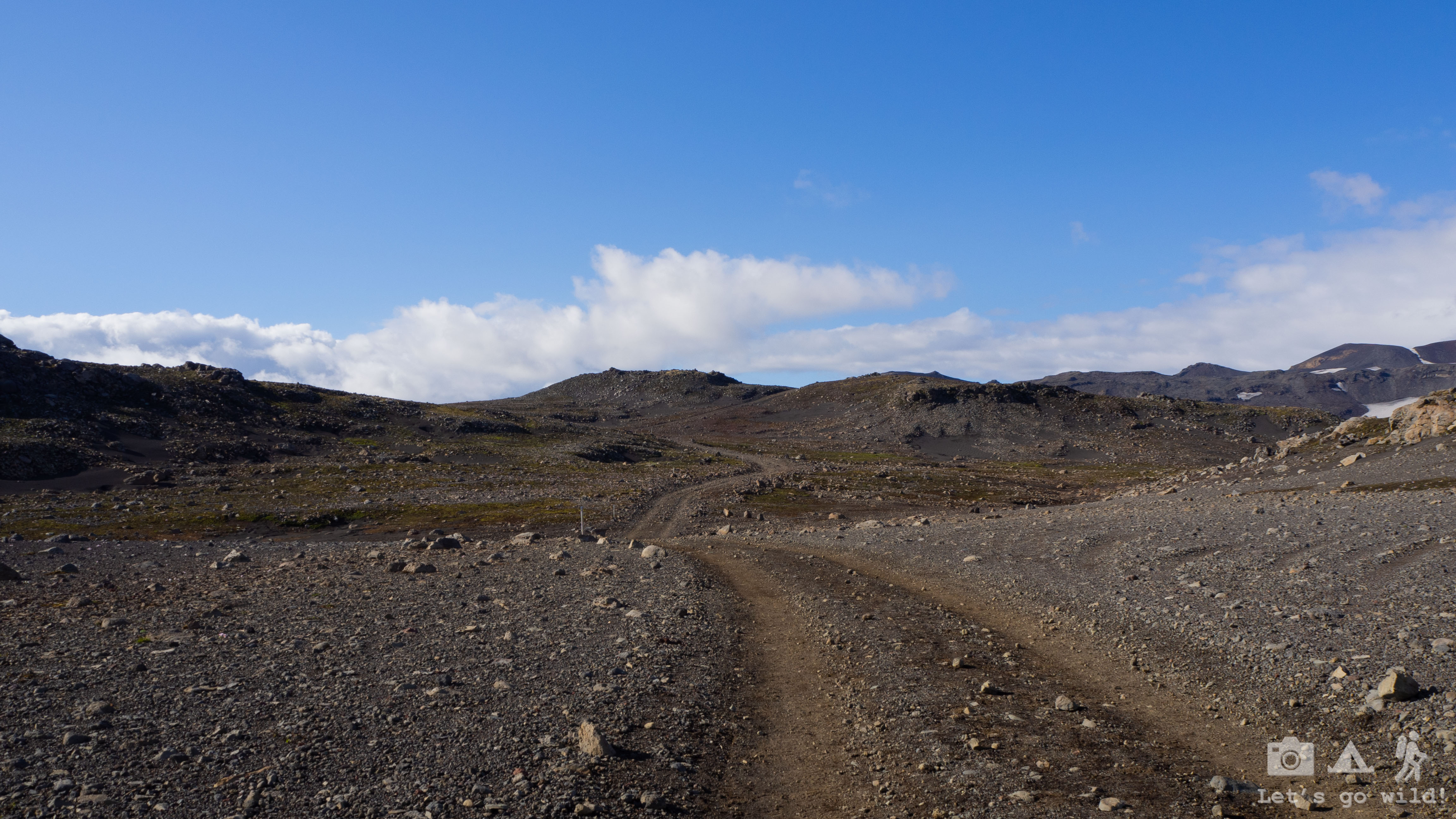
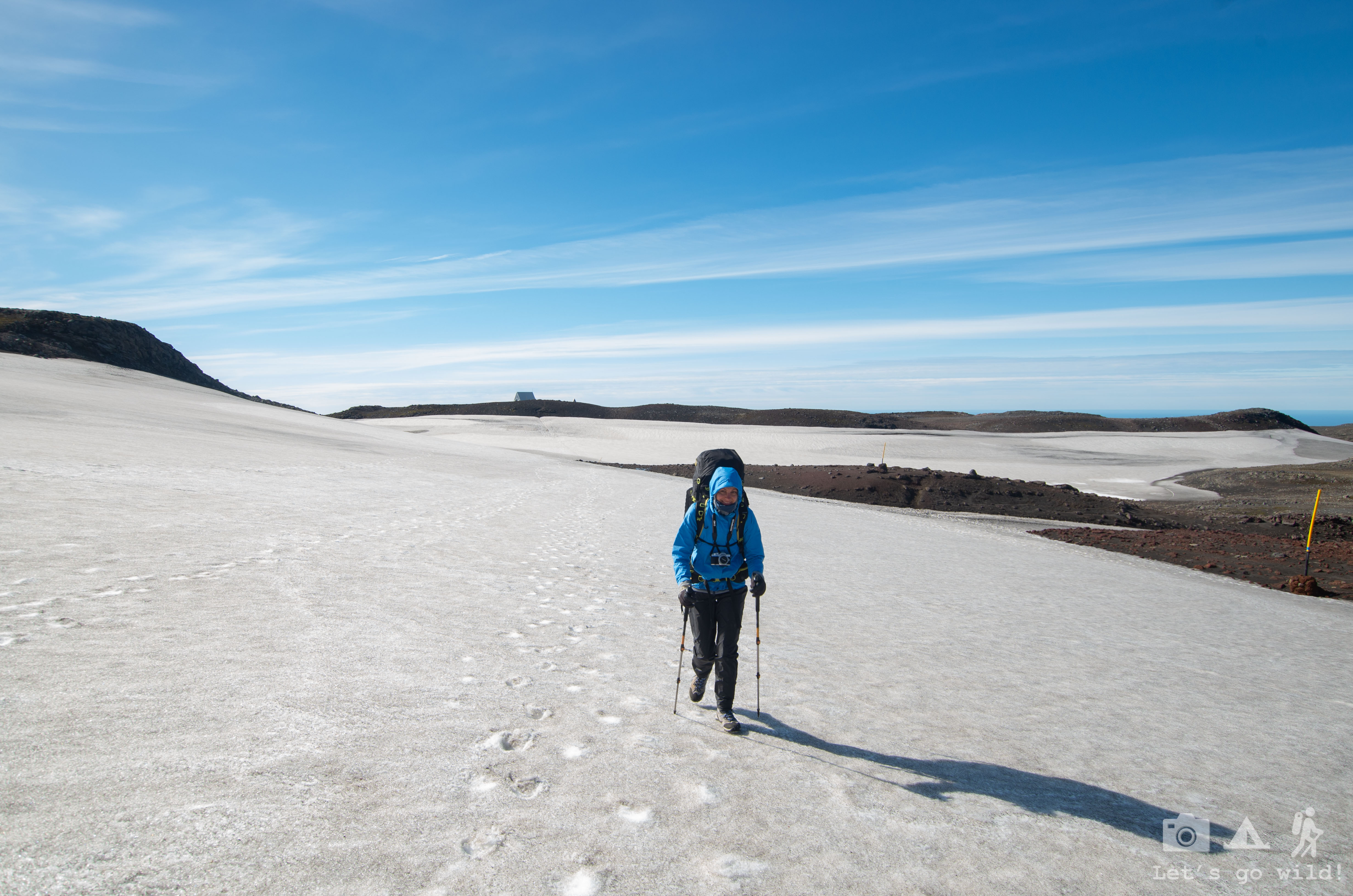
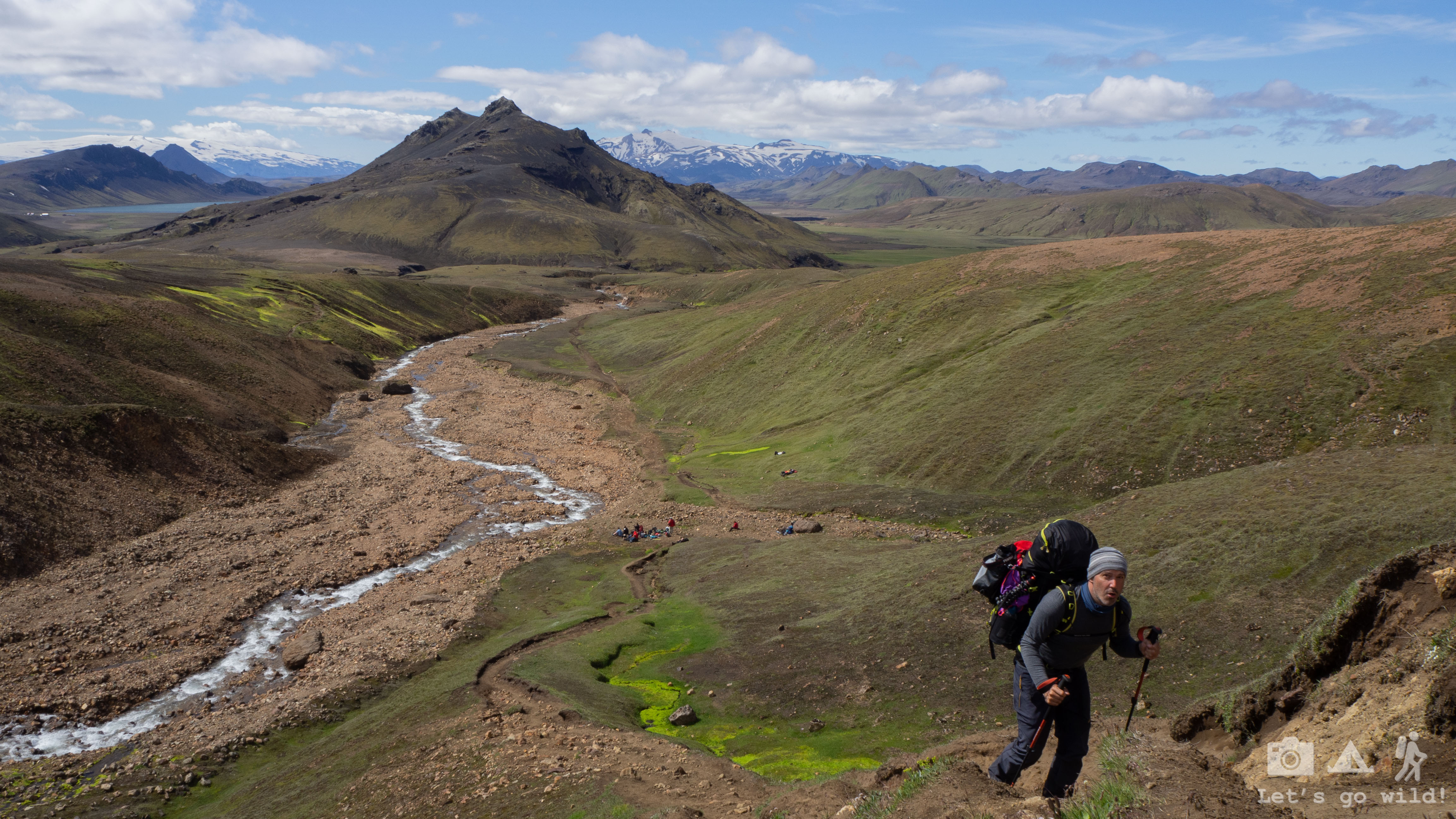
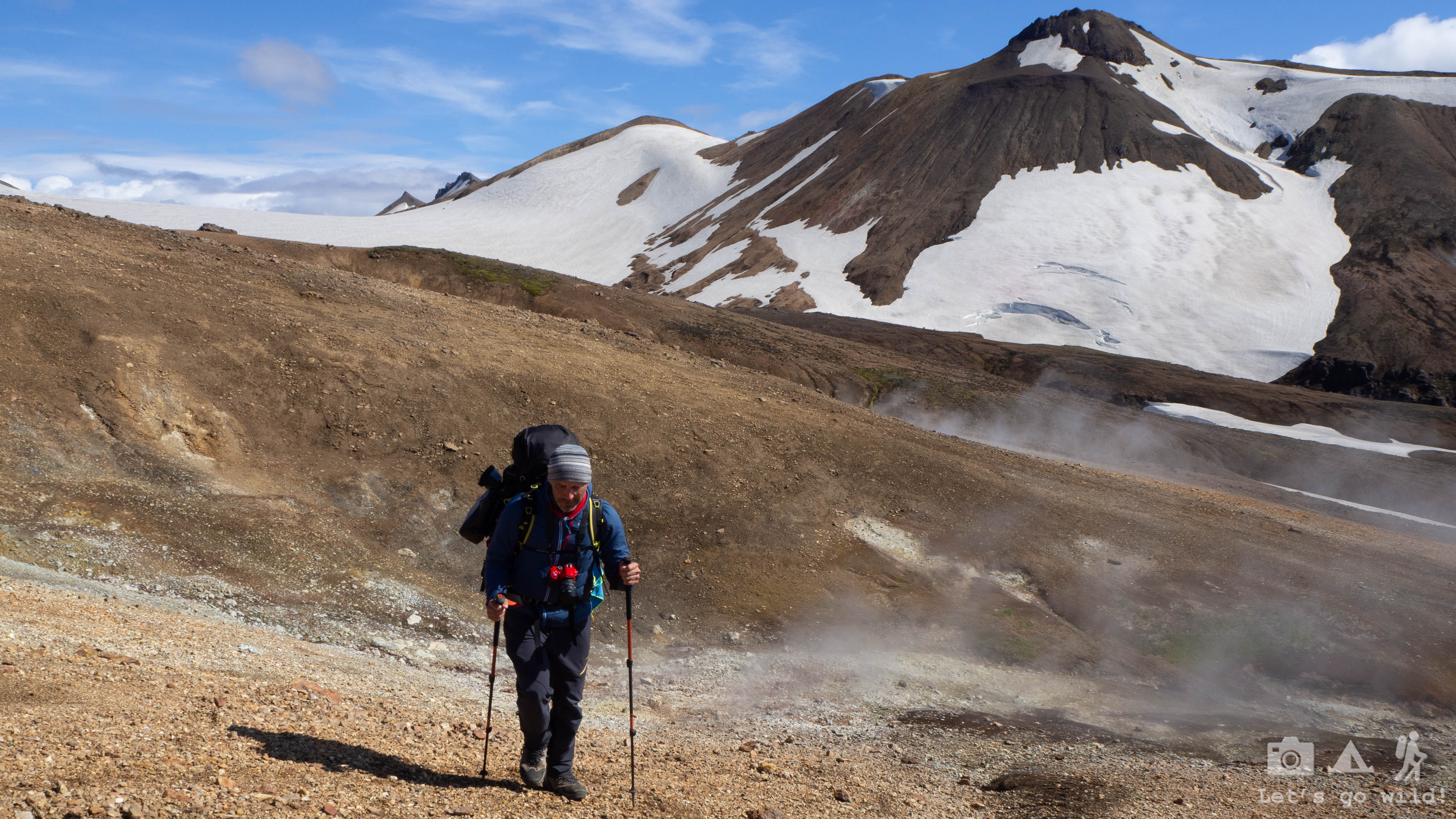
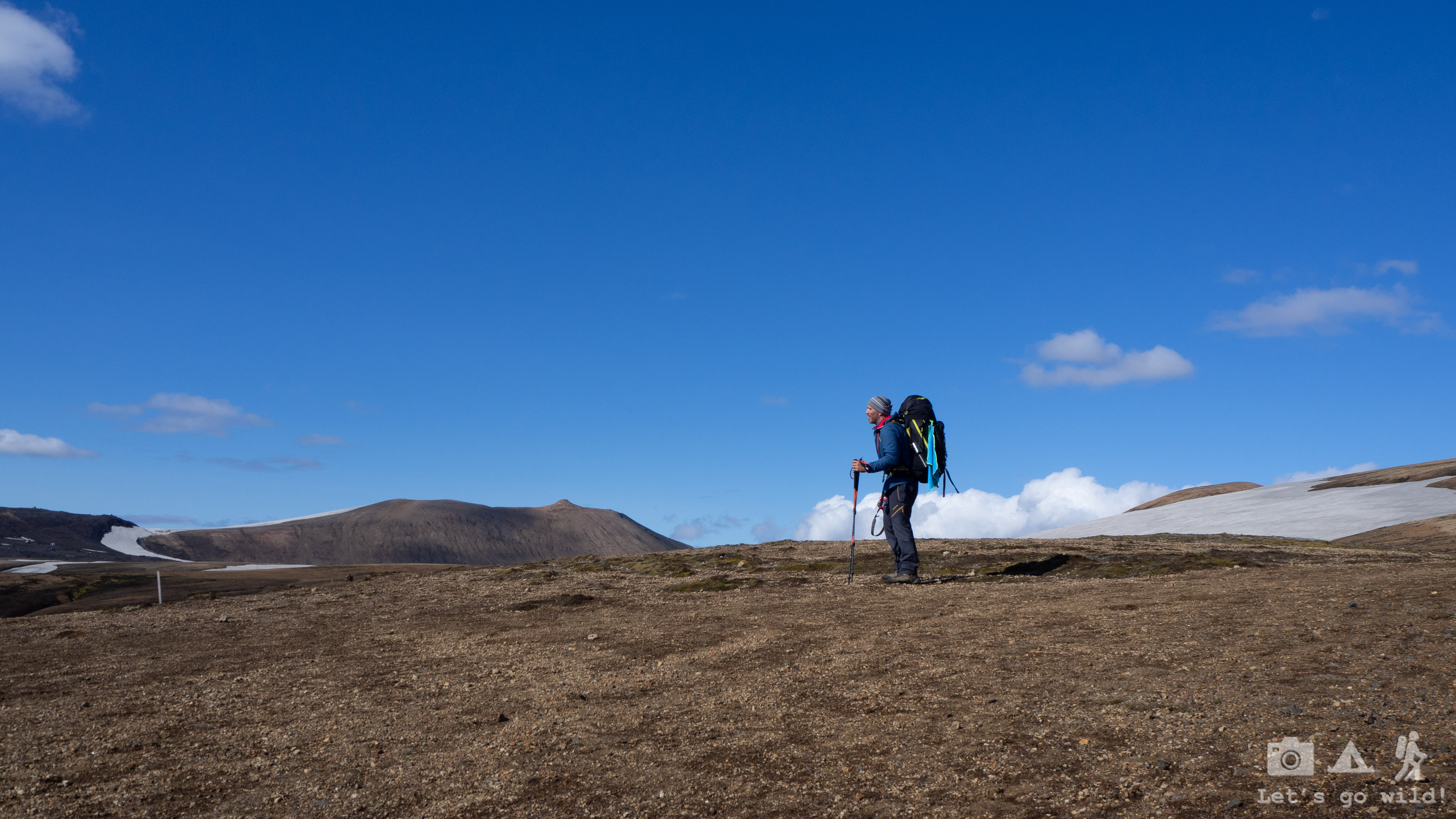
Today we would have a fairly easy day. Still with a significant number of kilometers, but with a flat terrain. And it was flat for a reason. It’s a desert! A never-ending black Icelandic desert that gets on your nerves eventually. How on earth are you supposed to pee in such a landscape?
After a 10 km walk on a desert with some volcanos on the way, we finally started seeing some colors coming back into the panorama. Colors always come back with water, thus we had to get our feet wet again. What a refreshment after a dry desert!
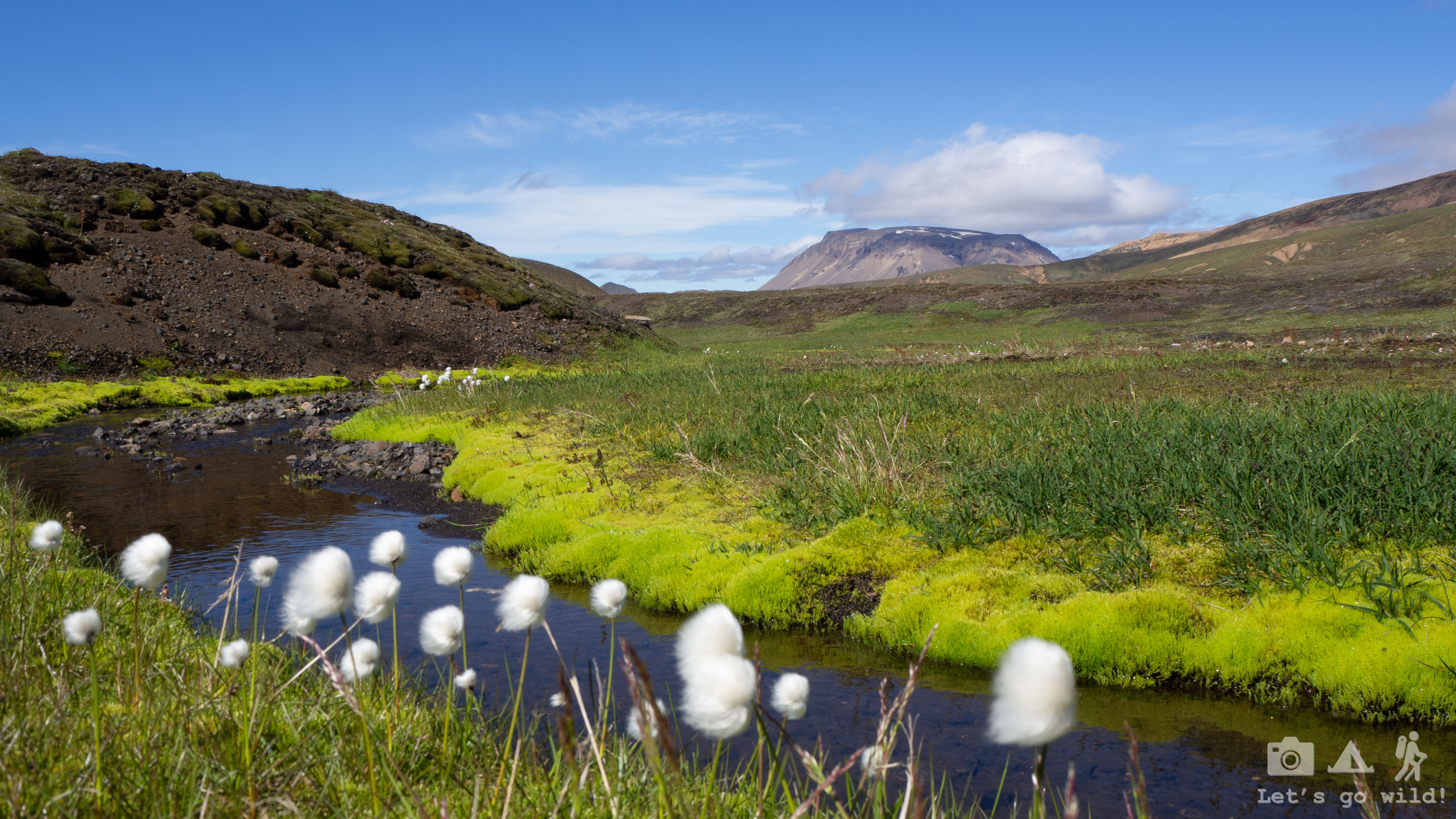
Breathtaking landscapes with vibrant green were surrounding us again. When I say vibrant green, I mean it. I kept staring at every riverside with my jaws wide opened, tempted by the softness of the lemon green carpet yet afraid even to touch it – it looked so fragile and easy to destroy.
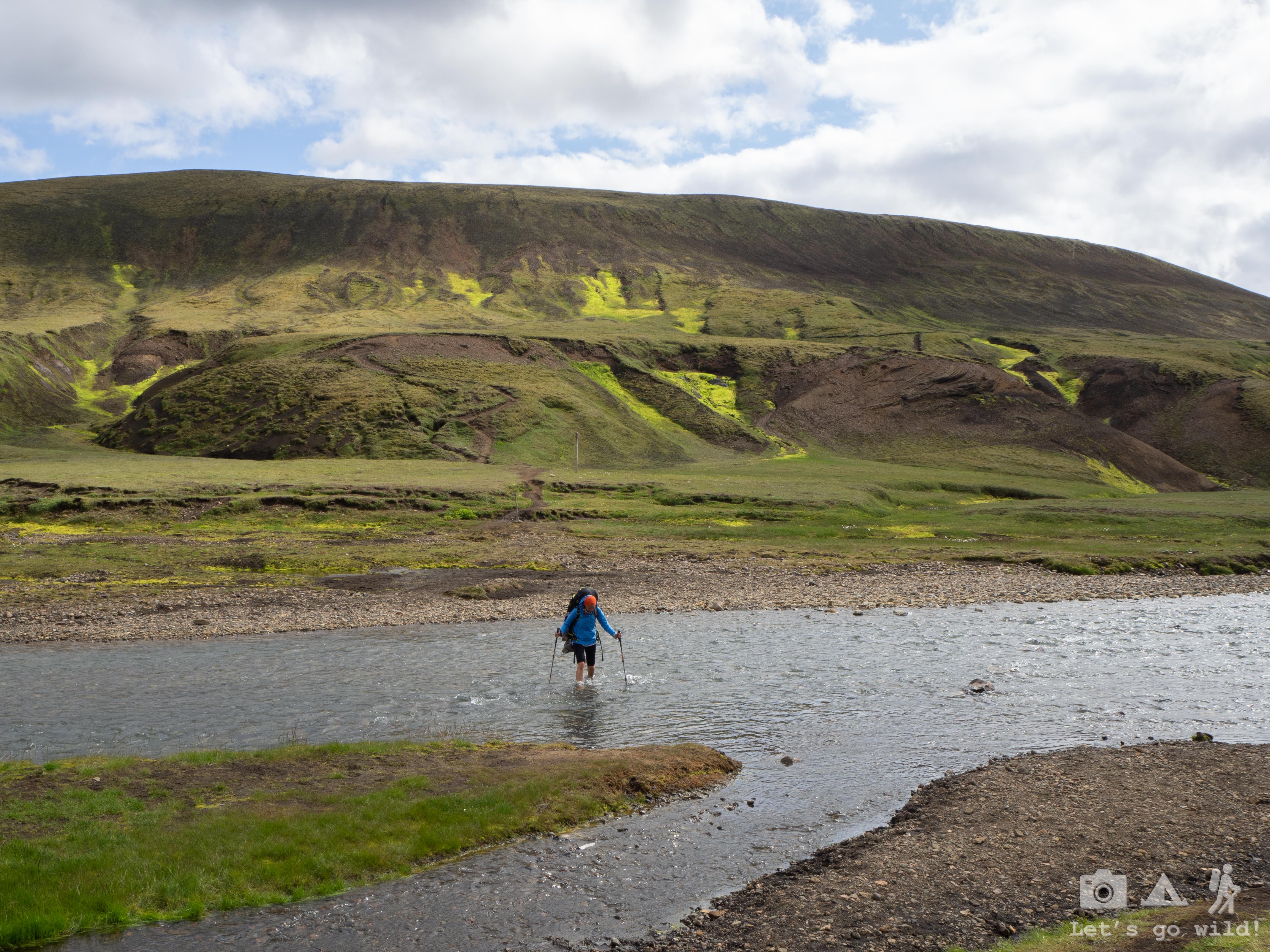
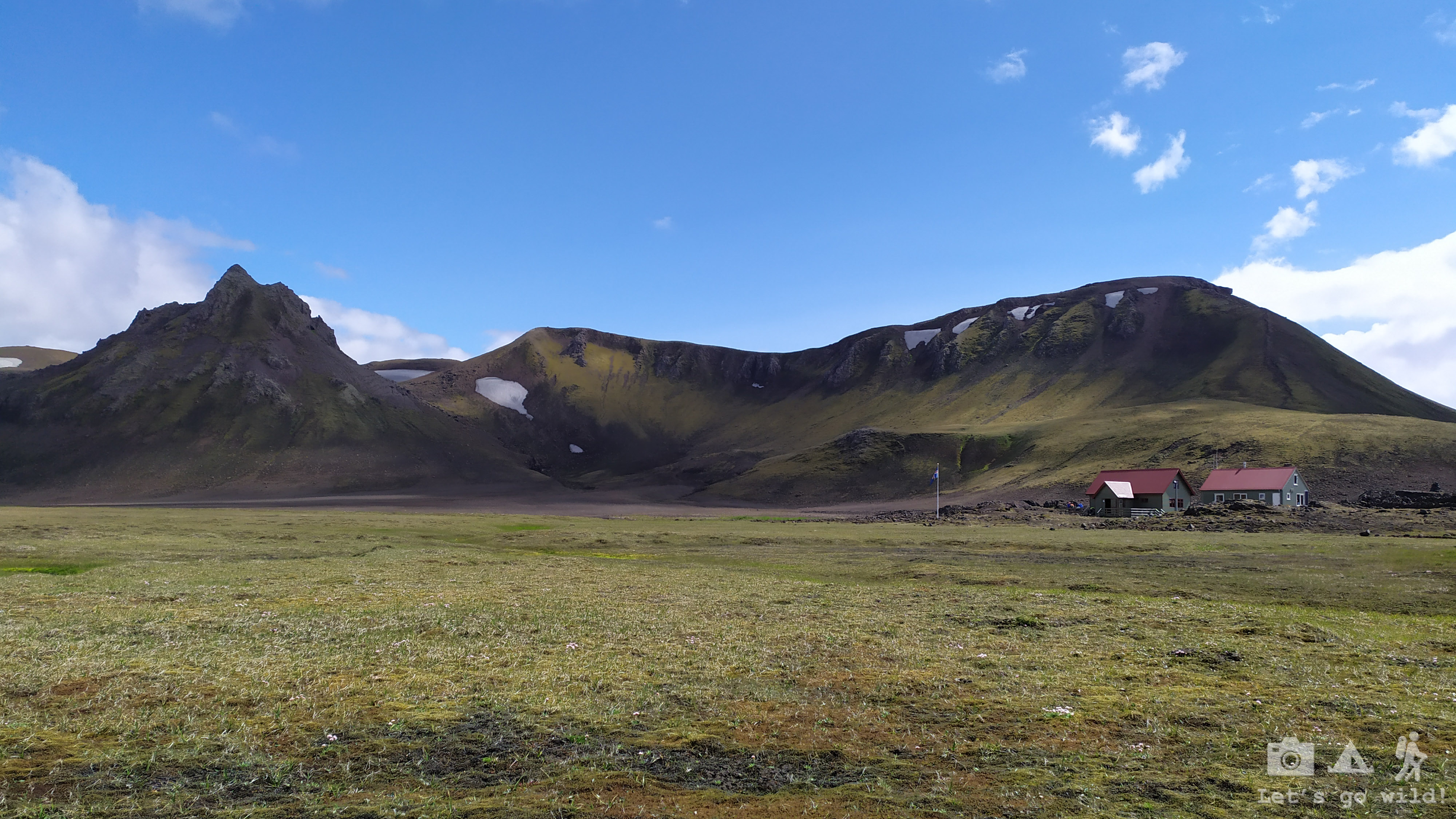
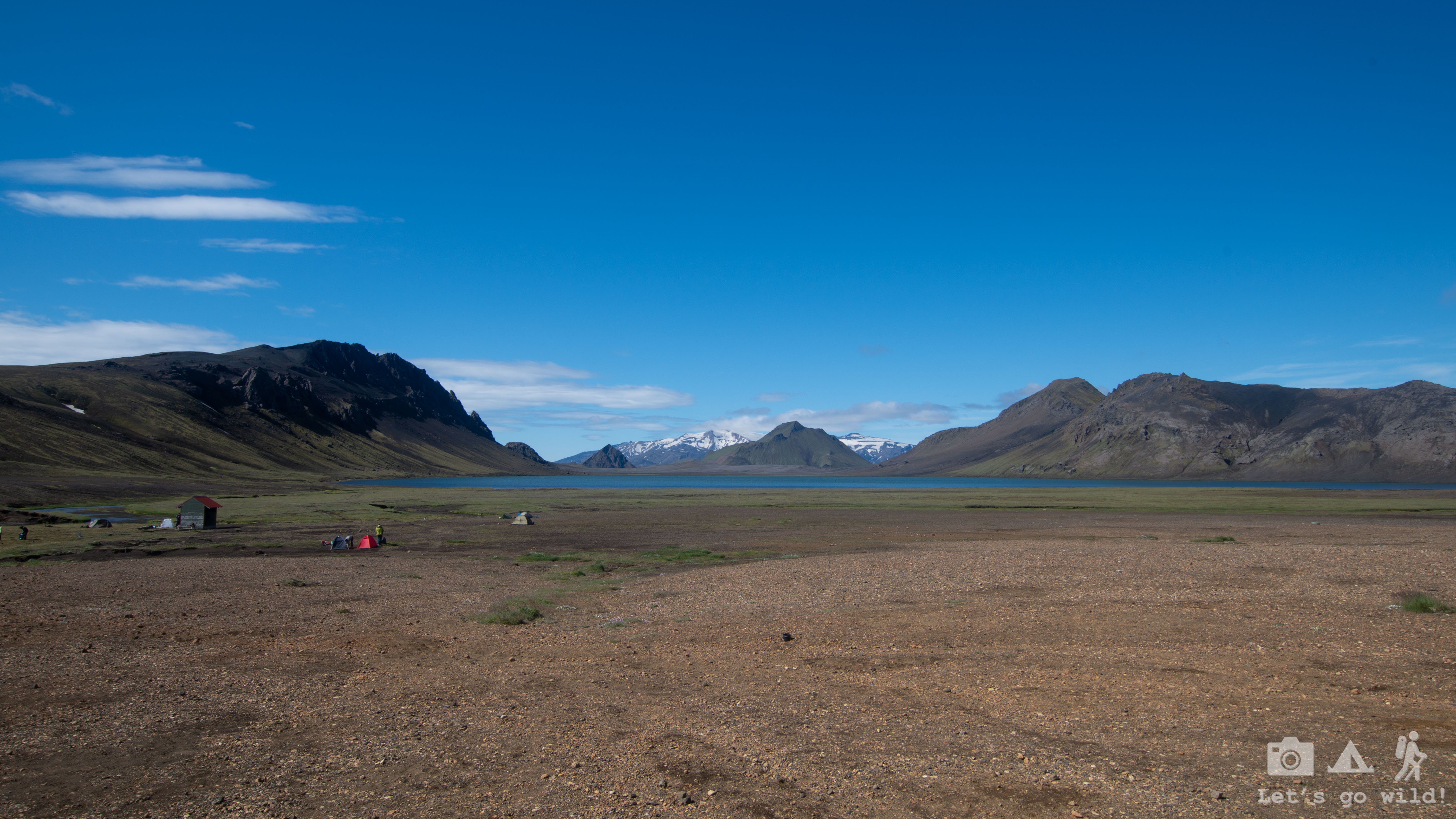
Energized by stunning views and cold water in the rivers we had to cross, we reached our destination fairly easy today. We passed though one hut that was few km earlier on the trail and finished the day in Álftavatn which is situated right next to a beautiful lake surrounded by mountains from all sides. Such a cozy place to camp! Unfortunately, the weather got worse when we arrived. It was windy and rainy so we didn’t dare to take a walk around the lake which would add quite a few more km to our day.
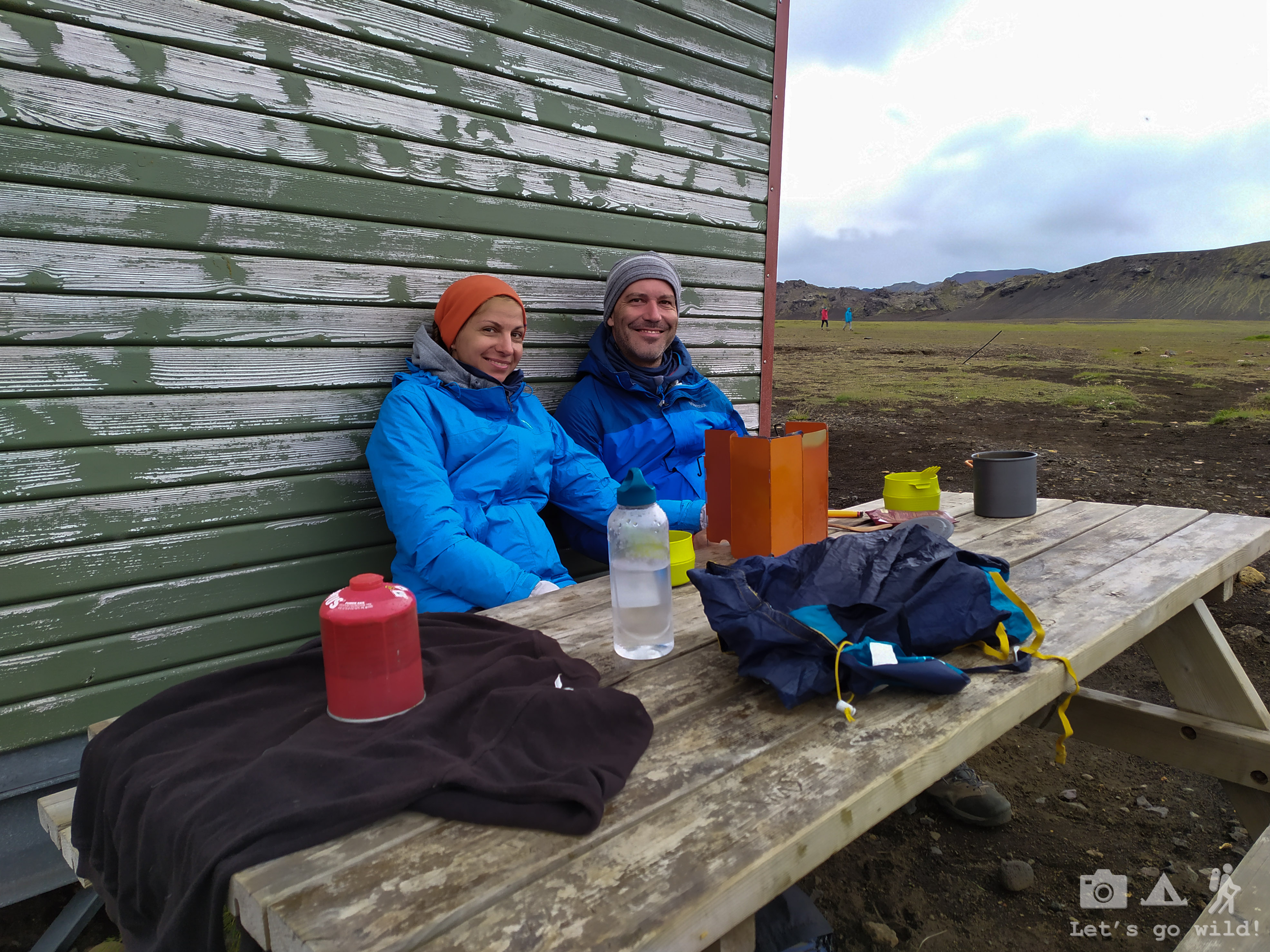

Instead, we went to the only restaurant in all the trail to have something warm to drink and sinned with chocolate muffins before having our yet another pour-on dinner.
Staying in our tent and listening to the raindrops we started thinking of what we would do after we finish this trail. Our initial plan was to spend all 8 days on the trail, although it only requires 6 to complete it. We thought that maybe we’d go for some detours and spend extra days on the way, or maybe the weather would be bad and force us to make a brake. But we were more than lucky with the weather and coping well with the hikes, so our finish was scheduled in two days from now. And then what? After browsing the web for a while (yes, there was some mobile coverage around majority of the huts), we went to sleep without having anything conclusive in our minds.
Statistics of the day:
Emstrur to Álftavatn
16,7 km, ↑340 m, ↓260 m, 2 river crossings and 6:30 hours on the trail.
July 5, Friday
The WOW day
Why is it so hot in the tent? Is the sun back? And what time is it at all?
After getting a grip of reality we opened our tent to enjoy the views. A sunny and calm morning was promising a nice day again.

With no rush at all we calmly had our breakfast in bed and started the morning packing routine. By this time we already know very well who is packing what and how. Even though the amount of food was reducing quite significantly in my backpack, it wasn’t getting any emptier as we were constantly redistributing weight or volume.
A quick toothbrushing ceremony outside the bathroom trying not to look into the mirror and off we go again.
It was an absolutely amazing hike today. We were so lucky with the weather which allowed us to enjoy the beauty of landscapes to its fullest.
We started with a short walk in yet another desert like field, but very soon came across a river to refresh our feet. I felt a bit sentimental crossing it. It was the last one on the trail. Our adventure is slowly going to an end…
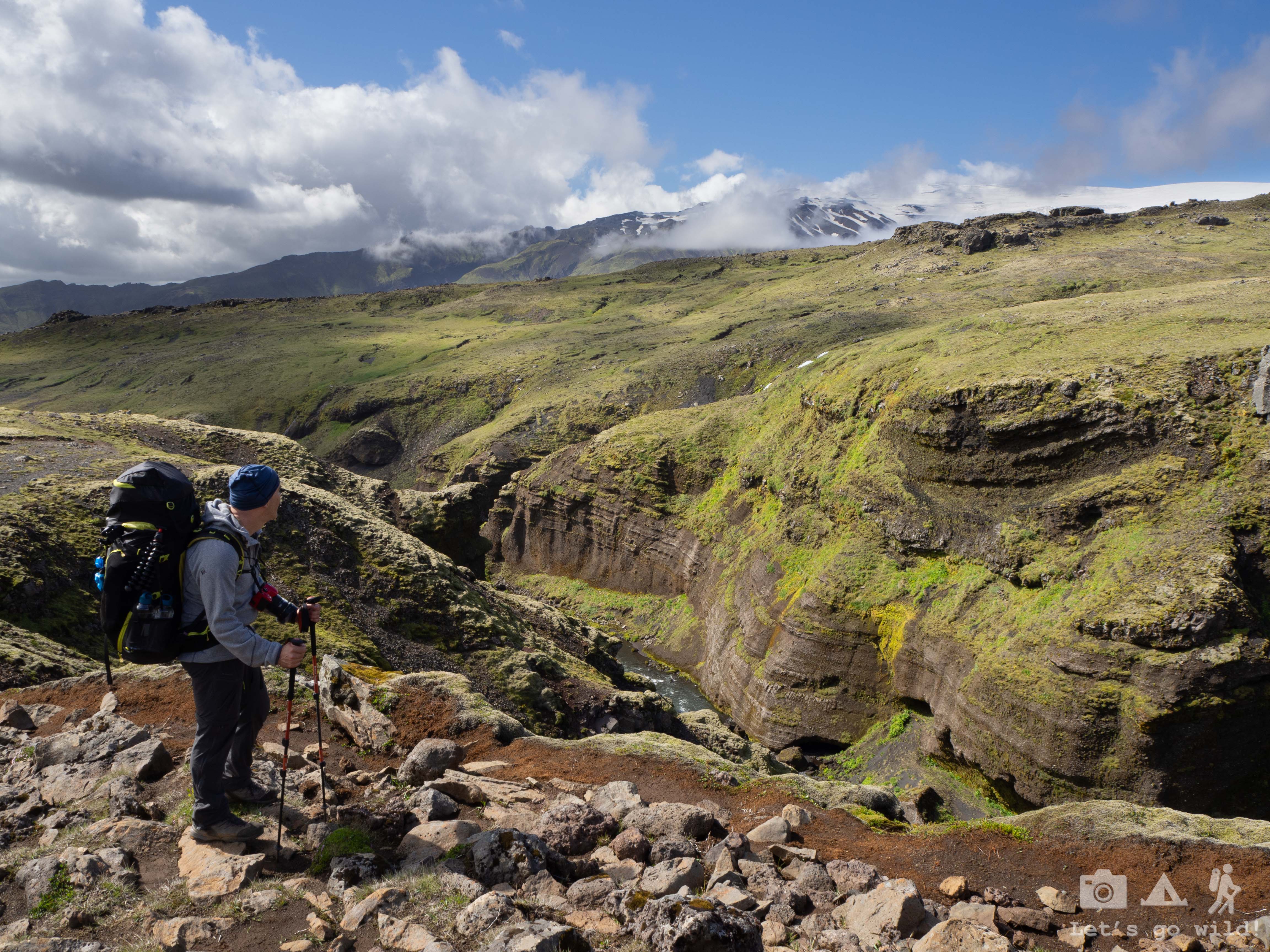
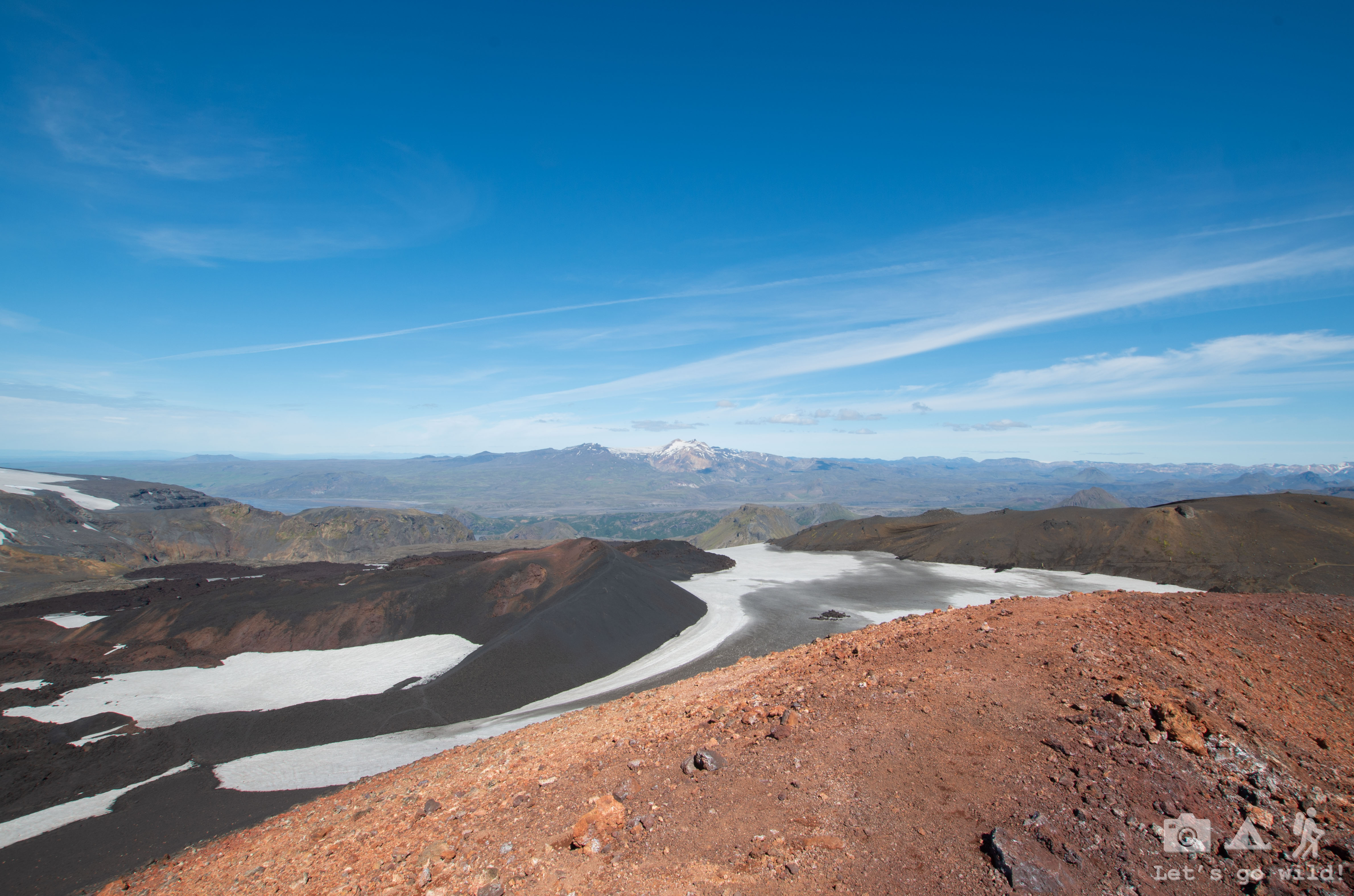
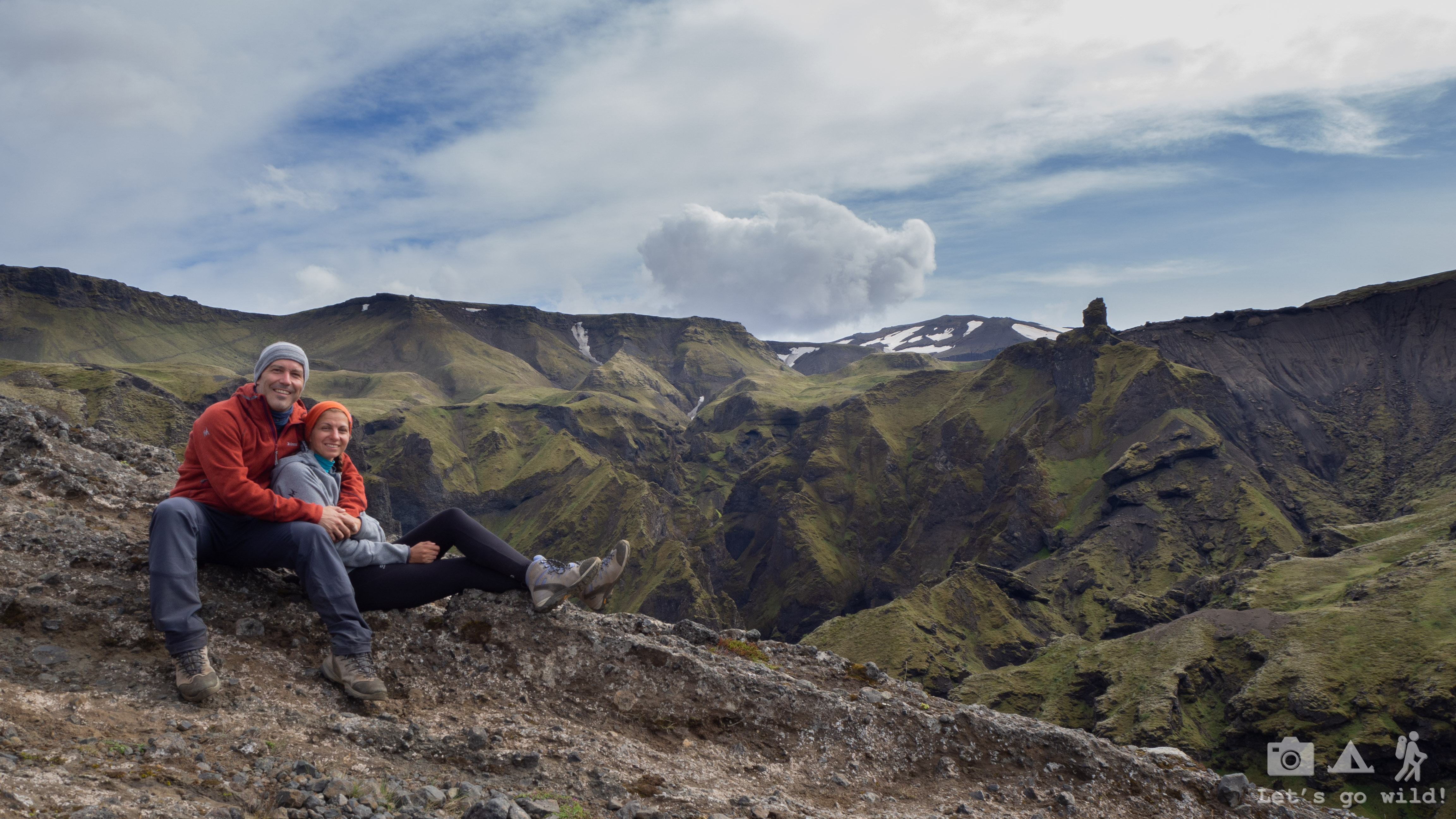
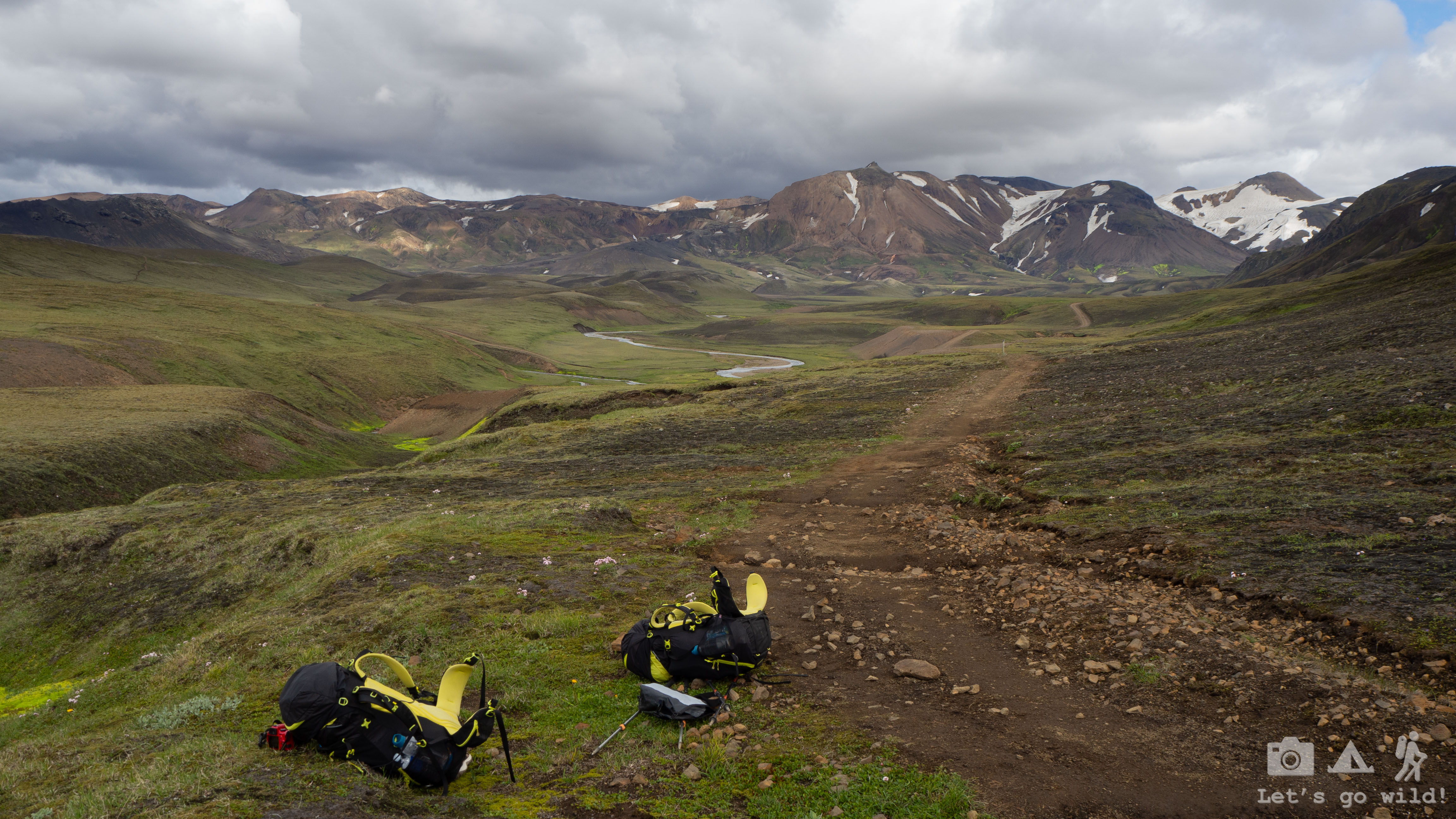
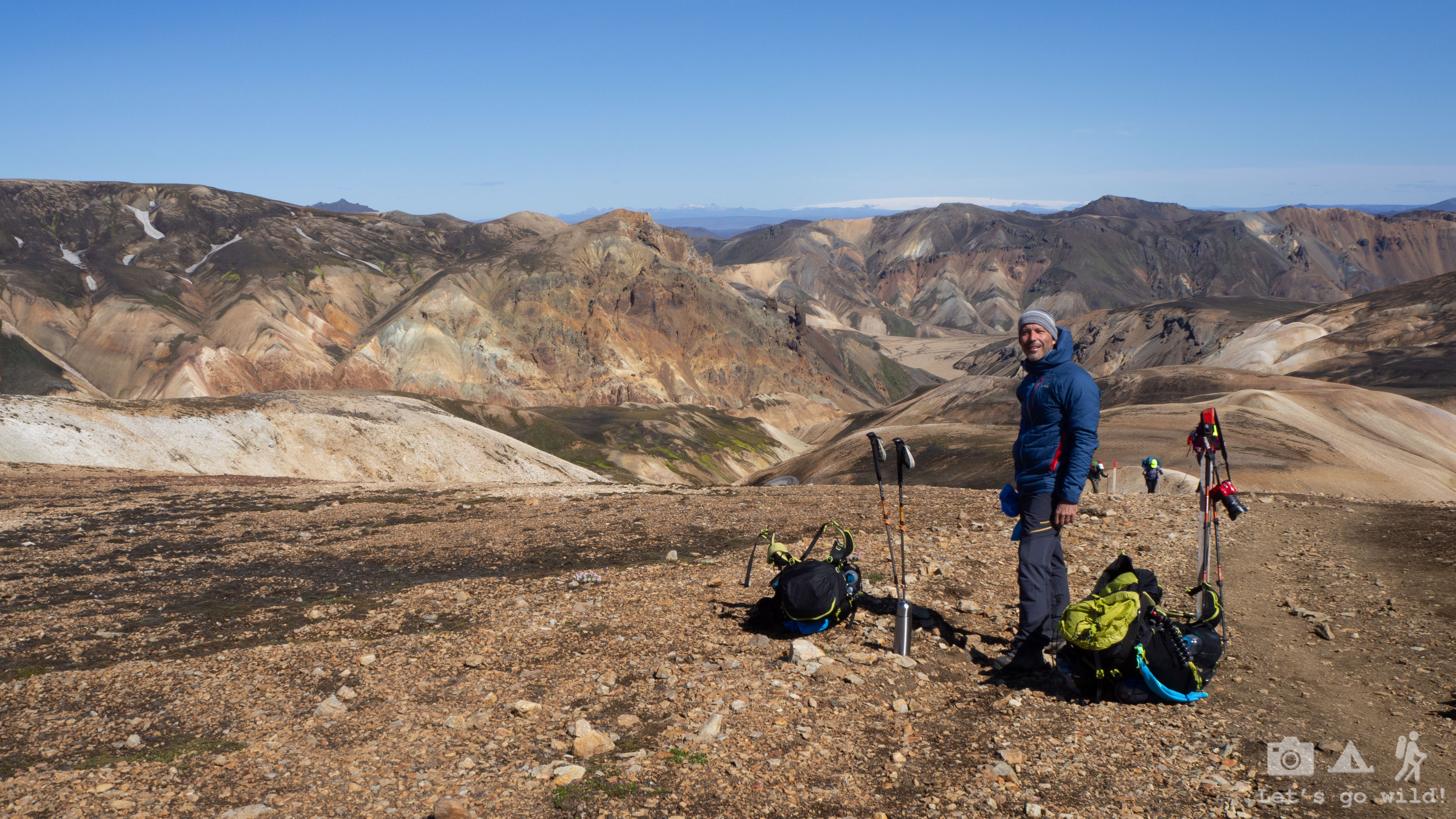
Then, a tough climb. Probably one of the toughest in all the trail as we had to do quite a few vertical meters in just a couple of km. But the view on top of it was definitely rewarding.
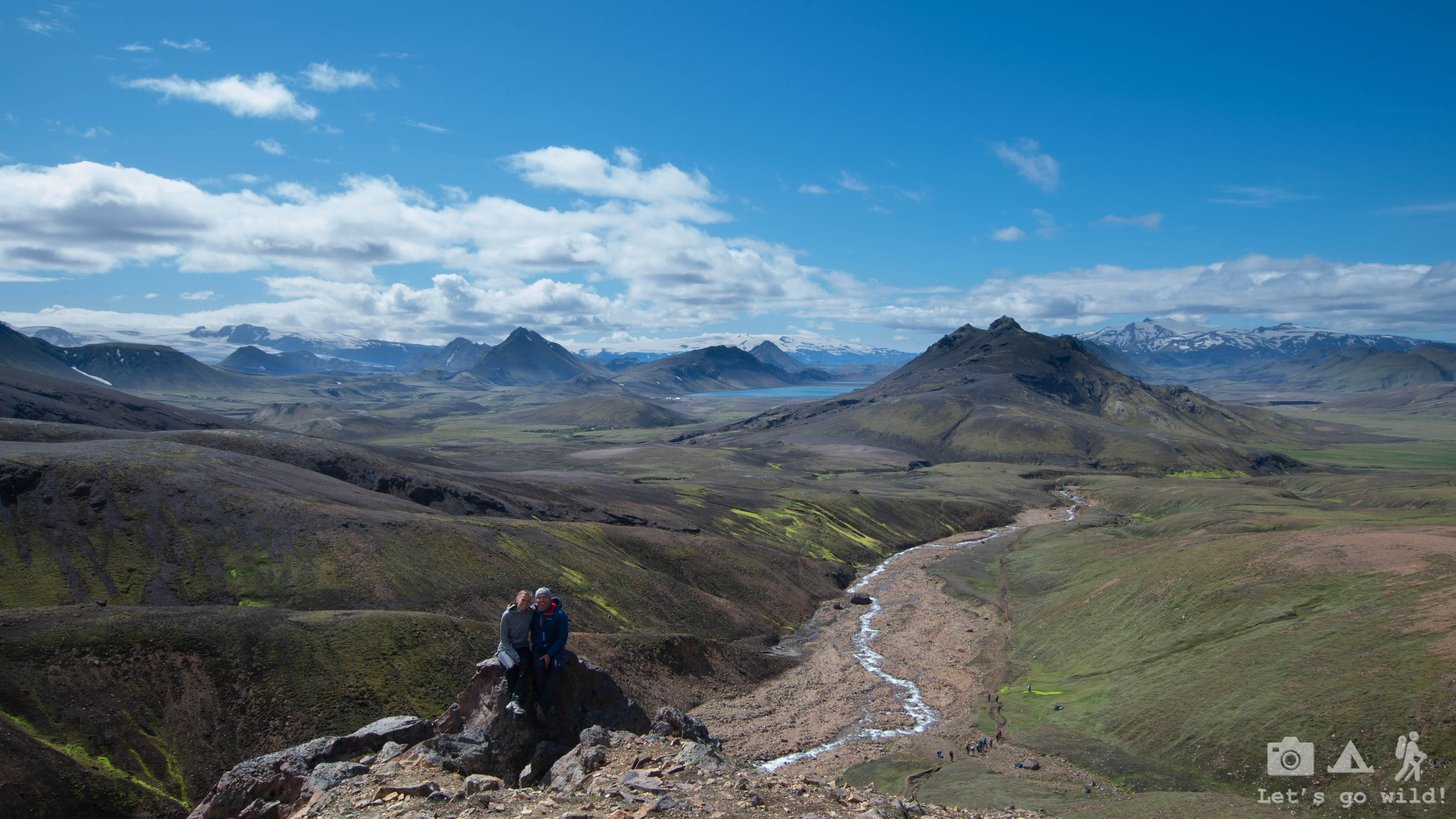

We sat down for a lunch break enjoying the views of a glacier and the lake already far far away. Warm sun, a shelter from a strong wind and soft moss below our bottoms was so relaxing that we couldn’t resist a quick siesta right there. I don’t know how long we slept before I woke up from a snoring sound. It was a moment of pure pleasure and laziness. Our French companions (Lea and Stefani) were having exact same euphoric moment just a few meters above us.

“Enough being lazy” I break a moment of perfect idyll.
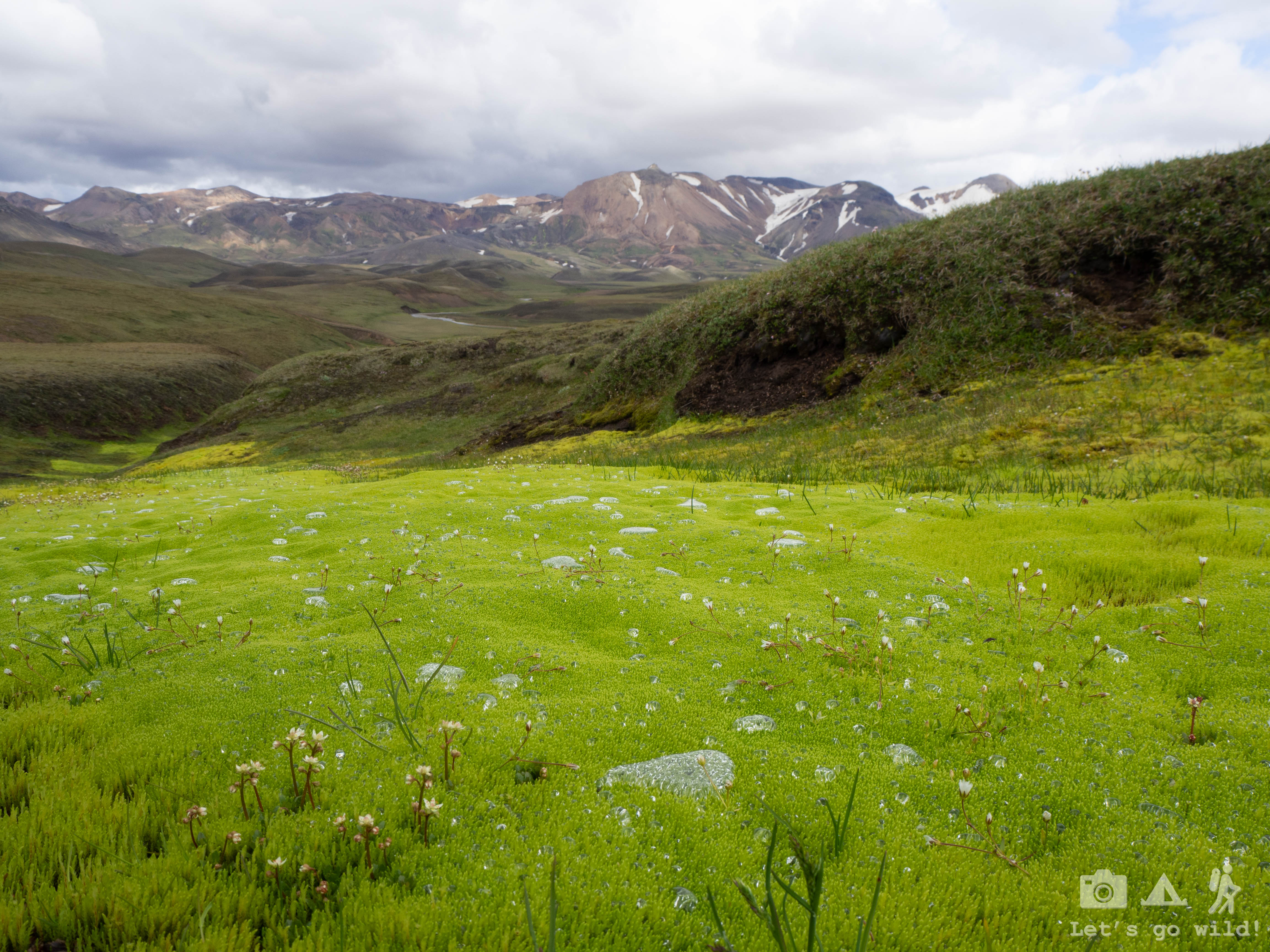
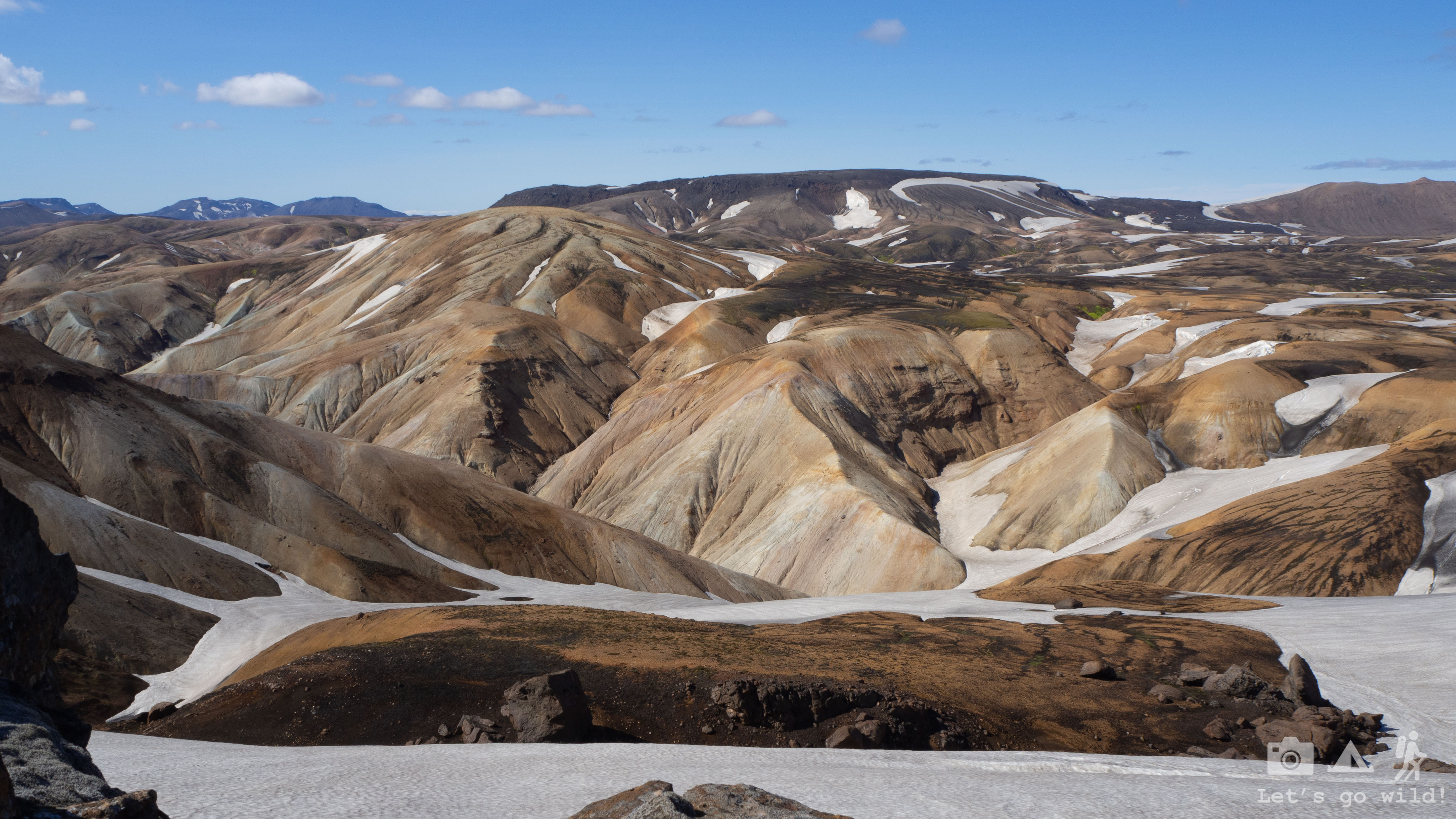
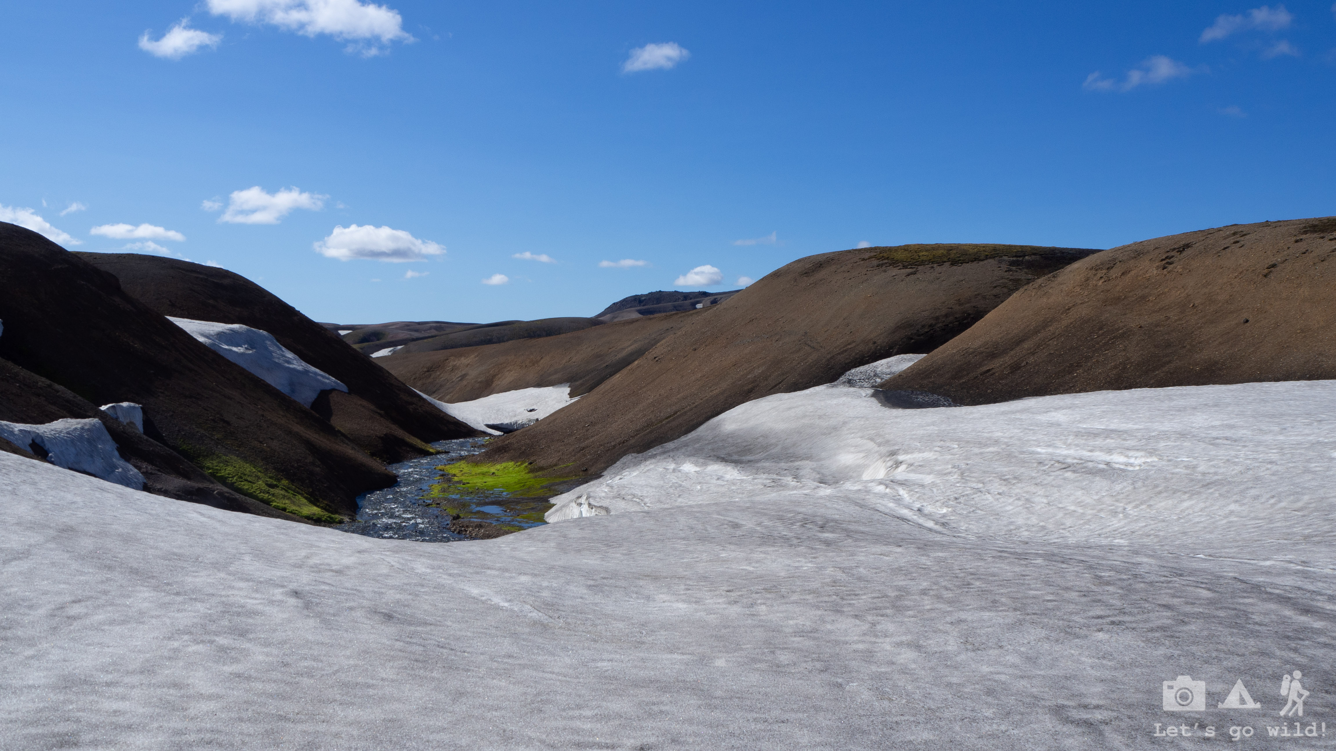
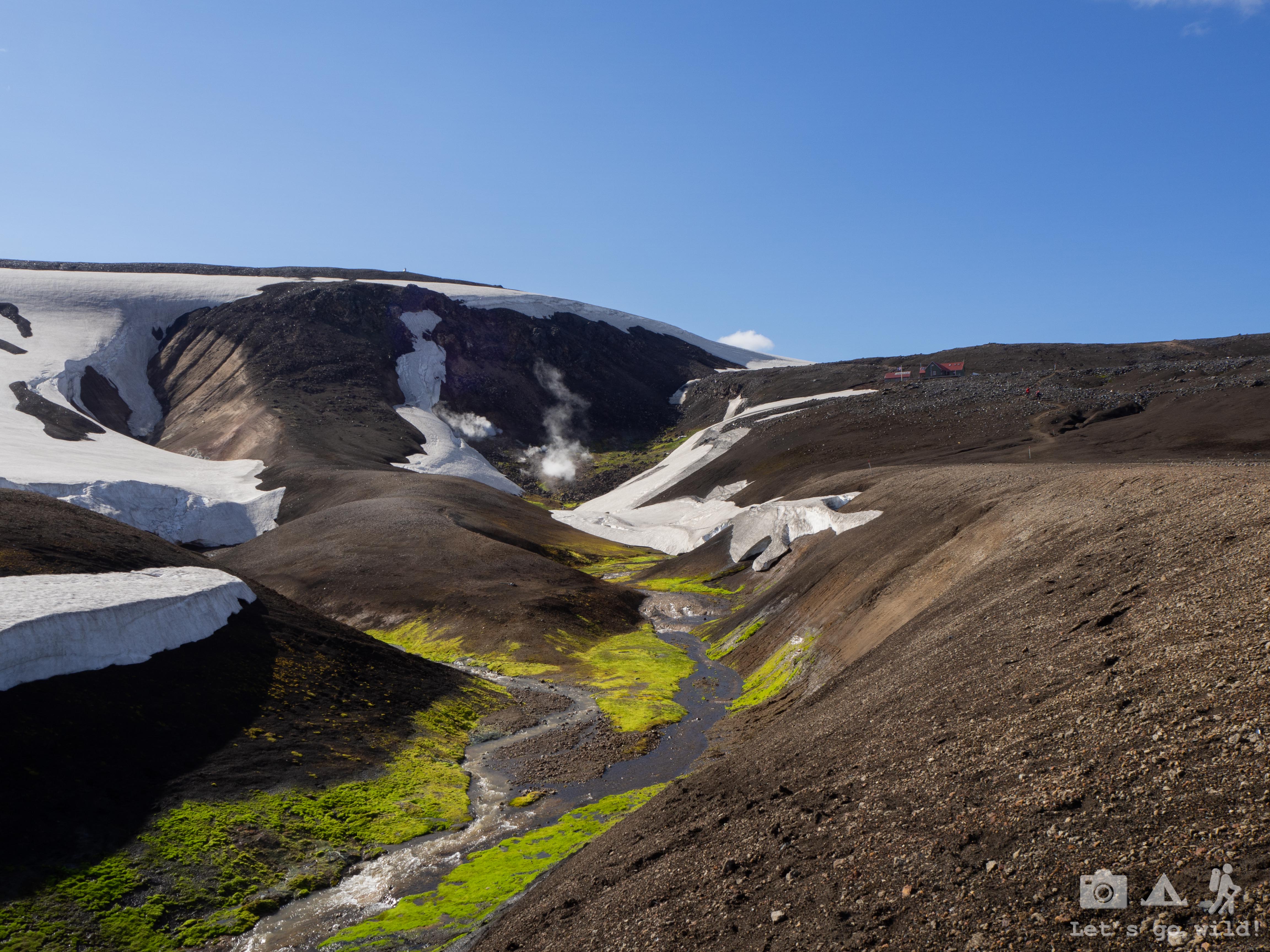
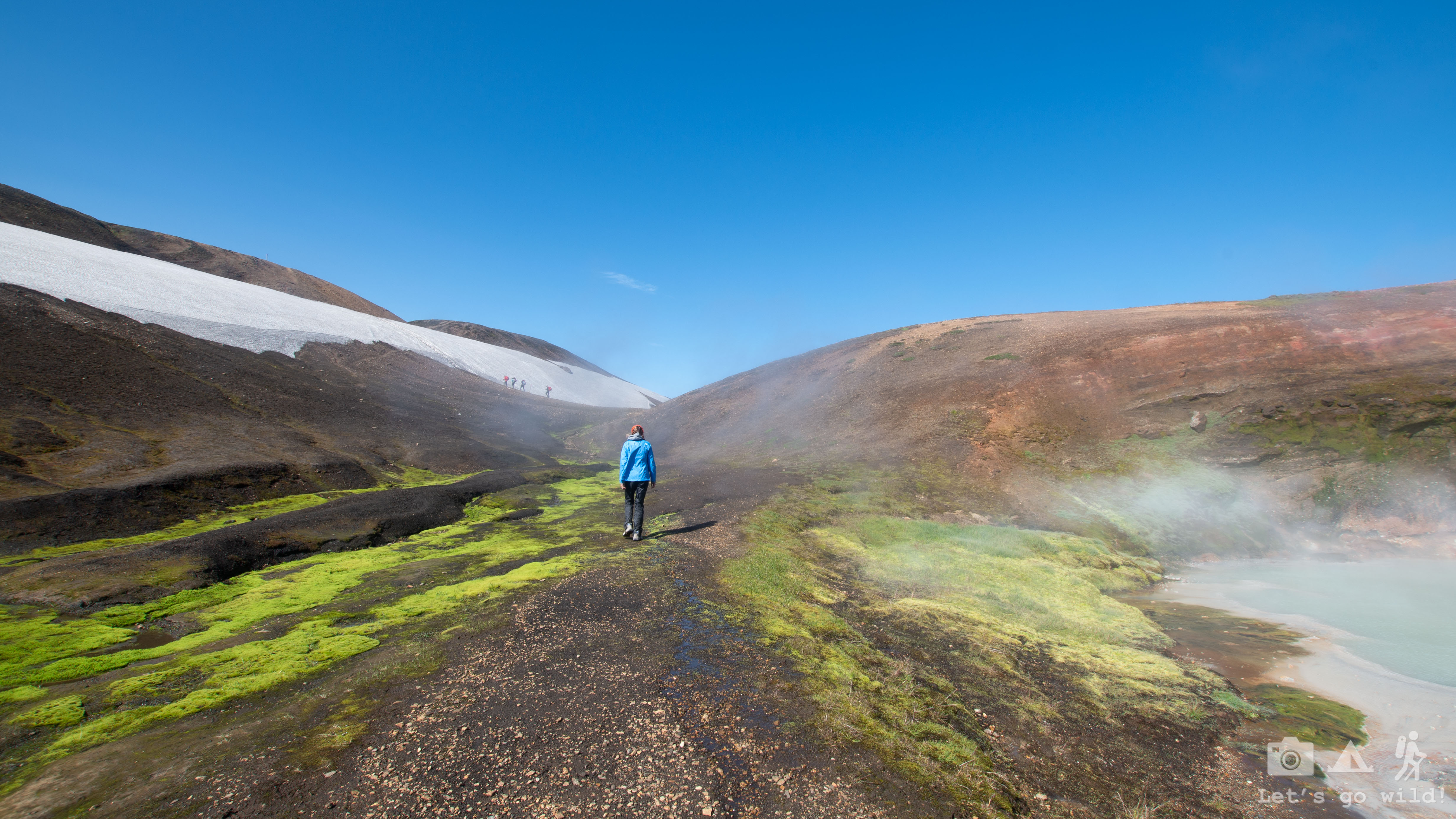
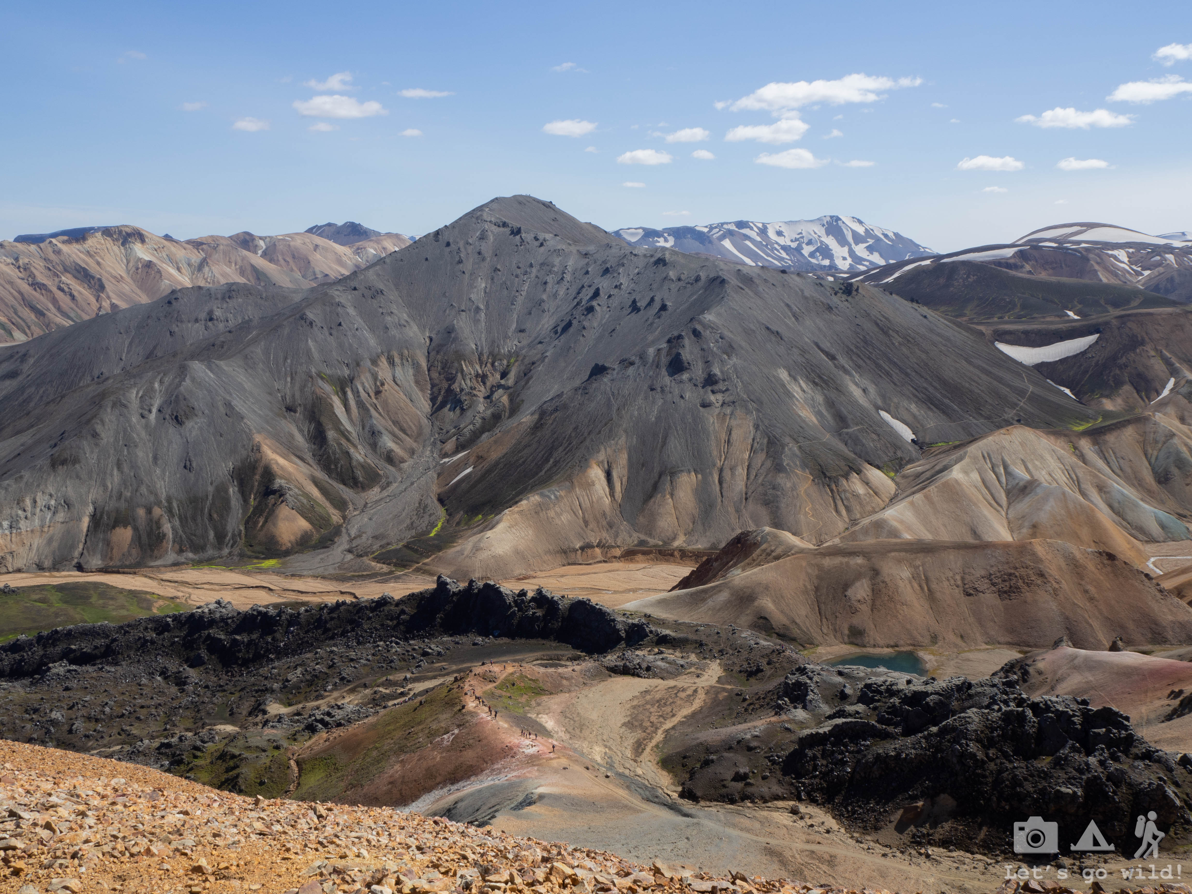
We slowly gather our backpacks and head back towards the trail. One more tiny climb and then it started… Photos every 3 steps! Hard to even describe how drastically the landscape changed into something so unfamiliar, never seen before. Everything started looking as if in another planet. The boiling ground, the forms and colors of the mountains, snow caves, the mix of different colors… The smell was hard to describe either! I never imagined that these beautiful mud pots would be so smelly!

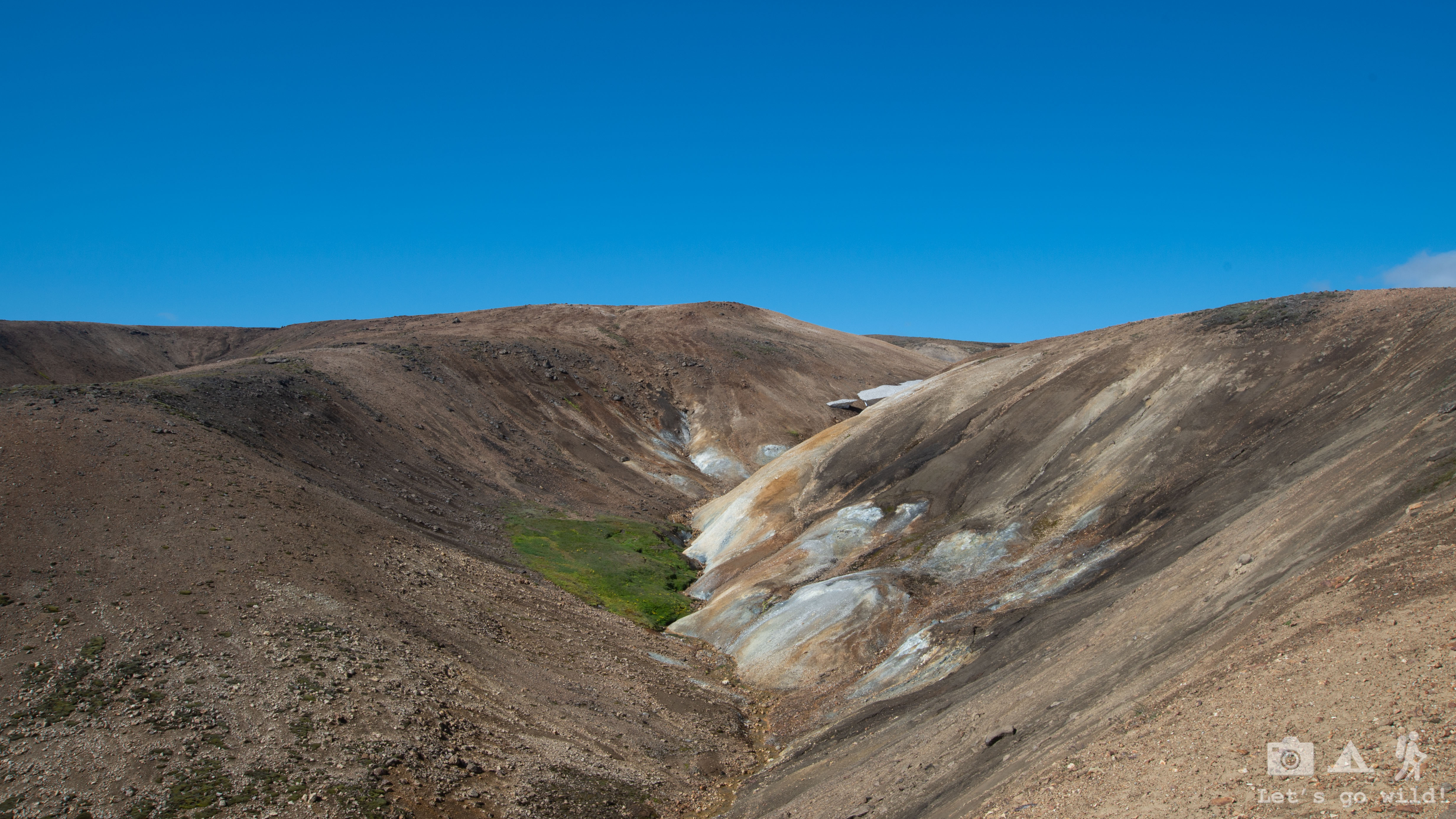

We walked slowly taking dozens of photos around every corner, smiling wide like a child with a big candy in hands! Once again, I was grateful to the forces that gave us such a beautiful weather today which made the views even more spectacular.

Occasionally we looked back as we saw some dark clouds gathering above the lake and getting closer to our side. Eventually it forced us to increase our pace.

Although the views gave us extra energy, the last km anyway transformed into a killer-mile with double heavier backpacks. A weird phenomenon of this trip.

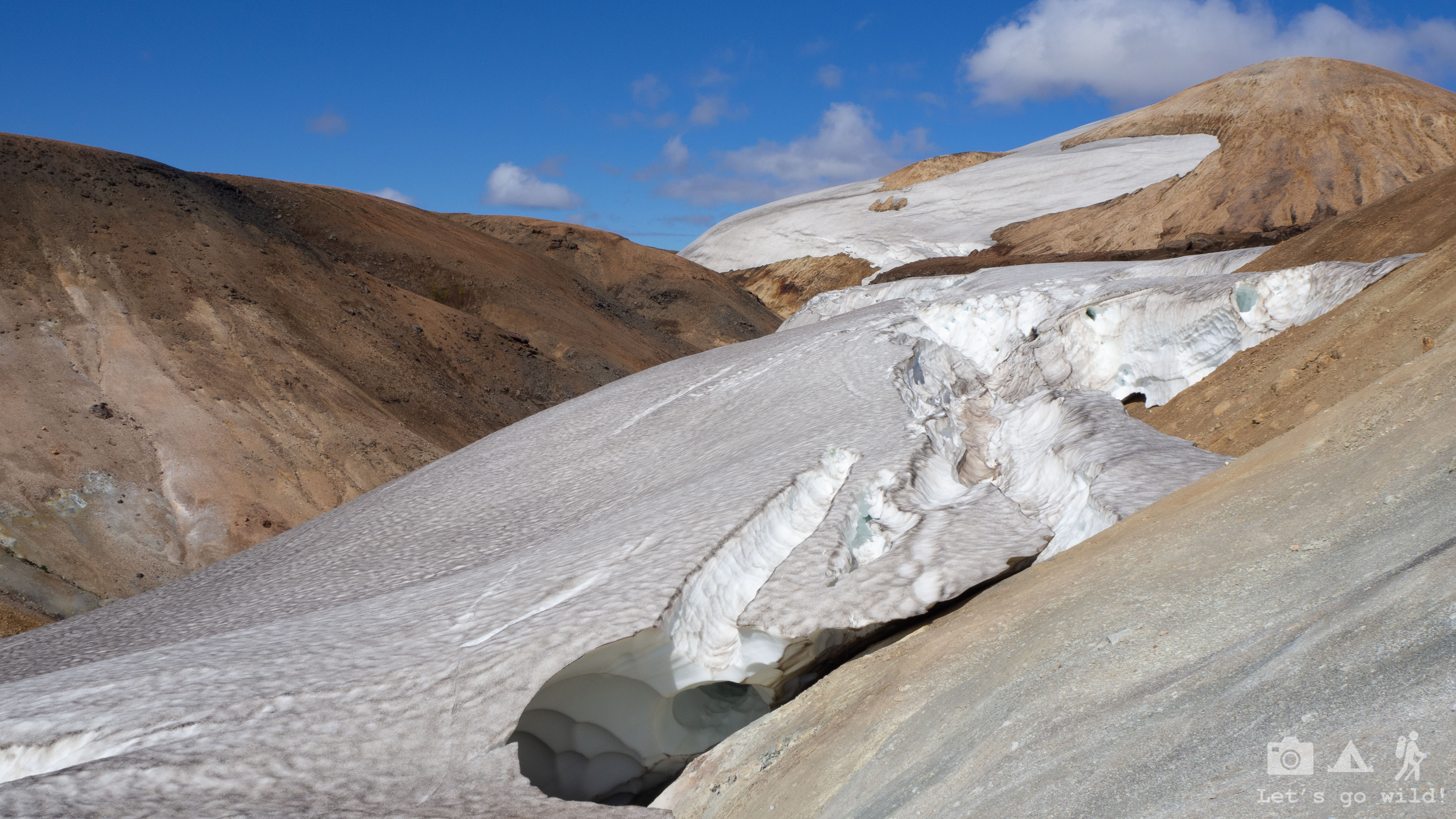
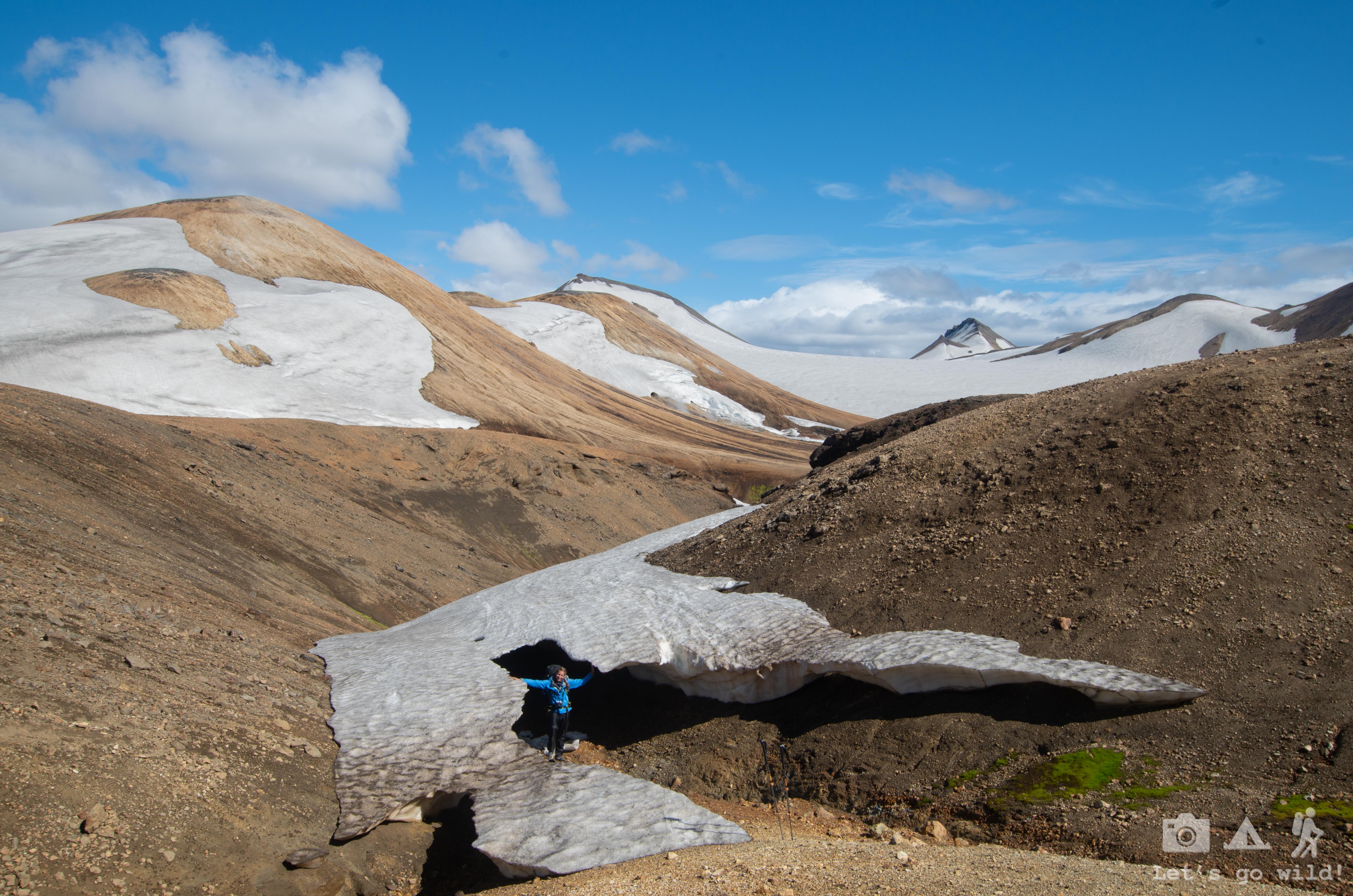
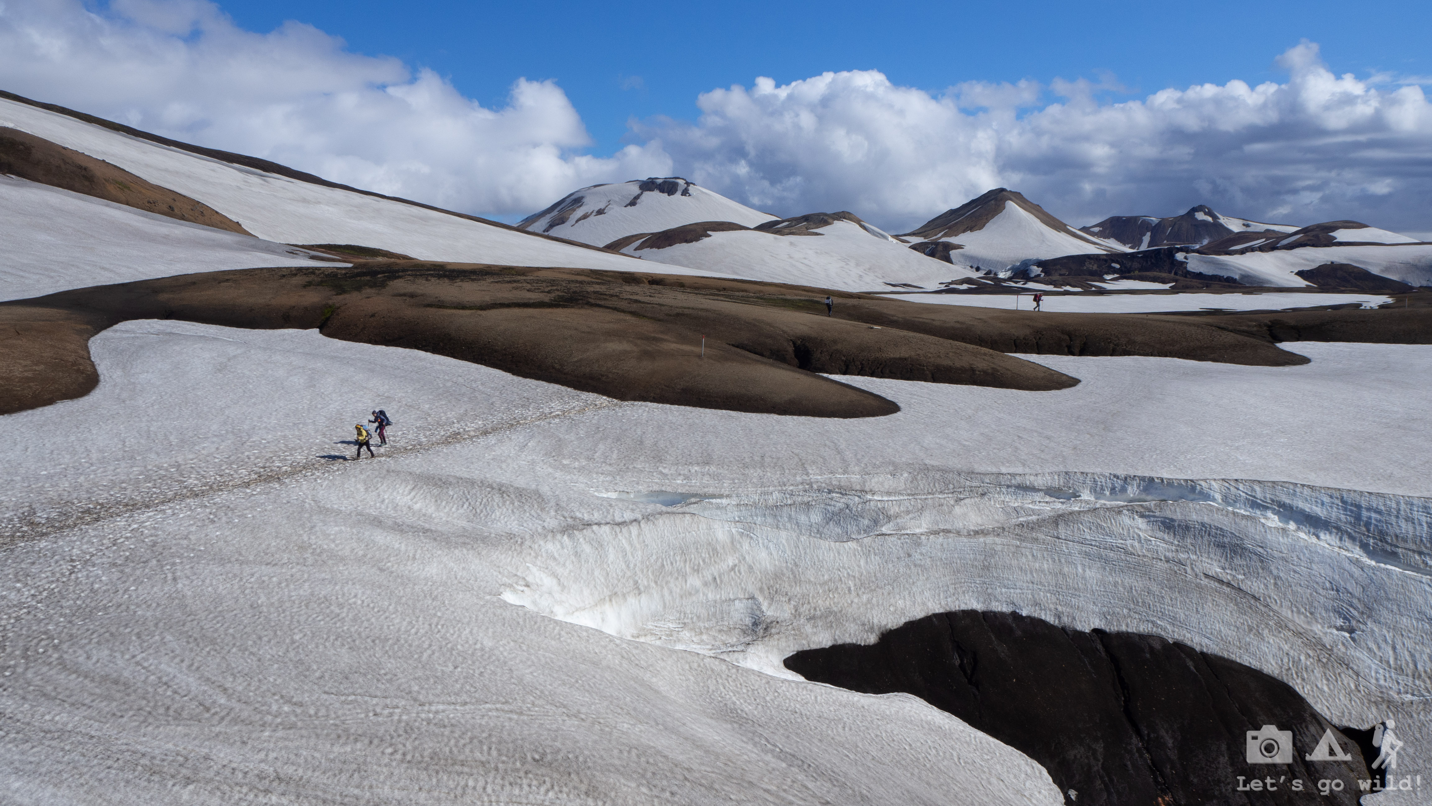
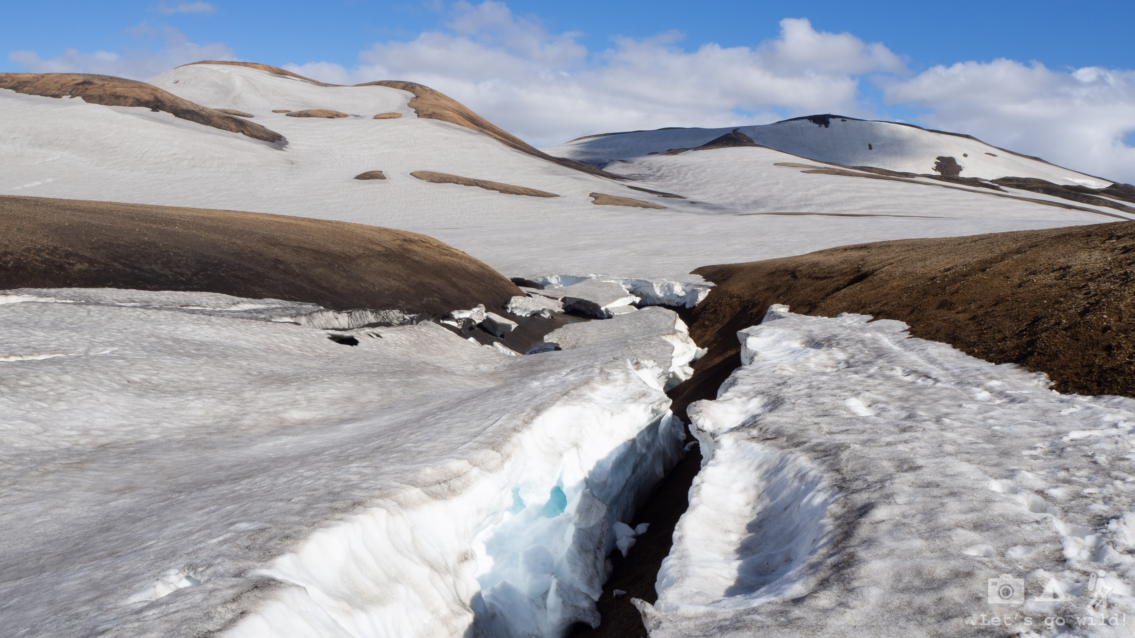
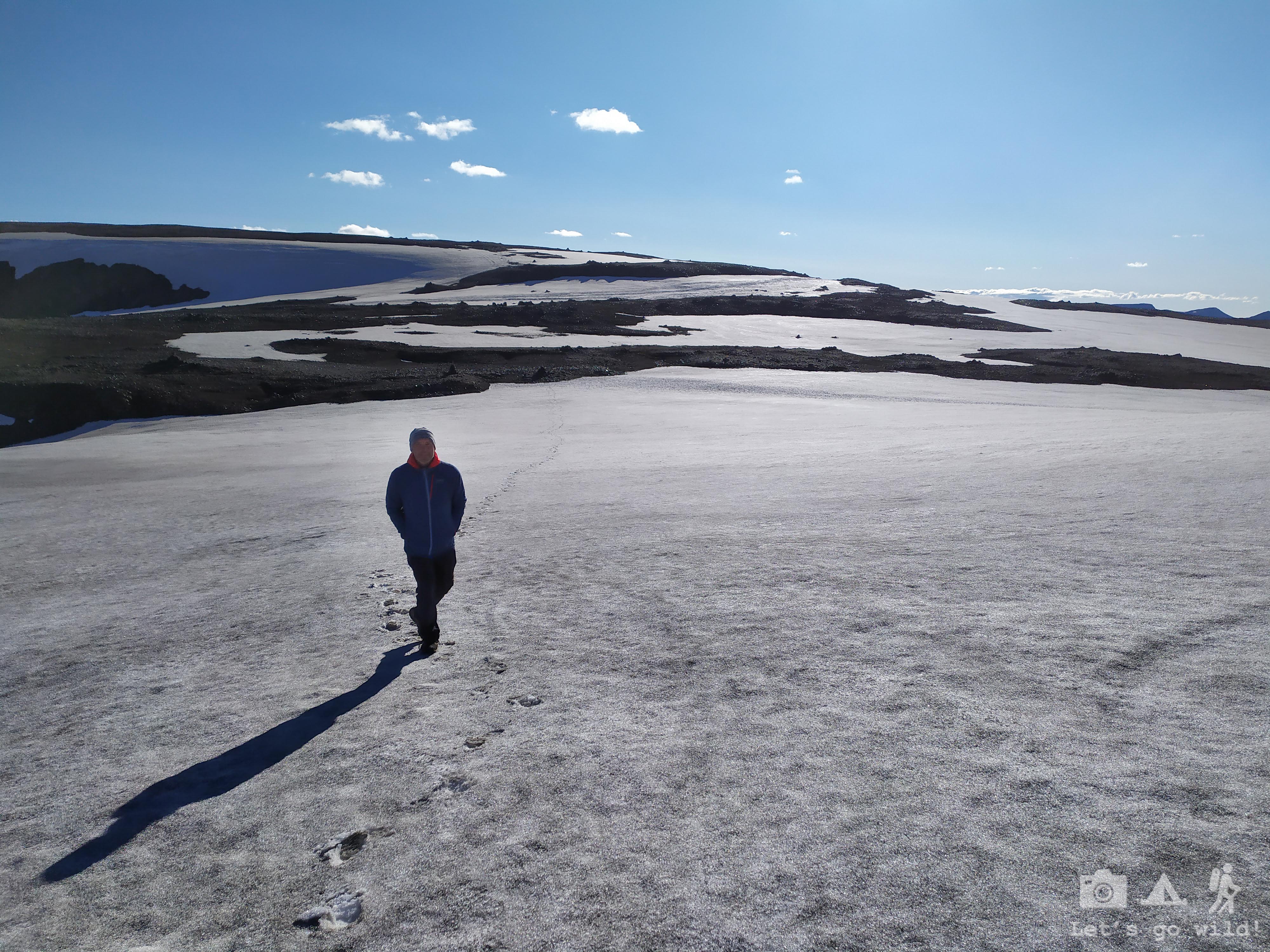
The path to reach the hut was giving us chills and butterflies in the belly. We had to cross again quite a few snow fields on our way, and it was getting colder and colder as we approached the refuge. But cracks in the ice were giving us much more chills than the cold wind. It felt weird to walk on those extended fields of snow not knowing what was hiding below.
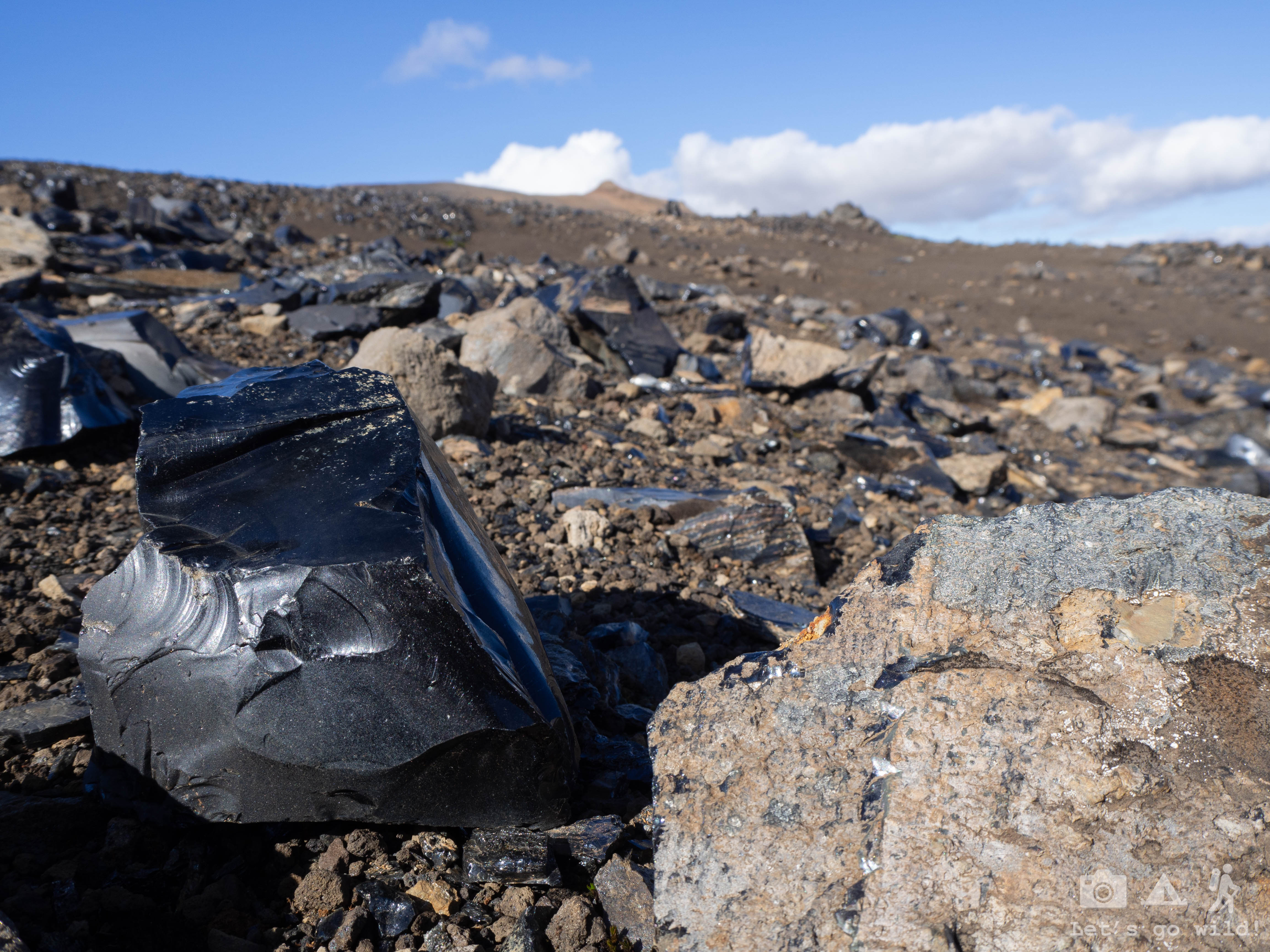
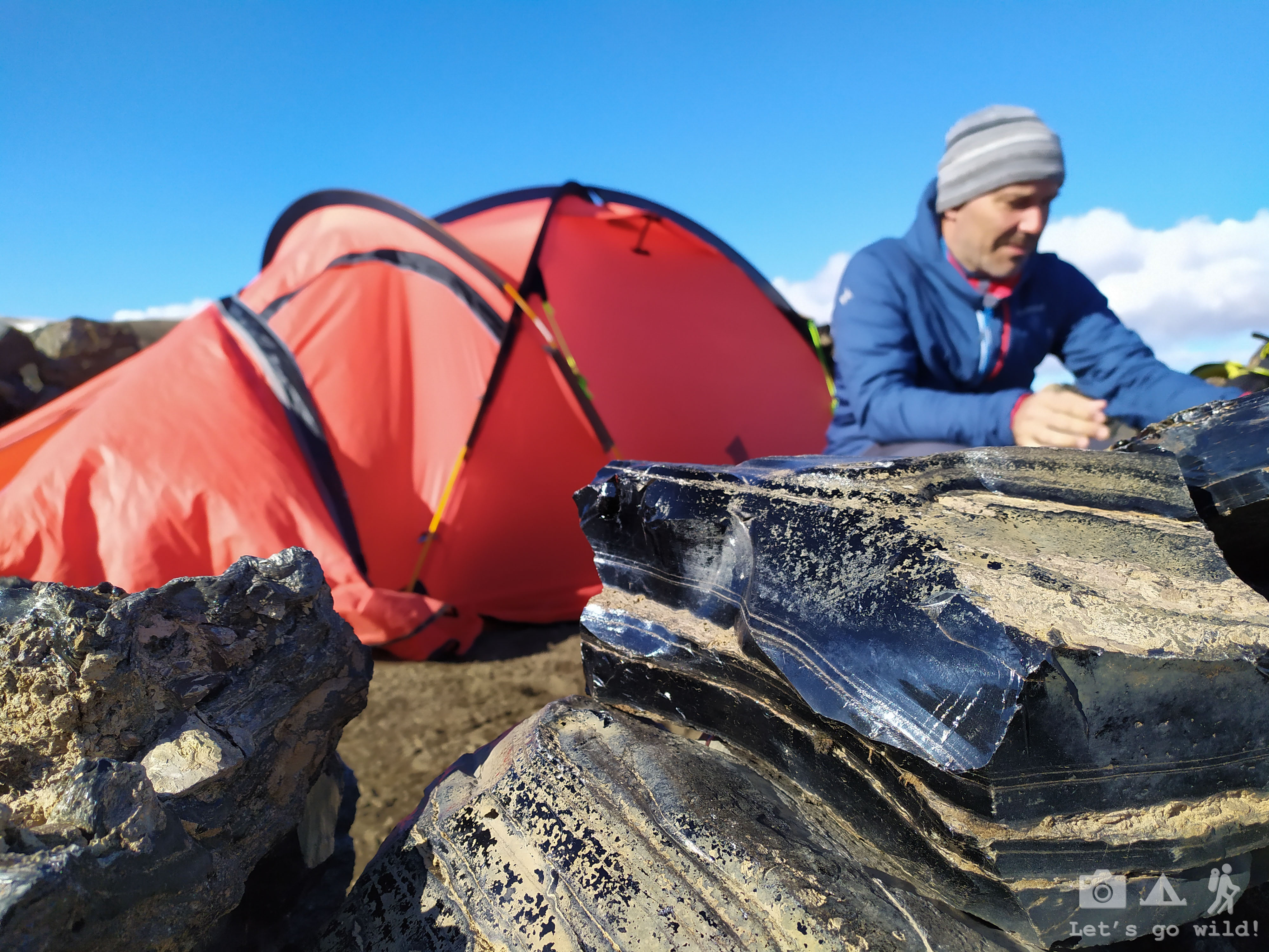
Right before reaching the hut, the landscape changed again. This time into obsidian fields. Pedro got excited looking for some nice rocks to bring home for our girls, Minecraft lovers. Did you know that you can build a portal to another dimension with obsidian rock ?? 😀
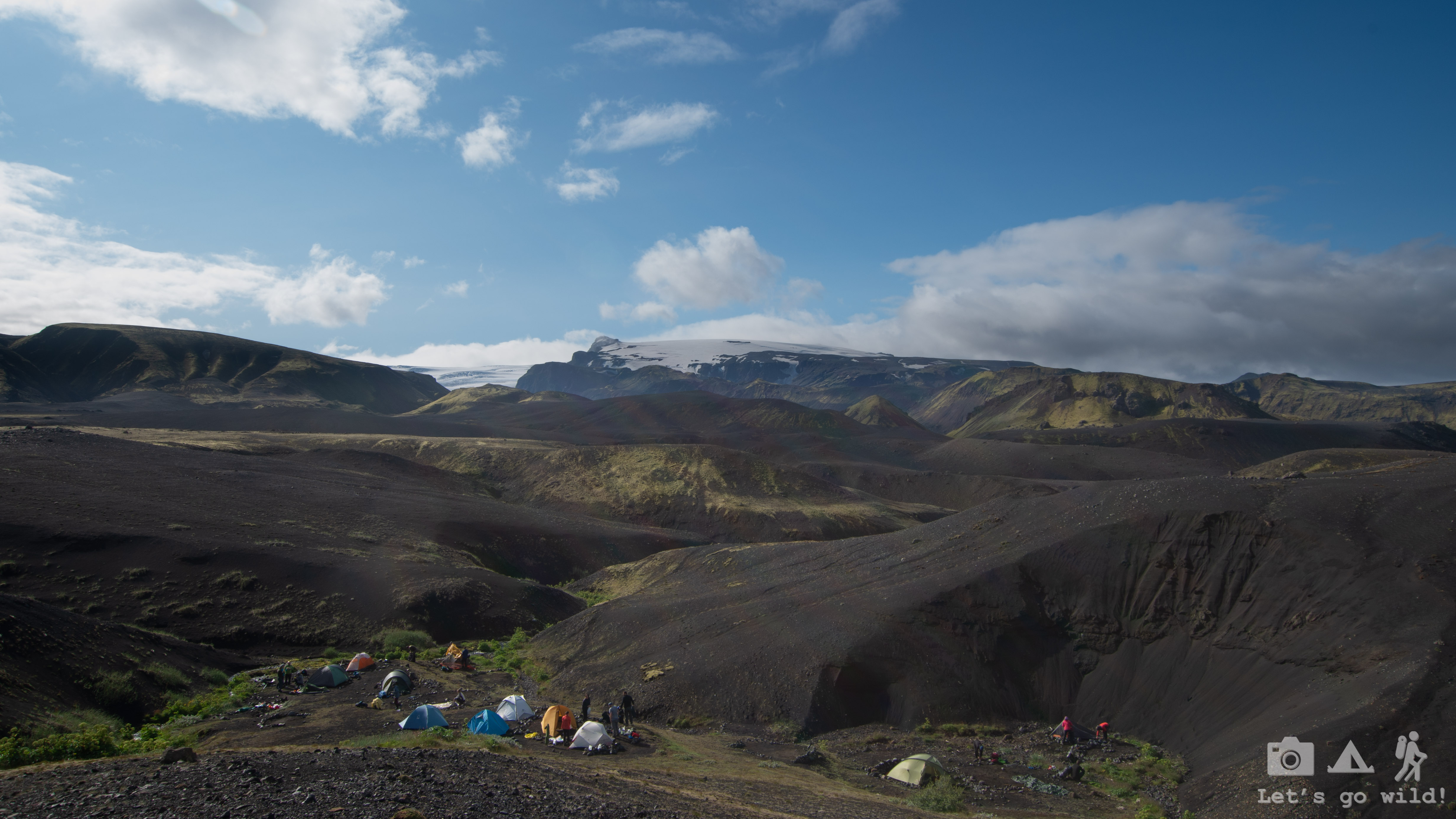
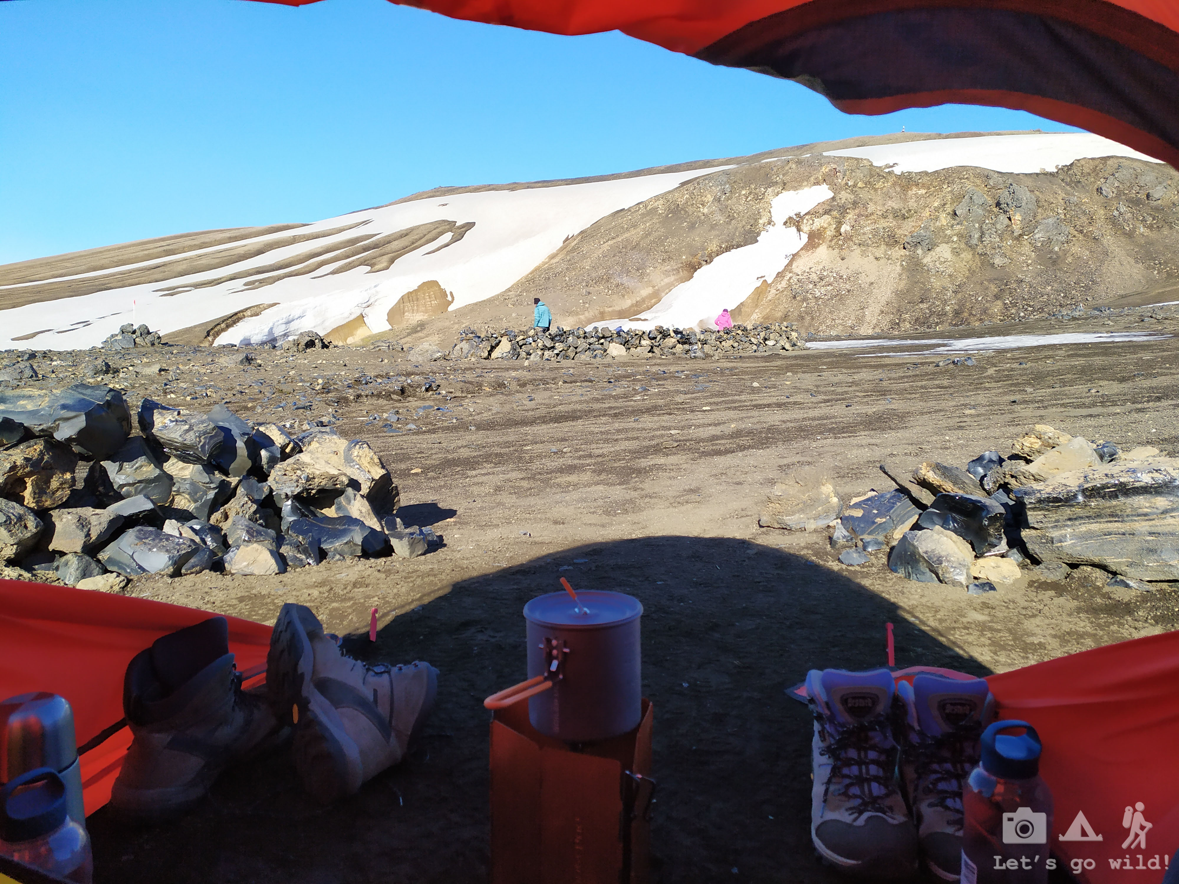
A bit more of a climb and we finally reach Hrafntinnusker hut and its charming penguin nest like camping. Everyone can find a bit of privacy in their spot for a tent surrounded by a tiny wall built of obsidian rocks. A bit of shelter from cold wind too.
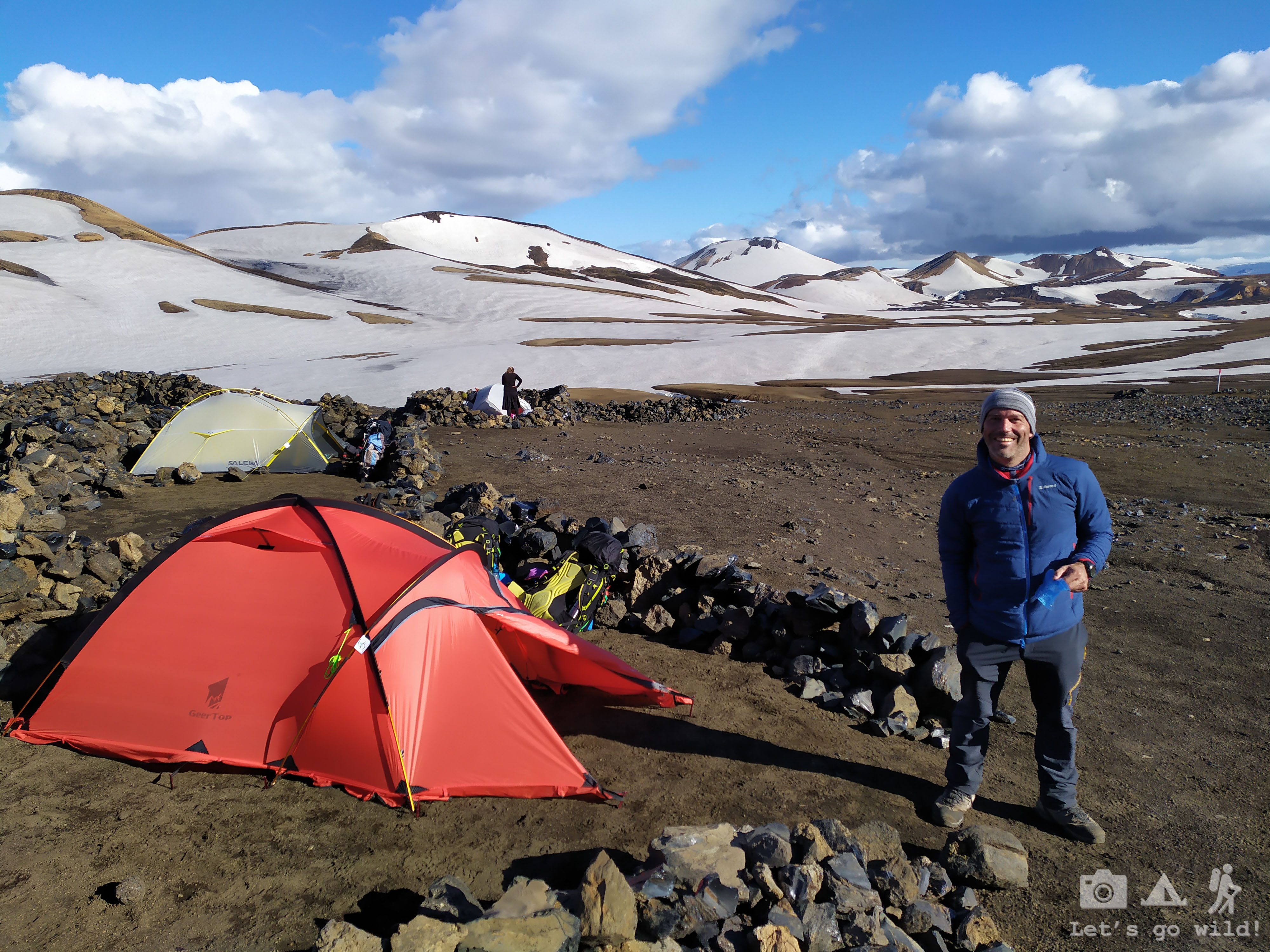
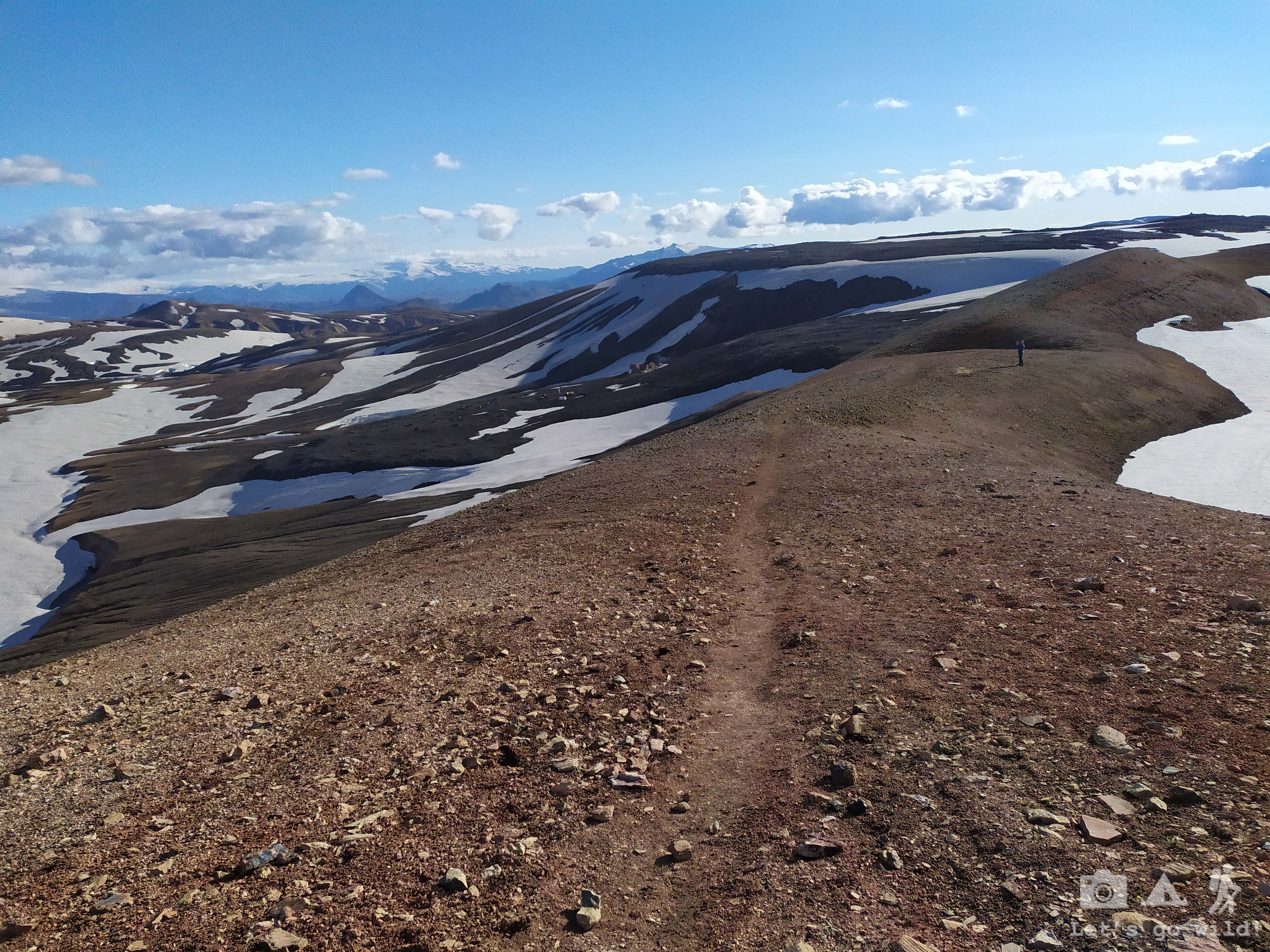
We pitched our tent and went out in search of a mobile network. Majority of the huts have some coverage but in this one you had to climb a bit up the hill to make a call. Like if the day of hiking wasn’t enough, we ended up doing a second small hike to the nearby peak. I think this peak with the altitude of 1132 was our highest point during all the trip. Being so high in the mountains also meant one thing – it would be a cold night.

Statistics of the day:
Álftavatn to Hrafntinnusker
11,8 km, ↑768 m, ↓322 m, 1 river crossing, countless hot springs and photos, 6:30 hours on the trail
Additional climb to Sodull summit, aprox 1,5 km, 112 m up and down, 1 hour.
July 6, Saturday
The day of extremes
The morning was chilly. I had to gather all my willpower to leave the tent in the morning. The sun was already (or still) up but not reaching our tent directly. We left the backpacks outside tonight and found them a bit frozen. It will be a cold start.
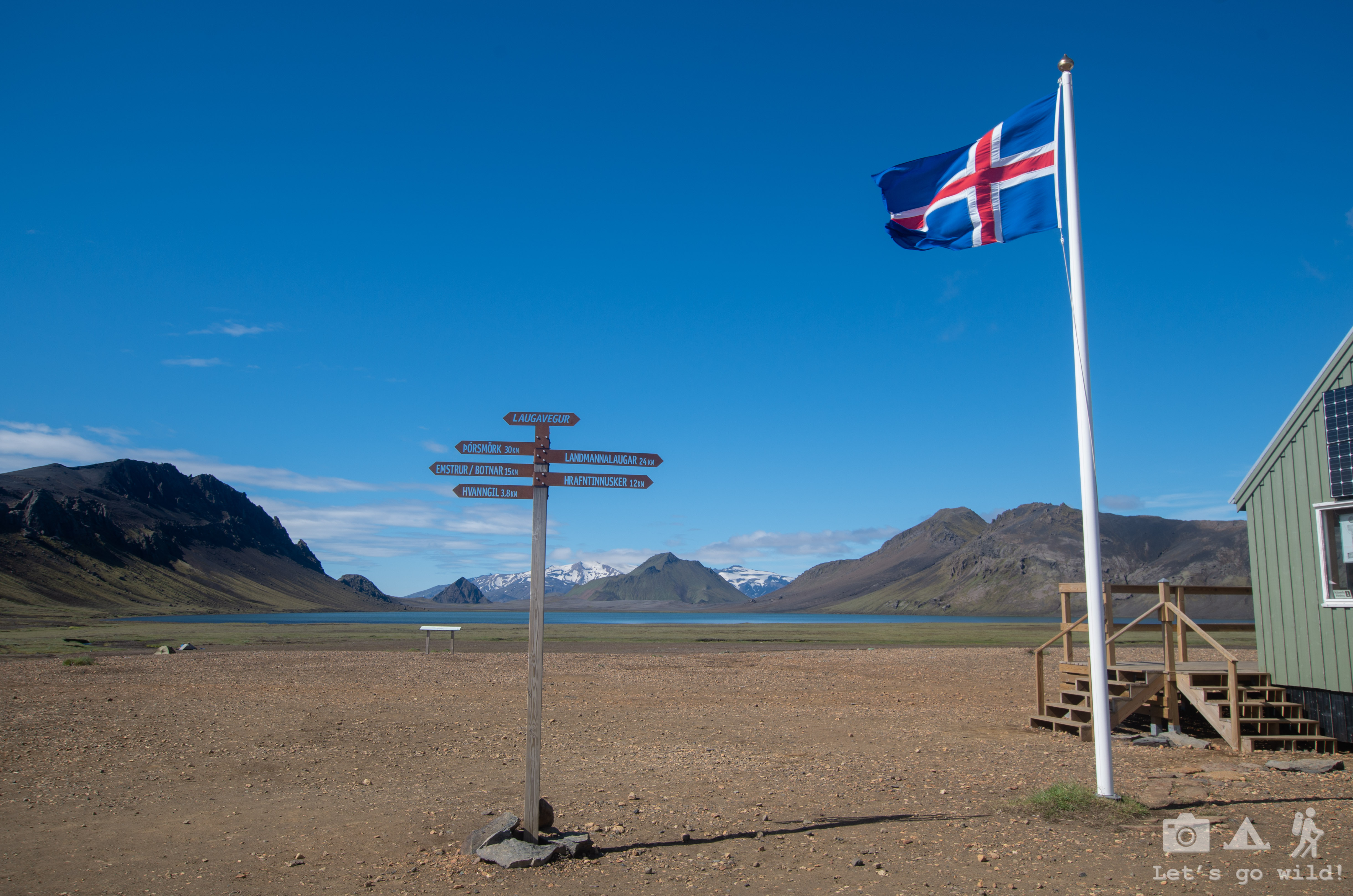
We wanted to leave early to be on time for the afternoon bus departing from Landmannalaugar.
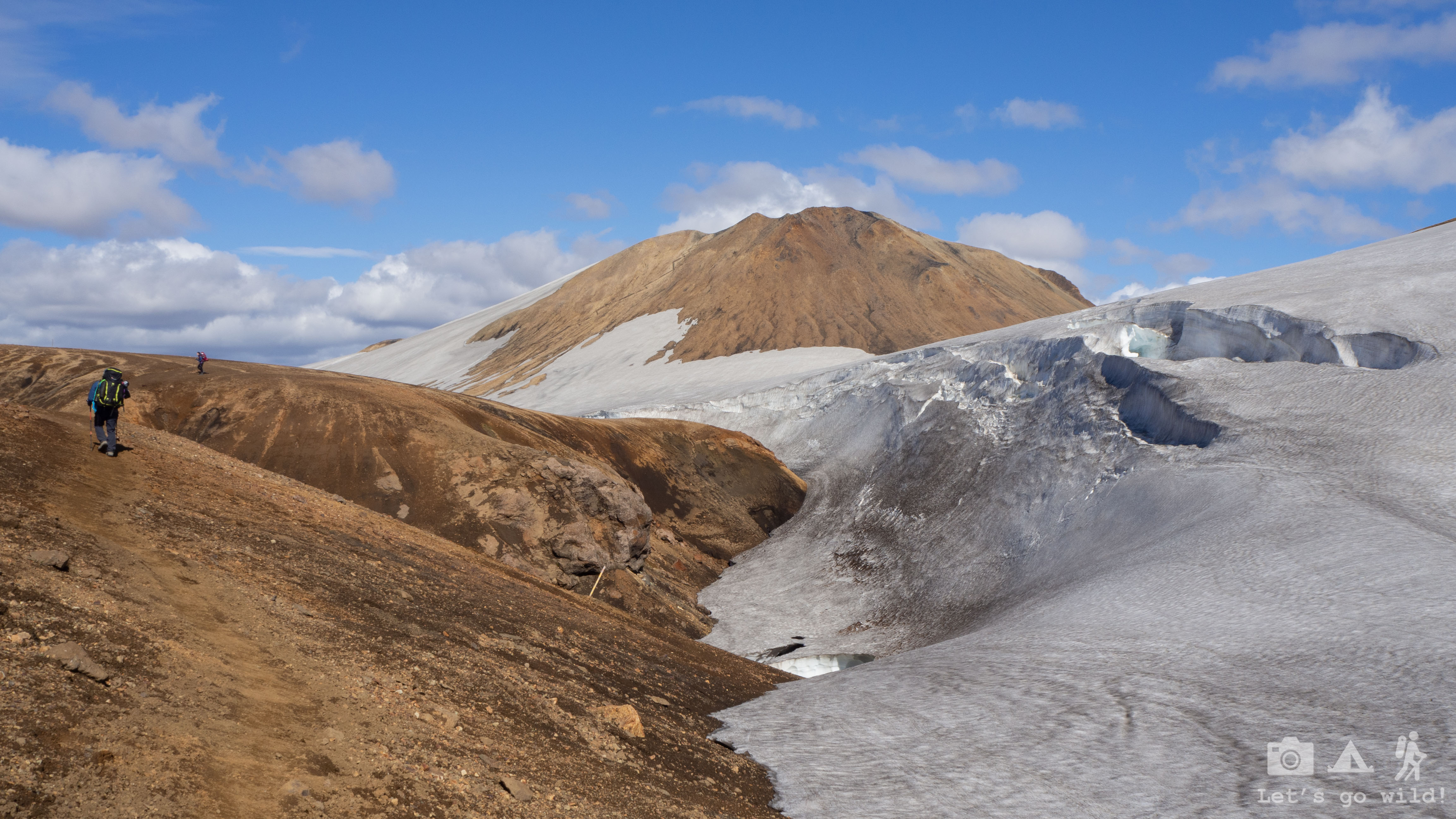
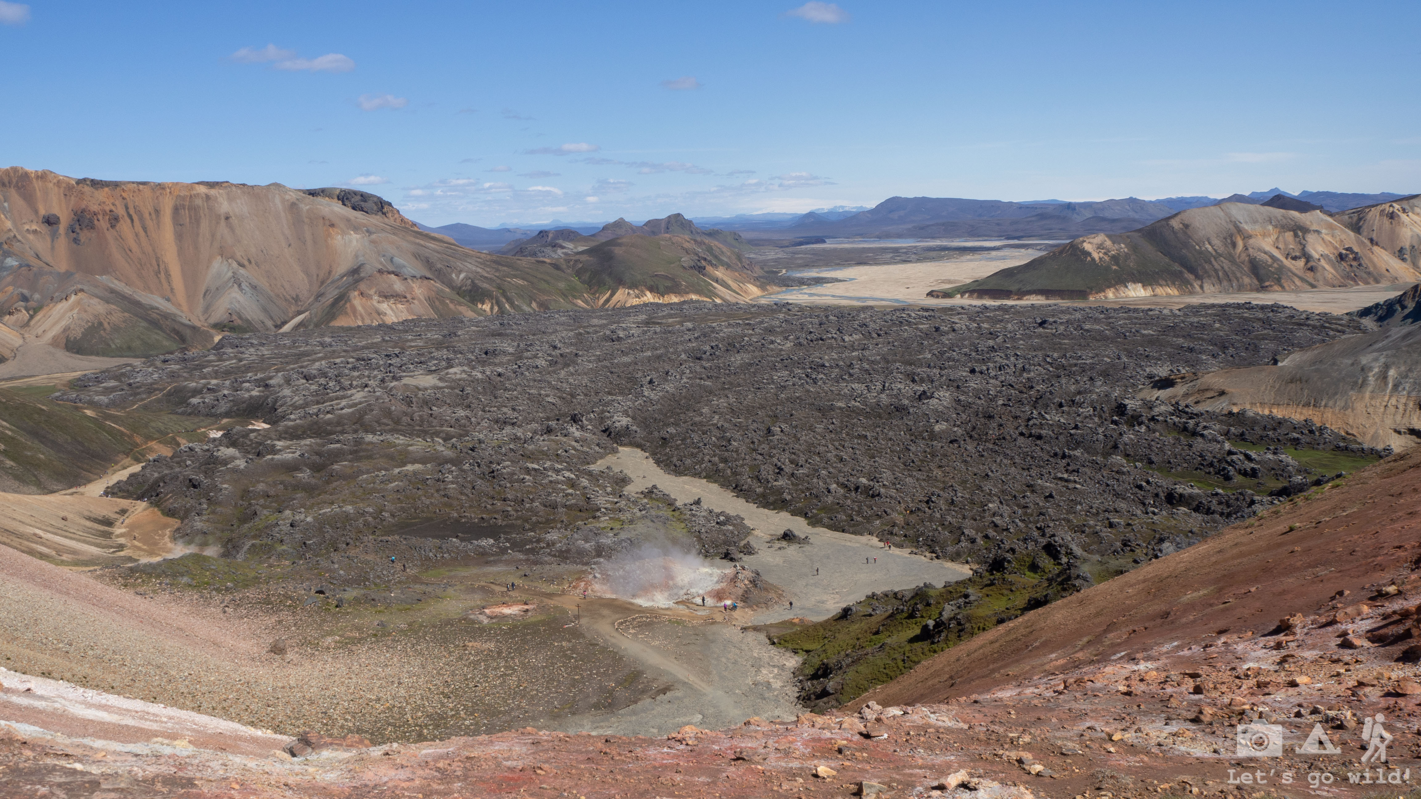
The hike started with a very cold, windy and long walk on the snow and the same crazy out of this planet panorama. After few kilometers we started descending and the views started changing vary fast again. The snow was changed by steaming hot springs of boiling water, colorful mountains and huge lava fields. I can’t understand how but this part of the trail had such an outrageous amount of bugs that it was hard to walk without eating a few.


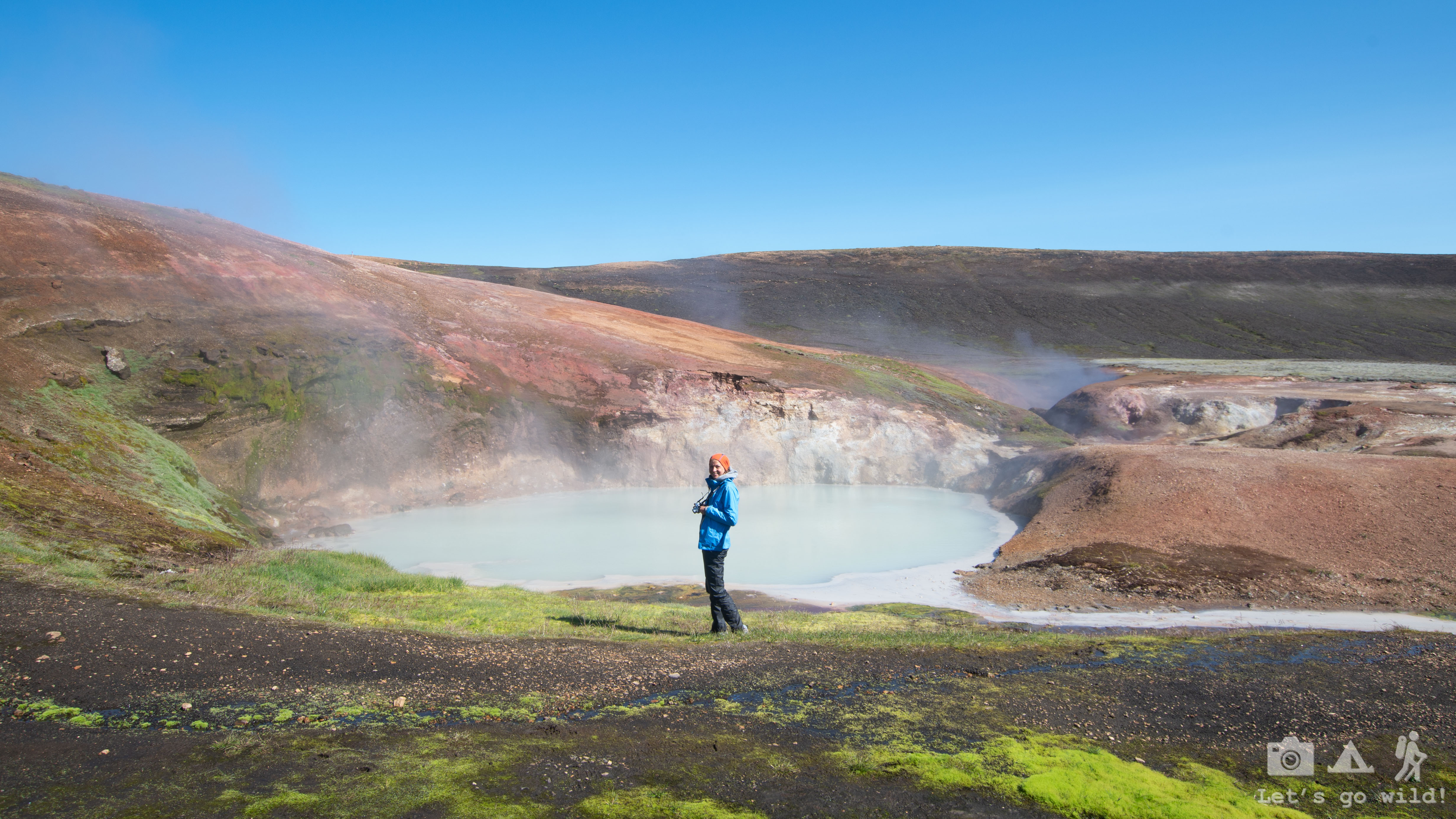
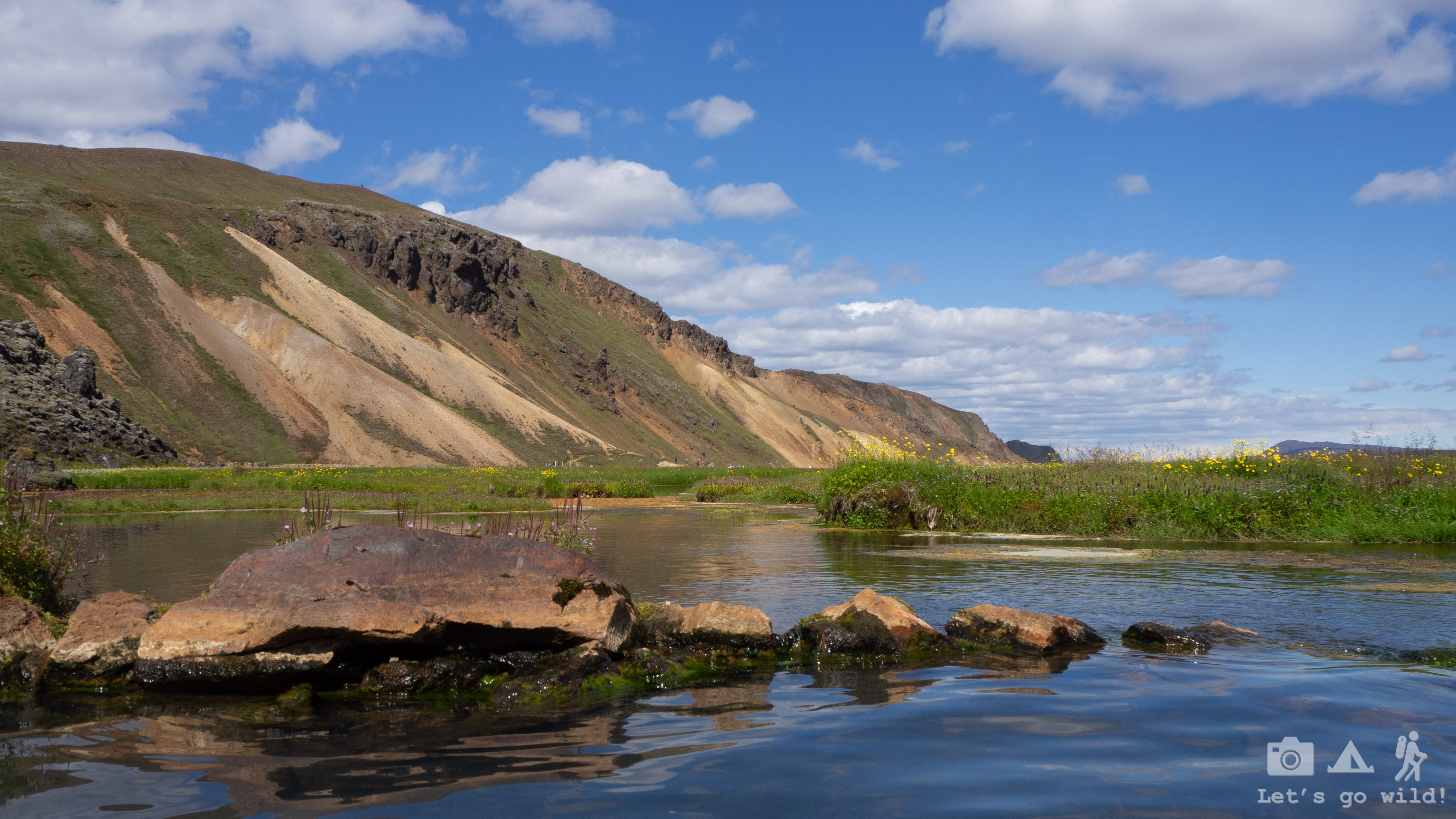
As we were approaching Landmannalaugar the number of people (and bugs) was increasing dramatically and our solitude of these past days was broken. Yet the mother nature kept surprising us with its beauty and creativity as well as with the power hidden below the ground. It is such a volcanic area that you make a small hole in the ground and it starts smoking!

We started a day all cold with all possible layers of clothes on us and ended up undressing almost to the shorts. The sun was burning so strong today!!! (and why the hell we decided to leave the sun protector at home??? No, it wasn’t an accident, it was a choice!!!)
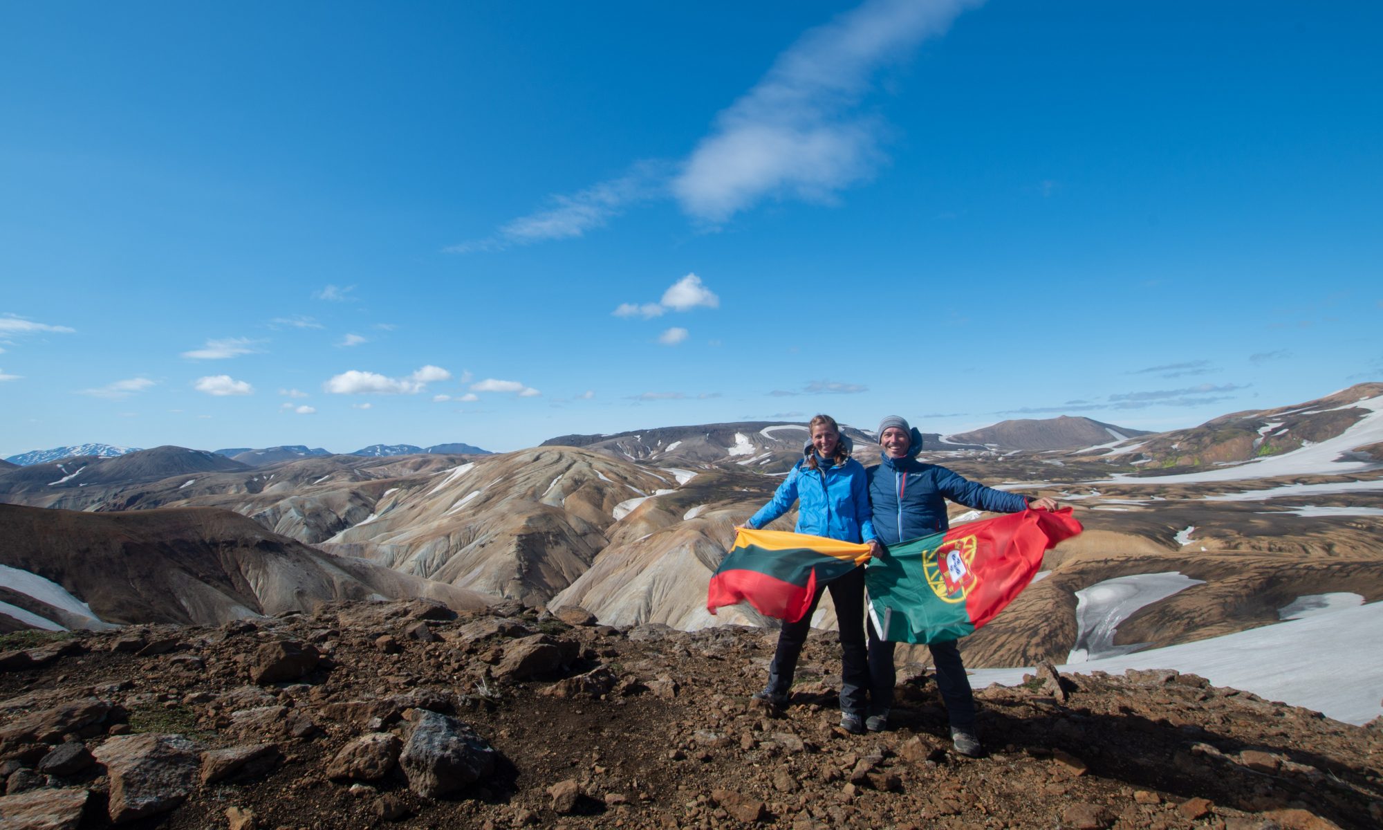
Our 6 days adventure was going to an end… Full of all kinds of landscapes and colors, full of cold wind and warm sun, full of emotions… This last day was just a reflection of all the extremes we had on the way.

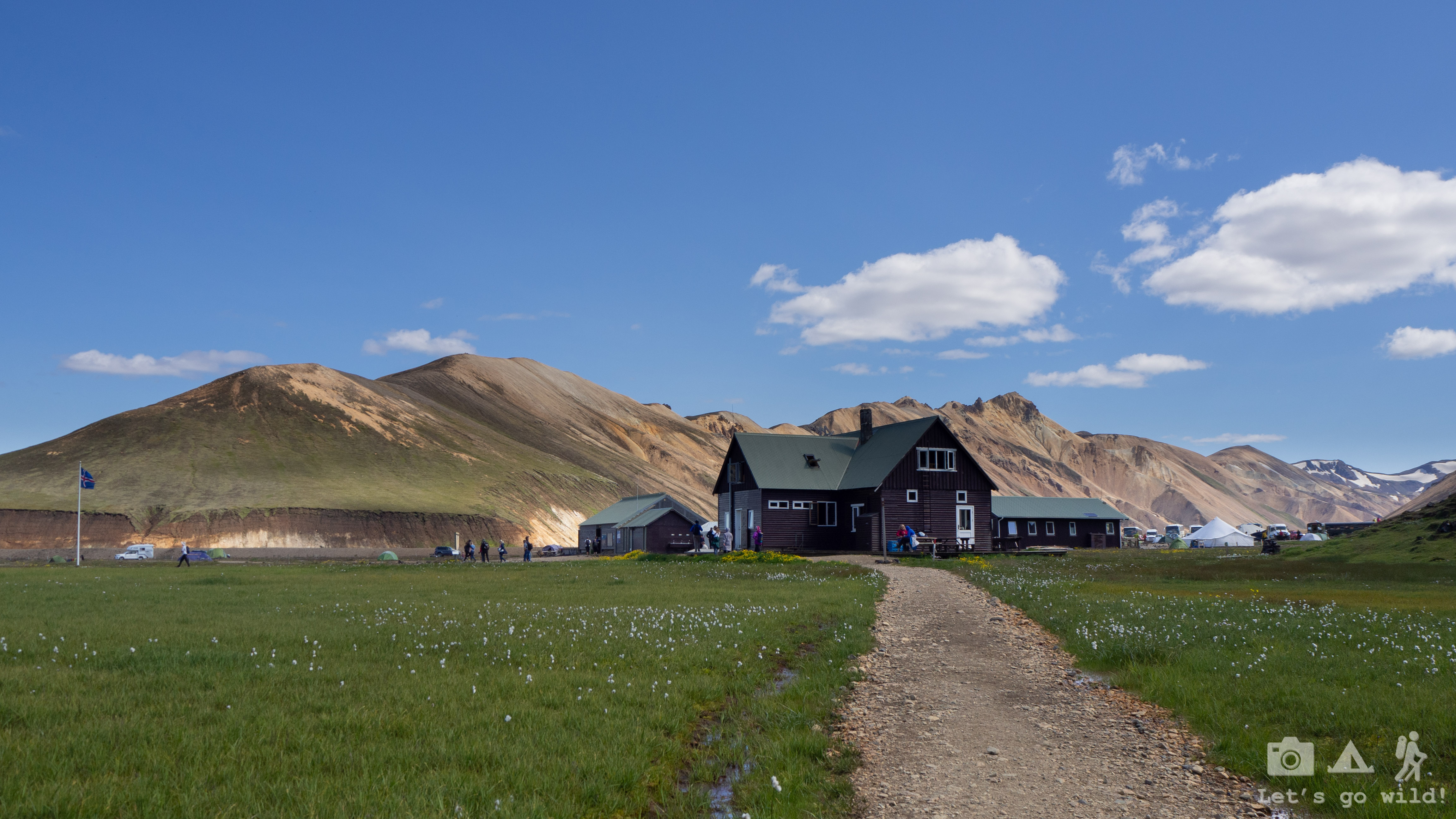
The camping in Landmannalaugar was quite a disappointment. I was happy that we wouldn’t be staying in it not even for one night. It was just a rocky field right next to a huge bus parking, full of one day tourists and noise. Did I mention bugs already? Yeah, those too.
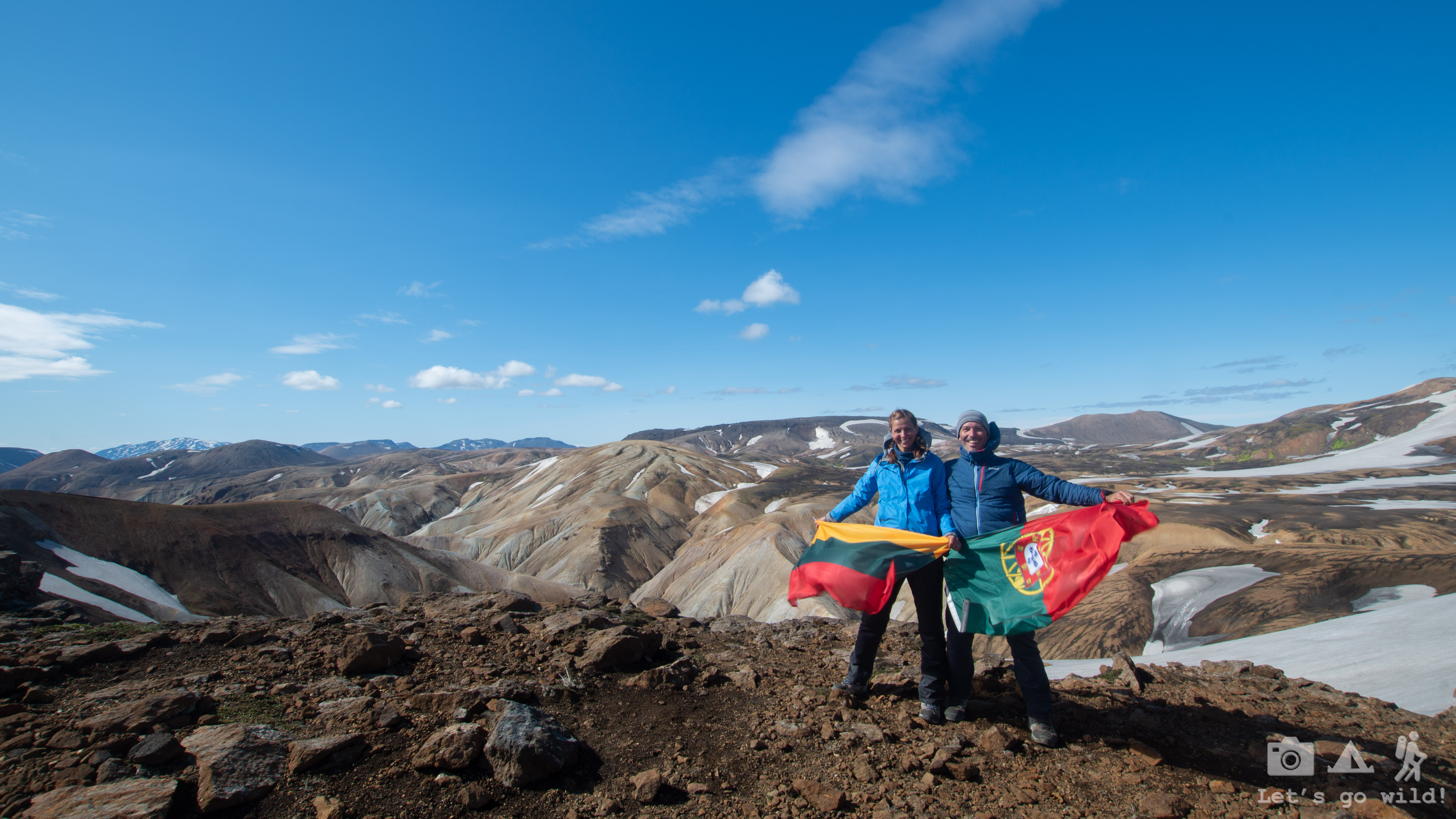
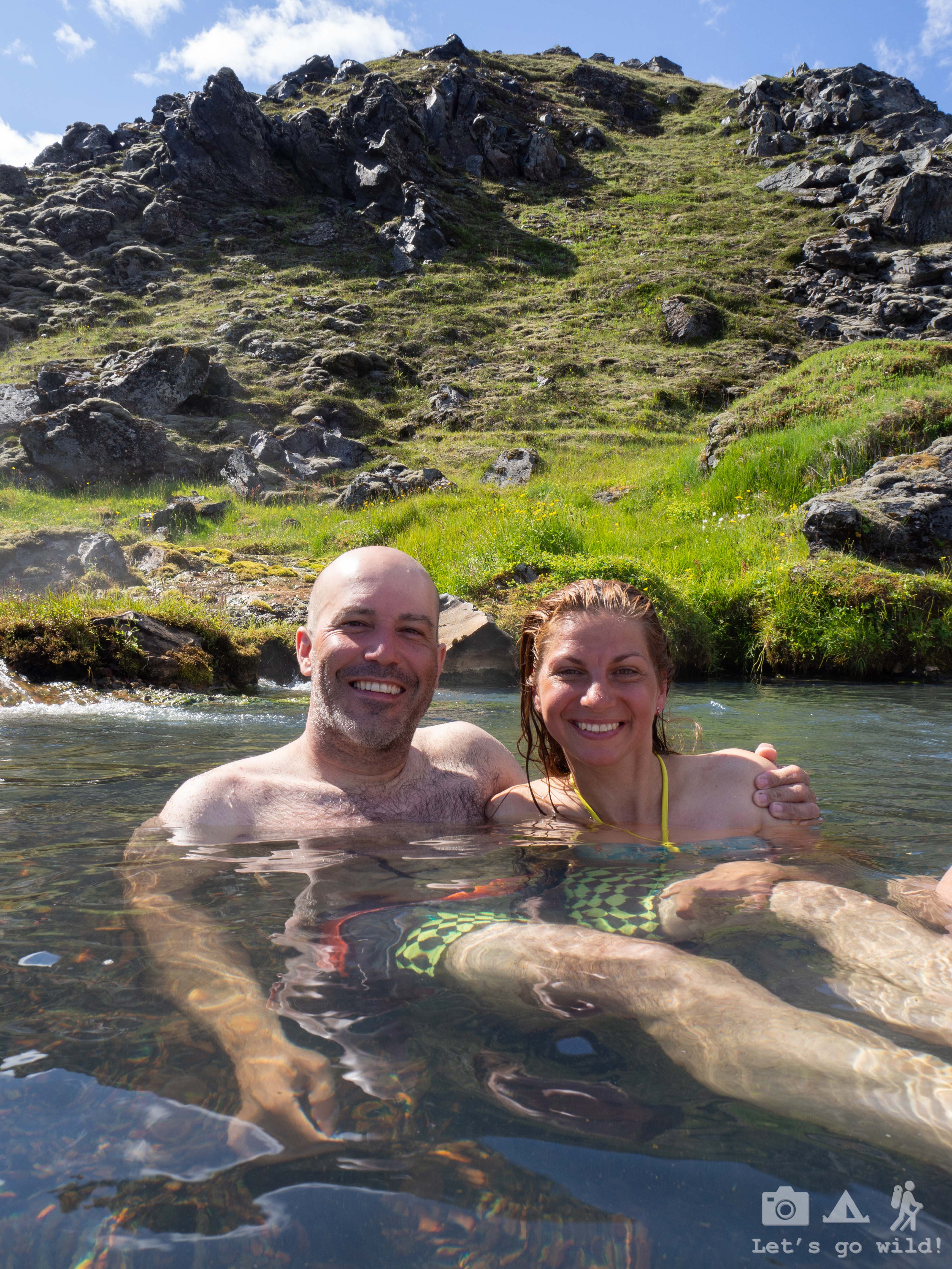
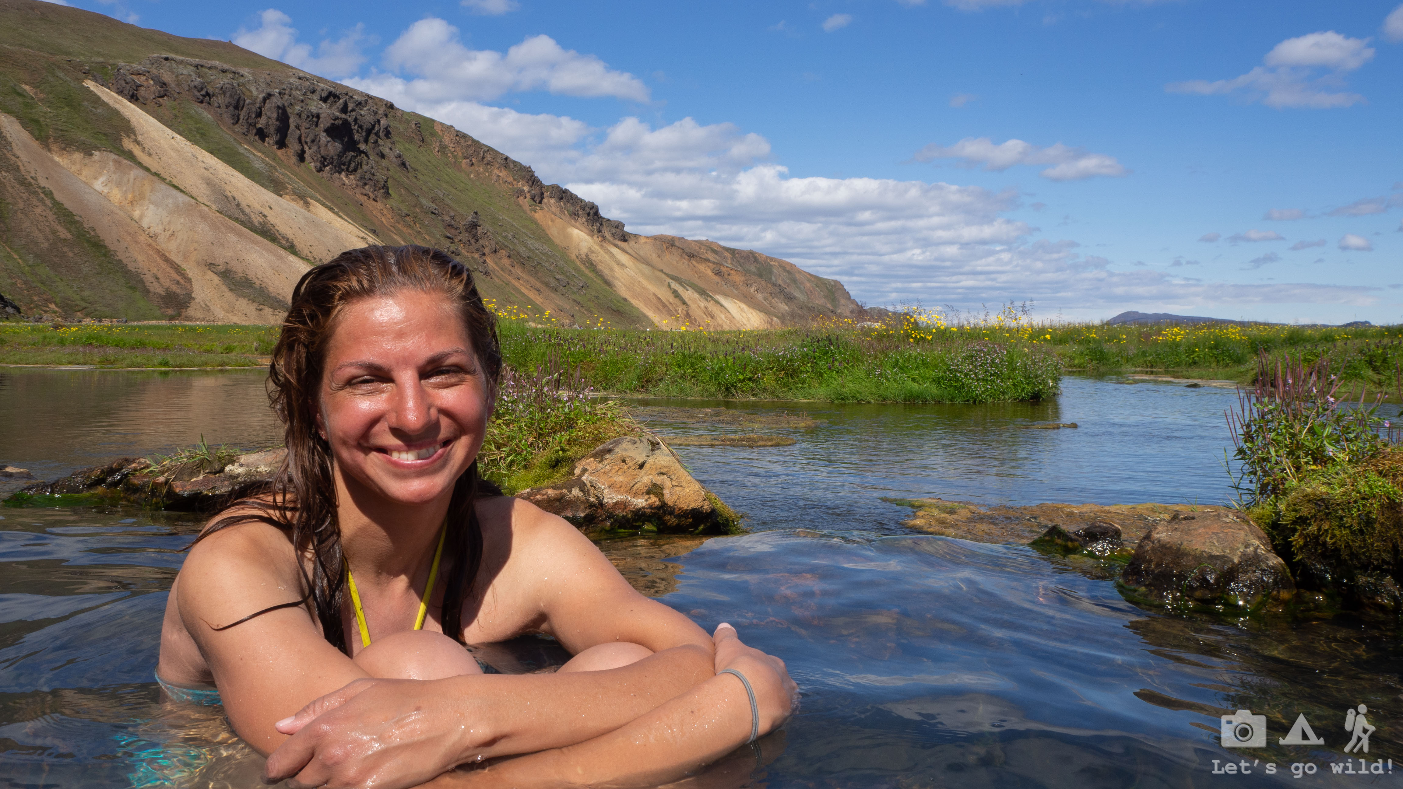
We knew there was a hot spring natural pool nearby the camping so we directed ourselves slowly towards it wondering if it would be just another disappointment like the camping. But it was a true blessing! Even though there were quite a few people in it, but this warm water gently caressing our bodies made us forget everything in the world. We could feel how the hot spring minute by minute was washing away our tiredness of 6 long days we had. It is worth doing this route South to North direction just to have this blessing moment…

After soaking in a hot pond for an hour, we had to start moving again. The bus is departing in an hour and we still have to get dressed, have lunch and… decide where to go next. We had our return ticket to Reykjavik, but were not sure what we want to do next. The biggest problem was that we left our credit card at home so we couldn’t rent a car for these last three days. On the other hand, traveling to more distant places in Iceland with public busses would take too much time which we didn’t have.
“Can we drop off in Hella?” we ask the driver while boarding…
Statistics of the day:
Hrafntinnusker to Landmannalaugar
11,3 km, ↑348 m, ↓746 m, hundreds of tourists and billions of flies. All in 4:30 hours.

2 Replies to “Skogar to Landmannalaugar: Multi-day hiking in Iceland”